On East Bay Bike Path at New Meadow Road, on the right when traveling west on East Bay Bike Path.
"When workers were building the Barrington Bridge in 1914, my grandmother, Maria Balia, who lived nearby would serve them drinks that she kept cold in her well. The workers used to go to her house every day and sit under the grape . . . — — Map (db m222998) HM
Near Thames Street near State Street, on the left when traveling north.
Finney's Distillery was discovered during demolition of the structure of the original Bank of Bristol (shown below, center). For nearly thirty-five years, two hundred gallons of rum were made each day. The rum was placed in barrels called . . . — — Map (db m222816) HM
On Thames Street north of Franklin Street, on the left when traveling north.
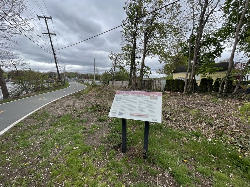
The War of Independence
Voice of the People
In response to the "Boston Tea Party" the citizens of Bristol in the Town Meeting of February 28, 1774 adopted an 11-point resolution in support which included these words: . . . — — Map (db m222856) HM WM
On Main Street (Rhode Island Route 114) at Market Street, on the right when traveling south on Main Street.
This tablet was erected
May 25, 1897
by the
Benevolent Baptist Society
Incorporated Aug. 29, 1785.
First Officers
Pres. Nathan Miller •
V.Pres. Ebenezer Cole •
Treas. Robert Carr •
Sec. Wm Turner Miller . . . — — Map (db m222986) HM
On Church Street west of Main Street (Rhode Island Route 114), on the right when traveling west.
This truly magnificent building has been a light in both the spiritual and navigational life of Warren.
The first Methodist sermon ever preached in Warren was by Rev. Daniel Smith in 1789. The Rev. Jesse Lee, noted pioneer of . . . — — Map (db m222983) HM
On Washington Street at Main Street, on the right when traveling west on Washington Street.
Washington St. so called since 1835. In colonial days, known as Ferry Lane; later, as King St. On the corner opposite stood Burr’s Tavern, which in Revolutionary times played host to Washington; Jefferson, De Lafayette, De Castellux, Putnam and . . . — — Map (db m66344) HM
Near Taft Street, on the right when traveling north.
This American Liberty Elm was named after “The Liberty Tree: Our Country’s First Symbol of Freedom.” On the morning of August 14, 1765 Boston awakened to discover two effigies of British official hanging from the branches of a towering elm in . . . — — Map (db m83422) HM
On Flat River Road (Rhode Island Route 117) east of Brenda Drive (Walker Lane), on the right when traveling east.
This American Liberty Elm was named after "The Liberty Tree: Our Country's first Symbol of Freedom." On the morning of August 14, 1765, the people of Boston awakened to discover two effigies suspended from an elm tree in protest of the hated Stamp . . . — — Map (db m152526) HM
Near Taft Street, on the right when traveling north.
Of the generals of the American Revolution, second only to Washington. Built this house in 1770 and lived in it as a private. He joined the army at Cambridge in 1775. — — Map (db m83586) HM
On Taft Street, on the right when traveling north.
Coventry High School and the National Student Council honor Maj. Gen. Nathanael Greene Rhode Island Delaware New Hampshire Maryland Massachusetts Virginia New York North Carolina Connecticut . . . — — Map (db m83411) HM
On Taft Street, on the right when traveling north.
Homestead OverviewIn 1770, this house was built by 27 year-old Quaker and iron-master, Nathanael Greene. The building is a well-preserved 18th Century structure of simple, yet refined design. The iron forge, which was located on the Pawtuxet . . . — — Map (db m83326) HM
Near Taft Street, on the right when traveling north.
Cemetery HistoryThe first Greene family interment occurred in 1786 with the death of Miss Margaret Greene, daughter of Jacob (General Greene’s brother) and Margaret Greene. There are seventeen identified interments in the cemetery and four . . . — — Map (db m83400) HM
Used as Headquarters for the French
Troops on their march to and from
Yorktown 1781-1782
Maj. Gen. Nathanael Greene
Gen. Lafayette
Gen. Rochambeau
RI Commemorative Committee for
Maj. Gen. Nathanael Greene
Coventry . . . — — Map (db m189625) HM
General James Mitchell Varnum Brigadier General of the Continental Army was instrumental in creating the Rhode Island Black Regiment which provided the first genuine route to freedom for Afro-American people in Rhode Island — — Map (db m58174) HM
On Court House Lane, on the right when traveling east.
On June 12, 1775
The General Assembly for the state of Rhode Island met on this site and enacted a resolution to charter and arm two sloops for the protection of trade and appointed Abraham Whipple to be commander with the rank and power of . . . — — Map (db m58263) HM
Near Church Street, on the right when traveling east.
1774-1974
Kentish Guards Drill Field
To those Kentish Guardsmen who in 1774 utilized this field to prepare themselves for the conflict that assured our independence. This tablet was dedicated on the 200th Anniversary of the Kentish Guards . . . — — Map (db m58261) HM
On Main Street at Division Street, on the right when traveling north on Main Street.
Erected by Varnum Continentals 1914 on the second site of Rhode Island Central Bank, first bank in East Greenwich 1840-1857
To the memory of
James Mitchell Varnum
of East Greenwich
Brig. Gen. Continental Army 1777-1779 • . . . — — Map (db m223025) HM WM
On Main Avenue (Rhode Island Route 113) at Walnut Glen Drive, on the right when traveling west on Main Avenue.
The Peter Freeman Lot (Warwick Historical Cemetery #26) is an historic cemetery protected by State and City regulations. The Lot is described as 100 feet by 75 feet in size, containing 22 individuals (with 20 inscribed headstones and one . . . — — Map (db m150256) HM
Conanicut Battery
A Revolutionary Fort
Built by Americans in 1776
Grounds cleared and tablet placed by the Daughters of the American Revolution of Rhode Island — — Map (db m56383) HM
On Beavertail Road, on the right when traveling south.
Below this concrete cap sits the stone foundation Beavertail's 1749 lighthouse.
Initially built to provide safe passage into Newport's colonial harbor, it was designed and built by Peter Harrison, "America's first architect," who later designed . . . — — Map (db m56457) HM
On Fort Wetherill Road, on the right when traveling east.
Historically, the rocky cliffs behind and above the buildings of the Harbor Mine Complex were of military significance to Rhode Island's earliest colonists, who built earthen fortifications on its headland and installed cannon to protect nearby . . . — — Map (db m242649) HM
On West Main Road (Rhode Island Route 114), on the right when traveling north.
In this house the British General Prescott was taken prisoner on the night of July 9, 1777 by Lieutenant-Colonel Barton of the Rhode Island Line. — — Map (db m48060) HM
On Vernon Avenue east of Boulevard, on the left when traveling east.
Built 1777 by the English for the defence of Newport The gift of ---------- W. W. Sherman J. N. Brown H. Brown F. S. Barker S. P. Barker — — Map (db m48062) HM
On Equality Park West at Gould Street, on the left when traveling south on Equality Park West.
On this old common the boats of H.M.S. Liberty were burned on July 19, 1769 by the citizens of Newport, who had previously fired upon and destroyed the sloop. This was the first overt act of violence to Great Britain in America. — — Map (db m223295) HM
On Marlborough Street at Farewell Street, on the left when traveling east on Marlborough Street.
In 1639, Helen and Nicholas Easton, John Clarke, William Coddington and others left Portsmouth, the settlement founded in 1638 by Anne Hutchinson and others on the northern end of Aquidneck Island. They came south and founded Newport. Newport’s . . . — — Map (db m48498) HM
On Washington Street at Elm Street, on the right when traveling south on Washington Street.
has been designated a Registered National Historic Landmark Under the provisions of the Historic Sites Act of August 21, 1935 this site possesses exceptional value in commemorating and illustrating the history of the United States U.S. . . . — — Map (db m48093) HM
Mary Ferrazzoli (1928-1994) was the visionary leader who founded the Friends of the Waterfront in 1982. She vigorously championed public access and stood firmly opposed to the commercial overdevelopment of the Newport waterfront blocking public . . . — — Map (db m189622) HM
On Wellington Avenue, on the right when traveling west.
[ South side : ] Near this spot the French army of 6000 men led by General Rochambeau our allies in the War for Independence first set foot upon American soil July XIII 1780 [ East side : ] I welcome the news of your arrival A . . . — — Map (db m49054) HM
On Wellington Avenue at Columbus Avenue, on the right when traveling west on Wellington Avenue.
Newport Harbor has been a center of commerce and industry since the days Narragansetts and Wampanoags, Native Americans, fished the waters of this bay. The first European explorer was Giovanni da Verrazzano, an Italian who sailed for the King of . . . — — Map (db m189621) HM
On Wellington Avenue, on the right when traveling west.
[ Left Marker : ]On June eighteenth, 1781, General Rochambeau left Newport with his army to join the American forces on the Hudson, and on August nineteenth, 1781, the combined armies under command of General Washington began their . . . — — Map (db m48054) HM
On Washington Square, on the right when traveling east.
Because of its commitment to religious toleration, Newport had no established church during the colonial period. There was no Puritan meeting house on the town square as was the norm elsewhere in New England. Instead, the Colony House and the Brick . . . — — Map (db m48556) HM
On Touro Street east of Spring Street, on the right when traveling west.
The Letter from Moses Seixas, Warden of the Hebrew Congregation in Newport, Rhode Island to President George Washington, August 17, 1790.
To the President of the United States of America
Sir,
Permit the children of the . . . — — Map (db m223099) HM
On Poplar Street at Thames Street, on the right when traveling east on Poplar Street.
To commemorate the repeal of the Stamp Act in March 1766, William Read deeded a small triangle of land at this site where grew the original Tree of Liberty, to William Ellery and others in trust. This tree was cut down by British occupation forces . . . — — Map (db m48095) HM
On West Main Road (Rhode Island Route 114) at Anselmo Drive, on the right when traveling south on West Main Road.
During the American Revolution the British strategy focused on controlling American ports and blockading the coast. Because of Newport’s significance as a deep-water port and as a center of trade, British forces landed in Newport in December of . . . — — Map (db m48348) HM
On Fort Street south of Sprague Street, on the right when traveling east.
These fortifications erected by the British 1777 were occupied by the Americans 1778, becoming the island base of the Continental Army under General Sullivan in the Battle of Rhode Island. They are now consecrated to the immortal memory of those . . . — — Map (db m48069) HM
On W Main Road (Rhode Island Route 114), on the left when traveling north.
has been designated a --------------------------------- National Historic Landmark ---------------------------------- This site possesses national significance in commemorating the history of the United States of America 1975 National Park . . . — — Map (db m48094) HM
On W Main Road (Rhode Island Route 114), on the left when traveling north.
The 1st Rhode Island Regiment of the Continental Line 1775 – 1783 The war for American Independence was a long and arduous struggle that demanded much of the American people. Rhode Island responded to those demands with patriotic fervor, . . . — — Map (db m48374) HM
Near Highland Road at Lawton Avenue, on the left when traveling south.
The earthen mounds on this site are the original fortifications that defended Tiverton against British forces that occupied Aquidneck Island. With hand tools & human toil colonists dug the breastworks then pulled artillery pieces up the hill to the . . . — — Map (db m48078) HM
On Highland Road at Lawton Avenue, on the left when traveling south on Highland Road.
Through the unrelenting efforts of Dr. James W. Holt, Jr. Fort Barton was preserved. It was given to the town of Tiverton by the Newport Historical Society in 1968. In 1777 the site was fortified by the colonial army to defend against British . . . — — Map (db m48225) HM
Providence’s Downtown was not always located in its present location across the river.
The first town center was located along the Moshassock River and North Main Street near St. John’s Episcopal Church.
The second Downtown was located around . . . — — Map (db m107762) HM
On South Main Street (U.S. 44) at College Street, on the left when traveling north on South Main Street.
Near this spot the men and women of Providence showed their resistance to the unfair taxation by burning British Taxed tea in the night March 2nd 1775 — — Map (db m56349) HM
On South Main Street at Planet Street, on the right when traveling north on South Main Street.
Upon this corner stood Sabin Tavern in which on the evening of June 9th 1772 the party met and organized to destroy the H.R.M. schooner Gaspee, in the destruction of which was shed the first blood in the American Revolution. — — Map (db m56292) HM
On Congdon Street north of Cushing Street, on the left when traveling north.
This hilltop has been an important and strategic location throughout the history of Providence. In early days there was a beacon to use for communication between settlements along Narragansett Bay. Later, at the beginning of the Revolutionary . . . — — Map (db m223296) HM
On South Water Street at Packett Street, on the right when traveling south on South Water Street.
In the decade before the Revolutionary War, the British were enforcing revenue laws by stationing maritime law enforcement vessels in Newport Harbor and Narragansett Bay. In 1769, Newport citizens burned the British sloop in protest of violations . . . — — Map (db m151735) HM
On Main Street (U.S. 44) at Hopkins Street, on the right when traveling south on Main Street.
A turning point in the American Revolution came in February 1780, when the King of France approved a plan to send an army to help the Americans. A French fleet carrying thousands of soldiers arrived five months later in Newport, where they spent . . . — — Map (db m189624) HM
Near North Main Street (U.S. 1) at North Court Street, on the left when traveling north.
Welcome to the birthplace of religious freedom in the United States. Roger Williams, fleeing religious persecution in England and Massachusetts Bay Colony, founded Providence here in 1636. The original inhabitants, the Narragansett and Wampanoag, . . . — — Map (db m115217) HM
On Hopkins Street at Benefit Street, on the right when traveling east on Hopkins Street.
Ten times Governor of Rhode Island
Chief Justice of the Superior Court
Chancellor of Brown University
Member of the Colonial Congress
Signer of the Declaration of Independence
Lived in this house 1743-1785
Washington was here a guest . . . — — Map (db m56030) HM
On North Main Street (U.S. 44) at North Main Street, on the right when traveling east on North Main Street.
If this building could speak, it would tell the remarkable tale of a city’s transformation.
The Antram-Gray House, the oldest surviving commercial building in Providence, was built around 1730 as a residence and distillery.
It soon found . . . — — Map (db m107736) HM
On North Main Street (U.S. 44) at Church Street, on the left when traveling north on North Main Street.
Welcome to the birthplace of religious freedom in the United States. Roger Williams, fleeing religious persecution in England and Massachusetts Bay Colony, founded Providence here in 1636. The original inhabitants, the Narragansett and Wampanoag, . . . — — Map (db m222490) HM
On F C Greene Memorial Blvd., on the left when traveling south.
Brigadier General Casimir Pulaski
Soldier of Liberty
American Revolutionary Hero
1747-1779
This monument was erected by the Brigadier General Casimir Pulaski Bi-Centennial memorial committee of Rhode Island in memory of Casimir Pulaski. A . . . — — Map (db m57674) HM WM
On Park Lane south of Old Post Road (Rhode Island Route 1A), on the right when traveling south.
This American Liberty Elm was named after "The Liberty Tree: Our Country's first Symbol of Freedom." On the morning of August 14, 1765, the people of Boston awakened to discover two effigies suspended from an elm tree in protest of the hated . . . — — Map (db m114946) HM
On Shore Road (U.S. 1A) near Langworthy Road, on the right when traveling east.
A.D. 1904
Erected by the Samuel Ward Society, Children of the American Revolution of Westerly, Rhode Island, to mark the site of the birthplace of Lieutenant-Colonel Samuel Ward, born in Westerly, November 17, 1756, died in New York City, August . . . — — Map (db m68757) WM