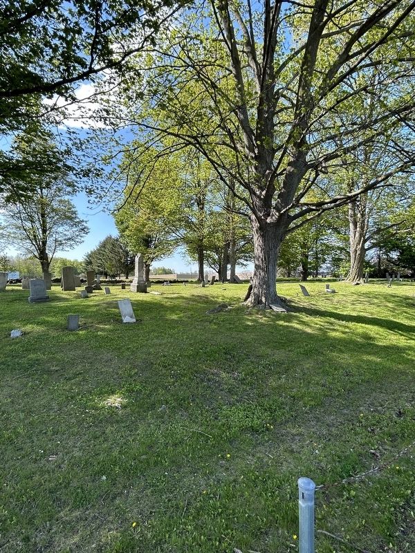
Rev. Samuel S. Day 1808-1871
Roenna Clark his wife 1809-1881
Founders of the American Baptist
Telugu Mission India
Mary M. Day their dau. 1839-1915
Missionary in India 32 y'rs.
The Lone Star Mission and their example
of faith . . . — — Map (db m141474) HM
Near River Street south of Patterson Street, on the right when traveling south.
Centuries ago, the land including this park was the site of a stockaded Indian village and burial knoll. Other Indian villages followed at intervals. The area is rich in Revolutionary history. In 1901, a factory was built on this and adjoining . . . — — Map (db m220624) HM
Located 530 ft. Northeast surrounded by distinctive stone slab fence. Family burials 1835-1906 and three possible unknown burials. — — Map (db m207454) HM
On Wolcott Avenue (New York State Route 9D), on the right when traveling south.
Burial site of William Few, Jr. 1748 – 1828 Signer of U.S. Constitution for the State of Georgia – 1787 Reinterred in Augusta, Georgia – October 1973 — — Map (db m44515) HM
On Wolcott Avenue (New York State Route 9D), on the right when traveling south.
In this tomb rests the remains of William Few Born June 18, 1748 – Died July 16, 1828 Lieut. Colonel, Georgia Militia during the American Revolution, 1776-1779. Member, Continental Congress, 1780-1788 Signed Federal Constitution, 1787 . . . — — Map (db m44562) HM
On Van Wyck Lake Road at U.S. 9, on the left when traveling east on Van Wyck Lake Road.
In memory of those who served in the Continental Army, while at the Fishkill Supply Depot. Near here lie buried Revolutionary War heroes, patriots who were among the first to fight for our freedom. On behalf of these valiant soldiers, we dedicate . . . — — Map (db m190178) HM
Near Albany Post Road (U.S. 9) at FDR Drive, on the left when traveling north.
I felt like the moon, the stars, and all the planets had fallen on me. - President Harry S. Truman, Roosevelt’s successor.
I’m walking south on Michigan Boulevard and I can’t stop crying. Everybody’s crying. - Studs Terkel, writer. . . . — — Map (db m83112) HM
Son of Philip & Rebecca Hamilton.
Killed in the Battle of the Washita
Nov. 27, 1868,
"while gallantly leading his command."
"A little while, and ye shall see me."
—————————————————————————
Born July 21, 1844 at the City of New York; . . . — — Map (db m210636) HM WM
Dedicated by
Hamilton-Sleight Post
Grand Army of the Republic
1923
to the memory of
their comrades
in the Civil War
1861 - 1865
———————————————————
"The world will little note, nor
long remember what we say here;
but it can . . . — — Map (db m210624) WM
For fifty years a minister
and twenty eight a bishop
in the
Methodist Episcopal Church.
In his ministry he performed
an astonishing amount of labor
and endured many hardships.
He was a pattern of Christian
propriety and integrity . . . — — Map (db m210641) HM
In memory of members of the
Volunteer Fire Department
of Poughkeepsie
who died in the service of
The World War
1917—1918
Herrman H. Vail • Captain
Charles V. Byrne • Corporal
August L. Madlinger • Seaman
Judson Moshier • Cook . . . — — Map (db m210638) HM
Sacred to the memory of
Samuel Neilson
An Irish patriot of 1798
One of the founders of the
United Irishmen
who sacrificed his fortune and his life
in the cause of his country
Born in County Down, Ireland, Sept 1761.
Died in . . . — — Map (db m210619) HM
In Memoriam
U.S.S. Maine
Destroyed in Havana Harbor
February 15th 1898
This tablet cast from metal recovered
from the U.S.S. Maine
———————————————————
[Teddy Roosevelt bas relief]
"Aggressive fighting for the right
is the . . . — — Map (db m210631) WM
On Bruzgul Road (County Route 21) at Clapp Hill Road, on the left when traveling east on Bruzgul Road.
Potters Corners Burying Ground
Early stone marked 1785
Site of Trinity Methodist Church
Until 1860’s
Union Vale Historical Society — — Map (db m24880) HM
On Feddick Road (County Route 469) 0.1 miles west of Zimmerman Road (County Route 467), on the right when traveling west.
Horton Hill Bros. John & Truman Horton walked from New Lebanon, NY to Concord. Bought land in 1815 from Holland Land Co. Bought land in Boston 1834. — — Map (db m80635) HM
On Feddick Road (County Route 469) 0.6 miles south of Keller Road, on the right when traveling south.
West Boston A German evangelical church was organized 1834 with 20 members. Rev. Jacob Bastian served for many years. All that remains ia a cemetery. — — Map (db m93781) HM
On Military Road (New York State Route 265) at Lansing Street, on the right when traveling south on Military Road. Reported missing.
St. John's German United Evangelical Church acquired this site in 1862 for its cemetery. Black Rock pioneers including War of 1812 veterans, German immigrants who began arriving in the 1840s, and their descendants through the mid 1920s were . . . — — Map (db m93774) HM
Final resting place of The Senecas of the Genesee Valley that the Mt. Morris Dam inundated. Buffalo Creek Council Fire. June 22, 1952 — — Map (db m137877) HM
Near Main Street (New York State Route 5) near Delaware Avenue.
Surgeon - Brigadier General - Inventor of the 'Wig-Wag' signal system - First director of the Army Signal Corps - Founder of the U.S. Weather Bureau - U.S. Delegate to the International Meteorological Conferences of Vienna, Austria, 1873 & Rome, . . . — — Map (db m65473) HM
Near Main Street (New York State Route 5) near Delaware Avenue.
Born in Beckett, Massachusetts, Williams College class of 1799, first lawyer west of the Genesee River.
Escaped captors during the War of 1812. Buffalo board of trustees president in 1816, founding member of the Buffalo Harbor Company, first Judge . . . — — Map (db m65474) HM
Near Main Street (New York State Route 5) at West Delavan.
Burial place of Millard Fillmore, Samuel Wilkeson, Red Jacket and other famous Buffalonians, including veterans of seven wars. Site of homestead of Erastus Granger, first Indian Agent. — — Map (db m81167) HM
Near Main Street (New York State Route 5) near Delaware Avenue.
13th President of the United States of America
Born January 7, 1800. Died March 8, 1874
Dedicated by The Millard Fillmore Republican Women's Club
Memorial Day May 30, 1932 — — Map (db m65479) HM
Near Main Street (New York State Route 5) near Delaware Avenue.
Sa-Co-ye-Wat-Ha (He keeps them awake)
Died at Buffalo Creek January 20, 1830 aged 78 years.
"When I am gone and my warnings are no longer heeded, the graft and avarice of the white man will prevail. My heart fails me when I think of my people, so . . . — — Map (db m65478) HM
In this vicinity from 1780 to 1842 dwelt the larger portion of the Seneca Nation of the Iroquois League. In this enclosure were buried Red Jacket, Mary Jemison the white woman of the Genesee and many of the noted chiefs and leaders of the nation . . . — — Map (db m232547) HM
This tablet is erected by the Buffalo Historical Society in honor of the American and British soldiers of the War of 1812 who died in the military hospital at Williamsville, New York and were buried here in 1814 and 1815. — — Map (db m74884) HM WM
On Buffalo Road (County Route 413) 0.1 miles east of Springville Boston Road (County Route 228), on the left when traveling south.
Erie County's Gateway to the Allegheny Mountains. You are standing in the historic Concord Community Park. The land was donated and the park was created in 1952, becoming the home of the Springville Baseball Club. The club converted a 20 acre . . . — — Map (db m104197) HM
On Millard Fillmore Place at Temple Place on Millard Fillmore Place.
East Aurora Cemetery
This plaque dedicated to the
memory of the pioneers who
settled in the town of Aurora
and erected by their descendants
in 1968.
The Allaire Co Buffalo NY
Established 1827
Attached plaque -
Revolutionary . . . — — Map (db m130980) HM
On North Main Street (U.S. 62) 0.2 miles north of Shadigee Road (County Route 476), on the right when traveling south.
Quaker Cemetery 26th day of 10th month 1813 Friends of Eden requested permission to hold meetings. Log meeting house was built across road from cemetery. — — Map (db m93796) HM
On North Main Street, 0.2 miles south of Gold Street, on the right when traveling south.
Burial Site of Asa Ames 1823-1851 Celebrated folk artist. His wood carvings are exhibited in many acclaimed folk art museums. Town of Evans Historical Society.
Pioneer Cemetery 1810-1928 Burial ground of early settlers in Evans . . . — — Map (db m75199) HM
On Gowanda State Road (aka: North Collins Road) (U.S. 62) at Shirley Road (County Route 447), on the right when traveling south on Gowanda State Road (aka: North Collins Road).
Near Southwestern Boulevard (U.S. 20) 0.1 miles west of Countryside Lane.
In 1848, Johann Georg Michael, a stone mason, came from Fischborn, Baden, Germany, to establish a residence in East Hamburgh, New York. On his 80 acres, he grew fruit. In 1855, he married Caroline Reichert from Unterschefflenz, Baden, Germany. The . . . — — Map (db m82368) HM
On Delaware Road at Willow Breeze Road, on the right when traveling north on Delaware Road.
This is one of the early cemeteries in the Town of Tonawanda. Donated by Jeremiah and David Failing, it is now known as the Failing Cemetery. — — Map (db m92761) HM
On Court Street (U.S. 9) at Park Street, on the left when traveling north on Court Street.
John Brown’s body guarded by local citizens rested in this court house on the night of Dec. 6, 1859 on its way to burial at his home in North Elba. — — Map (db m136665) HM
Near John Brown Road, 0.5 miles south of New York State Route 73, on the right.
John Brown of Osawatomie
Here Lies Buried
John Brown
Born at Torrington, Connecticut
May 9th, 1800
He emigrated to Kansas in 1855 where he took an active part in the contest against the pro-slavery party. He gained in August 1856 a . . . — — Map (db m46521) HM
On Sandy Redoubt, on the right when traveling south.
Here are interred the bones of Eighteen Colonial Soldiers found near the Old Military Road in Ticonderoga Village on Nov. 1st 1924 — — Map (db m9650) HM
On Sandy Redoubt, on the right when traveling south.
Here are buried several hundred officers and men of the American Army, chiefly New York, New Jersey and Pennsylvania Militia 1775-77. — — Map (db m9582) HM
On The Portage at Treadway Street, on the right when traveling south on The Portage.
On October 3rd, 1889, a workman digging a trench opened by mere accident across the street from this point, a grave which contained the skeleton of a man, and within this grave found, at its head, a stone, now in the Black Watch Library in this . . . — — Map (db m9539) HM
On New York State Route 9N, on the left when traveling south.
One of the earliest common burying grounds of historic Ticonderoga. Memorialized here are many first settlers, early doctors and supervisors, the town’s first State Senator, veterans of the Revolutionary, 1812, and Civil Wars. Last burial of a Civil . . . — — Map (db m11711) HM
On New York State Route 309, 0.2 miles south of Lilly Lake road and 112 (County Route 112), on the left when traveling north.
Earliest gravestone 1852
Several unmarked/fieldstone
Near site of first tannery c. 1840 in Bleecker, NY
A.k.a. School District #3 Cemetery — — Map (db m131497) HM
On County Road 125 (County Route 125) 0.2 miles east of Bowlers Hill Road, on the left when traveling east.
Earliest gravestone 1811
Several unmarked/fieldstone
Named for early Bleecker settler, c. 1795
A.k.a. Upper Bleecker or Grant Cemetery — — Map (db m176628) HM
On County Route 112, 0.1 miles south of Gutha Road, on the right when traveling north.
Earliest gravestone 1862 Several unmarked/fieldstone Church built 1866, closed in mid 1930's Reopened 1945 as Bleecker Community Church — — Map (db m131495) HM
On County Route 146, on the right when traveling west.
Graves of Captain Gershom Woodworth, French and Indian and Revolutionary Wars and Sergeant Selah Woodworth of Revolution: Mayfield Pioneer. — — Map (db m68208) HM
On Riceville Road south of Phelps Street, on the right when traveling south.
Here are Buried Jonathan Fisk-
Oliver Rice-William Woodworth-
Samuel Woodworth-Jesse Foote-
Isaac Bemis-Jonathan Canfield-
Soldiers of The Revolution
— — Map (db m225060) HM
On County Route 152, on the right when traveling south.
King Cemetery
Henry King and son John
Settled on this site and
Are buried here. Graves
of Revolutionary soldiers
And pioneers of 1788-1815.
— — Map (db m51154) HM
On County Route 107, 0.1 miles east of New York State Route 30, on the left when traveling west.
Founded Jan. 19, 1807 on land
donated by Daniel McIntyre.
Some burials already there.
Perth Cemetery Assoc.
formed Mar. 10, 1874. — — Map (db m148060) HM
On Alleghany Road (New York State Route 77) 0.1 miles south of Judge Road (New York State Route 63), on the right when traveling south.
Deeded to: "Trustees of the Burying Ground in School District #8", Town of Alabama, by Rev. Augustus Warren & his 2nd wife Maria, May 19, 1842. To all those buried here - May You Rest in Peace. — — Map (db m86682) HM
On Harvester Avenue, 0.1 miles south of Main Street (New York State Route 33/5), on the left when traveling south.
Batavia Cemetery
Has been placed on the
National Register of
Historic Places in 2002
by the United States
Department of Interior — — Map (db m158623) HM
On South Lyon Street, 0.2 miles south of West Main Street (New York State Route 5), on the right when traveling south.
Early Cemetery in village of Batavia on this site deeded August 10, 1820. Bodies were re-interred to other cemeteries in Batavia — — Map (db m94895) HM
On Harvester Avenue, on the left when traveling south.
Born - 1760 Died - 1826
Surveyor - Land Developer
Agent of Holland Land Co.
Land Office - Batavia, N.Y.
Family Monument (200' East) — — Map (db m83417) HM
Near Harvester Avenue, 0.2 miles south of East Main Street (New York State Route 5).
Joseph Ellicottwas born in Bucks County, Penna., November 1st, 1760. Died at New York, August 19th, 1826. He was the first resident agent of the Holland Land Company for whom in 1798 he began the survey of the western part of the state then owned . . . — — Map (db m83098) HM
Near County Route 42 near Peter Bronck Road, on the left when traveling north.
Prior to the Revolutionary War, burial
sites were unprotected, reused, unmarked, frequently disturbed and for other purposes such as agriculture. In the 1790s Americans reconsided how and where the dead were buried. This Bronck Burying Ground is . . . — — Map (db m178792) HM
On New York State Route 81, 0.2 miles west of Guild Road, on the right when traveling east.
Oak Hill Cemetery
has been placed on the
National Register of
Historic Places in 2011
by the United States
Department of the Interior — — Map (db m145171) HM
Near NY Thruway (U.S. I-90), on the right when traveling west.
(Three miles northwest of Remsen, Oneida County) Home and grave of Baron Frederick William von Steuben (1730-1794) Drillmaster of the American Revolution Arriving at Valley Forge in February, 1778, this German-born officer found . . . — — Map (db m75979) HM
Near New York State Route 169 east of General Herkimer Road, on the right when traveling north.
Gen.
Nicholas Herkimer
Died
Aug. 17, 1777.
Ten days after the
battle of Oriskany, in
which engagement
he received wounds which
caused his death — — Map (db m66096) HM
758 entries matched your criteria. Entries 101 through 200 are listed above. ⊲ Previous 100 — Next 100 ⊳