Camp SCS-4 (Huron): located on SE corner of State Fair Grounds. Companies: 2770--10/31/35-10/7/37; 4725V--10/7/37-8/15/41.
The Civilian Conservation Corps was a federal work - relief program during the Great Depression. From 1933 to 1942, . . . — — Map (db m179885) HM
The World's Largest Pheasant spans 40 feet in length, stands 28 feet tall, and weighs 22 tons. It was dedicated on October 18, 1959. Sculptor RF Jacobs of Gooding, Idaho completed the project in 4 ½ months, costing $23,000 at that time. The . . . — — Map (db m123909) HM
Camp BF-3: located 1 mile E, 4 miles S, 1 mile W & 5 miles S
Company: 4723 May 1937-Fall 1939
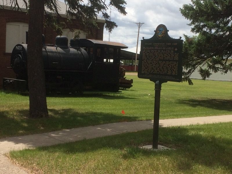
The Civilian Conservation Corps was a federal relief program during 1933-1942 that gave jobless men work renovating abused lands. The Army . . . — — Map (db m137082) HM
This 108-foot tower was built by the Civilian Conservation corps in 1936. The Sand Lake CCC camp ran from 1925 through 1939 and housed several hundred men. They built many of the dikes, fences, and facilities you see on the Refuge today. The . . . — — Map (db m103080) HM
Pollock, South Dakota Settlers The first settlers came to this area
about 1880. LaGrace, 9 miles
southwest, was the first town and
the County seat until 1888, when
It gradually disappeared.
The town of Pollock was founded
In 1901 at . . . — — Map (db m112086) HM
Did you notice that this forest burned? Some areas show no signs of fire. Blackened tree skeletons tell of crown fire in other areas. This is a typical burn mosaic of a western wildfire. How did the visitor center and nearby trees survive? Fire . . . — — Map (db m37096) HM
This sculpture depicts a bird atop a person and is meant to show a co-existence of man, animals, and societal or physical environment. Other visual forms that appear bring a message of reconciliation with nature.
Oscar Howe, the eminent Yanktonai . . . — — Map (db m124207) HM
The landscape before you has undergone many changes since 1804. The Army's Corps of Discovery, headed by Captains Meriwether Lewis and William Clark, passed through here heading west. The hill you are standing on is man-made, associated with . . . — — Map (db m112893) HM
This is the site of the Burlington Interurban Power Plant, commonly known as the Burlington Powerhouse. The Powerhouse was originally built to generate electricity to run a passenger trolley between the cities of Lead and Deadwood. The Powerhouse . . . — — Map (db m183463) HM
(Panel 1)
In its heyday, the Chicago Burlington & Quincy Railroad yard was a beehive of activity. Four different railroads including the Deadwood Central, the Black Hills & Ft. Pierre, the Grand Island & Wyoming Central, and the . . . — — Map (db m121051) HM
Since 1877, four county jails have been constructed within the Deadwood city limits. The first jail was erected in May of 1877 in the Ingleside Townsite (today's Presidential Neighborhood) and consisted of a 30 x 50 foot log structure enclosed by a . . . — — Map (db m120998) HM
This brick structure before you served as the foundation base and cleanout chamber that supported the 135-foot smokestack. Once part of the Burlington & Missouri Railroad Powerhouse complex, this brick feature was created in 1901 and helped supply . . . — — Map (db m183432) HM
It took about a thousand people just 255 days to build the 114-mile Chicago, Burlington and Quincy Railroad between Edgemont and Deadwood using primitive methods. It took more than 15 years to complete the George S. Mickelson Trail on the . . . — — Map (db m183281) HM
Lead's City Hall was located in this ornate building at 215 West Main Street from 1912 until 1938. The building originally housed the mayor's and treasurer's offices, the courtroom, jail, and judge's chambers. After construction of a new City Hall . . . — — Map (db m121489) HM
Lead's earliest city hall was located in the old business district, an area that was eventually lost due to ground subsidence. A new City Hall had then been constructed in 1912 on the corner of Main and Siever Streets and served the community until . . . — — Map (db m121499) HM
In the early days of mining stamp mills were used to crush the ore prior to gold recovery. A stamp mill is a very simple machine. The flywheel builds momentum to turn the cam. The cam lifts the stamps and then gravity drops them back down at a rate . . . — — Map (db m121493) HM
Homestake Mining Company Locomotive Number 9 was purchased in 1907 from the H.K. Porter Company of Pittsburgh Pennsylvania. The H.K. Porter number for this locomotive was 3847.
This locomotive is powered by compressed air. The capacity of the . . . — — Map (db m121593) HM
The Halloran Block was designed by City of Lead Architect J. A. Archibald and was completed for James Halloran in December, 1897. Mr. Halloran originally came to the Black Hills with the Custer Expedition of 1874. James Halloran was a prime mover . . . — — Map (db m121495) HM
Locomotive Number 35 was purchased in April, 1931 from the H.K. Porter Company of Pittsburgh, Pennsylvania. This locomotive was in service on the Homestake Tramway hauling ore from the Homestake shafts to the Homestake mills.
This locomotive is . . . — — Map (db m121492) HM
The one-ton ore cars were prevalent throughout the mining industry in the early Twentieth Century. These ore cars were small enough to be used in the smallest tunnels to haul rock from the production face to a dump point. Some dump points were over . . . — — Map (db m121494) HM
Slag buggies, cast at the Homestake Foundry, were used in two different processes at the Homestake Refinery. One process was receiving slag produced in the blast furnace process. The Homestake blast furnace process utilized a coke-fired furnace to . . . — — Map (db m121498) HM
Built between 1912-1914 by the Homestake Mining Company, this $250,000 facility included not only a beautiful modern opera house with a seating capacity of over 1,000, but also a bowling alley, swimming pool, library, social rooms, and billiard and . . . — — Map (db m121500) HM
The national Good Roads Movement was a coordinated effort to improve roadways across the United States. The automobile helped define roadways, sometimes referred to as "auto trails". In 1912, the "Black and Yellow Trail", more specifically the . . . — — Map (db m121095) HM
During the City's early years, a number of industries located at the Falls of the Big Sioux River and used the energy produced by the river's flow to run their machinery.
The Queen Bee Mill and the Sioux Falls Light & Power Company . . . — — Map (db m124191) HM
The Falls were at the heart of the young city of Sioux Falls — nicknamed the Queen City. The Queen Bee Mill stood at the most powerful point of the Falls and was a center of activity in the 1880s.
The Queen Bee Mill was sited to take full . . . — — Map (db m124190) HM
Side 1
When T.H. Lewis surveyed burial mounds in this area in 1884, he sketched an unusual and puzzling linear or "cigar" shaped mound at this spot. Lying from the southeast to the northwest, it measured 60 by 20 feet and was 1 foot . . . — — Map (db m139854) HM
In these mounds were buried the physical remains of Indians who lived in eastern South Dakota 1600 years ago. Radiocarbon testing established the time of the burials. Known to archaeologists as the Woodland Indians, they moved westward from the . . . — — Map (db m179951) HM
Side 1
Between 300 to 1000 A.D., stone-age people of the Late Woodland culture lived nearby. They were among the first permanent residents of Sioux Falls. Proof of their existence is provided by the line of five burial mounds that they . . . — — Map (db m139820) HM
(side 1)
In 1891, the Unites States Government purchased the southeast corner lot on Phillips Avenue and 12th Street for $8,000 for the construction of a government building. While everyone agreed that the fledgling city of Sioux Falls . . . — — Map (db m124096) HM
For most of the 119 years between 1873 and 1992, a majority of Sioux Falls children attended one of three successive public schools erected on this site. The first, an unnamed small wood-frame elementary school, was replaced five years later by . . . — — Map (db m124194) HM
South Dakota Mahogany Granite - Sculptor Darold E. Bailey - 1999
Herds of Buffalo Roamed the Falls Area in the 1800's
The First Sculpture at Falls Park
Sioux Falls Sponsors
Denny and Char Oviati
Freda Horsmann Dawley
David . . . — — Map (db m112687) HM
(Side One)
Congress appropriated $30,000 in 1881 for the construction of a prison in Sioux Falls to serve Dakota Territory. In order to finance a building large enough to house up to 150 inmates, the territorial legislature . . . — — Map (db m131714) HM
The Harney Peak fire lookout, dam
and pumphouse were built by the
CCC in 1939 and are listed in the
National Register of Historic
Places. Harney Peak Elevation is
2207 meters (7242 ft). The peak is
the highest point east of the . . . — — Map (db m125087) HM
This memorial dedicated to
the young men of the
Civilian Conservation Corps
1933-1942
Made possible by a grant from
”Sarge”
Melvin B. Hermanson
2008 — — Map (db m120159) HM
Sheridan, located 1/2 mile NE, now 30 feet under water, was named for General Philip Sheridan and founded in 1875 on Cheyenne-Deadwood Trail, as Golden, in the belief that fabulous placer gold existed here. Still Indian Country and everybody a . . . — — Map (db m184420) HM
Construction of Pactola Dam began in 1952 and was completed in 1956. At times nearly 200 men worked on the dam. Unskilled workers earned $1.25 an hour and skilled workers $2.75 an hour. The men placed 2,163,251 cubic yards of impervious earthfill . . . — — Map (db m37064) HM
By the mid-20th century, water in the West did more than irrigate 160 acre patches of alfalfa. Water flowed as the life blood of cities, private industries, and military bases. Droughts during the 1930s illustrated that Rapid City could not depend . . . — — Map (db m37070) HM
His birthplace was Idaho. California first taught him art. Then France, who first gave him fame. England welcomed him. America called him home. His genius for the exquisite as for the colossal, gave permanence on canvas, in bronze, in marble, to . . . — — Map (db m49105) HM
His birthplace was Idaho. California first taught him art. Then France, who first gave him fame. England welcomed him. America called him home. His genius for the exquisite as for the colossal gave permanence on canvas, in bronze, in marble, to . . . — — Map (db m134568) HM
Doane Robinson (1856-1946) was the South Dakota state historian from 1901 to 1926. Speaking to the Black and Yellow Trail Association in January 1924, Robinson proposed his idea to carve legendary figures of the American West into the Black Hills . . . — — Map (db m184424) HM
Castle
This magnificent structure has been constructed out of prehistoric logs, some of which weigh more than 10,000 pounds apiece. The entire castle is composed of more than 300 tons of petrified rock (think 8 full semi-trucks, or 200 . . . — — Map (db m231224) HM
Ole S. Quammen, the mastermind behind the Petrified Wood Park, was born in 1871, his family immigrated to America in 1872 and homesteaded in MN. When Quammen was 23 he became a Watkins Medical Co. distributor which eventually led him to Voltaire, ND . . . — — Map (db m231140) HM
Constructed in 1933, the Petrified Wood Park Museum is a truly impressive structure. The walls of the building are constructed from petrified logs and the flooring of the original building is made of petrified grass and reeds. The base of the walls . . . — — Map (db m231226) HM
A bit of history lies under the water behind Oahe Dam. Before the dam was built many islands and sandbars were commonly found along the Missouri River. When the Corps of Discovery traveled along this river on the way to the Pacific Ocean they . . . — — Map (db m112088) HM
This wide, low moving, Missouri River of today is quite different from when the Corps of Discovery navigated in then torrent waters in 1804. Lewis and Clark fought against the strong current, using ropes to pull the boat upstream. By the time . . . — — Map (db m112114) HM