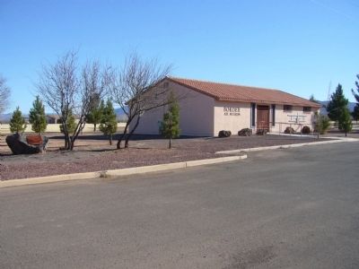
On West Airport Road near 10th Street, on the right when traveling north.
At this location on June 5, 1933, First Lady Eleanor Roosevelt, wife of President Franklin Delano Roosevelt, dedicated Douglas International Airport as the first international airport in the United States.
Designed by J. P. Sexton as the first . . . — — Map (db m28357) HM
On Hatfield Street at Irwin Street, on the right when traveling south on Hatfield Street.
The Crazyhorse system was fielded in 1985 to meet the need for a capability to locate unique electronic emissions in Central America. It consisted of three RC – 12G airframes converted from C – 12D aircraft by Sanders Associates, . . . — — Map (db m29587) HM
On Hatfield Street at Irwin Street, on the right when traveling south on Hatfield Street.
The Mohawk is a high-performance, two-seat, observation aircraft made by the Grumman Corporation. The first model flew in 1959 and the last came off the production line in 1970. First deployed in 1962, it became the mainstay of Army aerial . . . — — Map (db m29588) HM
On North Circle I Road north of Fort Grant Road (Arizona Route 186), on the right when traveling north.
On 30 December, 1951, during a routine training flight from Merced, California, to Tyndall Air Force Base, Florida, Lt. Robert G. Westlund lost his life when his F-51 "Mustang" fighter plane crashed near Sunset Peak in the Galiuro Mountains . . . — — Map (db m28414) HM
Near South San Francisco Street when traveling east.
On June 30, 1956, a TWA Constellation and a United Airlines DC-7 collided over the Grand Canyon. The 123 passengers and crew members aboard both aircraft perished.
This site is a common burial and memorial to 66 of the 70 TWA passengers and . . . — — Map (db m154949) HM
Near West Mars Hill Road, 0.6 miles west of West Santa Fe Avenue.
This 11-ton telescope, built by the Alvan Clark & Sons Telescope Manufacturing Company of Cambridgeport, Massachusetts, was installed at Lowell Observatory in 1909. It came with four secondary mirror combinations so that it could be operated at four . . . — — Map (db m149451) HM
Near West Mars Hill Road, 0.6 miles west of West Santa Fe Avenue.
Understanding and predicting local weather patterns helps astronomers plan successful observing runs. Because of this, observatories such as Lowell typically maintain weather stations to monitor the conditions. One such station was set up at the . . . — — Map (db m149452) HM
Near West Mars Hill Road, 0.6 miles west of West Santa Fe Avenue.
Another life-long employee of Lowell Observatory, Henry is best remembered for his Proper Motion Study of 1971, which entailed repeating the Pluto search plates after 25 years to determine whatever changes had taken place in the background of . . . — — Map (db m149456) HM
Near West Mars Hill Road, 0.6 miles west of West Santa Fe Avenue.
Lowell Observatory has been designated a Registered National Historic Landmark Under the provisions of the Historic Sites Act of August 21, 1935 this site possesses exceptional value in commemorating or illustrating the History of The . . . — — Map (db m149455) HM
Near West Mars Hill Road, 0.6 miles west of West Santa Fe Avenue.
A gift to the Observatory from President A. Lawrence Lowell through this instrument the ninth planet Pluto was first found in 1930 ”It means a planet out there as yet unseen by Man, but certain sometime to be detected and added to the . . . — — Map (db m149454) HM
Near Desert View Road, 0.5 miles north of Desert View Drive.
1956 Grand Canyon TWA-United Airlines Aviation Accident Site has been designated a National Historic Landmark.
This tragic accident site represents a watershed moment in the modernization of America's airways leading to the establishment of . . . — — Map (db m81861) HM
Near Desert View Drive (Arizona Route 64) 21.4 miles east of South Entrance Road, on the left when traveling east.
Catastrophe can happen even in spectacular beauty. When technological achievements and human actions fail, disasters may happen.
On June 30, 1956, a United Airlines DC-7 and a TWA Super Constellation maneuvered around towering cumulus clouds on . . . — — Map (db m124533) HM
On Plymouth Road north of East Quail Trail Street, on the left when traveling north.
McDonnell Douglas F-4 Phantom was a multi-service aircraft, served as primary fighter with Air Force, Navy and Marine Corps during Vietnam era. Carrying a crew of two, Pilot and Weapon Systems Officer, it was capable of speeds in excess of Mach . . . — — Map (db m118796) HM
On N. Greenfield Road at E. McKellips Road, on the right when traveling north on N. Greenfield Road.
Commemorative Air Force
Arizona Military Aviation
Walk of Honor
Proudly Recognizes
1st Lieutenant Ralph Ambrose O’Neill
1896 — 1980
Hailing from Nogales AZ, Ralph O’Neill served in the U.S. Army Air Service with the 147th Aero . . . — — Map (db m102904) HM WM
On N. Greenfield Road at E. McKellips Road, on the right when traveling north on N. Greenfield Road.
The 3-Inch Mark 33 is a twin dual-purpose drive mount on a carriage base ring structure used with selective remote or local control. The Gun is primarily designed for defense against enemy aircraft and was installed on combat ships. Each gun is . . . — — Map (db m102917) HM WM
On North Greenfield Road, on the right when traveling north.
This propeller, one of four, was installed on a B-29 Super Fortress. The B-29 was the largest and deadliest American heavy bomber of WWII. It is the aircraft that effectively ended WWII by delivering atomic bombs on Hiroshima and Nagasaki in August . . . — — Map (db m49868) HM
On N. Greenfield Road at E. McKellips Road, on the right when traveling north on N. Greenfield Road.
Commemorative Air Force
Arizona Military Aviation
Walk of Honor
Proudly Recognizes
Arizonan Tuskegee Airmen
1940 — 1949
“Red Tails”
The Tuskegee Airmen set the precedent African-Americans could excel in military . . . — — Map (db m102913) HM WM
On N. Greenfield Road at E. McKellips Road, on the right when traveling north on N. Greenfield Road.
Commemorative Air Force
Arizona Military Aviation
Walk of Honor
Proudly Recognizes
Arizonan Women Airforce Service Pilots – WASP
1942 — 1944
“We live in the wind and sand … and our eyes are on the stars!”
The . . . — — Map (db m102898) HM WM
On N. Greenfield Road at E. McKellips Road, on the right when traveling north on N. Greenfield Road.
Commemorative Air Force
Arizona Military Aviation
Walk of Honor
Proudly Recognizes
Barrett Tillman
Barrett Tillman (born 1948) is an award-winning author who has made significant contributions to aviation history. As a teenaged private . . . — — Map (db m102907) HM
On N. Greenfield Road at E. McKellips Road, on the right when traveling north on N. Greenfield Road.
Commemorative Air Force
Arizona Military Aviation
Walk of Honor
Proudly Recognizes
BGen. Joseph J. Foss
1915 — 2003
Medal of Honor
Brigadier General Joseph J. Foss was awarded the Medal of Honor while flying with Marine Fighting . . . — — Map (db m102912) HM WM
On N. Greenfield Road at E. McKellips Road, on the right when traveling north on N. Greenfield Road.
Commemorative Air Force
Arizona Military Aviation
Walk of Honor
Proudly Recognizes
Captain Ted Elvans Lines (AAF)
1921 — 2005
Born and raised in Arizona, Ted Lines joined the U.S. Army Air Forces after his graduation from Mesa Union . . . — — Map (db m102908) HM WM
On N. Greenfield Road at E. McKellips Road, on the right when traveling north on N. Greenfield Road.
Commemorative Air Force
Arizona Military Aviation
Walk of Honor
Proudly Recognizes
Colonel Bruce Perry Crandall U.S. Army (Ret.)
1933 —
Colonel Bruce Crandall served two tours in Vietnam as a Army helicopter pilot, leading over 900 . . . — — Map (db m102901) HM WM
On N. Greenfield Road at E. McKellips Road, on the right when traveling north on N. Greenfield Road.
Commemorative Air Force
Arizona Military Aviation
Walk of Honor
Proudly Recognizes
Dr. S. Harry Robertson III
1934 —
Father of Crashworthy Fuel Systems
Dr. S. Harry Robertson, a life-long Arizonan, has made unique contributions to . . . — — Map (db m102902) HM
On N. Greenfield Road at E. McKellips Road, on the right when traveling north on N. Greenfield Road.
Commemorative Air Force
Arizona Military Aviation
Walk of Honor
Proudly Recognizes
General Seth Jefferson McKee, USAF (Ret.)
1916 —
During World War II, General Seth McKee commanded the 370th Fighter Group in Europe and achieved . . . — — Map (db m102909) HM WM
On N. Greenfield Road at E. McKellips Road, on the right when traveling north on N. Greenfield Road.
Commemorative Air Force
Arizona Military Aviation
Walk of Honor
Proudly Recognizes
Lt. Frank Luke, Jr.
1897 — 1918
The Arizona Balloon Buster
Lieutenant Frank Luke, Jr. became “The Arizona Balloon Buster” of WWI. Flying with the 27th . . . — — Map (db m102899) HM WM
On N. Greenfield Road at E. McKellips Road, on the right when traveling north on N. Greenfield Road.
Commemorative Air Force
Arizona Military Aviation
Walk of Honor
Proudly Recognizes
Major Frederick E. Ferguson
1939 —
Medal of Honor
Frederick E. Ferguson gradated from the US Army Warrant Officer flight program in 1957 and was . . . — — Map (db m102900) HM WM
On N. Greenfield Road at E. McKellips Road, on the right when traveling north on N. Greenfield Road.
Commemorative Air Force
Arizona Military Aviation
Walk of Honor
Proudly Recognizes
Major Gen Carl G. Schneider, USAF (Ret)
Carl Schneider enlisted in the U.S. Army Air Force in 1946. He graduated from Williams AFB flying the P-51 Mustang. . . . — — Map (db m102905) HM WM
On N. Greenfield Road at E. McKellips Road, on the right when traveling north on N. Greenfield Road.
Commemorative Air Force
Arizona Military Aviation
Walk of Honor
Proudly Recognizes
MGen Barry Morris Goldwater, USAFR
1909 — 1993
Barry Goldwater served in World War II with the U.S. Army Air Force as an instructor and Ferry Command . . . — — Map (db m102903) HM
On Fighter Access Road, on the left when traveling west.
On June 12th, 1982, this plaque was unveiled to commemorate the years 1941 to 1945 when Falcon Field was established as No. 4 British Flying Training School.
To this airfield came many air cadets of the British Royal Air Force, British . . . — — Map (db m49869) HM
On N. Greenfield Road at E. McKellips Road, on the right when traveling north on N. Greenfield Road.
Commemorative Air Force
Arizona Military Aviation
Walk of Honor
Proudly Recognizes
Rear Admiral Hugh Dennis Wisely (USN, ret)
Admiral Wisely entered the Naval Aviation Cadet Program in 1961. He flew 350 combat missions with VF-114 over . . . — — Map (db m102906) HM WM
On N. Greenfield Road at E. McKellips Road, on the right when traveling north on N. Greenfield Road.
Commemorative Air Force
Arizona Military Aviation
Walk of Honor
Proudly Recognizes
Rear Admiral Walter Lewis Chatham, USN (Ret)
1934 —
Naval Aviator
Rear Admiral “Lew” Chatham, USN (Retired) has approximately 5,000 . . . — — Map (db m102910) HM WM
On N. Greenfield Road at E. McKellips Road, on the right when traveling north on N. Greenfield Road.
Commemorative Air Force
Arizona Military Aviation
Walk of Honor
Proudly Recognizes
Sergei I. Sikorsky
1925 —
Rotorcraft Pioneer
Mr. Sergei Sikorsky learned aviation from the ground up working with his father, Igor. He began . . . — — Map (db m102911) HM
On North Tegner Street at East Apache Street, on the right when traveling north on North Tegner Street.
b. July 12, 1899 Hope, NM
d. October 25, 1971 Wickenburg, AZ
Known as the cowboy's cowboy
Admired and revered by townsfolk
Father and organizer of Turtle Association 1936 which became the Professional Rodeo Cowboy Association
1937 Owned . . . — — Map (db m29473) HM
Near Beachcomber Boulevard west of Kiva Drive, on the right when traveling west.
Site #6, now officially known as Lake Havasu Auxiliary Field #6, was acquired by the Army Air Force during World War II as an emergency landing field for the Kingman Army Air Field's Yucca Aerial Gunnery Range. The emergency field was established . . . — — Map (db m145825) HM
On North McCoulloch Boulevard east of Capri Boulevard, on the left when traveling north.
Dedicated to Captain James A. Wheeler, United States Air Force, Tucson, Arizona, and all members of the armed services who have given their lives in the maintenance of freedom. Captain Wheeler was killed in combat April 18, 1965, over South Viet . . . — — Map (db m31839) HM
On U.S. 93, 3 miles north of Willow Beach Road, on the right when traveling south. Reported damaged.
With its rugged mountains, deep canyons, stark deserts, and two large blue lakes, America's first national recreation area is a place of great contrasts. Lake Mead National Recreation Area (NRA) was established in 1964, well after the waters of the . . . — — Map (db m193366) HM
On East 2nd Street, 0.1 miles east of North Kinsley Ave.
US Route 66: The Mother Road
In 1926, the section of the transcontinental National Old Trails Highway that passed through downtown Winslow on Second Street became part of US Route 66, which ran from Chicago to Los Angeles. The highway was . . . — — Map (db m239369) HM
On Meteor Crater Road, on the right when traveling west.
NASA
On October 1, 1958, the National Aeronautics and Space Administration (NASA) was created to promote American civilian interests in space. Established at first to direct the nations efforts toward the scientific exploration of space, the . . . — — Map (db m71635) HM
This test capsule, named Boiler Plate 29A never flew into space. Instead, the capsule was built in 1965 to test the systems that helped Apollo space capsules float upright after splashdown at sea.
The test capsule represents an Apollo command . . . — — Map (db m161618) HM
On East 2nd Street, 0.1 miles east of North Kinsley Ave.
After World War II, Winslow's growth slowed as technology reduced the railroad industry's manpower requirements. In 1979, downtown businesses were devastated when the Interstate 40 bypass opened. Today, the economy is more diversified, and Winslow's . . . — — Map (db m239387) HM
Tucson Air Museum Foundation
of Pima County
Titan II Intercontinental Ballistic Missile Museum
Established May 8, 1986
571st SMS, 390th SMW
Davis-Monthan AFB
Strategic Alert July 1963 – November 1982
National . . . — — Map (db m26926) HM
On South 6th Avenue at West Oklahoma Street, on the right when traveling north on South 6th Avenue.
[Marker Front:]
This ground was the location
of the
First Municipal Airport
in the
United States
The Tucson City Council approved the
financing for the airport, July 21, 1919
and
the City of Tucson in cooperation . . . — — Map (db m8432) HM
Near Arizona Route 386, 12 miles south of W. Tucson-Ajo Hwy. (Route 86), on the left when traveling south.
Steward Observatory
90 inch Reflector
University of Arizona
Erected 1967
Board of Regents
Jack Williams Governor · George W. Chambers President · Elwood W. Bradford · Sarah Folsom · Wesley P. Gross · Leon Levy · Norma Barr Rockfellow · . . . — — Map (db m102921) HM
Near Arizona Route 386, 12 miles south of W. Tucson-Ajo Hwy. (Arizona Route 86), on the left when traveling south.
The accompanying picture shows a cross section of the solar vacuum telescope. This facility, built in 1973, is used to study the evolution of sunspots and other solar magnetic fields. It is operated daily by the National Solar Observatory (NSO) . . . — — Map (db m102918) HM
Near Arizona Route 386, 12 miles south of W. Tucson-Ajo Hwy. (Arizona Route 86), on the left when traveling south.
The octagon-shaped building that you see in the distance is the enclosure for the telescope of the WIYN Observatory. Completed in 1994, WIYN is owned and operated by the University of Wisconsin, Indiana University, Yale University, and the . . . — — Map (db m102920) HM
Near Sabino Canyon Road at North Kolb Road, on the right when traveling north.
On November 30, 1944, at 7:40 A.M. 18 airmen from Davis-Monthan Army Air Field died following a mid-air collision between two B-24 Liberator Bombers over the Pantano Wash. This bridge is dedicated to those brave men who lost their lives while on a . . . — — Map (db m100761) HM WM
Near East Valencia Road, 0.3 miles west of South Wilmot Road.
Douglas C-54D Skymaster Transport 1942-1975
On loan from the National Museum of the United States Air Force
2nd Plaque
Douglas C-54D
This aircraft served in the Berlin Airlift in 1949 and is painted as such (despite . . . — — Map (db m185679) HM