On Martin Luther King Boulevard at Harrison Avenue, on the right when traveling east on Martin Luther King Boulevard.
Front
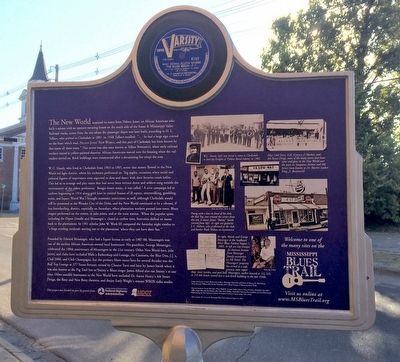
This neighborhood, known since the turn of the twentieth century as the New World, was a breeding ground for ragtime, blues, and jazz music in Clarksdale's early days as a prosperous and adventurous new cotton town, when . . . — — Map (db m90060) HM
On Issaquena Avenue at Blues Alley, on the right when traveling south on Issaquena Avenue.
"Father of the Blues" composer and family lived at this site 1903-05. In
Clarksdale Handy was influenced by Delta blues which he collected
and later published as well as his own famous and influential music. — — Map (db m89929) HM
On Issaquena Avenue at Blues Alley, on the right when traveling south on Issaquena Avenue.
Front
One of Clarksdale's most talented and renowned blues musicians, Wade Walton (1923-2000) chose to pursue a career as a barber rather than as a professional entertainer. Walton never lost his love for blues, however, and often . . . — — Map (db m90049) HM
On Delta Avenue, 0.1 miles south of East 2nd Street, on the right when traveling south.
Front
WROX, Clarksdale’s first radio station, went on the air on June 5, 1944, from studios at 321 Delta Avenue. From 1945 until 1955 the station was headquartered here at 257 Delta. Legendary disc jockey Early “Soul Man” . . . — — Map (db m90033) HM
On Commissary Circle at Hopson Road, on the left when traveling north on Commissary Circle.
Front
One of the major factors behind the “great migration” of African Americans from the South to northern cities was the mechanization of agriculture, which diminished the need for manual laborers. In 1944 the Hopson . . . — — Map (db m90029) HM
On South Front Avenue at 2nd Street, on the left when traveling north on South Front Avenue.
Front
The Lula area has been home to legendary Mississippi blues performers Charley Patton, Son House, Frank Frost, and Sam Carr. Patton immortalized Lula in the lyrics of his recordings “Dry Well Blues” (1930) and . . . — — Map (db m107619) HM
On Oakhurst Stovall Road at Farrell-Eagles Nest West, on the right when traveling south on Oakhurst Stovall Road.
Front
Muddy Waters lived most of his first thirty years in a house on this site, part of the Stovall Plantation. In 1996 the restored house was put on display at the Delta Blues Museum in Clarksdale. Muddy Waters was first recorded here . . . — — Map (db m160400) HM
On West Railroad Avenue at West Georgetown Street, on the right when traveling south on West Railroad Avenue.
Tommy Johnson (1896-1956) was one of the most influential blues artists in Mississippi in the 1920s and 1930s. He grew up in the Crystal Springs area, where he often performed with his brothers LeDell and Mager. His original songs, which were widely . . . — — Map (db m50895) HM
On Caldwell Drive (U.S. 51) at West Gallatin Street, on the left when traveling south on Caldwell Drive.
Robert Johnson born Hazelhurst, Mississippi May 8, 1911 Copiah County
Robert Johnson recording career left an enormous legacy to American music. The body of his work is considered to be the most powerful of its kind.
His music struck a . . . — — Map (db m50874) HM
On South Ragsdale Avenue at West Gallatin Street, on the right when traveling north on South Ragsdale Avenue.
Front
The legendary bluesman Robert Johnson was born on the northern outskirts of Hazlehurst to Julia Major and Noah Johnson, on May 8, 1911 (or possibly 1912). Johnson lived in Tunica County and in Memphis as a child, but in the early . . . — — Map (db m81864) HM
On School Drive at Administration Drive, on the right when traveling west on School Drive.
The Utica Institute, founded by William Holtzclaw in 1903 and moved to this site in 1910, was modeled after the Tuskegee Institute. Booker T. Washington considered Utica a prime example of his vision for African American education. Known by a . . . — — Map (db m237872) HM
On Elm Street south of Southern Street, on the right when traveling south.
Founded in 1900 by the North Mississippi
Baptist Educational Convention, the
Baptist Industrial College was the first
school in De Soto County to offer
instruction through grade twelve to
African Americans, and one of the
earliest private . . . — — Map (db m170272) HM
On West Oak Grove Road, 0.3 miles west of College Street, on the left when traveling west.
Hernando Central School was the first black
school built in DeSoto County during the
equalization period, when the state tried to
preserve segregation by more fairly distributing
resources to black and white schools. Designed
by architect Walk . . . — — Map (db m170273) HM
On U.S. 51 at Vinson Road, on the right when traveling south on U.S. 51.
Front
James Meredith began his Memphis-to-Jackson
"March Against Fear" on June 4, 1966, challenging
a'the all-pervasive and overriding fear" that kept
black Mississippians from registering to vote. On
the second day, south of Hernando, . . . — — Map (db m141545) HM
On Center Street East south of Goodman Road (State Route 302), on the right when traveling south. Reported damaged.
Blues harmonica virtuoso Big Walter Horton was renowned for his innovative contributions to the music of Memphis and Chicago. Horton was born in Horn Lake on April 6, 1918, and began his career as a child working for tips on the streets of Memphis. . . . — — Map (db m170527) HM
On Pigeon Roost Road, 0.2 miles north of Camp Creek Blvd, on the left when traveling north.
East Side High was established under the direction of Rev. R.C. George as principal (1958-1968). Henry B. Wilkerson served as the second principal from 1968 to 1970. Opened as a segregated school for African Americans, East Side existed for just . . . — — Map (db m233661) HM
Albert King’s readily identifiable style made him one of the most important artists in the history of the blues, but his own identity was a longtime source of confusion. In interviews he said he was born in Indianola on April 25, 1923 (or 1924), and . . . — — Map (db m105007) HM
Near Airways Boulevard north of Church Road West, on the left when traveling north.
Dockery Farms, one of the most important plantations in the Delta, was founded in 1895 by William Alfred “Will” Dockery (1865-1936). Dockery purchased thousands of acres bordering the Sunflower River and worked for years to clear the . . . — — Map (db m104690) HM
Charley Patton has been called the Founder of the Delta Blues. He blazed a trail as the music’s preeminent entertainer and recording artist during the first third of the 20th century. Born between Bolton and Edwards, Mississippi, in April 1891, . . . — — Map (db m105041) HM
Near Airways Blvd, 0.3 miles north of Church Road.
Club Ebony, which opened for business around 1948, was built over a period of years by John Jones, who purchased the property in November of 1945 with his wife Josephine. In a 1948 memoir, Jones wrote: "It is said to be the South's largest and . . . — — Map (db m104465) HM
Living Blues, the first American magazine dedicated exclusively to the blues, was founded in 1970 by seven young enthusiasts in Chicago. Cofounders Amy van Singel and Jim O’Neal became owners and publishers of the magazine in 1971, operating it . . . — — Map (db m104661) HM
Hubert Sumlin grew up in Mississippi and Arkansas hearing his churchgoing mother admonish him for playing “the devil’s music”—the blues. But he found out, after sneaking in some blues licks on his guitar in church, that the sounds . . . — — Map (db m105046) HM
According to Willie “Po’ Monkey” Seaberry he opened a juke joint at his home in this location in 1963. Seaberry (b. 1941) worked as a farmer and operated the club, where he continued to live, at night. By the 1990s Po’ Monkey’s was . . . — — Map (db m105044) HM
The "Peavine" branch of the Yazoo and Mississippi Valley Railroad met the Memphis to Vicksburg mainline at this site. From the late 1890s through the 1930s, the "Peavine" provided reliable transportation for bluesmen among the plantations of the . . . — — Map (db m104681) HM
On Delta View Road, 0.4 miles south of Business U.S. 61, on the right when traveling south.
Delta Center opened in 1959 to approximately
1,500 "colored" students from southwest and
northern DeSoto County. Elias Johnson was
principal of the "Home of the Wildcats." In
1970, it was desegregated, enlarged and
reopened as Delta Elementary, . . . — — Map (db m235173) HM
On Norfolk Road, 0.6 miles north of Old Hwy 61, on the right when traveling north.
Memphis Minnie (Lizzie Douglas, 1897-1973) was one of the premier blues artists of the 1930s and '40s. Her singing and songwriting, spirited demeanor, and superlative guitar playing propelled her to the upper echelons of a field then dominated by . . . — — Map (db m233857) HM
On Spencer Street at Milton Barnes Avenue, on the right when traveling north on Spencer Street.
On this site stood the old Mount
Zion Baptist Church, demolished in
1993. Known locally as "The Cvil
Rights Church", the church hosted
a "Freedom School” in 1964 and
many mass meetings during the
Civil Rights Movement. Dr. . . . — — Map (db m118478) HM
Near East Memorial drive south of Smalling Drive, on the right when traveling north.
Forrest County native Clyde Kennard was a pioneer in the quest to desegregate higher education in Mississippi. His efforts to enroll at Mississippi Southern College (now USM) in 1955-1959 were obstructed by college president William D. McCain and . . . — — Map (db m118838) HM
On East Sixth Street west of New Orleans Street, on the left when traveling west.
The East 6th Street USO Club was built
in early 1942 under the umbrella of the
United Services Organization (USO).
This T-shaped, wood-frame building
included an auditorium, stage, lobby,
restrooms, dressing rooms, and meeting
rooms. Built for . . . — — Map (db m118393) HM
On East Sixth Street west of Mobile Street, on the right when traveling west.
This building, opened in 1921, under the leadership of W.H. Jones, was one of the first modern brick schools in Miss. for blacks. Its alumni have served the state and nation with distinction. — — Map (db m118458) HM
On Mobile Street north of East Sixth Street, on the left when traveling north.
Side A Rock and roll is rooted in the blues of Mississippi. The Mississippi Jook Band (brothers Roosevelt and Uaroy Graves and pianist Cooney Vaughan) earned a niche in the annals of rock after they recorded in Hattiesburg in 1936, nearly . . . — — Map (db m118400) HM
On Mobile Street north of East 5th Street, on the left when traveling north.
Taking our Rightful Place in History
The Birthplace of the Voting Rights Movement in Mississippi
Rev. I.C. Peay et al. vs. Luther Cox
It was here on Mobile Street at various businesses that 15 African-
American Men regularly met and . . . — — Map (db m175155) HM
On West Pearl Street at Water Street, on the left when traveling west on West Pearl Street.
Organized ca. 1868, Belle Flower
M. B. Church, one of the oldest
Black Baptist churches in
Grenada, served as a headquarters
and meeting place for a number of
organizations during the Civil
Rights movement. From its pulpit
such leaders as . . . — — Map (db m173971) HM
On 1st Street at Green Street, on the right when traveling east on 1st Street.
Front
Grenada County-bred blues has long been an influential force in popular music. Musicians whose talents were nurtured in the Grenada area have included St. Louis bluesmen Walter Davis, a major blues recording artist of the 1930s, . . . — — Map (db m90022) HM
On Union Street, 0.2 miles west of Dr Martin Luther King Jr Boulevard (U.S. 51), on the right when traveling west.
Front
Morris "Magic Slim" Holt, who developed a raw, hard-hitting guitar style that made him a favorite on the international blues club and festival circuit from the late 1970s well into the twenty-first century, was born in Torrance . . . — — Map (db m90020) HM
On Union Street, 0.1 miles east of South Necaise Avenue, on the left when traveling east.
Front
The 100 Men D.B.A. Hall, a longtime center of African American social life and entertainment, was built in 1922 by the One Hundred Members’ Debating Benevolent Association. Over the years the association sponsored many events and . . . — — Map (db m80992) HM
On Logtown/Possum Walk Trail, 1.5 miles west of State Highway 604, on the right when traveling west.
In the early 1900's, there were 2,000-3,000 residents of Logtown. There was a two-story general store, company offices, homes built in rustic versions of the popular Queen Anne style, a public school with classes through 12th grade, several wooden . . . — — Map (db m107883) HM
On South Beach Boulevard south of Brown Road, on the right when traveling south.
Originally called the Gulfside Chatauqua and Camp Meeting Ground, Gulfside was founded in 1923 by Robert E. Jones, the first black Methodist Bishop. At the time, it was the only resort in the Gulf Region open to black Methodists. In 1980, Gulfside . . . — — Map (db m108598) HM
On Beach Boulevard (U.S. 90) at Porter Avenue, on the right when traveling east on Beach Boulevard.
Front
On April 24, 1960, Gilbert R. Mason, Sr., M.D., led about 125 volunteers in a peaceful wade-in on segregated Biloxi Beach. Trained in non-violent passive resistance, they expected to be arrested. Instead they were attacked by a . . . — — Map (db m122359) HM
On Main Street at Murray Street, on the right when traveling north on Main Street.
Front
The Mississippi coast, long a destination for pleasure seekers, tourists, and gamblers, as well as maritime workers and armed services personnel, developed a flourishing nightlife during the segregation era. While most venues . . . — — Map (db m90623) HM
On U.S. 90 at Porter Avenue, on the right when traveling east on U.S. 90.
On May 14, 1959, April 24, 1960, and June 23, 1963, the Biloxi beach front was the site of planned civil rights wade-ins demanding equal access to the public beach. On April 24, 1960, several citizens, both black and white, were injured and . . . — — Map (db m68460) HM
In 1959, 1900 and 1963 over 182 courageous souls participated
in the Biloxi Beach Wade-in protests. Many of the participants
have passed away and many are still alive, leaving a proud
heritage to their families. A number of the wade-in . . . — — Map (db m243034) HM
On Division Street at Elmer Street, on the right when traveling east on Division Street.
Originally located at 306 Elmer St., the
Pleasant Reed House was completed ca.
1887 by prominent African American
carpenter and community leader Pleasant
Reed. The earliest portion was a
one-story, three-room, frame “shotgun"
type . . . — — Map (db m122360) HM
On Jones Park Drive, 0.2 miles east of 25th Avenue, on the right when traveling east.
The Louisiana Native Guards, composed largely of former slaves and free men of color from Louisiana, were organized by Union Maj. Gen. Benjamin Butler in 1862. On April 9, 1863, 180 men from companies B and G of the 2nd Regiment, landed at . . . — — Map (db m102161) HM
On Southpark Drive, 0.1 miles south of Seaway Road, on the right when traveling south.
Front
Blues radio took off in the post-World War II era with the arrival of rhythm & blues programming. A new era for blues radio began in 2000 when Rip Daniels, a Gulfport native, launched the American Blues Network (ABN) at this site. . . . — — Map (db m80988) HM
On 38th Avenue at 19th Street, on the right when traveling south on 38th Avenue.
An African American physician, lived and practiced medicine here fron 1953 until 2002. His work to register African American voters provoked repeated death threats and fire bombing of his clinic. He was president of the Gulfport Branch NAACP and . . . — — Map (db m102169) HM
On Martin Luther King Jr Boulevard at Arkansas Avenue, on the right when traveling east on Martin Luther King Jr Boulevard.
Front
Gulfport was once home to an active blues and rhythm & blues scene, particularly here in the North Gulfport area. Jaimoe, famed drummer with the Allman Brothers Band, was raised in Gulfport, as was the band’s onetime bassist . . . — — Map (db m80990) HM
On East Beach Boulevard (U.S. 90) at Pratt Avenue, on the right when traveling east on East Beach Boulevard.
Near this spot on April 17 and April 24, 1960, Gulfport NAACP president Dr. Felix Dunn and his family joined in peaceful "wade-in" demonstrations to challenge the laws denying African Americans use of the beach. Gulfport police officers removed the . . . — — Map (db m68450) HM
On Live Oak Avenue at Silver Lane, on the right when traveling north on Live Oak Avenue.
The Mississippi City Colored School was
built here in 1914 without utilities. Funding
came from the Rosenwald Foundation, the
county, and private donations. Students
completed the eighth grade here, and most
went on to graduate from high school . . . — — Map (db m243082) HM
On Church Street west of Watkins Avenue, on the left when traveling west.
Riley Chapel, located in the Handsboro
community, was founded in 1869 as
the Methodist Episcopal Church
(Colored). In 1907. a wood-framed
church was built with a bell, wooden
pews, and stained-glass windows.
The property also included a . . . — — Map (db m243083) HM
On 36th Avenue at 19th Street, on the right when traveling north on 36th Avenue.
The St. Therese Parish Hall was built in 1941 by
Rev. Joseph Hennessey, SSJ, across from the
St. Therese of Lisieux Catholic Church. Used by
the parish for a variety of purposes, it was also a
United States Service Organization (USO) center
for . . . — — Map (db m243115) HM
On Rippy Road at Creosote Road, on the right when traveling east on Rippy Road.
In 1866, emancipated African American
settlers established this community
along Turkey Creek, building homes, a
church, and a school. Many residents
are descendants of the original settlers.
Designated in 2001 by Mississippi
Heritage Trust as . . . — — Map (db m243138) HM
On Three Rivers Road at Rippy Road, on the right when traveling north on Three Rivers Road. Reported missing.
In 1866, emancipated African American
settlers established this community
along Turkey Creek, building homes, a
church, and a school. Many residents
are descendants of the original settlers.
Designated in 2001 by Mississippi
Heritage Trust as . . . — — Map (db m243140) HM
On East Scenic Drive at Davis Avenue, on the right when traveling west on East Scenic Drive.
Front
The histories of blues and jazz are often traced along separate pathways, but, especially on the Gulf Coast, the two genres were intertwined from the earliest days. Blues was a key element in the music of Pass Christian’s . . . — — Map (db m80991) HM
On Clarke Avenue north of West Railroad Street, on the left when traveling north.
Built in 1928, this school for African American
students in Pass Christian was funded by
public and private money, including the
Rosenwald Foundation. First known as the
Harrison County Training School, the name
was changed to honor a former . . . — — Map (db m243128) HM
On Handy Lane at Davis Avenue, on the right when traveling west on Handy Lane.
Born and raised in Pass Christian, Lawrence
Guyot Jr. learned about voter discrimination
and began registering citizens to vote while
a student at Tougaloo College. He became a
leader of the Student Nonviolent Coordinating
Committee in . . . — — Map (db m243122) HM
On Saucier Avenue at East Railroad Avenue, on the left when traveling north on Saucier Avenue.
Dedicated on March 5, 1911, Our Mother of
Mercy Catholic Church began as a mission for
Pass Christian's African American community.
who had attended St. Paul's Catholic Church
since 1844. First known as St. Philomena, the
church was established . . . — — Map (db m243126) HM
On Sam Herring Road, 2.1 miles north of Natchez Trace Parkway, on the left when traveling north.
Mississippi blues master Charley Patton was born on this property when it was known as Herring's Place, according to Bolton bluesman Sam Chatmon. Patton's birthdate has often been reported as April 1891, but other sources cite earlier dates, . . . — — Map (db m80015) HM
On Texas Street, 0.1 miles east of Church Street, on the right.
Front
The Henderson Chatmon family, which produced some of Mississippi's most important blues and string band musicians, lived near this site on Texas Street in 1900. Henderson's sons Armenter, better known as "Bo Carter" and Sam . . . — — Map (db m90192) HM
On West Leake Street at Jefferson Street, on the right when traveling west on West Leake Street.
Charles Caldwell, Republican leader during Reconstruction, was assassinated outside Clinton's Store on the northeast corner of Leake and Jefferson Streets on December 30, 1875. Caldwell, a former slave, was a delegate to the 1868 State . . . — — Map (db m89731) HM
On East Leake Street east of East Street, on the right when traveling east.
Walter Hillman was President of the Central Female Institute from 1855 to 1887 and of Mississippi College from 1867 to 1873. During the Civil War he saved many Clintonians from starvation by requesting rations from General Sherman. When Charles . . . — — Map (db m103744) HM
On Clinton-Tinnin Road at Northside Drive, on the right when traveling south on Clinton-Tinnin Road.
The blues has long been connected to Black churches in a variety of ways, and in Clinton this connection can be traced through generations of blues and gospel musicians. Clinton's renowned resident blues artists, Eddie Cotton, Jr. and Jarekus . . . — — Map (db m219696) HM
On East Leake Street east of East Street, on the right when traveling east.
Following the closure of the female department at Mississippi College in 1851, the Central Baptist Association founded the Central Female Institute on this site in 1853. The institute provided primary and secondary education, as well as a two-year . . . — — Map (db m103743) HM
On East College Street, 0.1 miles west of Fairmont Street, on the right when traveling west.
Walter Hillman and Consider Parish led a congregation of former slaves in forming Pleasant Green Baptist Church in 1870. The church, under Reverend Dunbar, met in the Mississippi College chapel before relocating to a lot east of the chapel. The . . . — — Map (db m148592) HM
On West Northside Drive, 0.2 miles west of Vernon Road, on the left when traveling west.
On September 4, 1875, a political rally and
debate turned violent on the grounds of the
former Moss Hill plantation, near downtown
Clinton. An exchange of gunfire between White
Democrats and Black Republicans left seven
dead and dozens . . . — — Map (db m184616) HM
On September 4, 1875, Charles Caldwell, a
former slave and Republican state senator,
organized a political rally at “Moses
Hill." Firing erupted during the rally,
attended by more than 1,500 blacks and
about 75 whites, including some white . . . — — Map (db m115338) HM
On Rose Street south of Dr. Robert Smith Sr Parkway, on the right when traveling south.
On October 14, 1938, elght African American women
chartered the state's first graduate chapter of
Zeta Phi Beta Sorority, Inc. here, at 723 Rose
Street. At the time, this area, located south of
what is now Jackson State University, was home . . . — — Map (db m244416) HM
On Old Canton Road south of River Thames Road, on the right when traveling south.
Front
Rabbi Perry Nussbaum came to Beth Israel in 1954 and was an important voice for racial justice. Working with diverse ministers, he helped found the Committee of Concern, raising money for black churches burned by the Klan. In 1967, . . . — — Map (db m133848) HM
On Parkway Avenue south of Utah Street, on the left when traveling south.
The Boys Baseball Association was founded
in 1956 at the YMCA on Farish Street in
Jackson by Curtis Coward, a local resident.
With no baseball fields available for
Black youth at the time, the first games
were played at Brinkley . . . — — Map (db m219754) HM
On Albermarle, 0.1 miles south of West Ridgeway Street.
~Front~ Grammy Award-winning jazz vocalist Cassandra Wilson, a native of Jackson, is known for her broad explorations of various forms of music, including the blues. Her recordings include versions of songs by Delta blues artists Robert . . . — — Map (db m72134) HM
Built 1846-47 by slave labor, of handmade brick. Original cost $7,505.58. John Oldham, Mayor - Will Gibbon, Arch. Used as hospital for both Union and Confederate soldiers during War Between the States, this building was spared when the town, having . . . — — Map (db m49682) HM
On North State Street south of Mississippi Street, on the left when traveling north.
Front
On March 27, 1961, nine African American Tougaloo
students quietly sat in at the Jackson Municipal Library,
which served only white patrons. Police ordered
them to Carver Library, the "colored" library, and
when they refused, . . . — — Map (db m109294) HM
On John R. Lynch Street west of Short Street, on the right when traveling west.
Named in honor of Grand Master
Thomas W. Stringer, founder of Prince
Hall Masonry in Mississippi, who served
as Grand Master from 1867 to 1893.
Dedicated on May 30, 1955, with an
address given by civil rights activist
and future Supreme . . . — — Map (db m115332) HM
On West Northside Drive, 0.5 miles east of Medgar Evers Boulevard, on the right when traveling east.
Front
Malaco Records, one of America’s foremost labels in the fields of southern soul, blues, and gospel, was founded at this site in 1967. Malaco’s studio was the first state-of-the-art recording facility in Mississippi. The label . . . — — Map (db m90193) HM
On Margaret W Alexander Drive east of Missouri Street, on the left when traveling east.
Front
Medgar and Myrlie Evers moved into this
home with their children - Darrell and Reena -
in 1955 after Medgar became Mississippi's first
NAACP Field Secretary. Son Van was born in
1960. Evers was an outspoken activist for . . . — — Map (db m115401) HM
On West South Street at South Roach Street, on the right when traveling east on West South Street.
~ Front Side ~
Otis Spann and Little Johnnie Jones, two of the acknowledged masters of Chicago blues piano, were cousins who lived in Jackson in the 1930s and '40s. On the vibrant post-World War II Chicago scene they both played with blues . . . — — Map (db m81972) HM
On North Gallatin Street at West Capitol Street, on the right when traveling north on North Gallatin Street.
Front
Scott Radio Service Company, located at 128 North Gallatin Street, just north of this site, was one of the first businesses in Mississippi to offer professional recording technology. The Jackson-based Trumpet record label used . . . — — Map (db m90196) HM
On South Jefferson Street south of Morris Street, on the right when traveling south.
In 1964 a group of Jackson citizens and the
United Church of Christ challenged Lamar Life
Insurance Company's application for renewal of
their WLBT license, charging racial discrimination.
In 1971 the Federal Communications Commission
granted a . . . — — Map (db m178458) HM
On East Capitol Street east of North Farish Street, on the right when traveling west.
(front)
Woolworth's variety store was the scene of a pivotal event in the Mississippi Civil Rights Movement on May 28, 1963. When three black Tougaloo College students sat down at the white lunch counter seeking service, the nonviolent . . . — — Map (db m105565) HM
On High Street, 0.1 miles east of North West Street, on the right when traveling east.
Front
On June 26, 1966, James Meredith's "March Against Fear" — led by Stokely Carmichael. Martin Luther King, Jr., Floyd McKissick, and others after Meredith was shot and wounded — ended its three-week trek from Memphis . . . — — Map (db m89745) HM
On North Lamar Street, on the left when traveling north.
This denomination, which has over 160 member churches in the U.S., was founded ca. 1896 in Jackson by the Rev. Charles Price Jones, preacher, evangelist, and prolific writer of religious songs. — — Map (db m105598) HM
Near East Fortification Street at North Jefferson Street.
The Jitney Jungle grocery store chain was
founded in 1919 by the McCarty and Holman
families. In 1933, Jitney No. 14 held its
grand opening in this Tudor Revival
building designed by Emmett Hull. The
building, called "The English Village," . . . — — Map (db m115335) HM
On North Lamar Street at East Church Street, on the left when traveling north on North Lamar Street.
On January 8, 1868, Thomas E. and Mary Helm, prominent members of First Presbyterian Church, donated this plot of land to African-Americans who had worshipped in the basement of First Baptist Church from 1835 to 1867. Mount Helm was built here in . . . — — Map (db m105597) HM
On Martin Luther King Jr Drive at Ann Banks Street, on the right when traveling south on Martin Luther King Jr Drive.
Front
The Queen of Hearts, a primary venue for down-home blues in Jackson, opened at this location in the 1970s. During the following decades, owner-operator Chellie B. Lewis presented the blues bands of King Edward, Sam Myers, Big Bad . . . — — Map (db m90194) HM
On North Lamar Street south of East Griffith Street, on the right when traveling south.
(front)
On May 28, 1961, a Greyhound bus with nine Freedom Riders aboard arrived here, the third group of Riders into Jackson. The first two came on Trailways buses May 24. That summer 329 people were arrested in Jackson for integrating . . . — — Map (db m82000) HM
On North Farish Street at West Griffith Street, on the left when traveling north on North Farish Street.
(side 1)
Henry Columbus (H.C.) Speir (1895-1972) played a crucial role in the recording of dozens of blues, country and gospel artists in the 1920s and 30s. In his position as owner of Speir Phonograph Company, founded here at 225 N. . . . — — Map (db m148590) HM
On East Church Street east of Dreyfus Street, on the left when traveling east.
Formed in 1835, the congregation of Mt. Helm is the oldest black religious body in the city. The church bears the name of the Helm family who donated this land on which the church originally stood. — — Map (db m115363) HM
Built in 1894 as Jackson's first public school for black students. Commonly known as the "Mother School," it was named for Smith Robertson, a respected community leader, and Jackson's first black city alderman. Among the school's graduates is author . . . — — Map (db m94959) HM
On Farish Street at East Hamilton Street, on the left when traveling north on Farish Street.
The Alamo Theatre opened at this location in 1949. Prior to that the Alamo occupied two other spots in the area. The theatre showed movies, hosted music competitions, and presented blues and jazz concerts by artists such as Nat “King” . . . — — Map (db m51197) HM
On Farish Street at East Hamilton Street, on the left when traveling north on Farish Street.
Trumpet Records was the first record company in Mississippi to achieve national stature through its distribution, sales, radio airplay and promotion. Willard and Lillian McMurry launched the label from their retail store, the Record Mart, here at . . . — — Map (db m51196) HM
On West Pearl Street, on the right when traveling east.
This church, organized in 1883, began as a Sunday School mission to blacks under the episcopate of Bishop Hugh M. Thompson. The first instructor was a Mr. Williams, an African American. The Rev. Richard T. Middleton became the first priest in 1904. . . . — — Map (db m51176) HM
On West Pearl Street, on the right when traveling east.
During the era of segregation, traveling African Americans had few options for lodging. In Jackson, many black musicians stayed at the Summers Hotel, established in 1944 by W.J. Summers. In 1966 Summers opened a club in the hotel basement that he . . . — — Map (db m71513) HM
"There is no place you or I can go, to think about or not think about, to summon the presences of, or recollect the absences of
slaves; nothing that reminds us of the ones who made the journey and of those who did not make it. There is no . . . — — Map (db m178607) HM
On John R. Lynch Street at Valley Street, on the right when traveling west on John R. Lynch Street.
Front
Bobby Rush, a Louisiana native who lived for decades in Chicago, earned the title “king of the chitlin circuit” after relocating to Jackson in the early 1980s. Rush's distinctive “folk funk” style, featured . . . — — Map (db m109296) HM
On John R. Lynch Street at Short Hickory Street, in the median on John R. Lynch Street.
Front
From this building, COFO (Council of Federated
Organizations) coordinated efforts of SNCC,
NAACP, CORE, SCLC, and other activist groups
from early 1963 through early 1965. Clarksdale's
Aaron Henry was COFO president. Bob . . . — — Map (db m115397) HM
On John R. Lynch Street at Short Hickory Street, on the right when traveling east on John R. Lynch Street.
Founded in 1961, COFO combined the Civil
Rights efforts of the Congress of Racial
Equality. NAACP, Southern Christian
Leadership Conference, Student Nonviolent
Coordinating Committee, and local groups
under one umbrella. COFO's grassroots . . . — — Map (db m115333) HM
On Fortune Street, 0.1 miles east of Hattiesburg Street, on the right when traveling east.
~Front~
One of the earliest blues musicians from Mississippi to make recordings, Ishmon Bracey (1899-1970) is buried in the nearby Willow Park Cemetery. In the 1920s and '30s Bracey was a leading bluesman in the Jackson area and . . . — — Map (db m71512) HM
Near Gibbs-Green Plaza, 0.1 miles west of Dalton Street, on the right when traveling west.
Tragedy struck Jackson State College on May 15, 1970, when Jackson police and Mississippi Highway Patrol officers suppressed student unrest with intense gunfire. Phillip Lafayette Gibbs and James Earl Green were killed and many injured when bullets . . . — — Map (db m178451) HM
On John R. Lynch Street west of South Prentiss Street, on the right when traveling east.
Tragedy struck Jackson State College on May 15,
1970, when Jackson police and Mississippi
Highway Patrol officers suppressed student unrest
with intense gunfire. Phillip Lafayette Gibbs
and James Earl Green were killed and many
injured when . . . — — Map (db m109209) HM
Born July 7, 1915, in Birmingham, Alabama, Margaret Abigail Walker
grew up in a sophisticated Black family in New Orleans. After
attending Northwestern University, she joined the WPA in Depression-
era Chicago, where she met some of the day's . . . — — Map (db m178376) HM
483 entries matched your criteria. Entries 101 through 200 are listed above. ⊲ Previous 100 — Next 100 ⊳