This farm established by Walthus L. Watkins, centered around his woolen factory built 1860-1861. It operated for 40 years with mass production machines. This farm (Bethany) also boasted a grist mill, flour mill and saw mill, church and octagonal . . . — — Map (db m46134) HM
This property built in c.1894
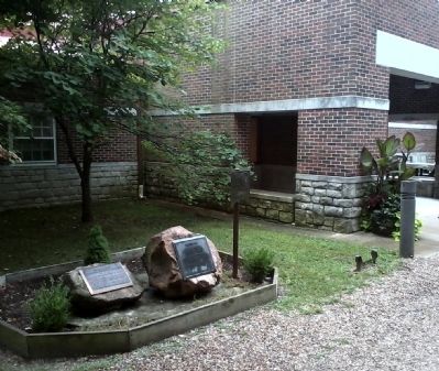
has been placed on the
National Register
of Historic Places
by the United States
Department of Interior
1993 — — Map (db m68153) HM
This property
built in c.1880
has been placed on the
National Register
of Historic Places
by the United States
Department of Interior
1993 — — Map (db m68188) HM
This property
built in 1885
has been placed on the
National Register
of Historic Places
by the United States
Department of the Interior
1993 — — Map (db m68129) HM
This property
built in c.1875
has been placed on the
National Register
of Historic Places
by the United States
Department of Interior
1993 — — Map (db m68189) HM
This property
built in 1885
has been placed on the
National Register
of Historic Places
by the United States
Department of the Interior
1993 — — Map (db m68127) HM
This property
built in c. 1877;1915
has been placed on the
National Register
of Historic Places
by the United States
Department of Interior
1993 — — Map (db m68190) HM
This property built in c.1886
has been placed on the
National Register
of Historic Places
by the United States
Department of Interior
1993 — — Map (db m68157) HM
This property built in c.1875
has been placed on the
National Register
of Historic Places
by the United States
Department of Interior
1993 — — Map (db m68187) HM
This property built in c.1895
has been placed on the
National Register
of Historic Places
by the United States
Department of Interior
1993
Formerly the Messick Hotel, was purchased by Sterling Price Boggess in 1902 and operated . . . — — Map (db m68155) HM
[Front]
"Come, drink, all who thirst for freedom: The water fountain will no longer separate us as a people."
During the Civil War era, one of every four Clay County residents was of African descent. Although sold in slave auctions and . . . — — Map (db m68207) HM
Drugstore built in 1877 by Daniel Hughes. Owned by Wm. Goodson after 1908. Operated by Joseph Simmons until 1945, then by Clarence Ferril. Purchased from Goodson estate complete with furnishings by Historical Museum in 1965. Walnut cabinets are . . . — — Map (db m68128) HM
This property
built in 1923
has been placed on the
National Register
of Historic Places
by the United States
Department of the Interior
1993 — — Map (db m68130) HM
This trail follows the original route of the Kansas City, Clay County and St. Joseph railroad through Westboro-Canterbury Park. The "Interurban" provided commuter and freight service to this area beginning January 21, 1913.
Located just . . . — — Map (db m245220) HM
Built in 1858, only ante-bellum building remaining on the square. Originally housed a branch of the Farmer's Bank. Scene of first daylight robbery in 1866, supposedly by James-Younger gang. Restored to original appearance by Jack Wymore. . . . — — Map (db m68210) HM
This small frame church was built circa 1842 and is one of the oldest remaining buildings in Liberty. It is build of brick and stucco and has served several uses. In 1855 it became part of the Clay Seminary, an all girls school. One of its most . . . — — Map (db m45678) HM
Clay County offers a variety of interesting choices for visitors. History buffs can visit the Jesse James farm in Kearney, the Elms Hotel, once a popular mineral water destination in Excelsior Springs, the Woolen Mill at Watkins Mill State Park and . . . — — Map (db m68365) HM
In 1860 Watkins Mill became the first industry in Clay County. Major industries that followed were Cook Paint and Varnish in 1913, Ralston Purina Company in 1940's and the Claycomo Ford Assembly Plant in 1951. The ASB Bridge was built in 1912 . . . — — Map (db m68311) HM
To meet the needs of an increasing population, Antioch Shopping Center was built in 1955. The Northland Fountain, dedicated in 1983, and Tryst Falls provide beauty and enjoyment to many. — — Map (db m68322) HM
February 3, 1903, Chicago meat packers Armour & Company and Swift & Company founded the North Kansas City Development Company. It purchased from Willard E. Winner several thousand acres of Clay County property immediately north of the Missouri . . . — — Map (db m73534) HM
In the 1920's Cameron boasted over 40 trains a day and three active stations, including the elaborate Cameron Junction, described as one of the most popular and elegant eating houses in the West.
Two Cameron men are credited with initiating the . . . — — Map (db m86717) HM
The memorial tree planted nearby
is dedicated by the Rock Island
in affectionate memory of
John T. Walker
who by his industry courage and
loyalty through every vicissitude
signally aided in the development
of the
Chicago Rock . . . — — Map (db m67375) HM
Cole County
November 16, 1820
State Capital
October 1, 1826
State of Missouri
August 10, 1821
This Bicentennial Monument, erected in 2020 by the Cole County Bicentennial Committee, is dedicated to the people of Cole . . . — — Map (db m169388) HM
George W. Burruss, President
Robert W. Wilson, Vice-President
Dedication September 26, 2003
The Missouri Motor Carriers Association proudly dedicates this building in honor of these great men who have served the trucking industry with . . . — — Map (db m62223) HM
On February 20, 1823, the U.S. government granted the land on which this building stands to the State of Missouri "for the purpose of fixing their seat of government thereon." The land was subsequently divided into 40 town lots, the first sale of . . . — — Map (db m62386) HM
Lewis and Clark, 1804
"The object of your mission is to explore the Missouri river, & such principal stream of it, as, by its course & communication with the water of the Pacific ocean may offer the most direct & practicable water . . . — — Map (db m62349) HM
Historic Boonville's first settlers were pioneer Mother Hannah Allison Cole and her 9 children who located on the Missouri River bluffs where St. Joseph Hospital now stands, 1810. Hannah, whose husband William T. Cole was killed by Indians, ran . . . — — Map (db m46067) HM
The two story part of the building to the west of the 3-1/2 story part of the building was built in 1822 as the Ballantine House which served as a hotel. This German Style brick structure is one of the oldest still standing in Boonville and in fact . . . — — Map (db m45867) HM
The 1870 Drum Creek Treaty forced the Osage off their land to Oklahoma Indian Territory. The Osage became the only tribe to purchase their own reservation. They chose land "the white man would never want or be able to use." They obtained mineral . . . — — Map (db m139773) HM
Paul T. Carr, who also sold Pontiacs from the location, built this Phillips 66 cottage style station in 1932. The site was purchased in 1968 by Bill Wallis and was converted to Mobil that year as well as becoming the first office for Wallis Oil . . . — — Map (db m171955) HM
The Osage (Wa-zha-zhe) tribe were early inhabitants of the Missouri region. Their villages were located along the Osage and other Missouri rivers. French explorers first made contact with the Osage in the 1670s. At that time, the Osage were the most . . . — — Map (db m139826) HM
A.J. Barnett, the first cashier and President of Peoples Bank from 1920-1959, was mayor of Cuba, for ten years. The first city lighting system was installed during his first term in 1922. The mural shows him cranking the first Model T Ford in Cuba. . . . — — Map (db m58899) HM
In the 1900's, Prosperity Corner drew citizens to meet, do business, and pass the time of day. H.H. Tieman's General Merchandise Store was the hub of this activity. Hayes Store stands on the original site of Prosperity Corner. — — Map (db m139829) HM
This mural recreates the look of the 1948 Robert-Judson Lumber Company Millworks Building. The saying "measure twice, cut once, -was very much the rule when employee of 54 years Francis Nixon worked here. The building was the site of custom . . . — — Map (db m58922) HM
[Side A]
Encompassing 504 sq. miles of the west slope of Missouri's Ozarks, Dade County was organized in 1841 and named for Maj. Francis L. Dade killed in Florida War with Seminoles in 1835. In territory ceded by Osage tribes in 1808, the . . . — — Map (db m79788) HM
Built in 1848 A.D. by Levi Beckner this is the only brick building to survive the Civil War. It housed mercantile, newspaper, the first bank 1884-1910, abstract, cafe, and insurance businesses. — — Map (db m62540) HM
[Front]
Dallas County, organized 1841, was first called Niangua for the river flowing within its borders, but the name proved difficult and it was changed to Dallas in 1844 for U.S. Vice Pres. George M. Dallas. Settled in the early 1830's . . . — — Map (db m62544) HM
For nearly a century ferryboats docked along the river bank below. Beginning in 1831, at a site one mile west of here called Griswoll City, a ferryboat poled across the river daily. By the late 1800's ferryboats were making hourly trips from New . . . — — Map (db m236383) HM
With the arrival of the Pacific Railroad in 1855 Miller's Landing became a railroad town. Track was laid westward from St. Louis beginning in 1851. Progress was slow and it was 1865 before St. Louis and Kansas City were connected by rail. The . . . — — Map (db m121293) HM
This World War II era Quonset hut, with a unique stone façade was built here in 1950. It started out as a family-run dry cleaning business by the original owners. Over the years it has been a photo studio and the home of several roadside diners . . . — — Map (db m205178) HM
Worlds Fair, St. Louis, Missouri
McHugh Dailey Opera House
Reconstructed from the 1904 World's Fair
Grand opening New Years Eve 1908 — — Map (db m191390) HM
Head's Store
St. Albans, MO
has been placed on the
National Register
of Historic Places
by the United States
Department of the Interior
c. 1892 — — Map (db m169296) HM
In 1880 the Bank of Washington constructed this Italianate style building. The bank remained here until 1923. From 1877 to 1880, the bank was located in the building adjacent to the west. — — Map (db m124329) HM
Originally a one story structure owned by Miss Julia Beckmann; she had a stationary and book business here until 1892 when she sold the building to the Trentmann family. Miss Beckmann had two additional "bays" which she rented to other shop keepers. — — Map (db m124314) HM
Tobacconist and wine merchant Bernard Wiese used this structure as his home and shop. Eduard Robyn included this building in his lithograph of Washington produced in 1859. — — Map (db m132888) HM
Henry Bertelsmann lived and worked in this building for nearly thirty years, operating a furniture shop where he also built coffins and skiffs. — — Map (db m124358) HM
Johann "Friedrich" Bleckmann built his first blacksmith shop in 1834. His son Fritz and grandson Henry J. built the eastern part of this building in 1888.
"Bleckman's" is the oldest business in Washington. — — Map (db m124389) HM
John F. Bleckman began business here in 1856. He was joined by son Henry in 1880. The family lived upstairs and continued business here until about 1914 when the business relocated. — — Map (db m124390) HM
For about five years, the Kahmann family operated a hotel and saloon here. John Boland then conducted the Commercial Hotel for about fifteen years, at which time it was sold to and enlarged by Elijah Zumwalt. — — Map (db m124315) HM
Erected in 1891, this addition created a dining room to the north and a "sample room" to the south for salesmen to show wares. Elijah Zumwalt managed the Commercial Hotel from 1888-1921 and became the owner in 1892. The Kahmann Pork Packing Plant . . . — — Map (db m124312) HM
Built by developer C.H. Kahmann, for fifty-one years this was Dickbrader Hardware. Since then it has been an eating establishment, housing the Olympia Candy Kitchen, Mealer's Cafe and Cowan's Restaurant. — — Map (db m124313) HM
In 1867 John G. Droege opened Droege's Mercantile Food Store on Main Street in Downtown Washington. He was followed by Cecilia Jack, Firmin and Butch & Judy Droege. This building was built in 1896. — — Map (db m124359) HM
Busch entered the implement and hardware business in 1882 and built this structure five years later. He also served as a three-term mayor for the City of Washington. — — Map (db m124324) HM
Joerden occupied this structure with his general store for about forty years. In the early twentieth century, it housed a bakery owned by Julius Rombach. — — Map (db m124327) HM
G. Henry Herweck, a barber with two barber apprentices erected this building in 1869. Later businesses included Bihr's Millinery Store and Kuhlmann's Drug Store. — — Map (db m169264) HM
Herkstroeter established his men's clothing business in 1875 and built this structure four years later. His descendants continued business until 1923. Bocklage Menswear built the addition in 1947. — — Map (db m124322) HM
Having been in business with partners L. H. Peistrup and C. H. Herkstroeter since 1861, John D. Hibbeler relocated to this building from Elm and Main Streets. Later operating solely, records show that the Hibbeler General Merchandise Store remained . . . — — Map (db m124388) HM
Foss constructed this building for his newspaper business. He was the proprietor of the "Observer" for several years and then in the insurance business. this building later housed the First National Bank. — — Map (db m124321) HM
Washington began in the area of Front and Lafayette Streets. The John Clayton Inn was located near the natural river landing site used in early times. Erected by John Clayton, this inn/boardinghouse is one of Washington's oldest surviving . . . — — Map (db m124366) HM
Built by Louis Kohmueller, a son of Frederick who had emigrated from Osnabruck, Germany in 1843 and purchased what once was an 80 acre farmstead. Clay was mined extensively here for brick manufacturing purposes. — — Map (db m169278) HM
Built by the Kahmann family, records indicate that ownership of this structure passed to and from the Mense family several times. Different members of that family conducted a general store here for over fifteen years. — — Map (db m169267) HM
Dutch immigrant Henry Tibbe and his son Anton began production of corncob pipes in 1869. The first portion of the factory was completed in 1883. The corncob pipe made Washington famous around the world. — — Map (db m124375) HM
C.H. Kahmann had Pacific House built as a tavern and hotel to accommodate passengers on the just-completed Pacific Railroad. Sold to Frederick Wohlgemuth in 1857, it has continued as a tavern under numerous owners. — — Map (db m124362) HM
August Roettger completed this structure for two businesses. He had a woodworking shop in the lower level and his wife operated an inn on the upper floors. Local architect Otto Brix is credited with the building design. — — Map (db m124365) HM
After four years in business, Joseph H. Schmidt purchased this building in 1880 and his "Schmidt Boss Jewelers" continued for 110 years through three generations of the Schmidt family. — — Map (db m124323) HM
Built to house Fred Schnier's sewing machine and tailoring business, it also showcased his wife Katharina's handmaid hair goods shop. The family resided here for two generations. — — Map (db m124404) HM
Fritz Schuenemeyer built this structure in 1880 and operated a saloon here. Later the business was sold to and continued by Joseph Stamm. — — Map (db m169265) HM
Built by John F. Schwegmann, a miller, whose business was located across Olive Street. This home was built to accommodate Schwegmann's rural customers who brought their grain to town for milling. — — Map (db m132887) HM
George Tamm, a German immigrant, bought this lot from Bernard Fricke in 1863. Tamm and his son Charles had their shoe business and residence here until 1925. The addition was added after the Tamms' ownership. — — Map (db m124402) HM
The John B. Busch Washington Brewery And Malt House
In about 1854 John Baptiste Busch together with his older brother, Henry Busch, and a friend, Fred Gersie, started the Washington Brewery and Malt House at Jefferson and Eighth Street. John . . . — — Map (db m125024) HM
Ethnic Heritage: Located in the strongest area of German settlement in Missouri, Washington by the 1850s was a predominantly German town and remained so until the post World War I years. With a German newspaper, church and parochial schools, . . . — — Map (db m124360) HM
John D. Grothaus and John G. Droege operated a general merchandise store at this location from 1867 until Grothaus's death in 1876. The Grothaus family has since leased the property to various businesses. — — Map (db m124325) HM
Constructed between c. 1857-1941, District buildings are good representative examples of major styles and types of Washington, Missouri's historic structures, illustrating the evolution of a 19th century German immigrant community into a small 20th . . . — — Map (db m132890) HM
This building was the second of three electrical plants built by Anton Tibbe Sr. It was completed in 1904. Tibbe was responsible for bringing both electricity and telephone service to Washington in the 1890's. — — Map (db m132886) HM
In December of 1915, amid much fanfare, this power plant came online. Remarkable for that era, this building housed two 75-horsepower generators. Theodore Link of St. Louis Union Station fame was the architect. — — Map (db m132889) HM
Robert Voss built this structure in 1876. The Bank of Washington used it from 1877-1880. Kruel's Five and Dime Store was here for much of the 20th century. The Modern Woodmen of America and Odd Fellows Lodge met here. — — Map (db m169266) HM
Characterized by old world charm of its German heritage, Washington was founded by William G. Owens who bought acreage here 1828, at the Missouri River ferry then called Washington Landing, Lucinda Young Owens, his widow, filed the town plat, . . . — — Map (db m61607) HM
Built in 1868 by developer C. H. Kahmann it served as the C. Kegelmann Cigar Fctory until 1889. Julius Rombach and Paul Schmidle had their bakery here until the partners split in 1902, Schmidle stayed until 1920. The rear addition was an early . . . — — Map (db m133200) HM
East-facing:
Home of Lucinda Owens, official founder of Washington.
November 20, 1909 - November 20, 1984
This monument
dedicated to
the citizens of Washington, Missouri
by Franklin County Mercantile Bank
in . . . — — Map (db m124394) HM
This building was erected by the Interstate Gas and Waterworks Company. The building served not only as a pumping station for Washington's water supply but also as the home of the proprietor. — — Map (db m61587) HM
Hotelkeeper William Wolf had this building constructed in 1869. It was one of several inns and hotels located alongside the railroad tracks and near the depot. Wolf later sold this hotel and started a hotel in Pacific, Missouri. The building has had . . . — — Map (db m124364) HM
This house was purchased by Zachariah and Amelia Foss in 1848. Zachariah was a cabinetmaker and Amelia was a teacher of English-speaking children. The house served as a school and is Washington's oldest surviving frame structure. The cellar was . . . — — Map (db m124369) HM
Built in 1868, this federal style building has catered to guests for over 150 years. EF Rippstien operated the US Hotel across the street. Wishing to build a larger hotel, construction began in 1866 and by 1868 the "Grandest Hotel along the line" . . . — — Map (db m169351) HM
Chrisman House
Circa 1850
has been placed on the
National
Register of
Historic Places
by the United States
Department of the
Interior
— — Map (db m169350) HM
On April 15, 1870, Otto Monnig purchased this building on the corner of East Front and Guttenberg Streets and relocated his established hardware and cutlery store to this site. Over time, he expanded his inventory, adding a full line of clothing, . . . — — Map (db m63205) HM
This is an American Revolution Bicentennial Memorial marking the juncture of three famous pioneer trails here.
They are the Lewis and Clark Trail 1804-1806, the Ozark Frontier Trail mid-1800's and the Old Iron Road which linked the Meramec . . . — — Map (db m63207) HM
Strehly House
This house combines the European half-timber construction with the local brick tradition. It is representative of the less affluent Germans who emigrated to Missouri in the early 19th century, survived frontier hardships, and . . . — — Map (db m63260) HM
"as we were pushing off this Morning two Canoes Loaded with fur &c. Came to from the Mahars nation [Omahas]...., at about 10 oClock 4 Cajaux or rafts loaded with furs and peltres came too one from the Paunees (Pawnees) the other from . . . — — Map (db m63210) HM
Catherine Oelschaeger Gentner bought the house in 1882 for $1,500. She and her husband, G. Heinrich, had been a part of the first group who arrived in December 1837 to begin the town of Hermann. Unlike the Pommers, the Gentners started with very . . . — — Map (db m63251) HM
This house is associated with two early Hermann families. Both the Pommer and Gentner families were among the initial members of the Deutsche Ansiedlungs-Gesellschaft zu Philadelphia (German Settlement Society of Philadelphia). Organized in 1836, . . . — — Map (db m169329) HM
841 entries matched your criteria. Entries 101 through 200 are listed above. ⊲ Previous 100 — Next 100 ⊳