On Ford Street at Pearl Street, on the right when traveling south on Ford Street.
The Corning Fountain was commissioned by John J. Corning as a tribute to his father, John B. Corning. It was designed by John Massey Rhind, a noted sculptor born in Scotland.
The fountain's location was chosen as part of a grand entranceway . . . — — Map (db m230328) HM
On Jewell Street west of Trumbull Street, on the right when traveling east.
Dr. Horace Wells was a Hartford Dentist who is credited with the discovery of anesthesia in Hartford in 1844. Wells stated, "let anesthesia be as free as the air we breathe" and did not try to benefit commercially from his discovery. After his . . . — — Map (db m230389) HM
On Trinity Street south of Jewell Street, on the left when traveling north.
Israel Putnam (1718-1790), the legendary general of the French and Indian and Revolutionary Wars, is considered Connecticut's first authentic folk hero. At the outbreak of the Revolutionary War in 1775, at 57 years old, he is famous for riding 18 . . . — — Map (db m230347) HM
On Trinity Street south of Jewell Street, on the right when traveling north.
The City of Hartford commissioned the Soldiers and Sailors Memorial Arch to recognize the 4,000 Hartford residents who served in the Union Army from 1861-1865, including 400 who died during the war. It was designed by George Keller, who also . . . — — Map (db m230367) HM
On Trinity Street at Elm Street, on the right when traveling north on Trinity Street.
Spirit of Victory is a war memorial honoring the Hartford men who fought in the Spanish-American War, 1898-1902. Its creator was Evelyn Longman Batchelder, the first woman sculptor elected as a full member of the Academy of Design, who . . . — — Map (db m230406) HM
Near Main Street at Central Row, on the right when traveling north.
Adriaen Block
A short distance from
where you are standing,
in 1614
Adriaen Block, captain of the ship Restless
sails up a river from the Atlantic Ocean
which native peoples of the region have named
"Quinnehtukqut", meaning the Great . . . — — Map (db m53151) HM
On Main Street at Arch Street, on the right when traveling north on Main Street.
In memory of the courageous
Adventurers
who inspired and directed by
Thomas Hooker journeyed through the
wilderness from Newtown (Cambridge)
in the Massachusetts Bay to
Suckiaug (Hartford) – October 1635
Mathew Allyn • John . . . — — Map (db m52432) HM
Near Central Row at Main Street, on the right when traveling west.
Alexis de Tocqueville
The 25 year-old French aristocrat and author of
Democracy in America
visited this area
during his 1831 – 1832 tour of America
Tocqueville
C-SPAN
placed by C-SPAN and the cable television industry . . . — — Map (db m52694) HM
On Main Street at Gold Street, on the left when traveling north on Main Street.
On Tuesday, April 15, 1817, in a building located on this site, the Connecticut Asylum for the Education of Deaf and Dumb Persons officially opened. The school was the first in America to teach deaf children and had a class of seven syudents. The . . . — — Map (db m52437) HM
On Prospect Street at Bob Steele Street, on the right when traveling south on Prospect Street.
Boxer, motorcyclist, wordsmith, cartoonist and entertainer, Bob Steel joined WTIC (Travelers Insurance Company) in 1936 when it operated from the 6th floor of this Grove Street building. From here until 1961, from Broadcast House in . . . — — Map (db m151923) HM
On Asylum Street east of Union Place, on the right when traveling east.
Reverend Horace Bushnell believed Prosperity was Our Duty and that civic improvement was critical to a prosperous Hartford. As a result of economic decline in the 1840s, Bushnell recognized Hartford's long want of "spacious . . . — — Map (db m230332) HM
On Jewell Street at Trumbull Street, on the right when traveling east on Jewell Street.
Reverend Horace Bushnell believed Prosperity was Our Duty and that civic improvement was critical to a prosperous Hartford. As a result of economic decline in the 1840s, Bushnell recognized Hartford's long want of "spacious . . . — — Map (db m230390) HM
Near Main Street at Gold Street, on the right when traveling south.
[ east side ]
Deming In Memory Of
Capt. Pownal Deming
Son Of
David Deming & Mehitable Champion
Born Sept. 30, 1749
Died April 9, 1795
[ west side ]
An earnest patriot, he enlisted
in the Continental Army at the . . . — — Map (db m44066) HM
Near Main Street at Central Row, on the right when traveling north.
Where you are standing, on October 31, 1687 came Sir Edmund Andros to the meeting house built on this site, sent by the British Crown to revoke Connecticut's Charter and establish the Dominion of New England. Captain Joseph Wadsworth, determined . . . — — Map (db m53150) HM
On Main Street at Church Street, on the right when traveling south on Main Street.
Christ Church
Cathedral
Diocese of Connecticut
Episcopal
Founded as Christ Church 1762
Set Apart as Cathedral 1919
Present Building 1828
The Rt. Rev. Ian T. Douglas
Bishop of Connecticut
The Very Rev. Mark B. Pendleton . . . — — Map (db m44074) HM
Near Main Street at Gold Street, on the right when traveling south.
1771 Memorial 1912
To The Deceased Members Of
The First Company Governor's Foot Guard
Hartford Connecticut
Erected By The
Veteran Corps
Dedicated June 1912
1771
Captain Samuel Wyllys . . . — — Map (db m43772) HM
On Main Street at Gold Street, on the left when traveling north on Main Street.
First speech in Hartford on the grounds of this Church May 18, 1843
"[We found several towns in which people closed their doors and refused to entertain the subject. Notably among those were Hartford, Conn., and Grafton, Mass. . . . — — Map (db m151933) HM
Near Main Street near Central Row, on the right when traveling north.
Where You Are Standing
On September 20, 1780
Waits General George Washington,
Commander-in-Chief of the American Armies
During the American Colonies' Revolution
Against Great Britain.
He has come with Governor Trumbull and . . . — — Map (db m52783) HM
Near Main Street at Gold Street when traveling south.
[ south side ]
George Wyllys
Born 1590 in Fenny Compton Co Warwick England
Came to Hartford 1638
Deputy Governor of Connecticut 1641
And Governor 1642. Died March 9, 1645
Bridget Young his wife died at Fenny Compton
March 1629 . . . — — Map (db m43771) HM
On Main Street at Central Row, on the right when traveling north on Main Street.
To Commemorate The
One Hundred Seventy-Fifth Anniversary
Celebration of the Founding in 1771
Of the First Company
Governor's Foot Guard.
General Jonathan M. Wainwright,
Hero of Corregidor and Guest of Honor
at this celebration was . . . — — Map (db m52913) HM
Near Main Street at Central Row, on the right when traveling north.
To commemorate the
Two Hundreth Anniversary Celebration
Of the First Company Governor's
Foot Guard, founded in 1771.
The oldest military unit in continuous
service in the United States.
Participating were the Centennial
Legion of . . . — — Map (db m52916) HM
On Main Street at Gold Street, on the right when traveling south on Main Street.
Hartford was named in 1637 after the English town of Hertford. The Indian name was Suckiaug. The first colonial settlement, called House of Good Hope, was made by the Dutch in 1633. The Reverend Thomas Hooker arrived overland from Newtown . . . — — Map (db m43708) HM
On State House Square just east of Main Street, on the left when traveling east.
You are now standing where once stood a structure that was an important piece of Hartford history: The Isle of Safety. An exact outline of this iconic structure has been created on the paved walkway behind you.
When it was erected . . . — — Map (db m151922) HM
Near Main Street at Atheneum Square, on the right when traveling north.
Col. Jeremiah Wadsworth
SAR Branch Connecticut
Erected MCMXIII
Here stood the home of Col. Jeremiah Wadsworth Commissary General of the American forces in the War for Independence and a trusted friend of George Washington and "Brother Jonathan . . . — — Map (db m52427) HM
Near Main Street at Gold Street, on the right when traveling south.
In Memory of the First
Settlers of Hartford
Jeremy Adams • Matthew Allyn • Francis Andrews • William Andrews • John Arnold • Andrew Bacon • John Barnard • Thomas Barnes • Robert Bartlett • John Baysey • Thomas Beale • Nathaniel Bearding • Mary . . . — — Map (db m195603) HM
Near Main Street near Gold Street, on the right when traveling south.
Of Copford Hall. Essex England. Third Governor of Massachusetts. A founder of this commonwealth & its first Governor. A lover of religious liberty. A man trusted and honored.
Near this place he was buried & by this tablet The Connecticut . . . — — Map (db m44068) HM
Near Main Street near Central Row, on the right when traveling north.
Jonathan Trumbull
Where You Are Standing
From 1768 to 1784
Jonathan Trumbull guides the people of Connecticut
to independence as the colony's Royal Governor.
Governor Trumbull is the only colonial governor
to stand with the patriots . . . — — Map (db m52782) HM
On Central Row west of Market Street, on the right when traveling west.
On Sept. 4, 1824, General Lafayette visited Hartford during his triumphal return to the U.S. He was addressed here by Governor Wolcott. — — Map (db m230408) HM
On Main Street near Arch Street, on the right when traveling north.
Mark Twain
Samuel Clemens
1835 - 1910
[ north side ]
One of the nation's most celebrated authors
Mark Twain lived here in Hartford during the peak
of his writing career from 1871 until 1891
Of Hartford, Twain wrote "Of all the . . . — — Map (db m52434) HM
On Central Row at Main Street, on the right when traveling west on Central Row.
Marquis de La Fayette
Where You Are Standing
On September, 1824
Arrives the Marquis de La Fayette in Daniel Wadsworth's carriage drawn by four white horses. Hartford's citizens shout hurrahs, wave banners and throw garlands of flowers at the . . . — — Map (db m43767) HM
Near Central Row at Main Street, on the right when traveling west.
Old State House
Has been designated a
Registered National
Historic landmark
Under the provisions of the
Historic sites act of August 21, 1935
This site possesses exceptional value
in commemorating and illustrating
the history of . . . — — Map (db m52699) HM
On Asylum Street at Union Place, on the right when traveling east on Asylum Street.
With trains arriving in Hartford and passing the western edge of the Park, Reverend Horace Bushnell wanted to provide an aesthetically pleasing first impression of the City. Bushnell envisioned the Park as an "outdoor parlor", a specialized room in . . . — — Map (db m230325) HM
On Asylum Street at Ford Street, on the right when traveling east on Asylum Street.
Hartford suffered great floods in 1936 and 1938. This resulted in the City and Army Corps of Engineers designing an extensive flood control system that buried the Park River in a tunnel under the Park. In this location, you would have been . . . — — Map (db m230345) HM
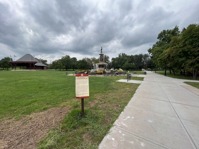
On Ford Street at Pearl Street, on the right when traveling south on Ford Street.
The Pearl Street gate was designed by Olmsted Brothers Landscape Architects and added to the Park in the 1940s. The path Leads from the gateway to the Corning Fountain. Donated by John J. Corning in 1898, the fountain was installed in 1899 to honor . . . — — Map (db m230346) HM
Jacob Weidenmann's design of the Park utilized many of Frederick Law Olmsted's techniques, including curvilinear paths and the separation of uses. His design incorporated pedestrian use in the eastern section. Through the design of a carriage path . . . — — Map (db m230349) HM
On Trinity Street south of Jewell Street, on the right when traveling north.
Reverend Horace Bushnell preached Unconscious Influence (1842), the idea that we are "ever touching unconsciously the spring of motion in each other… we overrun the boundaries of personality -- we flow together… by a law of social contagion." . . . — — Map (db m230368) HM
On Jewell Street at Ann Uccello Street, on the right when traveling east on Jewell Street.
As a result of severe flooding, the Army Corps of Engineers created the Park River relocation plan in 1941, placing the river in a concrete tunnel under Bushnell Park. As part of this plan, the firm of Olmsted Brothers landscape architects, . . . — — Map (db m230370) HM
On Wells Street at Gold Street, on the right when traveling south on Wells Street.
The Park was first conceived of by Reverend Horace Bushnell in 1853. In 1860, the City hired Jacob Weidenmann, a Swiss-born landscape architect, to finalize the Park design and complete construction. Weidenmann's design incorporated the styles of . . . — — Map (db m230391) HM
On Central Row at Main Street, on the right when traveling west on Central Row.
Prudence Crandall
Where You Are Standing
on May 24, 1833
The Connecticut General Assembly passes the Black Law expressly forbidding Prudence Crandall from recruiting African-American women for her school in Canterbury. Prudence refuses to obey . . . — — Map (db m43765) HM
Near Columbus Boulevard near State Street, on the right when traveling north.
Recapture of the
Connecticut River
1981 – 1999
Dedicated September 3, 1999
On the occasion of the opening of
Riverfront Plaza and Terraces
Founders Bridge Promenade and
State Street Landing
[ left plaque ]
A Historic . . . — — Map (db m52601) HM
On Main Street at Gold Street, on the right when traveling south on Main Street.
Rev. Samuel Stone 1602 – 1663
First Church Teacher and 2nd Pastor
Co-Founded Hartford with Thomas Hooker
Born in Hertford England — — Map (db m43742) HM
On Church Street just west of Ann Uccello Street, on the left when traveling west.
In memory
of the
Rev'd. John Brady,
who died
November 16, 1854,
aged 48.
He was Catholic Pastor
of this City from
1836 to 1854;
and through his Apostolic labors
this Cathedral was erected.
May his soul rest in . . . — — Map (db m151938) HM
On Main Street at Gold Street, on the right when traveling south on Main Street.
Sacred to the Memory of
the Three Hundred or more
African Americans
Free People, Slaves, and
five Black Governors
Who rest in Unmarked
Graves in Hartford's
Ancient Burying Ground
1640 - 1810
[ back ]
School children in . . . — — Map (db m43803) HM
On Church Street just east of High Street, on the right when traveling east.
Site of the first convent
Sisters of Mercy
arrival in Connecticut
St. Patrick Parish
May 11, 1852
to serve the poor, sick and ignorant
throughout the state — — Map (db m151939) HM
Near Main Street at Central Row, on the right when traveling north.
This tablet commemorates the historic first meeting of General George Washington and General Comte de Rochambeau, commander-in-chief of the French army in America, which took place September 20, 1780.
On that occasion and in a subsequent meeting . . . — — Map (db m52914) HM
Near Central Row near Main Street, on the right when traveling west.
In 1636
The Church in Newtown, Massachusetts
Thomas Hooker, Minister
was transplanted to this locality, called
Meeting House Yard,
Old State House Square
City Hall Square.
Near this site on May 31, 1638.
Thomas Hooker preached his . . . — — Map (db m52695) HM
On Elm Street at West Street, on the right when traveling west on Elm Street.
The Pump House was designed by Hartford architect, H. Hilliard Smith in 1940 and built in 1947 as part of the Connecticut River Flood Control Program. This project began after the downtown area suffered catastrophic floods in 1936 and 1938. The . . . — — Map (db m230393) HM
Near Main Street at Gold Street, on the right when traveling north.
In June 1636, about one hundred members of Thomas Hooker's congregation arrived safely in this vicinity. With one hundred and sixty cattle, they had followed old Indian trails from the Massachusetts Bay Colony to the Connecticut River to build a . . . — — Map (db m52557) HM
Near Central Row at Main Street, on the right when traveling west.
The Tower Clock
Was Given in Memory Of
Horace John Wickham
1836 – 1914
By His Son
Clarence Horace Wickham
1919
Perpetual care and replacement
provided for by endowment — — Map (db m52696) HM
On Main Street at Gold Street, on the right when traveling south on Main Street.
This Approach
to
Hartford's Ancient Burying Ground,
which was set apart in 1640 and
contains the graves of Thomas Hooker
and the other founders of Hartford,
was completed in 1952 by the
generosity of
Edward M. Day
and other . . . — — Map (db m43743) HM
Near Main Street at Gold Street, on the right when traveling south.
Thomas Hooker
1586 – 1647
A leader of the founders in this commonwealth. A preacher of persuasive power. A statesman who based all civil authority on the free consent of the people.
This tablet is placed near the site of his burial by The . . . — — Map (db m44070) HM
On Main Street at Central Row, on the right when traveling north on Main Street.
Thomas Hooker
1586 – 1647
Founder of Hartford
Pastor – Statesman
[ east side ]
Leading his people through
the wilderness, he founded
Hartford in June 1636.
On this site he preached
the sermon which inspired
the . . . — — Map (db m52917) HM
On American Row at Main Street, on the right when traveling west on American Row.
Washington – Rochambeau Revolutionary Route
Hartford
French General Jean Baptiste Donatien de Vimeur, comte de Rochambeau, and thousands of French ground and naval forces arrived in Newport in July of 1780 to assist the Americans . . . — — Map (db m43739) HM
Near Columbus Boulevard near State Street, on the right when traveling north.
Welcome to William H. Mortensen Riverfront Plaza
Mortensen Riverfront Plaza, the centerpiece of the Riverfront park system, spans I-91 to connect downtown Hartford with the Connecticut River. From the plaza, visitors can cross the river on the . . . — — Map (db m52617) HM
Near Columbus Boulevard at State Street, on the right when traveling north.
This plaza is dedicated in honor of William "Bill" Mortensen – whose life is an inspiration to a new generation of Hartford residents. Born in Hartford, Bill Mortensen graduated from Hartford High School, and became one of the city's leading . . . — — Map (db m52618) HM
On Central Row near 800 Main Street, on the right when traveling west.
In recognition of the lasting
contribution toward a better life for the
People of Connecticut – especially for
those of greater Hartford by
William H. Putnam
With Ability – Courage – Devotion and
vision he served his . . . — — Map (db m52784) HM
On Columbus Boulevard at Arch Street, on the right when traveling south on Columbus Boulevard.
Along this avenue, once called Front Street, thousands of immigrants came after leaving their war-ravaged, poverty-stricken countries in search of freedom and a better life. They helped to build the City of Hartford, the roads on which their . . . — — Map (db m52563) HM
On Columbus Boulevard at Arch Street, on the right when traveling south on Columbus Boulevard.
This plaque and the renaming of this bridge honor the Revolutionary War hero and distinguished citizen of Connecticut, Thomas Y. Seymour. Seymour, who later rose to the rank of Major in the Continental Army, was born June 19, 1757, the eldest . . . — — Map (db m52560) HM
On Charter Oak Avenue just east of Main Street, on the right when traveling east.
Designed by George Keller, dedicated 1876. First building in the state built as a synagogue, it served Congregation Temple Beth Israel from 1876 to 1936 — — Map (db m230412) HM