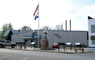
New Franklin, known as the city where four trails meet, owes its place in history to the Lewis & Clark Expedition of 1803-1806; the blazing of the Boonslick Trail pioneered by Daniel Boone from Kentucky to the original historic rivertown of . . . — — Map (db m46460) HM
Franklin, 1816
The original town of Franklin, founded in 1816, was located on the north bank of the Missouri River and was the seat of Howard County. It was about two miles southwest of present day New Franklin. The town was named for . . . — — Map (db m46464) HM
On Missouri Route 87 west of U.S. 40, on the right when traveling north.
Seat of Howard County
The settlement of Franklin, Missouri Territory, was established as the seat of Howard County in 1816. As the largest town west of St. Louis, it was the hub of a large region along the Missouri River called the . . . — — Map (db m247475) HM
On Missouri Route 161 at Boonslick Road, on the right when traveling east on Missouri Route 161.
Missouri achieved statehood in 1821 as a result of the famous "Missouri Compromise." It was decreed that Missouri be admitted as a slave state, but thereafter no state north of the 36º 30' North latitude in the Louisiana Territory would be . . . — — Map (db m44280) HM
1790
Indians Along the Missouri
The Missouri River served as a boundary between Indian tribes in historic times. The Osage dominated a vast area south of the river. To the north, the loway, and later Sauk and Fox, held power. . . . — — Map (db m247363) HM
On East Water Street east of 4th Street, on the right when traveling west.
Third Battle: October 11, 1863
The Third Battle of Boonville was fought from this wharf. Confederate General Joseph O. Shelby and his men approached Boonville from the south where they had burned a railroad bridge near Otterville. Local . . . — — Map (db m247262) HM
On Morgan Street near Main Street (U.S. 40), on the left when traveling east.
Hannah Cole was one of the earliest settlers of the present site of Boonville. She was born in Virginia about 1762. In 1789 she married William Temple Cole. They moved to Kentucky about 1805 and then to what would soon become Missouri Territory in . . . — — Map (db m45905) HM
On South Street east of Nelson Street, on the left when traveling east.
The plaque pictured at left has been placed in Sunset Hills Cemetery in remembrance of eight Union cavalry soldiers who died in action and are buried here.
In central Missouri in the summer of 1864, bands of Southern partisan cavalry roamed the . . . — — Map (db m252367) HM
On Water Street at Market Street, on the right when traveling south on Water Street.
In 1877, the Chicago & Alton Railroad decided to build a bridge across the Missouri River at Glasgow. It was to be the first large all-steel bridge in the world. Mr. A.F. Hay, of Burlington, Iowa, had developed a steel that met all specifications & . . . — — Map (db m216963) HM
On Morgan Street near Main Street (U.S. 40), on the left when traveling east.
David Barton was born December 14, 1783, near Greeneville, North Carolina (now Tennessee). He came to the then-Louisiana Territory in 1809. Though Barton had some legal training, his first job was teaching in St. Charles. When the Missouri . . . — — Map (db m46019) HM
On Morgan Street, on the left when traveling east.
In 1810 Hannah Cole and her nine children crossed the Missouri River and built a cabin on the site of Boonville, thus becomig the first white settlers south of the river.
After repeated Indian trouble in 1814 it was deemed necessary to build a . . . — — Map (db m46052) HM
Near Northeast Pleasant Valley Road east of Northeast Antioch Road, on the right when traveling east.
In 1824, William Allen, of Howard County, Missouri, applied for and received a land patent for the original 80 acres of land and later purchased additional land where the Atkins-Johnson Farm is today. Soon after, 130 acres of the land was sold to . . . — — Map (db m252138) HM
On Randolph Street (Highway 240) at Bridge Street, on the right when traveling east on Randolph Street.
Here along the scenic river bluffs where the Missouri forms a natural port, Glasgow was laid out, 1836. Named for pioneer James Glasgow, it was the first successful town in this general area. Chariton, Monticello, and Thorntonsburg, earlier towns . . . — — Map (db m266952) HM
Lee Edgar Settle was born in New Franklin MO, on July 20, 1882, the son of J. M. and Laura (Van Aradale) Settle at xxxx S. Howard Street. Edgar Settle was a natural piano player and began playing at the age of five or six years [balance illegible]. . . . — — Map (db m46927) HM
On Market Street near Main Street, on the right when traveling south.
Daniel Boone, universal symbol of the American frontier, was 65 when he came to Upper Louisiana, now Missouri, 1799. His wife Rebecca was 60. The Spanish lieutenant governor granted Boone 845 acres nearby here on Femme Osage Creek.
Boone did . . . — — Map (db m42564) HM
On B Road north of Local Road 748, on the left when traveling north.
The exact location of the Sarepta Fly grace is unknown. The headstone marking her grave was discovered early this century by children playing in a field on the old Dilworth Ranch, not far from this location. It had been covered by prairie grasses . . . — — Map (db m294540) HM
On Missouri Route 5 at Katy Trail, on the right when traveling south on Missouri Route 5.
There is evidence that around the year 1800, Daniel Boone or his sons, Daniel Morgan and Nathan, discovered a salt lick in what is now western Howard County. The lick became known as Boone's Lick, and the trail he blazed, believed to be parts of old . . . — — Map (db m252432) HM
Near Missouri Route 5 at Katy Trail, on the right when traveling south.
Josiah Gregg was born in Overton County, Tennessee – the youngest son of Harmon and Susannah (Smelser) Greggs' seven children. In 1812 his family settled at Cooper's Fort in Howard County, and later moved to Jackson County. Sickly, shy and studious, . . . — — Map (db m252443) HM
On Katy Road (County Road 391) 0.6 miles north of Oilwell Road, on the right when traveling north.
Cole County, Missouri
Established November 16, 1820
Dedicated in this bicentennial year to those who have given life to Cole County, from the generations of Ancient Ones before the settlers of European and African lineage who formed our . . . — — Map (db m169397) HM
On North Street at Rear North Middle Street, on the right when traveling west on North Street.
St. James A.M.E. Church was constructed in 1875, under the leadership of Reverend Spottswood Rice. Rice was apparently born into slavery in Virginia in 1819, and later moved by his owner to Glasgow in Howard County, Missouri. Rice was valued for . . . — — Map (db m263292) HM
On North Church Street (State Highway 240) at East Davis Street, on the right when traveling north on North Church Street.
Fayette is the county seat of Howard, "Mother of Counties," and first county in the Boon's Lick Country. Named for Benjamin Howard, first Missouri Territory governor, and organized, 1816, the county contained so vast an area that from it have . . . — — Map (db m267444) HM
On Missouri Route 87 west of U.S. 40, on the right when traveling north.
A Look Back in Time
The Santa Fe Trail began here in Old Franklin, Missouri. Pack trains quickly gave way to freight wagons lumbering to and from Mexico (now New Mexico). When floods destroyed Franklin, residents established New Franklin. The . . . — — Map (db m247510) HM
On East Water Street 0.2 miles west of 8th Street, on the right when traveling west.
Dedication Day One of the first highway bridges over the Missouri River, the Old Trails National Highway Bridge was a significant link in Missouri's transportation system for nearly 75 years. In 1921 Thomas A. Johnston and John Cosgrove, . . . — — Map (db m252409) HM
On Main Street (U.S. 40) north of Vine Street, on the right when traveling north.
By 1864, the horrors of the Civil War had reached into all families on both sides. Guerillas and opportunists attacked wherever they sensed easy rewards. Thus, men from both sides formed the Boonville Home Guard (same name as in 1861 but with . . . — — Map (db m247308) HM
On Missouri Route 87 west of U.S. 40, on the right when traveling north.
Beyond the Mississippi
The Boone's Lick Road was the first to bring settlers deep into the heart of the great Louisiana Purchase from early settlements west of the Mississippi River. It bore the nation's constant westward push, extending by . . . — — Map (db m247698) HM
On Main Street (Missouri Route 87) east of High Street, on the left when traveling east.
The domed octagonal cupola, domed semicircular portico supported by curved brick columns of Corinthian order, 24-paned windows and fanlighted front door lend architectural interest to this classic revival-styled building completed in 1868. What . . . — — Map (db m62427) HM
On West Singleton Street at South Allen Street, on the right when traveling east on West Singleton Street.
A violent encounter between Southern partisan cavalry and Union forces occurred in and near Centralia on September 27, 1864. The Southern forces were irregular Confederate partisan rangers under the overall command of William "Bloody Bill” . . . — — Map (db m116878) HM
On Boonslick Drive south of Main Street ( Route B), on the right when traveling north.
By October 1864, the horrors of the Civil War had reached most Boonville families. It was then that Boonville citizens learned that a large force of Confederates was approaching from the southeast. These were the men of Maj. Gen. Sterling Price's . . . — — Map (db m247313) HM
1816
A River Town Begins
Named for American statesman Benjamin Franklin, the frontier river town of Franklin was established in 1816. The following year, it was designated the county seat of Howard County. In the blink of an eye, Franklin's . . . — — Map (db m46950) HM
(left panel:)
Franklin
The town of Franklin was established in 1816 and in 1817 was selected as the county seat of Howard County. The town grew rapidly and by 1823 contained about 1,500 people. Franklin served as the . . . — — Map (db m249006) HM
1797 - James Mackay granted land including the salt spring by Spanish authorities in St. Louis.
1799 - Daniel Boone and his family arrive in Missouri and receive land grants in St. Charles County from the Spanish authorities.
. . . — — Map (db m248767) HM
On Dames Park Drive at State Highway P, on the right when traveling north on Dames Park Drive.
"Bold, courageous, genial and inventive, James H. Audrain was a man in his times almost larger than life. No frontier constrained him. He was in step with many of the men we know from the history books and countless others." . . . — — Map (db m169536) HM
On Missouri Route 87 west of U.S. 40, on the right when traveling north.
The Lewis and Clark Expedition traveled up the Missouri River past here on June 8, 1804. On June 7, the party had camped at the mouth of Bonne Femme Creek, at what is now Franklin Island Conservation Area. Capt. Meriwether Lewis and two men made a . . . — — Map (db m247613) HM
On Heritage Landing south of South St. Peters Parkway, on the right when traveling north.
Cribbin's Home
• This park, historically known as the Cribbin's Home, Kuhlmann's Grove, and even Cedar Grove in 1875, features a well-known home built in the mid-1800s.
• The home was built by Lawrence Cribbin (sometimes spelled . . . — — Map (db m150854) HM
On South Main Street north of East 2nd Street, on the right when traveling north.
In 1900, James Currie, a rancher in Glasscock County, Texas, constructed a place of business at 117 Main Street, Big Spring, Howard County, Texas on property he purchased from Martha Hope of St. Louis, Missouri, in 1897.
From that time until . . . — — Map (db m86635) HM
Near Missouri Route 5 at Katy Trail, on the right when traveling south.
The story of heroine Millie Cooper is one of the great legends of Howard County. Mildred, nicknamed Millie by her father, was born in Madison County, Kentucky. She lived there until her father, Braxton, and his two brothers, Benjamin and Sarshall, . . . — — Map (db m252453) HM
On East Walnut Street east of North 7th Street, on the right when traveling west.
(text is on base)
(front:)
Boone County, organized November 16, 1820, from a portion of Howard County, was named for pioneer Daniel Boone. It developed because of its proximity to transportation - the Boone's Lick Trail, the . . . — — Map (db m249700) HM
On Lucille Avenue west of Highway 94 ( Route 94), on the left when traveling west.
The Boone Trace was an important westward trail for American settlers. The Boone Trace probably followed a trail used by American Indians. In the early 1800s it was used by Daniel Boone's sons Nathan and Daniel Morgan Boone. For travel to the . . . — — Map (db m133212) HM
On Sully Street at East 3rd Street, on the right when traveling south on Sully Street.
County named for Texas Confederate Stockton P. Donley 1821 - 1871 Came to Texas from Kentucky 1846. Dist. Attorney 1853. Enlisted private 7th Tex. Infantry 1861, made Lieutenant. Captured with regiment after bitter fight at Seige Fort Donelson Tenn. . . . — — Map (db m96827) HM
Thin black lines indicate changes in relevance. Between each pair of lines entries are ordered geographically but all have the same relevance.
* Inflectional forms of words are their plurals, singulars, and possessives as well as gramatical tenses and similar variations.