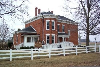
J. Scott Garbry, a 1986 inductee into the Ohio Conservation Hall of Fame, had a lifelong commitment and passion for conservation, historic preservation, and education. His gift of land and artifacts to the Upper Valley JVS led to the creation of the . . . — — Map (db m17150) HM
Originally known as Allen's Mill Bridge, the Eldean Covered Bridge was built over the Great Miami River in 1860 for Miami County by the Hamilton Brothers of nearby Piqua. Its 224 feet place it among Ohio's longest covered bridges and the longest in . . . — — Map (db m28339) HM
The 1804 Iddings House is the oldest structure on its original site in Miami County. A second generation American and cousin to General “Mad” Anthony Wayne, Benjamin Iddings brought his wife, Phoebe, and six of their ten children up the Stillwater . . . — — Map (db m18429) HM
Born in Kentucky in 1793, his family moved to the Ohio country in 1797. Taught by his mother and in a log-cabin school near Dayton, he began teaching here by 1809. Purchasing land here in 1811, he served at Fort Greenville in the War of 1812. He . . . — — Map (db m28367) HM
In 1832, Sylvanus Allen's property became the site of Brown Township's sixth and final school district. Following many building expansions, the current building, constructed in 1916, became the home of the Lena-Conover Consolidated School and . . . — — Map (db m29839) HM
Michael Ingle, the first permanent white settler in Newberry Township, arrived in Miami County in 1804. A tanner from Virginia, Ingle cleared and cultivated eight hundred acres of land, where he grew wheat and other essential produce. He erected a . . . — — Map (db m28342) HM
Side A:
Hanktown, settled in 1846, was home to eighty-nine of the three hundred and eighty-three slaves, owned by John Randolph (1773-1833), a wealthy Virginian landowner and cousin to President Thomas Jefferson. Randolph had decided to . . . — — Map (db m19744) HM
You are now traveling U.S. 40, the Old National Road, used in the westward expansion of our country. In 1837 notice was given that this section of the road would be constructed. A toll house was located at the east edge of Brandt. — — Map (db m267932) HM
Once the center of telephone communications in America, Phoneton, originally platted as Phonetown, was established in 1893 by the American Telephone and Telegraph Company (AT&T) as the place to service and operate three major telephone and . . . — — Map (db m28347) HM
On March 20, 1868, the Ohio General Assembly passed a revision to the Ohio Revised Code allowing for a municipality and a township to join together in purchasing land for a shared cemetery. On April 24, 1868, the Washington Township Trustees passed . . . — — Map (db m17140) HM
The roots of Huntersville began when John and Elizabeth Hilliard purchased this former Shawnee tribal land in 1797 from Ohio's largest land speculator Judge John Symmes. When Symmes defaulted on his payments, the Hilliards found themselves . . . — — Map (db m17291) HM
[Side A:]
This section of the Miami and Erie Canal, constructed from 1833-1837, was vital to this region's commerce and development. It allowed for farmers and businesses to get their goods to larger markets at a lower cost and faster . . . — — Map (db m18385) HM
Elizabeth Township was founded in 1807. The Elizabeth Township House was built about 1870, serving as the community's assembly hall. The building is similar to the seven remaining one-room, brick schoolhouses, built throughout the township between . . . — — Map (db m28340) HM
Benjamin Overfield (1774-1831), son of a Revolutionary War soldier, opened his tavern in this log house on September 13, 1808. Never moved, it is the oldest surviving building in Troy. The tavern provided food, lodging and space for business and . . . — — Map (db m230518) HM
Thomas Cemetery is the resting place for many of Concord Township's and Miami County's early settlers. The cemetery is maintained by Concord Township.
This marker was placed here in Miami County's and Concord Township's . . . — — Map (db m259874) HM
The Twin Arch stone culvert was constructed in 1837 as part of the “extension” of the original Miami and Erie Canal which ran from Dayton to Piqua. The purpose of the Twin Arch was to carry stream water from the Howell Ditch under the . . . — — Map (db m122981) HM
You are standing where the very first section of bike trail was constructed in the Miami Valley. From this point forward a regional trail network has grown to over 375 miles.
To build the first mile of trail, the City of Troy worked with The . . . — — Map (db m276095) HM
Piqua and Troy have long had a friendly rivalry. This has included wrangling over railroad routes, bragging rights over size and maintaining one of the oldest high school football rivalries in the State of Ohio. The ultimate manifestation of the . . . — — Map (db m275921) HM
Original Plat of (Jacksonville) Versailles by Silas Atchison - August 28, 1819
The history of the village passed through several name changes; from Jacksonville (1819-1837) to Versailles (1837-1854); then added North Jacksonville (1842-1854) . . . — — Map (db m252785) HM
Side A: Randolph Settlement
In 1833, John Randolph from Roanoke, Virginia, died leaving three wills that requested that all of his slaves be set free and that land be purchased for them. Although contested for thirteen years by his family, . . . — — Map (db m111980) HM
During World War II, forty of Troy's teenage girls, their mothers, and volunteers operated a free canteen service for troops on the platform of the Baltimore & Ohio Railroad station. The group began as a few neighborhood girls providing magazines to . . . — — Map (db m19746) HM
Peru River Walkway Park
This site along the Wabash River has been an important transportation route and life center from the first Indigenous People to today. Pressure for Native People to move began before Indiana became a state in 1816. . . . — — Map (db m310943) HM
Eldean Bridge is the only covered bridge left of about 30
that once crossed Miami County streams. The bridge, built in
1860, is one of Ohio's oldest. With a deck length of 222 feet,
it is also the state's second longest covered . . . — — Map (db m166799) HM
Piqua's public square, like in many mid-western communities, functions as the historical and cultural center of the city. Long after government buildings have moved to newer and larger sites, the public square maintains its status as the focal . . . — — Map (db m17367) HM
In 1808 the court appropriated this city block
for educational purposes. It was here that
the Union School was built in 1852. William
Norton Edwards (1812-1867) became the first
Troy superintendent and the school was
renamed in his honor. In . . . — — Map (db m229197) HM
To commemorate the first church erected in
Union Township, Miami County, Ohio, this log
replica was constructed in 1976 by the Union
Township 4-H Clubs and the West Milton area
Camp Fire Girls.
The Laura Lions Club established this . . . — — Map (db m90539) HM
Units assigned to guard the Alton Federal Military Prison
13th U.S. Regular Infantry
Ordered to Alton February, 1862
77th Ohio Volunteer Infantry
Ordered to Alton August, 1862
37th Iowa Volunteer Infantry (The . . . — — Map (db m210701) HM
"The Marsh of the Swans" is the meaning of the river's French name. In 1828, Baptist missionary Isaac McCoy brought a group of Indians on a journey to examine this area as a possible relocation site for eastern and Great Lakes tribes. McCoy . . . — — Map (db m67727) HM
Thin black lines indicate changes in relevance. Between each pair of lines entries are ordered geographically but all have the same relevance.
* Inflectional forms of words are their plurals, singulars, and possessives as well as gramatical tenses and similar variations.