Southampton County. Southampton County was formed in 1749 from Isle of Wight County, a part of Nansemond County was added later. The county was either named for the English borough of Southampton or for Henry Wriothesley, third earl of . . . — — Map (db m316091) HM
Begun 1825
Completed 1828
Built by Dabney Cosby
master brickmason under Thomas Jefferson
in the construction of the University of Virginia
Declared a National Historic
Landmark 1973-Exterior restored
by the Board of Supervisors . . . — — Map (db m39790) HM
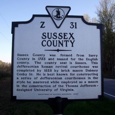
Sussex County. Area 515 Square Miles. Formed in 1753 from Surry, and named for an English county. Cornwallis passed through this county in 1781.
Greensville County. Area 307 Square Miles. Formed in . . . — — Map (db m18926) HM
Prince George County. Area 294 Square Miles. Formed in 1702 from Charles City, and named for Prince George of Denmark, husband of Queen Anne. The battles of the crater, 1864, and Fort Steadman, 1865, took place in this county. . . . — — Map (db m18920) HM
Prince George County. Area 294 Square Miles. Formed in 1702 from Charles City, and named for Prince George of Denmark, husband of Queen Anne. The battles of the crater, 1864, and Fort Steadman, 1865, took place in this county. . . . — — Map (db m18111) HM
Site of
Jones Chapel
Methodist Church
Organized 1777 – Closed 1926
The 16th Virginia Annual Conference
was held here in 1799. The Reverend
Jesse Lee presided due to the
illness of Bishop Asbury.
A great revival was . . . — — Map (db m39793) HM
Sussex County. Area 515 Square Miles. Formed in 1753 from Surry, and named for an English county. Cornwallis passed through this county in 1781.
Southampton County. Area 604 Square Miles. Formed in 1748 . . . — — Map (db m18110) HM
Here lived Gordon L. Vincent, who represented Greensville and Sussex counties in the 1901-1902 Virginia Constitutional Convention. A successful and respected business leader, Vincent headed the Emporia Manufacturing Company, then one of the largest . . . — — Map (db m18945) HM
Antioch Baptist Church was the first of its denomination in Sussex County and one of the earliest in Virginia.
It was formed on 13 June 1772 with 87 members, the result of effective preaching by Elder John Meglamre, of Kehukee Baptist Church in . . . — — Map (db m69386) HM
Neoclassical Revival style house built for William Henry Schaefer (1872-1959); and wife, Katherine Hall LeGwin (1882-1963). A native of Sussex County, Virginia, he came to Wilmington as a young man to work in the general offices of the Atlantic . . . — — Map (db m226794) HM
One mile south on Seacock Swamp stood the home of Col. Michael Blow. He was the first Chairman of the Committee of Safety of Sussex County, member of the House of Burgesses, member of the First Virginia Convention (1774), County Justice, and colonel . . . — — Map (db m35980) HM
The Stealthlike Nottoway of 1650
Edward Bland’s 1650 account of his journey along the lower reaches of the Nottoway and Meherrin river valleys contains the earliest known written record of direct contact between the Nottoway and . . . — — Map (db m226144) HM
The local militia mustered here on August 22, 1831, after the news of Nat Turner's uprising spread throughout Southampton County.
Governor John Floyd
Governor John Floyd, a War of 1812 veteran, held a militia commission as brigadier . . . — — Map (db m276518) HM
Before Dutch control of what is now Sussex County, Native American Iwatama Socuum held "Long Reach," now Bullseye-Ferry Landing Preserve. After 1674, when the Dutch left, it was held by the Waples family and later, the Faucett family. In 1696, Peter . . . — — Map (db m245054) HM
Mecklenburg Electric Cooperative was chartered March 11, 1938, by a group of Mecklenburg County residents. The first office was located in Boydton, Virginia. The group's stated purpose was: "To advance the position of agriculture, to enrich the life . . . — — Map (db m48290) HM
Mecklenburg Electric Cooperative was charted March 1, 1938, by a group of Mecklenburg County residents. The first office was located in Boynton, Virginia, The group's state purpose was "To advance the position of agriculture to enrich the life of . . . — — Map (db m165420) HM
Ellendale’s Railroad Square was a major rail junction and a beehive of economic activity in Sussex County. The first section of the Junction and Breakwater Railroad from Harrington to Milford was completed in 1859. In March 1860, the Company’s . . . — — Map (db m38647) HM
This monument sheds light on the facts that citizens here felt so strongly during the Civil War that they left their state, farms, businesses and families to head south to enlist. Delaware men served in units from Virginia to Texas. The journey . . . — — Map (db m199250) HM
This monument sheds light on the facts that citizens here felt so strongly during the Civil War that they left their state, farms, businesses and families to head south to enlist. Delaware men served in units from Virginia to Texas. The journey . . . — — Map (db m258114) HM
Sussex County. Area 515 Square Miles. Formed in 1753 from Surry, and named for an English county. Cornwallis passed through this county in 1781.
Dinwiddie County. Area 521 Square Miles. Formed in 1752 . . . — — Map (db m69937) HM
Greensville County was formed in 1781 from Brunswick County; parts of Brunswick and Sussex Counties were added later. It was the prehistoric home of the Meherrin and Nottoway Indians. Edward Bland and Abraham Wood explored the land in 1650; the . . . — — Map (db m19068) HM
All Aboard!
Chartered in 1857, the Junction & Breakwater Railroad (J&BRR) ran the 38 miles from a junction with the Delaware Railroad in Harrington to the Delaware Breakwater in Lewes. The portion of the line from Georgetown . . . — — Map (db m198907) HM
Carl Moore Jordan
1880 - 1957
Born in Sussex County, Virginia, Jordan moved to Norfolk in 1900e in search of work. After several years working for Richmond Cedar Works, he and his brother Wallace developed their own lumber company . . . — — Map (db m247131) HM
Tower Hill was a 400-acre land grant made to Daniel Browne in 1676 from the English Duke of York, James II. The tract moniker was most likely to honor Tower Hill, a garden square of the same name, and located northwest of the Tower of London.
— — Map (db m301078) HM
In 1787 the Golden Fleece Tavern owned by Elizabeth Battell, stood facing Court House Square on a property that included this site and there the Constitution of the United States was ratified by the Delaware state.
"Fully, freely . . . — — Map (db m142494) HM
What is a Hundred?
A hundred is an old English subdivision of a county. Although the origin is somewhat shrouded in mystery [,] basically it was a tract of land large enough to provide a hundred men to serve in the king’s wars. In American . . . — — Map (db m156916) HM
The Stockley-Street House
The Stockley-Street House, previously known as the Rabbits Ferry House, was built in the 1740s on the southwest side of Love Creek, in Sussex County, Delaware, by attorney Woodman Stockley II, of Accomack, . . . — — Map (db m315422) HM
Thin black lines indicate changes in relevance. Between each pair of lines entries are ordered geographically but all have the same relevance.
* Inflectional forms of words are their plurals, singulars, and possessives as well as gramatical tenses and similar variations.