Delaware Canal (AKA Delaware Division of the Pennsylvania Canal) Historical Markers
Markers highlighting the history of the Delaware Canal that was in operation along the west bank of the Delaware River between Easton and Bristol, Pennsylvania, from 1831-1932. The canal remnants are now part of the Delaware & Lehigh National Heritage Corridor.
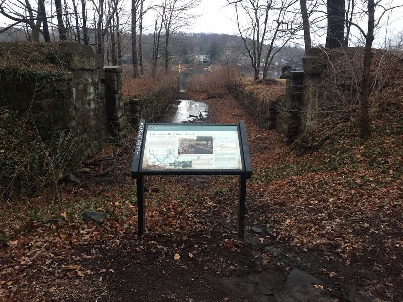
The outlet lock at this location was built to allow canal boats to pass between the Delaware & Raritan Canal and Pennsylvania's Delaware Canal. Canal boats loaded with coal from the Lehigh Valley would come down the Lehigh Canal to Easton, . . . — — Map (db m100644) HM
On Little York - Mt. Pleasant Road (County Route 519) at Rick Road, on the right when traveling north on Little York - Mt. Pleasant Road.
This property, comprising the Mount Pleasant General Store and a smokehouse at the rear, is on the National and State Registers. The smokehouse was constructed in the early 1830's, and the store was erected around 1840. Both were built by the Warne . . . — — Map (db m37110) HM
As the United States began to feel the full force of the Industrial Revolution and expand its own manufacturing and commercial base, cities like Trenton that were blessed with an advantageous location were in the forefront of transportation . . . — — Map (db m166171) HM
“A quiet little village at the southern end of the canal suddenly awakened to find itself a teaming river port swarming with canal boats, boatmen, mules, and river and coastal boats of all sorts.”
C.P. Yoder
Delaware Canal . . . — — Map (db m31279) HM
On Canals End Road just south of Basin Park, on the left when traveling south.
The Industrial Revolution marked the shift in America's economy from hand-made to machine-made products. Better means of transportation, manufacturing, and communication were needed to make change. In the early 1800's, entrepreneurs and . . . — — Map (db m160086) HM
Whether they were headed down the Delaware River or making return trips north, canal boats needed a place to wait in Bristol Borough. A five-acre Basin located between Lock 1 and the Tide Lock provided that space. Some boats were waiting to be . . . — — Map (db m160088) HM
“We used to trade a lot along the canal, people who had vegetables and things, we’d give them coal and they’d give us cabbages, tomatoes and things like that. Then there were lock tenders whose wives made good bread. We’d give them . . . — — Map (db m62626) HM
On Canals End Road just west of Nichols Memorial Drive, on the left when traveling west.
Over its 59-mile length, the Delaware Canal drops 165 feet from Easton to Bristol. To overcome this elevation change, 23 lift locks were built along the way. They allowed safe and reliable navigation for cargo-filled boats.
A lift lock was a . . . — — Map (db m160055) HM
On Old U.S. 13 west of Market Street, on the right when traveling west.
The spot where Lock 2 once stood is located in front of this sign. It is outlined with concrete. By the lock were a locktender's house and shanty, as well as a blacksmith shop and mule barn.
The Delaware Canal not only served as a route for . . . — — Map (db m160053) HM
Near Old U.S. 13 near Mulberry Street, on the right when traveling west.
On October 27, 1827, five hundred people gathered here to witness the first shovelful of dirt being dug for the Delaware Canal, "one of the grandest enterprises of the age." Five years later, a 59-mile long, 40-feet-wide, 5-feet-deep waterway . . . — — Map (db m160050) HM
On Pond Street at Bath Street on Pond Street. Reported permanently removed.
Progress Canal boats continued to pass through Bristol for years after the Pennsylvania Railroad built a line nearby. Progress, in the form of the Railroad undermined the business of the Canal and led to the eventual demolition of its channel, . . . — — Map (db m87145) HM
On Canals End Road just south of Basin Park when traveling west. Reported unreadable.
[Unreadable]
At one time, Bristol Marsh was over four times as large as it is today and extended up Otter Creek for about one quarter of a ile. Bristol Marsh is located adjacent to the entrance and basin for the Delaware Division of the . . . — — Map (db m160082) HM
[parts of quote illegible] “T___ ___ seemed to be a solid mass of boats.”
W.H. ____
Mule ____
Waiting
The five acre Bristol Basin provided a place to wait. Located between Lock No. 1 and the Tidal Lock, the Basin . . . — — Map (db m31256) HM
On Canals End Road just west of Nichols Memorial Drive, on the right when traveling west.
At this point, a canal boatman coming from the north concentrated on stopping. The boat basin and Delaware River were just ahead. The route of the Canal purposefully made a turn toward the River. This change in direction slowed the water flowing . . . — — Map (db m160058) HM
On Canals End Road just east of Nichols Memorial Drive, on the right when traveling east.
A locktender was a crucial canal employee. Responsible for locking canal boats through quickly and efficiently, a locktender needed the endurance and skills to operate the lock's wickets and gates. Having the tact and good humor to deal with . . . — — Map (db m160056) HM
“This day [June 11] the first clearance on the Delaware Division of the Pennsylvania Canal was issued from his office to the Mauch Chunk Canal Boat No. 30, Capt. William C. Zanes, bound to Bristol with 30 tons of coal.”
The . . . — — Map (db m31224) HM
“Coal boats consigned to Philadelphia and adjacent ports were assembled in the river outside the tide lock in rows of up to twenty-one boats, three abreast, to be taken down the river by steamboats. The departure of these tows was . . . — — Map (db m31258) HM
On Basin Park, 0.1 miles south of Mill Street, on the left when traveling south.
Points of Interest
118.8: Bristol Marsh Preserve contains an important freshwater tidal marsh, one of the few remaining along Pennsylvania's coastal region. Visitors may use the viewing platforms, a walking trail, and interpretive . . . — — Map (db m160092) HM
The Delaware Canal was built to transport coal from northeastern Pennsylvania to the Philadelphia and New York markets. Its route essentially parallels the Delaware River. So why not use the River to convey boats loaded with 70-80 tons of cargo? . . . — — Map (db m160093) HM
On Canals End Road just south of Basin Park, on the left when traveling south.
A Tide Lock was located here. It separated the tidal Delaware River from the Delaware Canal. Unlike the other 23 locks along the Canal that accommodated changes in land elevation, this Lock accommodated fluctuations in water elevation. The tide . . . — — Map (db m160084) HM
On Green Lane south of Bristol Pike (U.S. 13), on the right when traveling south.
"Besides, I want to tell you there were pretty good times and many a heart broken and rough life on the canal."
Flora Henry, Locktender
Shouts of "Gid-Up" echo along the canal. Pairs of mules strain at their . . . — — Map (db m131430) HM
On Pennsylvania Route 611 at Durham Road on State Route 611.
Boatbuilding American canal boats met standards as unique as their canals. Here, the preferred boat met Lehigh Coal and Navigation Company’s specifications of 87 ½ feet long, 10.5 feet wide and 7 ½ feet tall. The wooden . . . — — Map (db m86687) HM
On Pennsylvania Route 611, on the right when traveling north.
Here is Lock No. 21 in a series of 23 lift locks, numbered from Bristol to Easton. The aqueduct over Cooks Creek is one of nine which carried water and shipping across branches of the Delaware River. — — Map (db m19233) HM
On River Road (Pennsylvania Route 32), on the right when traveling north.
Delaware Canal
Here is Lock No. 12 in a series of 23 lift locks, numbered from Bristol to Easton. Just above here is one of the nine aquaducts by which the canal and its traffic crossed courses of small streams.
Pennsylvania Canal
A . . . — — Map (db m17586) HM
On Main Street, on the right when traveling north.
Here are locks No. 8-11 of the 23 lift locks on this canal. New Hope also had one of the nine aqueducts and the only toll station between Bristol and Easton. Coal was the largest item of shipping. — — Map (db m20104) HM
Opened from Bristol to this place in 1831; and completed to Easton in 1852. Outlet lock to the river built here in 1834. The near-by River House, built 1794, was a popular barge stop on the canal. — — Map (db m86035) HM
The Borough of Riegelsville was formed in 1916, thanks to a petition by local citizens who sought the right of self-government for their thriving river and canal community.
During the late 18th century, a village slowly evolved around what was . . . — — Map (db m44764) HM
On River Road (Pennsylvania Route 32), on the right when traveling north.
Consisting of Treasure Island and Marshall Island. Home to one of the nation's oldest Boy Scout camps, established by the Philadelphia Council, B.S.A. in 1913. Birthplace of the Order of the Arrow, a national campers' honor society founded upon . . . — — Map (db m35078) HM
On Sanctuary Hill Circle, on the left when traveling south.
"I remember one day, my dad grabbed both the
driver and captain and threw them in the canal.
My dog Buster, got one of the captains by the seat
of the pants and really tore his pants off. He got his
wife to steer while he went in the cabin to . . . — — Map (db m163682) HM
On River Road (Pennsylvania Route 32), on the left when traveling east.
"The mill was shut down before 1909, but
the millstones and some of the machinery
was still there. We used to play around
the mill and run the truck back and forth
across the bridge on the steel rails."
George Fox,
C.P. Yoder's Delaware . . . — — Map (db m163689) HM
On Sanctuary Hill Circle, on the right when traveling south.
Used earth's resources
In natural order!
Built liquid highway
With flowing water!
Follow the river
Stay close to the source!
Locks raised - locks lowered
Control nature's force!
Construction complete
Eighteen thirty-two!
Transport . . . — — Map (db m163673) HM
On Sanctuary Hill Circle, on the left when traveling south.
Has been designated a
National
Historic Landmark
This site possesses national significance
in commemorating the history of the
United States of America
— — Map (db m163674) HM
On River Road (Pennsylvania Route 32), on the left when traveling east.
"Besides, I want to tell
you there were pretty
good times and many
a heart broken and
rough life on the canal."
Flora Henry, Locktender
Shouts of "Gid-Up” echo along the canal. Pairs of mules
strain at their harnesses to get . . . — — Map (db m163686) HM
On Sanctuary Hill Circle, on the right when traveling north.
"We used to trade a lot along the canal, people who
had vegetables and things. We'd give them coal and
they'd give us cabbages, tomatoes and things like
that. Then there were lock tenders whose wives
made good bread. We'd give them coal for . . . — — Map (db m163679) HM
On Sanctuary Hill Circle, on the left when traveling south.
"You didn't dare to be mean to your animals on
the Delaware. Boy, they'd arrest you right away...
I chewed tobacco a little and if I left the pack
sticking out of my back pocket, when I went by
mule he would pull it out of my pocket. I . . . — — Map (db m163681) HM
On Uhlerstown Hill Road, on the right when traveling west.
Uhlertown, known as Mexico at an earlier date, was named for Michael Uhler, boatbuilder and operator of a line of canal boats. Lock No. 18 and well kept buildings are interesting reminders of canal days. — — Map (db m18084) HM
On Washington Crossing Memorial Blvd. at River Road on Washington Crossing Memorial Blvd..
After suffering defeats to the British Army in New york and New Jersey, General George Washington retreated to the Pennsylvania banks of the Delaware River in early December, 1776. On Christmas night, Washington boldly moved approximately 2400 men . . . — — Map (db m76687) HM
On Delaware Drive (Pennsylvania Route 611) at Canal Road, on the left when traveling south on Delaware Drive.
OVER THE CENTURIES
The native Lenape paddled their boats on the Delaware River and trod footpaths through the woods. Settlers maneuvered their wagons on dirt roads. Adventurous oarsmen guided rafts of timber to be sold down river. Business . . . — — Map (db m221096) HM
On Delaware Drive (Pennsylvania Route 611) at Canal Road, on the left when traveling south on Delaware Drive.
The Delaware Canal drops 165 feet on its way from Easton to Bristol. Its engineers were mindful of the potential for generating power using the falling water at each of the waterway's 23 locks. Visions for canal-powered mills and businesses came . . . — — Map (db m221100) HM
On Delaware Drive (Pennsylvania Route 611) at Canal Road, on the right when traveling south on Delaware Drive.
"There is altogether more taste displayed than usual in a country
village, and the buildings denote convenience and comfort."
M. S. Henry
in praise of Uhlersville in 1851.
The fate of the town of Uhlersville was sealed in 1929 when a spark . . . — — Map (db m221092) HM
"I remember one day, my dad grabbed both the driver and captain and threw them in the canal. My dog Buster, got one of the captains by the seat of the pants and really tore his pants off. He got his wife to steer while he went in the cabin to . . . — — Map (db m109562) HM
Delaware Canal has been designated a National Historic Landmark. This site possesses national significance in commemorating the history of the United States of America. — — Map (db m86114) HM
Easton is situated at the confluence of the Lehigh and Delaware Rivers. Founded in the early 1750s, it became an important river community and transportation junction. Opened by 1834, the Lehigh, Morris, and Delaware Canal systems carried . . . — — Map (db m109572) HM
"The Lehigh Valley was one of the great transportation hubs of America, possessing 10 major wagon roads, 3 important canals and ultimately 8 important railroads."
Alfred Chandler, historian
From this unique point along the trail, you . . . — — Map (db m109575) HM
"The boatsmen had a hard life. But the locktenders did too, because they couldn't go nowhere. They had to be on the job all the time."
Harvey Brant
Locktender
It is early morning and still . . . — — Map (db m109560) HM
The Mid-Atlantic Highlands region of Pennsylvania, New Jersey, New York, and Connecticut forms 3-5 million acre forested greenbelt around the densely populated areas of Philadelphia, New York City, and Hartford.The region stretches from northwestern . . . — — Map (db m86118) HM
This canal's 47 miles from Mauch Chunk to Easton were constructed 1827-1829. Here the Lehigh Canal connected with the Delaware Canal to Philadelphia, and with the Morris Canal to New York. Vital to the transport of anthracite coal and to the rise of . . . — — Map (db m29601) HM
The canal channel, which parallels the Delaware River, lies just below the highway. Here are Locks No. 22 and 23, the last lift locks in the 60 miles of canal from Bristol to the Lehigh River at Easton. — — Map (db m86092) HM
On Delaware Drive (Pennsylvania Route 611) at Canal Road, on the left when traveling south on Delaware Drive.
Canallers You became a captain as young as sixteen by showing “The Company” what you could do. You demonstrate how to “snub” (slow down and brake for lock operations), keep accurate cargo records (pay based on number of miles hauled and coal . . . — — Map (db m86113) HM
On Delaware Drive (Pennsylvania Route 611), on the left when traveling south.
Mule Power Mules provided the power to move boats along the Delaware Canal. The mule is the offspring of a male donkey and a female horse. Compared to a horse, the surefooted mule ate less, had stronger endurance and better health. It was . . . — — Map (db m86094) HM