After filtering for Pennsylvania, 1576 entries match your criteria. Entries 101 through 200 are listed.⊲ Previous 100 — Next 100 ⊳
Settlements & Settlers Topic
By Craig Doda, July 3, 2021
Early Settlement 1772-1799 Marker
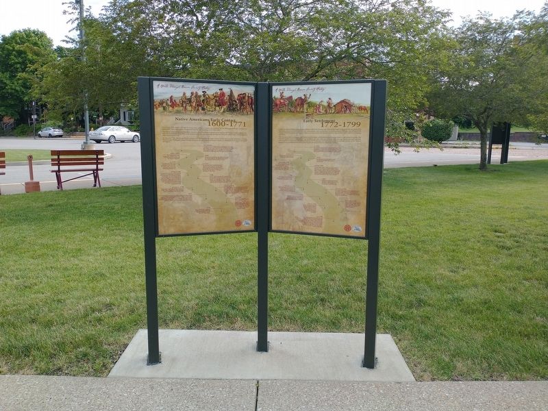
| 101 ► Pennsylvania, Beaver County, Beaver — Early Settlement 1772-1799 — |
| On East End Avenue, on the right when traveling north. | |||
| 102 ► Pennsylvania, Beaver County, Beaver — Fort McIntosh — |
| On River Road east of Market Street, on the right when traveling east. | |||
| 103 ► Pennsylvania, Beaver County, Beaver — Immigration and Migration Patterns — |
| On East End Avenue, on the right when traveling north. | |||
| 104 ► Pennsylvania, Beaver County, Beaver — King Beaver's Town — |
| On 3rd Street (Pennsylvania Route 68) at Wilson Avenue, on the right when traveling west on 3rd Street. | |||
| 105 ► Pennsylvania, Beaver County, Beaver — Native Americans-Early Contact 1600-1771 — |
| On East End Avenue, on the right when traveling north. | |||
| 106 ► Pennsylvania, Beaver County, Beaver Falls — Chinese Workers in Beaver Falls — |
| On 7th Avenue (Pennsylvania Route 18) at 3rd Street, on the right when traveling north on 7th Avenue. | |||
| 107 ► Pennsylvania, Beaver County, Beaver Falls — Homewood Junction — |
| On State Street at 3rd Avenue, on the right when traveling north on State Street. | |||
| 108 ► Pennsylvania, Beaver County, Darlington — Boulder — |
| On Market Street at 3rd Street, on the left when traveling north on Market Street. | |||
| 109 ► Pennsylvania, Beaver County, Darlington — Cannelton — |
| On Ridge Road at Cannelton Road, on the left when traveling north on Ridge Road. | |||
| 110 ► Pennsylvania, Beaver County, Darlington — George Foulks Home — Oldest in Area — |
| On Cannelton Road, 0.1 miles west of Allison Drive. | |||
| 111 ► Pennsylvania, Beaver County, Darlington — McMinn Mill — |
| On New Galilee Road at Haney Road, on the right when traveling south on New Galilee Road. | |||
| 112 ► Pennsylvania, Beaver County, Darlington — Thomas Sprott House — |
| On Market Street at Wallace Drive, on the left when traveling north on Market Street. | |||
| 113 ► Pennsylvania, Beaver County, Fombell — Fombell House — |
| On Old Furnace Road, 0 miles west of Lend Street, on the right when traveling west. | |||
| 114 ► Pennsylvania, Beaver County, Fombell — Stephen Stone House — |
| On Chapel Drive at Hart Road, on the right when traveling west on Chapel Drive. | |||
| 115 ► Pennsylvania, Beaver County, Frankfort Springs — Levi Dungan Land Patent — |
| On Pennsylvania Route 168, 0.4 miles north of Pennsylvania Route 18, on the right when traveling south. | |||
| 116 ► Pennsylvania, Beaver County, Georgetown, Hanover Township — Swearingen Cemetery — |
| Near Swearingen Road, 0.6 miles east of Hardin Run Road. | |||
| 117 ► Pennsylvania, Beaver County, Harshaville — David Littell House — |
| On Frankfort Road (Pennsylvania Route 18) 0.3 miles south of Bocktown Road (Pennsylvania Route 151), on the right when traveling north. | |||
| 118 ► Pennsylvania, Beaver County, Hookstown — Mill Creek — |
| Near Main Street (Pennsylvania Route 168). | |||
| 119 ► Pennsylvania, Beaver County, Monaca — New Philadelphia Society — |
| On Atlantic Avenue at 5th Street, on the right when traveling east on Atlantic Avenue. | |||
| 120 ► Pennsylvania, Beaver County, Rochester — Benvenue Manor — |
| On Pennsylvania Route 68, 0.4 miles south of Benvenue Road, on the right when traveling north. | |||
| 121 ► Pennsylvania, Bedford County, Bedford — 250th Anniversary of the Survey of the Town of Bedford by John Lukens — |
| On South Julian Street south of Penn Street, on the right when traveling south. | |||
| 122 ► Pennsylvania, Bedford County, Bedford — Anderson House — |
| On Pitt Street (Business U.S. 30), on the right when traveling west. | |||
| 123 ► Pennsylvania, Bedford County, Bedford — Bedford County — |
| On Juliana Street at Penn Street, on the right when traveling south on Juliana Street. | |||
| 124 ► Pennsylvania, Bedford County, Bedford — Bedford Village — |
| On Business U.S. 220 at Broad Street, on the right when traveling south on U.S. 220Business . | |||
| 125 ► Pennsylvania, Bedford County, Bedford — First Court House and Prison Built in 1774 — |
| On Juliana Street at Penn Street, on the right when traveling south on Juliana Street. | |||
| 126 ► Pennsylvania, Bedford County, Bedford — NE Boundary Original Survey of Bedford — |
| On Pitt Street at East Street, on the right when traveling west on Pitt Street. | |||
| 127 ► Pennsylvania, Bedford County, Bedford — NW Boundary Original Survey of Bedford — |
| On Pitt Street at West Street, on the right when traveling west on Pitt Street. | |||
| 128 ► Pennsylvania, Bedford County, Bedford — Presbyterian Burial Ground Patent — |
| On East John Street at Huntingdon Avenue, on the right when traveling east on East John Street. | |||
| 129 ► Pennsylvania, Bedford County, Bedford — SE Boundary Original Survey of Bedford — |
| On East John Street at East Street, on the left when traveling east on East John Street. | |||
| 130 ► Pennsylvania, Bedford County, Bedford — SW Boundary Original Survey of Bedford — |
| On West John Street at West Street, on the right when traveling west on West John Street. | |||
| 131 ► Pennsylvania, Bedford County, Bedford — The Squares — |
| On Juliana Street at Penn Street, on the right when traveling north on Juliana Street. | |||
| 132 ► Pennsylvania, Bedford County, Bedford, Bedford Township — Bedford Springs — |
| On Business Pennsylvania Route 220, on the right when traveling south. | |||
| 133 ► Pennsylvania, Bedford County, Bedford, Bedford Township — Bedford Springs Historic District — |
| On Business Pennsylvania Route 220, on the right when traveling south. | |||
| 134 ► Pennsylvania, Bedford County, Bedford, Bedford Township — Bedford Village — |
| On Pitt Street (Business U.S. 30) at Telegraph Road, on the left when traveling west on Pitt Street. | |||
| 135 ► Pennsylvania, Bedford County, Bedford, Bedford Township — Bedford Village — |
| On East Pitt Street at East Penn Street, on the right when traveling west on East Pitt Street. | |||
| 136 ► Pennsylvania, Bedford County, Bedford, Bedford Township — Black Spring — 1796 — |
| Near Sweet Root Road, 1.6 miles south of Business U.S. 220, on the left when traveling south. | |||
| 137 ► Pennsylvania, Bedford County, Breezewood, East Providence Township — The Pennsylvania Turnpike — Lincoln Highway Heritage Corridor — |
| Near Lincoln Highway (U.S. 30) at the Pennsylvania Turnpike's Breezewood Interchange (Interstate 70,76), on the right when traveling west. | |||
| 138 ► Pennsylvania, Bedford County, Hyndman — Hyndman — |
| On Pennsylvania Avenue (Pennsylvania Route 96) east of Washington Street, on the left when traveling north. | |||
| 139 ► Pennsylvania, Bedford County, Manns Choice, Harrison Township — William Frazier — 1759 - 1844 — |
| On Allegheny Road (County Route 31) 0.5 miles west of Shawnee Road (County Route 96), on the right when traveling west. | |||
| 140 ► Pennsylvania, Bedford County, Schellsburg — Shawnee Cabins — |
| On Lincoln Highway (U.S. 30) 0.2 miles west of Market Street (Pennsylvania Route 96), on the left when traveling west. | |||
| 141 ► Pennsylvania, Bedford County, Schellsburg, Juniata Township — Jacob Kinsey (Kintzy) Homestead — |
| On Helixville Road at Byrne Road, on the left when traveling north on Helixville Road. | |||
| 142 ► Pennsylvania, Bedford County, Schellsburg, Napier Township — 1806 Old Log Church — |
| Near Lincoln Highway (U.S. 30) 0.6 miles west of Market Street (Pennsylvania Route 96), on the left when traveling west. | |||
| 143 ► Pennsylvania, Berks County, Bally — Goshenhoppen — |
| On Main St. (PA 100) at 7th Street on Main St. (PA 100). | |||
| 144 ► Pennsylvania, Berks County, Bernville — Bernville — |
| On Bernville Road (Pennsylvania Route 183) 0.1 miles east of Shartlesville Road, on the right when traveling east. | |||
| 145 ► Pennsylvania, Berks County, Bernville — Bernville — |
| On Bernville Road (Pennsylvania Route 183) just west of North Heidelberg Road, on the right when traveling west. | |||
| 146 ► Pennsylvania, Berks County, Bernville, Upper Bern Township — Shartlesville — |
| On Old U.S. 22 at Roadside Drive, on the left when traveling east on U.S. 22. | |||
| 147 ► Pennsylvania, Berks County, Bethel, Bethel Township — Bethel — |
| On Lancaster Avenue (Pennsylvania Route 501) at Old U.S. 22, on the right when traveling south on Lancaster Avenue. | |||
| 148 ► Pennsylvania, Berks County, Bethel, Bethel Township — Fort Henry — |
| On Lancaster Avenue (Pennsylvania Route 501) at Fort Henry Road (Local Road 956), on the left when traveling north on Lancaster Avenue. | |||
| 149 ► Pennsylvania, Berks County, Bethel, Bethel Township — Fort Henry — |
| On Fort Henry Road (Local Route 956) 0.9 miles north of Lancaster Ave (Pennsylvania Route 501), on the right when traveling north. | |||
| 150 ► Pennsylvania, Berks County, Bethel, Bethel Township — 35 — Pilger Ruh — |
| Near Lancaster Avenue (Pennsylvania Route 501) at Pilger Ruh Road. | |||
| 151 ► Pennsylvania, Berks County, Birdsboro — 21 — Birdsboro — [Corporate Limit Marker] — |
| On Main Street (Pennsylvania Route 345/724), on the right when traveling east. | |||
| 152 ► Pennsylvania, Berks County, Birdsboro — Birdsboro Trailhead — Schuylkill River Trail — Berks County Thun Section — |
| On East Main Street (Pennsylvania Route 345) just west of North Water Street, on the right when traveling west. | |||
| 153 ► Pennsylvania, Berks County, Birdsboro — Neighborhoods — |
| On Water Street at East Main Street (Pennsylvania Route 724/345), on the right when traveling south on Water Street. | |||
| 154 ► Pennsylvania, Berks County, Birdsboro, Exeter Township — Daniel Boone — |
| On Baumstown Road (U.S. 422), on the right when traveling east. | |||
| 155 ► Pennsylvania, Berks County, Douglassville, Amity Township — Anthony Sadowski — |
| On Benjamin Franklin Highway (U.S. 422) at Church Lane, on the right when traveling east on Benjamin Franklin Highway. | |||
| 156 ► Pennsylvania, Berks County, Douglassville, Amity Township — Anthony Sadowski — |
| 157 ► Pennsylvania, Berks County, Douglassville, Amity Township — George Douglass Home — 1765 — Preserved by The Historic Preservation Trust of Berks County — |
| On Old Philadelphia Pike, 0.1 miles north of Britton Street, on the right when traveling north. | |||
| 158 ► Pennsylvania, Berks County, Douglassville, Amity Township — James Warren — |
| 159 ► Pennsylvania, Berks County, Douglassville, Amity Township — Michael Fulp House — c. 1783 — Preserved by The Historic Preservation Trust of Berks County — |
| Near Old Philadelphia Pike, 0.1 miles north of Britton Street, on the left when traveling north. | |||
| 160 ► Pennsylvania, Berks County, Douglassville, Amity Township — Morlatton Vilage — An 18th Century Crossroads — |
| On Old Philadelphia Pike, 0.1 miles north of Britton Street, on the left when traveling north. | |||
| 161 ► Pennsylvania, Berks County, Douglassville, Amity Township — Morlatton Village Trailhead — Schuylkill River Trail — Berks County Thun Section — |
| On Old Philadelphia Pike, 0.1 miles north of Britton Street, on the left when traveling north. | |||
| 162 ► Pennsylvania, Berks County, Douglassville, Amity Township — Mouns Jones House — 1716 — Preserved by The Historic Preservation Trust of Berks County — |
| Near Old Philadelphia Pike, 0.1 miles north of Britton Street, on the left when traveling north. | |||
| 163 ► Pennsylvania, Berks County, Douglassville, Amity Township — 52 — Old Swedes House — ← — |
| On Old Philadelphia Pike, 0.1 miles north of Britton Street, on the left when traveling north. | |||
| 164 ► Pennsylvania, Berks County, Douglassville, Amity Township — Riverside Settlement and the Covered Bridge — Heritage Preserved by The Historic Preservation Trust of Berks County — |
| Near Old Philadelphia Pike, 0.1 miles north of Britton Street, on the left when traveling north. | |||
| 165 ► Pennsylvania, Berks County, Douglassville, Amity Township — St. Gabriels — |
| On Benjamin Franklin Highway (U.S. 422) at Church Lane, on the right when traveling east on Benjamin Franklin Highway. | |||
| 166 ► Pennsylvania, Berks County, Douglassville, Amity Township — Welcome to Morlatton Village — Settled 1704 — |
| On Old Philadelphia Pike just north of Britton Street, on the left when traveling north. | |||
| 167 ► Pennsylvania, Berks County, Douglassville, Amity Township — William Bird, Esq. — |
| 168 ► Pennsylvania, Berks County, Douglassville, Union Township — Swedish Pioneers — |
| On East Main Street (Pennsylvania Route 724). | |||
| 169 ► Pennsylvania, Berks County, Geigertown, Robeson Township — Joanna Furnace Mansion Site — |
| Near Furnace Road, 0.5 miles east of Morgantown Road (Pennsylvania Route 10), on the right when traveling east. | |||
| 170 ► Pennsylvania, Berks County, Hamburg — 4th & Pine circa 1800's — |
| On 4th Street at Pine Street, on the right when traveling south on 4th Street. | |||
| 171 ► Pennsylvania, Berks County, Hamburg — Geiger's Mill — |
| Near Front Street north of State Street (Old U.S. Highway 22), on the left when traveling north. | |||
| 172 ► Pennsylvania, Berks County, Hamburg — Historic Hamburg — |
| On Front Street north of State Street (Old U.S. Highway 22), on the left when traveling north. | |||
| 173 ► Pennsylvania, Berks County, Hamburg — Martin Kaercher Jr. — |
| On Church Street north of Pine Street, on the right when traveling north. | |||
| 174 ► Pennsylvania, Berks County, Hamburg, Upper Bern Township — Northkill Amish — |
| On Hex Highway (Old Pennsylvania Route 22) 0.5 miles west of Roadside Drive, on the left when traveling east. | |||
| 175 ► Pennsylvania, Berks County, Kutztown — Brick-End Decorated Barns — |
| 176 ► Pennsylvania, Berks County, Kutztown — Colouring Easter Eggs — |
| 177 ► Pennsylvania, Berks County, Kutztown — Dew of Heaven — |
| 178 ► Pennsylvania, Berks County, Kutztown — Dutch Folksong Tradition — |
| 179 ► Pennsylvania, Berks County, Kutztown — Funeral Feasts — |
| 180 ► Pennsylvania, Berks County, Kutztown — Griener Dunnerschdag — |
| 181 ► Pennsylvania, Berks County, Kutztown — New Year's Day Lore — |
| 182 ► Pennsylvania, Berks County, Kutztown — Pennsylvania Dutch Ballads — |
| 183 ► Pennsylvania, Berks County, Kutztown — Pennsylvania Half-Timbering — |
| 184 ► Pennsylvania, Berks County, Kutztown — Thanksgiving & Harvest Home — |
| 185 ► Pennsylvania, Berks County, Kutztown — The Bush Meeting — |
| 186 ► Pennsylvania, Berks County, Kutztown — The Mennonites — |
| 187 ► Pennsylvania, Berks County, Kutztown — The Moravians — |
| 188 ► Pennsylvania, Berks County, Kutztown — The Plain Dutch — |
| 189 ► Pennsylvania, Berks County, Kutztown — Two Worlds - Dutch Country — |
| 190 ► Pennsylvania, Berks County, Kutztown — Wheelbarrow Matches — |
| 191 ► Pennsylvania, Berks County, Kutztown, Maxatawny Township — Thompson Cabin — Ca. 1750 — |
| On Luckenbill Drive, 0.2 miles west of Kutztown Road, on the left when traveling west. | |||
| 192 ► Pennsylvania, Berks County, Lorane — Lincoln Homestead — |
| On Perkiomen Avenue (U.S. 422). | |||
| 193 ► Pennsylvania, Berks County, Mertztown, Rockland Township — 15 — Sally Ann Furnace — (Hunter Furnace) — |
| On Sally Ann Furnace Road at Mine Road, on the right when traveling south on Sally Ann Furnace Road. | |||
| 194 ► Pennsylvania, Berks County, Mohnton, Cumru Township — Mohnton — |
| On East Wyomissing Avenue south of Mohnton Boulevard, on the right when traveling south. | |||
| 195 ► Pennsylvania, Berks County, Mohnton, Cumru Township — Mohnton — |
| On West Wyomissing Avenue, 0.1 miles east of Rudloff Lane, on the right when traveling east. | |||
| 196 ► Pennsylvania, Berks County, Mount Aetna, Tulpehocken Township — Mt. Aetna — |
| On Lancaster Avenue (Pennsylvania Route 501) south of Hunsicker Street, on the right when traveling north. | |||
| 197 ► Pennsylvania, Berks County, Mount Aetna, Tulpehocken Township — Mt. Aetna — |
| On Lancaster Avenue (Pennsylvania Route 501) south of Deck Road, on the right when traveling south. | |||
| 198 ► Pennsylvania, Berks County, Mount Penn — Mount Penn — [Corporate Limit Marker] — |
| On North 25th Street just north of Filbert Avenue, on the left when traveling north. | |||
| 199 ► Pennsylvania, Berks County, Oley, Oley Township — De Benneville House — |
| On Memorial Highway at Blacksmith Road on Memorial Highway. | |||
| 200 ► Pennsylvania, Berks County, Oley, Oley Township — De Turk House |
| On Memorial Hwy. (PA 73/662), at DeTurk Road on Memorial Hwy. (PA 73/662),. Reported missing. | |||
1576 entries matched your criteria. Entries 101 through 200 are listed above. ⊲ Previous 100 — Next 100 ⊳