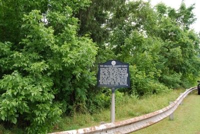
Abraham (1718-1781) and Mary Parker Tegarden from Frederick County, Virginia 1753, made an 'improvement' opposite mouth of Tenmile Creek, Fayette County; Abraham, sutler for Colonel Bouquet 1759, fought in French and Indian War, Captain Virginia . . . — — Map (db m56944) HM
River Formation
Prior to the glaciers (more than 780,000 years ago), the ancestral Monongahela River flowed from present day north central West Virginia across Pennsylvania and northwest Ohio. Extensive ice sheets dammed the old north . . . — — Map (db m230986) HM
Albemarle County. Albemarle County was formed in 1744 from Goochland County and named for William Anne Keppel, the second Earl of Albemarle, titular governor of Virginia from 1747 to 1754. A portion of Louisa County was later added to . . . — — Map (db m21585) HM
The homesite and grave of Revolutionary War officer, Colonel Robert McFarland, is located two miles north at Springvale. Born in 1759 in Orange County, North Carolina, he served in the Virginia Militia from 1776 to 1781. In 1783, McFarland moved . . . — — Map (db m80442) HM
(preface)
On July 18, 1863, Union Gen. Edward E. Potter led infantry and cavalry from New Bern to destroy the Wilmington and Weldon Railroad bridge at Rocky Mount. The infantry feinted toward Kinston and returned to New Bern. Potter raided . . . — — Map (db m232003) HM
On this site stood one of the principal stations of the Cumberland Settlements. Felix Robertson, son of Col. James Robertson and the first white child born in the Settlement, was born here, Jan. 11, 1781. On Jan. 15 the fort was heavily attacked by . . . — — Map (db m4131) HM
The village of Stanardsville was founded by William Stanard (died 1807), of Roxbury plantation, on land that was part of his 6,000 acre inheritance from the Octonia Grant of 1729. This grant included most of what is presently northern Greene County . . . — — Map (db m22988) HM
Peter Early served as Georgia governor from 1813 to 1815, during the War of 1812 with Great Britain and the Creek War of 1813-1814. Born in Virginia in 1773, he graduated from Princeton and moved to Georgia in 1795 to practice law, settling in . . . — — Map (db m267641) HM
Orange County. Formed from Spotsylvania County in 1734, Orange County, a pastoral Piedmont county, was probably named in honor of William IV, the Dutch prince of Orange, who married Anne, the Princess Royal, daughter of George II of England, . . . — — Map (db m24228) HM
Pennsylvania Railroad Company
Established in 1846, the Pennsylvania Railroad Company (PRR) was headquartered in Philadelphia, Pennsylvania. By 1882, it had become the largest railroad and transportation company in the world with a budget . . . — — Map (db m181582) HM
The grounds of the City Cemetery began to decline after it was closed in 1878. The stigma of disease that pushed the City Council to pass ordinances allowing only families with open plots to continue burials all but sealed the fate of Nashville's . . . — — Map (db m205318) HM
Greene County. Formed from Orange County in 1838, this rural Piedmont county was named for Gen. Nathanael Greene, Revolutionary War military hero. The county seat of Greene County is Stanardsville. William Donoho and William B. Phillips, . . . — — Map (db m21505) HM
Branch of Warrior Trail of the Great Catawba Indian War Path located here where Mason and Dixon Survey crossed Dunkard Creek for third time. Guide, Six Nations Indians’ chief, declared he “would not proceed one step further,” because hostile . . . — — Map (db m175212) HM
Front:
This Greek Revival style brick structure is known as the Hope Family Grave Shelter. Constructed in 1853, it is listed on the National Register of Historical places. The unusual splayed eaves and vaulted or “compass” . . . — — Map (db m47621) HM
Redmon Thornton and his wife Sarah Alford Thornton built this house in Greene County, Georgia after they moved to the area from Virginia. The house dates to around 1792, when George Washington was president. They had four children together and a . . . — — Map (db m208583) HM
Clinch Gray, son of Thomas Gray, who was council to the Crown in 1765, Virginia State Legislator 1779-1794, Tennessee lawyer and legislator 1795-1829.
Clinch Gray, accompanied by Fann Crease settled at this site in 1805.
In 1811, he was . . . — — Map (db m80365) HM
Union Meeting House
Organized in 1807
On this site in 1809, pious Christians from Virginia and North Carolina erected a Methodist Church, the first in Greene County. The church was officially organized on May 23, 1807 as the Bonner Society. . . . — — Map (db m91415) HM
Welcome to Greene County, Tennessee! Get ready to visit small towns with big stories.
Tennessee Civil War Trails tells riveting stories of battles and leaders, and much more. You'll learn about some of the state's 275,000 enslaved men and women . . . — — Map (db m214697) HM
Before the war began, Greene County had a long history of abolitionist sentiment. It was not surprising, then, that local residents overwhelmingly supported the Union when Tennessee seceded in June 1861. When 30 neighboring counties met in . . . — — Map (db m84761) HM
The Creation of Shenandoah National Park
This stone chimney was placed here to honor the people of the Blue Ridge Mountains who lost their homes, land and livelihood when Shenandoah National Park was formed in the 1930s. The memorial . . . — — Map (db m308045) HM
Side A
photos of John Taylor Sr-Revoluntionary War/Mary "Kiser" Taylor-Believed to Be/Pvt Jesse Taylor-Hero/Hero Post Office 1899-1917
The village of Hero was originally located on the land where this sign proudly stands. Today Hero is . . . — — Map (db m171818) HM
With the Proclamation of 1763, the British government set aside territory that would eventually become the state of Tennessee as a vast “Indian reservation” stretching west of the Appalachians to the Mississippi River. That same year, English . . . — — Map (db m179468) HM
Two Rockingham County Schools and Three Churches were Located Inside the Shenandoah National Park Boundary
Dean Mountain and Sunnyside were mountain schools operated by the Rockingham County Public School System; both schools were closed . . . — — Map (db m270102) HM
Built in 1837 by Col. John Erwin, wealthy lawyer and planter. Architects and contractors were from Philadelphia. It has been continuously occupied by the Erwin family and is now the home of Katherine Mahood Rugg, great great-granddaughter of Col. . . . — — Map (db m203647) HM
He was born near Madison, Virginia in 1773, the
son of Joel Early and Lucy Smith. His cousin, Jubal
Early, was the grandfather of Confederate General
Jubal Anderson Early (1816-1894). Peter Early
graduated from the Lexington Academy (current . . . — — Map (db m267646) HM
Godfrey Brown
1768 1843
“As to debts, thank God
I owe no man anything
but love”
Godfrey Brown was born a slave in
Brunswick County, Virginia in the year
of 1768. He yearned for freedom and
was freed by his master on March . . . — — Map (db m95414) HM
Watershed
A watershed is a geographic area that water moves towards a common water body. Several things determine
a watershed and what a watershed looks like. These include the unique geography and topography of an area,
networks of . . . — — Map (db m181370) HM
Edward Mine to Emerald Mine
When the mine first opened in 1921, it was known as the Edward Mine and was located near Clarksville and operated by the Chartiers Southern Coal Company. In 1923, the company constructed the initial 70 houses . . . — — Map (db m181680) HM
Start here
900 - 1200 AD
Monongahela village settled just outside borders of / near future site of Mason-Dixon Historical Park
1632
King Charles I issues a land grant, called Maryland, representing the area between . . . — — Map (db m256802) HM
Tuscarora stronghold. Site of decisive battle of the Tuscarora War, March 20-23, 1713, when 950 Indians were killed or captured. Site 1 mi. N. — — Map (db m222352) HM
Thin black lines indicate changes in relevance. Between each pair of lines entries are ordered geographically but all have the same relevance.
* Inflectional forms of words are their plurals, singulars, and possessives as well as gramatical tenses and similar variations.