783 entries match your criteria. The first 100 are listed. Next 100 ⊳
William G. Pomeroy Foundation Historical Markers
Since its inception, the Foundation has grown to six historic signage programs, funding over 1,000 markers & plaques in New York, Ohio and beyond, all the way to Alaska. Does not include the William G. Pomeroy Foundation Legends & Lore Series.
On Franklin Street, 0.1 miles Washington Street, on the left when traveling north.
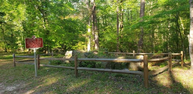
Courts met under "Jury Oak"
early 1800s. Judge presided
while sitting on tree limb.
Public executions held
at nearby "hanging tree". — — Map (db m221963) HM
On Cahaba Road, 1.1 miles east of County Road 9, on the right when traveling north.
On April 5, 1825, General Lafayette was welcomed at the State House, visited Halo Masonic Lodge, and dined at Mr. White's Hotel. — — Map (db m244889) HM
On Lauderdale Street at Selma Avenue, on the right when traveling south on Lauderdale Street.
Selma Suffrage Association
established here March 1910.
Joined the Birmingham League
to form the Alabama Equal
Suffrage Association in 1912. — — Map (db m224540) HM
On 2nd Avenue West east of 12th Street West, on the right when traveling east.
On Aug. 18, 1915, Alabama
Equal Suffrage Association
and Birmingham Barons
hosted suffrage day here in
support of women's suffrage — — Map (db m188885) HM
On Government Street (U.S. 90) east of South Jefferson Street, on the right when traveling east.
Eugenie Marx first president Mobile Equal Suffrage Assn. Educated and organized Mobile women to fight for the right to vote. Lived here 1910-1915. — — Map (db m226705) HM
On Dales Ferry Road (County Road 1) at U.S. 84, on the right when traveling west on Dales Ferry Road.
On April 6, 1825, General Lafayette, descending the Alabama River, was honored in Claiborne where he was addressed by James Dellet. — — Map (db m239945) HM
On North San Francisco Street north of East Birch Avenue, on the right when traveling north.
Arizona Equal Suffrage Assn hosted speech by national suffragist Anna Howard Shaw here in 1912 to promote woman suffrage in Arizona — — Map (db m193161) HM
Suffragists Helen Hurlbut of California & Elizabeth Upham Yates of Main spoke here, the former Janssen's Hall, for the 1896 Suffrage Campaign. — — Map (db m243782) HM
On Pennsylvania Street north of East 13th Avenue, on the right when traveling north.
Home of Margaret Brown, ‘Titanic’ survivor & national advocate for Suffrage & Labor Rights. Proposed as candidate for U.S. Senate 1914. — — Map (db m177950) HM
On Central Row west of Market Street, on the right when traveling west.
On Sept. 4, 1824, General Lafayette visited Hartford during his triumphal return to the U.S. He was addressed here by Governor Wolcott. — — Map (db m230408) HM
On Elm Street (Connecticut Route 160) west of Silan Deane Highway (Connecticut Route 99), on the right when traveling west.
Elm Street Historic District has been placed on the National Register of Historic Places in 1998 by the United States Department of the Interior — — Map (db m230832) HM
On Old Main Street at Glastonbury Avenue (Connecticut Route 160), on the right when traveling north on Old Main Street.
Rocky Hill Center Historic District has been placed on the National Register of Historic Places in 2007 by the United States Department of the Interior. — — Map (db m230830) HM
On Riverview Road north of Meadow Road, on the right when traveling north.
Rocky Hill-Glastonbury Ferry Historic District has been placed on the National Register of Historic Places in 2005 by the United States Department of the Interior — — Map (db m230787) HM
On Mapleton Avenue (Route 159) 0.1 miles south of Hickory Street, on the right when traveling north.
Hilltop Farm has been placed on the National Register of Historic Places in 2005 by the United States Department of the Interior — — Map (db m230482) HM
On East Main Street (U.S. 1) just east of Waterside Lane, on the right when traveling west.
On August 21, 1824, General Lafayette, traveling on the Post Road, was welcomed with military and civil honors in Killingworth, now Clinton. — — Map (db m245608) HM
On Main Street (Connecticut Route 154) just north of Pennywise Lane, on the right when traveling south.
On August 21, 1824, General Lafayette reached Saybrook where he spent the night while traveling from New York City to Boston, MA. — — Map (db m227271) HM
On N Road (Connecticut Route 117) 0.1 miles Newtown Road (Connecticut Route 117), on the right when traveling north.
Jabez Smith
House
has been placed on the
National Register
of Historic Places
in 1981
by the United States
Department of the Interior — — Map (db m227184) HM
On Main Street (Connecticut Route 27) just south of Old Mystic Center Road (Connecticut Route 27), on the right when traveling south.
Mystic Bank has been placed on the National Register of Historic Places in 2014 by the United States Department of the Interior. — — Map (db m227175) HM
On Town Hall Road, on the left when traveling west.
Union Green Historic District has been placed on the National Register of
Historic Places in 1990
by the United States
Department of the Interior — — Map (db m222813) HM
On Hyde Avenue (Connecticut Route 30) at East Street, on the right when traveling west on Hyde Avenue.
On Sept. 4, 1824, General Lafayette was received at King's Tavern by the 1st Co., Governor's Horse Guard and escorted to East Hartford. — — Map (db m230442) HM
Near River Road (Delaware Route 9) 0.3 miles west of Deemers Beech Access, on the left when traveling south.
Women munitions workers at former Bethlehem Steel Plant south of here jailed in Washington DC protesting for women's suffrage 1917-1919. — — Map (db m211090) HM
On North Market Street (Business U.S. 13) just north of Race Street, on the right when traveling north.
On October 6, 1824, General Lafayette entered Brandywine Village and he was escorted to Joseph Tatnall's house where he addressed family members. — — Map (db m210793) HM
On North Tatnall Street just south of West Girard Street, on the left when traveling south.
Blanche Stubbs, 1872-1952. Equal Suffrage Study Club leader & advocate for African American voting and civil rights. Lived here. — — Map (db m184935) HM
On North French Street just north of East 13th Street, on the right when traveling north.
Alice Dunbar-Nelson, 1875-1935. Teacher, author, civil rights leader. Elected president Equal Suffrage Study Club 1914. Lived here. — — Map (db m186358) HM
On West Pine Street, 0.1 miles west of Gardner Avenue, on the left when traveling west.
Margaret W. Houston Sussex Co. suffrage leader elected V.P. of Delaware Equal Suffrage Assn. 1896. Helped est. town library 1899. — — Map (db m190454) HM
On 16th Street Northwest at R Street Northwest, on the right when traveling south on 16th Street Northwest.
Founded 1896, the National Association of Colored Women fought for women's suffrage and human rights for all the disenfranchised. — — Map (db m235653) HM
On M Street Northwest at New York Avenue Northwest (U.S. 50), on the right when traveling east on M Street Northwest.
Nannie Helen Burroughs advocated for equality and women's suffrage. Graduated with honors 1896 from the former M Street High School. — — Map (db m198384) HM
On Utility Street just north of Florida Route 100, on the right when traveling north.
Bunnell Water Tower has been placed on the National Register of Historic Places in 2019 by the United States Department of the Interior — — Map (db m209101) HM
On North 15th Street just north of East 7th Avenue, on the left when traveling north.
Violence was commonplace during the early years of Ybor City. Even duels were sometimes fought over honor, women, and at least once over an argument regarding which novel was appropriate to be read by the lector of a cigar factory. These duels, . . . — — Map (db m176191) HM
On North Franklin Streeet at East Zack Street, on the right when traveling south on North Franklin Streeet.
WDAE was the first radio station to broadcast in Florida, doing so on May 15, 1922. The Tampa Daily Times was the original license holder, and the first radio studio was located in the Florida Citrus Exchange Building (later part of the Maas . . . — — Map (db m176260) HM
On East 7th Avenue (Florida Route 574) 0.1 miles west of I-4 Connector to the Leroy Selmon Expressway, on the right when traveling west.
On May 16, 1896, during Cuba's 1895 Revolution against Spanish rule, the Captain General of Cuba, Valeriano Weyler, enacted an embargo against Cuban tobacco to the United States. He was enraged by the revolutionary activities of the Ybor City . . . — — Map (db m176267) HM
On East 8th Avenue, 0.2 miles east of North 15th Street, on the right when traveling east.
Soon after the founding of Ybor City, Cuban, Spanish, and Italian immigrants established comprehensive health maintenance organizations. For small weekly dues they received medicines, hospitalization, and medical services.
On June 18, 1888, Don . . . — — Map (db m130180) HM
On Edgewater Drive (U.S. Alt 19) just south of Main Street, on the right when traveling south.
Elizabeth Skinner, Florida Equal Suffrage Assn. organized county women here in former library hall. Lobbied for suffrage in Tallahassee 1919. — — Map (db m174829) HM
On West Greene Street at South Clarke Street, on the right when traveling west on West Greene Street.
From March 27 to 29, 1825, General Lafayette stayed at
the Government House during his visit to Milledgeville, then Georgia's capital. — — Map (db m227241) HM
On Main Street (U.S. 278) east of Norwood Street, on the right when traveling east.
On March 25, 1825, General
Lafayette spent the night in
Warrenton on his way from
Augusta to Milledgeville.
He departed the next morning. — — Map (db m227214) HM
Near Bethany Road east of Sycamore Street (Illinois Route 23), on the right when traveling east.
Hybrid corn results from the cross of two inbred parents, each of which is developed by selfing (in-breeding) a corn line for 6-8 generations until it is mostly homozygous.
Corn plants are diploid with one set of chromosomes coming from the . . . — — Map (db m230907) HM
On West Maple Street just west of South Park Avenue, on the right when traveling east.
On April 6, 1891, attorney Ellen Martin & 14 women voted in Lombard election asserting town charter gave right to all citizens of voting age. — — Map (db m173085) HM
On North Clear Lane, 1.5 miles east of North Campground Lane, on the right when traveling east.
The Atkinson Cemetery was established March 11, 1875, by James Atkinson, who granted the land as a community burial ground. The first recorded burial (1843) was of Sarah A. Short, daughter of Thomas Jefferson and Martha "Patsy" (Maddux) Short. The . . . — — Map (db m236731) HM
On West Madison Street at La Salle Street (Illinois Route 23), on the right when traveling east on West Madison Street.
In 1859, Jim Gray, a slave who escaped from Missouri, was apprehended in Illinois by slave hunters. Gray was taken to Ottawa for a hearing before Justice John Dean Caton of the Illinois Supreme Court's northern division.
On October 19, with a . . . — — Map (db m201759) HM
On Washington Avenue south of 3rd Street, on the right when traveling north.
More than 250,000 horses were brought in from mid and western United States and shipped out of the East Alton stockyards during World War I. The horses of various breeds were shipped overseas to the British, French, and Belgian governments for the . . . — — Map (db m211576) HM
On 1st Street, 0.1 miles Webster Street, on the right when traveling south.
On Apr. 30, 1825, Lafayette arrived at Gen. Edgar's home, dined at Col. Sweet's Tavern & attended a Ball at William Morrison's house. — — Map (db m223511) HM
On Field Street east of 4th Street, on the left when traveling east.
Wilhelmina “Minnie” Vautrin, (1886-1941) was born in Secor,
Illinois, to French immigrants. Her mother died when Minnie
was 6, and she was raised by her father and grandparents. She
excelled at school and worked her way through Illinois
State . . . — — Map (db m239248) HM
On South Wayne Street at East Maple Street, on the right when traveling north on South Wayne Street.
Side 1
Ornithologist Jane L. Hine was born
in Ohio and graduated from Oberlin
College before moving to DeKalb
County. She raised a large family,
starting ornithological work later in
life by studying the birds near her
Sedan farm. . . . — — Map (db m241163) HM
On Prospect Street just east of South Alabama Street, on the right when traveling west.
The South Side Turnverein, an athletic and social club founded in 1893, fostered German cultural traditions in Indianapolis. It promoted the Turner philosophy of integrated mind and body wellness and expanded under the leadership of German . . . — — Map (db m238584) HM
On North Illinois Street at Fosters Place, on the right when traveling south on North Illinois Street.
Andrew “Bo” Foster. Entrepreneur and WWII veteran Andrew Foster was born in Indianapolis. He established a lucrative trucking company in the 1940s, enabling him to open and manage several businesses that served Black patrons in the segregated . . . — — Map (db m238556) HM
On South Capitol Avenue at West South Street, on the right when traveling east on South Capitol Avenue.
Arabic-speaking Syrian immigrants settled here on Willard St. by 1893 in small, crowded multiple-family row homes. They created a vibrant neighborhood alongside Black Americans and European immigrants. Searching for economic opportunities in the . . . — — Map (db m238603) HM
On Ohio River Scenic Byway (Indiana Route 66) 0.2 miles east of Girl Scout Road, on the right when traveling west.
On May 9, 1825, General Lafayette survived sinking of steamboat "Mechanic" nearby & continued to Louisville aboard passing steamboat "Paragon" — — Map (db m243576) HM
On Southeast Martin Luther King Junior Boulevard at Chestnut Street, on the right when traveling north on Southeast Martin Luther King Junior Boulevard.
Evansville Equal Suffrage Society founded 1886 at home on this site. Later, leader for national women's suffrage in Washington D.C. — — Map (db m226987) HM
On South 9th Street (U.S. 27) north of South B Street, on the left when traveling north.
Suffragist & journalist
Est. "The Little Paper" 1915. In which she advocated for women's rights & suffrage. Former home on this site. — — Map (db m232951) HM
On North Broadway Street south of East Broad Street, on the left when traveling south.
Belle Babb Mansfield, first U.S. woman attorney 1869. Elected Pres., Iowa Woman Suffrage Convention 1870. Taught at IW 1873-1881. — — Map (db m177820) HM
On Pleasant Street west of 12th Street, on the right when traveling west.
People lived and worked here. They shopped and prayed here. They gathered here to celebrate life. Welcome to what was Iowa's most vibrant Black community — the historic Center Street neighborhood, stretching from 15th Street to Keosauqua Way. . . . — — Map (db m235901) HM
On 17th Street south of Olive Avenue, on the right when traveling south.
A pillar of Des Moines' Black community, the Willkie House legacy dates to 1917 when it hosted the War Recreation Board's leisure programs for Black servicemen in the city. Its name and function changed in the early years, as did its location. . . . — — Map (db m235895) HM
Physician & teacher spoke here at 1887 State Assoc. of Colored Teachers Meeting advocating women's suffrage. Speech in national newspaper. — — Map (db m132656) HM
Near U.S. 641, 0.1 miles north of Mott City Road (State Road 70), on the right when traveling north.
Centreville Livingston Presbyterian Church cemetery. John Elder, Vet. of Rev. War, interred here 1799 on land given by Col. James Hawthorn. — — Map (db m244251) HM
On Sutton Street south of West 2nd Street, on the right when traveling south.
On May 21, 1825, General Lafayette landed at Fish St. Escorted to Capt. Langhorne's hotel, he dined and met with Revolutionary War veterans. — — Map (db m221946) HM
On Stamping Ground Road (Kentucky Route 227) 0.2 miles north of Frankfort Pike (U.S. 460), on the right when traveling north.
On May 17, 1825, General LaFayette dined nearby at Blue Spring Farm, home of Richard Mentor Johnson, and lodged 5 mi. from Georgetown. — — Map (db m221965) HM
On U.S. 79 north of Dawson Street, on the right when traveling north.
AKA pot liquor. Broth made from boiling greens and pork fat. Fed South's hungry by early 1850s. In 1935, Senator Huey Long praised its value. — — Map (db m220563) HM
On Summerfield Highway (Alternate State Highway 2) at Corney Lake Road, on the right when traveling west on Summerfield Highway.
Alabama Methodist Church has been placed on the National Register of Historic Places in 1995 by the United States Department of the Interior — — Map (db m209818) HM
On South River Road south of North Boulevard, on the right when traveling north.
Legislators debated passing Federal and State Suffrage Amendments here in 1920. Suffragists held a public rally in support of the 19th Amendment. — — Map (db m177927) HM
On North Charles Street north of East Pleasant Street, on the right when traveling north.
Edith Houghton Hooker led Just Government League in statewide women's suffrage advocacy campaign from office one block east 1910-1912. — — Map (db m237124) HM
On Druid Hill Avenue (Maryland Route 129) just east of McMechen Street, on the right when traveling east.
Augusta Chissell & Margaret Hawkins held meetings of African American women's suffrage clubs here in their neighboring homes 1915-1916. — — Map (db m143007) HM
Faculty & students campaigned for women’s suffrage, hosted suffrage seekers & marched in Washington DC 1913. Students picketed White House 1917. — — Map (db m145894) HM
On East Main Street just east of South Court Street, on the right when traveling east.
Mary B. Shellman, community leader and 1913 founding president Carroll County Just Government League, educated voters here 1920. — — Map (db m188390) HM
Near South Market Street (Maryland Route 355) at Stadium Drive, on the right when traveling south.
From 1911, sisters Florence & Bertha Trail promoted woman suffrage through the Just Government League of Frederick. Both buried here. — — Map (db m213565) HM
On Union Ave at St. John St, on the left when traveling east on Union Ave.
On July 29, 1825, General Lafayette visited Havre de Grace after he descended the Susquehanna River aboard the Steamboat Norfolk. — — Map (db m160215) HM
Near Bentley Road north of Olney Sandy Spring Road (Maryland Route 108), on the right when traveling north.
Caroline Hallowell Miller & Mary Bentley Thomas led Sandy Spring and Maryland campaigns for women's right to vote from 1883-1915. — — Map (db m219707) HM
On Aquinnah Circle west of Lighthouse Road, on the right when traveling west.
Gay Head Light has been placed on the National Register of Historic Places in 1987 by the United States Department of the Interior — — Map (db m221966) HM
On Riverview Drive just south of Pine Street, on the right when traveling south.
Riverside Village Historic District has been placed on the National Register of Historic Places in 2017 by the United States Department of the Interior — — Map (db m230570) HM
On Main Street (Massachusetts Route 12/62) at Park Street, on the right when traveling north on Main Street.
Lafayette’s tour on Sept. 3, 1824, General Lafayette was welcomed at the entrance of the village where he was addressed by Isaac Goodwin of Sterling. — — Map (db m211720) HM
On Court Tower Boulevard, 0.1 miles west of County Center Drive East, on the right when traveling west.
Oakland County Equal Suffrage Assn. organized May 9, 1912 at former courthouse in Pontiac to actively campaign for Women’s right to vote. — — Map (db m205904) HM
Home of Nellie Volstead. Active in Congressional Union for Woman Suffrage & Honorary Council in support of 1917 National Suffrage Convention. — — Map (db m231699) HM
On Silver Street, 0.5 miles south of South Canal Street, on the right when traveling north.
On April 18, 1825, General Lafayette visited Natchez, spoke on the Bluff, dined at The Steamboat Hotel & attended a ball at Traveller's Lodge. — — Map (db m192867) HM
783 entries matched your criteria. The first 100 are listed above. Next 100 ⊳