On Main Street at Duval Street, on the right when traveling west on Main Street.
James Price Phillips, descendant of a Brazoria County Old 300 family, married Selina Harris Lee in 1911. They had four children, and Price built this house for his wife to commemorate the birth of their youngest child, Oliver Wendel, in 1920. The . . . — — Map (db m173075) HM
Near Highway 332 east of Hand Lane, on the right when traveling east.
Joseph H. Hawkins Native Virginian Joseph H. Hawkins practiced law in Kentucky, where he served as state legislator and U.S. congressman before moving to New Orleans. There he befriended Stephen F. Austin, who was broke and reluctant to complete . . . — — Map (db m167943) HM
On Montgomery Road south of Winner Foster Road, on the right when traveling south.
In 1821, Stephen F. Austin was granted a permit from the Mexican government to act as empresario for 300 families to settle in Texas. That summer, he and the settlers, known as the Old Three Hundred, began crossing into Texas. From 1823 to 1824, . . . — — Map (db m209258) HM
On State Highway 288, on the right when traveling north.
Stephen was born in Virginia to Moses and Maria Austin in 1793. Stephen grew up to help run his father's lead mining business in Missouri, serve in the local militia battalion and the Missouri territorial legislature. Later, as Stephen studied law . . . — — Map (db m177382) HM
Near Farm to Market Road 183 0.7 miles south of U.S. 84, on the left when traveling south.
John Raney Bertrand was born in Brazoria County, the son of French immigrants who came to Texas before the Texas Revolution. He was a partner in a mercantile business in Washington County for several years before leaving to join the Confederate Army . . . — — Map (db m217408) HM
Near Gulf Prairie Road 0.2 miles south of Texas Highway 36, on the left when traveling south.
Born near Austinville, Virginia, as was her brother Stephen Fuller Austin (1793-1836), Emily moved with her father Moses Austin (1761-1821) and mother Maria Brown Austin (1768-1824) to Missouri in 1798. The family operated lead mines there and . . . — — Map (db m90628) HM
Near Gulf Prairie Road 0.2 miles south of Texas Highway 36, on the left when traveling south.
Pioneer Cemetery. Originally part of Peach Point Plantation. Used by descendants of James Franklin Perry and wife, Emily Austin Bryan Perry, Stephen F. Austin’s sister, and by the community since 1829. In 1836, Austin, the “Father of . . . — — Map (db m90591) HM
Near Gulf Prairie Road 0.2 miles south of Texas Highway 36, on the left when traveling south.
A native of Allegheny County, Pennsylvania, James Franklin Perry moved to Potosi, Missouri, in 1808. He joined the mercantile business of his relatives Samuel and John Perry, and became a partner in 1818.
While living in Potosi, Perry met and . . . — — Map (db m90627) HM
On Brazos River Road east of Highway 2004, on the left when traveling east.
Thomas Phillip Crosby (1799-1860) came to Texas from New York in 1830. After surveying sections of land along the Colorado River in 1830, he settled on this tract along the Brazos River with an eye toward building a landing for lower Brazos River . . . — — Map (db m172701) HM
Born in Connecticut. Moved to Texas in 1829. Took part in Texas Revolution, participating in Siege of Bexar, 1835. Served as aide to Stephen F. Austin, "The Father of Texas" (a distant relative), Gens. Edward Burleson and Sam Houston. Commander at . . . — — Map (db m127631) HM
On 3rd Street north of D Street, on the right when traveling north. Reported unreadable.
When this county was created in 1860 by the Eighth Texas Legislature, it was named for Texas patriot James Charles Wilson. A native of England, Wilson (1818-1861) left his homeland in 1836 and by 1839 had settled in Brazoria County, Texas. He . . . — — Map (db m117637) HM
On North Market Street at Travis Street on North Market Street.
Austrian-born Sofie Deligath (1846-1925) wed Dr. Moriz Herzog at the age of 14 and in 1878 emigrated with her family to the U.S., where she attended the Eclectic Medical College of the City of New York in May 1895. After the death of her husband, . . . — — Map (db m167910) HM
On County Road 316 (Highway 316), on the left when traveling north.
A tanner, John McCroskey came to Texas with Stephen F. Austin's "Old 300". He built this home in compliance with the terms of his 1824 land grant. Later owners remodeled the structure. Oliver Jones, the owner in 1849-50, was chairman of a . . . — — Map (db m173103) HM
Near Main Street (County Route 703) 0.1 miles south of Austin Street (County Road 300E), on the right when traveling north.
John Sweeny, Sr. (d. 1855) moved his family from Tennessee to Brazoria County, Texas, about 1833. With the help of slaves, he cleared his land and established a large plantation. This log cabin, originally located about 9 miles southwest of this . . . — — Map (db m49709) HM
On Richey Street at Shaw Avenue, on the right when traveling north on Richey Street.
This busy commercial area was once part of the Allen Ranch, one of the oldest and largest ranches in southeast Texas. A portion of the land was granted to Morris Callahan in 1824 by Mexico and inherited by his niece Rebecca Jane Thomas (d. 1919), . . . — — Map (db m126443) HM
Near West 11th Street at Congress Avenue, on the right when traveling east.
Henry Smith (1788-1851) immersed himself in public affairs soon after arriving in Texas in 1827. Initially a local political leader in what is now Brazoria County, he was appointed in 1835 as a delegate to the San Felipe Consultation, which met to . . . — — Map (db m26540) HM
On N. Brooks Street (State Highway 36) at W. Smith Street, on the right when traveling south on N. Brooks Street.
(South Face of Monument)
Henry Smith was born in Kentucky, May Twentieth 1788, came to Texas in 1827 and settled in what is now Brazoria County which he regarded as his home until his death. He was severely wounded in the Battle of . . . — — Map (db m90101) HM
Stephen F. Austin hoped his colony in Texas would help his family prosper. But the business of
being an empresario proved financially disappointing. Hoping a family business - like a store - would generate income, Austin encouraged his . . . — — Map (db m206267) HM
Alsbury, Young Perry (ca. 1814–1877)
Young Perry Alsbury, veteran of the battle of San Jacinto and the Mexican War, was born in Hopkinsville, Kentucky, around 1814, one of eleven children that included brother Horace Alsbury. He moved . . . — — Map (db m300917) HM
Paradise Memorial Cemetery was organized as a public cemetery in 1968 in Brazoria, Texas. It was named by Rev. Robert George Marshall who was the driving force in securing land for the cemetery. Paradise Memorial Cemetery is located on County . . . — — Map (db m172853) HM
Near Quintana Street east of North Brazosport Boulevard, on the right when traveling east.
Erected by the State of Texas in memory of Colonel Robert M. Coleman
Signer of the Texas Declaration of Independence
Aide-de-Camp to General Sam Houston at San Jacinto
Colonel of the First Regiment of Texas Rangers
Born in Kentucky in . . . — — Map (db m173991) HM
On West Brazos Street (State Highway 35) at Brown Street, on the left when traveling west on West Brazos Street.
Charlie Brown, born a slave in the late 1820s, came to the Brazoria County area from Virginia before the Civil War. Despite being illiterate and using an X for his mark beside his name on legal transactions, Brown acquired a vast amount of land . . . — — Map (db m172982) HM
Near East 26th Street at North Washington Avenue, on the right when traveling west.
Native of Missouri. Member of prominent family who were Texas statesmen, planters, developers. Grandson of Moses Austin, who obtained from Mexico charter for American Colony in Texas, but died before making settlement. Nephew of Stephen F. . . . — — Map (db m119643) HM
On East Main Street (State Road 25) at N Center St (State Road 79), on the right when traveling west on East Main Street.
Archer County was given its name Jan. 22, 1858 by an act of the Texas Legislature in honor of Branch Tanner Archer's service in the Texas Republic. Archer was born in Virginia on Dec. 31, 1790, where he later studied medicine. He came to Texas to . . . — — Map (db m269326) HM
On North Velasco Street, on the right when traveling north.
This stone is an original column from the 1895 Brazoria County Courthouse located in Brazoria, Texas. Column donated by Mr. A. T. "Tom" Covert in memory of his beloved wife Georgia City of Angleton Centennial Time Capsule 1892 - 1992 Placed May . . . — — Map (db m173354) HM
Near Cemetery Road at Shanks Road, on the right when traveling east.
Born in West Columbia, Texas. Married; had one son. Served as justice of the peace, Precinct 2, 1900-1912. Was appointed deputy sheriff of Brazoria County in 1913; elected sheriff in 1918; reelected for an additional 2-year term. Was killed in . . . — — Map (db m173307) HM
On East Locust Street, on the left when traveling east.
Tennessee native Rees P. Sweeny (1856-1937) constructed this raised Victorian house in 1896, the year Angleton became the seat of government for Brazoria County. The county's tax collector from the early 1890s to 1902, Sweeny moved here as part of . . . — — Map (db m173309) HM
Near County Road 373 west of Farm to Market Road 521.
The town of Brazoria began in 1828 as a port and trading center in Stephen F. Austin’s colony. Partially burned in 1836 during the Texas Revolution, it rebuilt and served as county seat until 1897. To escape floods and to enjoy a better life, the . . . — — Map (db m90103) HM
On South 16th Street 0.1 miles north of East Jackson Street, on the right when traveling north.
This congregation traces its history to early Methodist missionary activity during Texas' years as a republic in 1839. The Rev. Isaac L. G. Strickland was assigned to the Brazoria Circuit and organized a Methodist Church in Columbia (now West . . . — — Map (db m46456) HM
On State Highway 36 0.5 miles south of County Road 4, on the right when traveling north.
In 1920, Texas & Pacific Railway official William H. Abrams (1843-1926) of Dallas owned this old plantation land, then considered fit only for pasture. He leased mineral rights to the Texas Company (now Texaco, Inc.), whose drilling reached a . . . — — Map (db m52766) HM
Near Boonville Road (Farm to Market Road 158) 0.1 miles east of Austins Colony Parkway.
The State of Texas consists of 254 counties. Washington County, with its settlements of Independence and Washington on the Brazos, was one of the 23 counties created in 1836 following Texas independence. Most of the area of present day Brazos . . . — — Map (db m170365) HM
Near North Main Street (U.S. 87) at West Red River Street.
Served in Co. D, Texas Rangers (1927-1933), under Captains W.W. Sterling, Will Wright, and Albert Mace. Hazardous duties included patrolling the Rio Grande for smugglers, protecting a prisoner from a Sherman lynch mob, dipping cattle for tick fever . . . — — Map (db m192587) HM
Near East Cedar Street at North Velasco Street (Business State Highway 288).
Angleton's first permanent courthouse was built in 1897, a year after the city was chosen Brazoria County seat. Constructed from plans originally drawn for the Matagorda County courthouse, the structure was enlarged and extensively remodeled in . . . — — Map (db m120661) HM
On North Velasco Street, on the right when traveling north.
Brazoria County was the leading sugar producing county in Texas in the 1840's & 1850's. Sugar cane was grown and processed in sugar mills on large plantations using slave labor. After the cane was ground and the juice was extracted, the cane . . . — — Map (db m173315) HM
Near East Jackson Street east of South 16th Street, on the right when traveling east.
Byrd Lockhart, Jr. moved to Green DeWitt’s Colony from Missouri around 1826 with several female relatives. He worked as a surveyor for the colony and settled in Gonzales, where he organized defenses against Indian attacks and supervised . . . — — Map (db m173015) HM
On North Avenue O west of Skinner Street when traveling west.
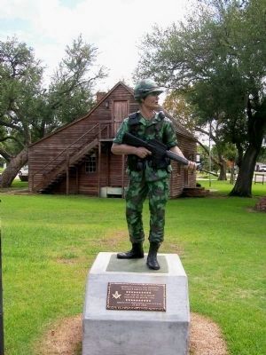
A part of Brazoria County history for more than a century, Velasco Lodge No. 757, Ancient Free and Accepted Masons, was granted a charter from the Grand Lodge of Texas on December 8, 1893. R. E. Murrell served as First Worshipful Master.
The . . . — — Map (db m169457) HM
On North Getty Street (U.S. 83) north of East Nopal Street, on the right when traveling north.
Maryland native William Benson (b. 1837) came to Texas after graduating from college as a civil engineer. After settling in Brazoria County he became a teacher. During the Civil War he commanded a cavalry regiment as one of the youngest captains . . . — — Map (db m111498) HM
On Farm to Market Road 1094 at Swearingen Road, on the right when traveling west on Highway 1094.
Austin County pioneer and Texas War for Independence veteran, Elemelech Swearingen, was born in Shepherdsville Kentucky (Bullitt Co.) in 1805. He married Angelina Weeks (1811-1883) in 1827 and in 1831, moved with his family to Texas. The Swearingens . . . — — Map (db m202526) HM
Flagpole stone, outward-facing side: Dedicated To The Members Of The Armed Forces From Brazoria County Who Gave Their Lives In Service Of Their Country To fallen soldiers let us sing, Where no rockets fly nor bullets wing, Our broken . . . — — Map (db m173310) HM
On North Grand Boulevard at East Broadway Street (Farm to Market Road 518), on the right when traveling north on North Grand Boulevard.
A terrible storm ravaged Pearland in 1915. Among the important structures it destroyed was the town's high school. For the next 22 years, Pearland teenagers traveled to Webster to attend classes. The long commute severely curtailed their involvement . . . — — Map (db m137329) HM
On South Wynden Drive 0.2 miles east of South Post Oak Lane, on the right when traveling east.
The end of the Civil War and Emancipation signaled the demise of plantations like Pleasant Bend. Agur Morse died of typhoid fever late in the War, and his widow Grace sold off much of the plantation land as small farms, except for a homestead here . . . — — Map (db m169804) HM
Near State Highway 332 0.1 miles County Highway 257. Reported missing.
The sidewheel steamer "Acadia", owned by Canadians, set out on her maiden voyage in Dec. 1864 for Nassau, Havana, and Vera Cruz. Loaded with food, hardware, and clothing, she braved the Federal blockade to bring the goods to suffering Texans. . . . — — Map (db m181333) HM
Thin black lines indicate changes in relevance. Between each pair of lines entries are ordered geographically but all have the same relevance.
* Inflectional forms of words are their plurals, singulars, and possessives as well as gramatical tenses and similar variations.