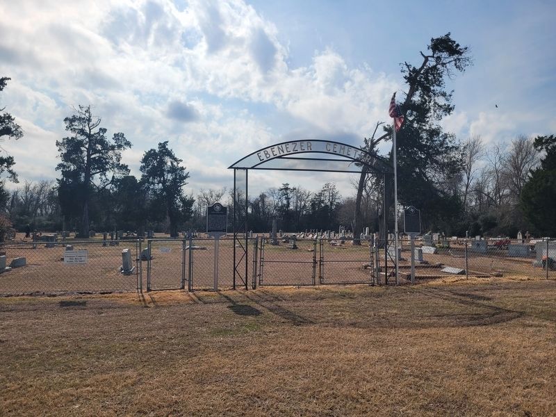
On Ebenezer Cemetery Rd (County Road 714) 1 mile south of State Highway 7, on the right when traveling south.
James A. Head was a Texas Ranger, veteran of the War for Independence, and Republic of Texas legislator. Born in Georgia in 1797, he moved to Texas in 1835, enlisting at San Felipe de Austin in Silas Parker's ranging company and securing a land . . . — — Map (db m293422) HM
Near Boonville Road 0.1 miles east of Austins Colony Parkway.
Eli Seale 1793-1857
Elias (Eli) Seale was born in North Carolina in 1793. He served as a fifer in the War of 1812 in Mississippi, and in 1835 moved with his three brothers and his family from Alabama to Texas. He received his Mexican . . . — — Map (db m170484) HM
Near North Texas Avenue at North Washington Avenue, on the right when traveling north.
The Civil War and its aftermath greatly affected Brazos County. War halted progress of the Houston & Texas Central Railway and made Millican a boomtown. After the war, the railroad created a new town, Bryan City, and brought a need for men and . . . — — Map (db m170303) HM
Harvey Mitchell Hall, erected in 1912 and razed in 1972, was named for the Father of Brazos County. He was responsible for locating the A. & M. College of Texas in Brazos County. This original cornerstone was placed, leveled and dedicated through . . . — — Map (db m285727) HM
Near East 26th Street at North Washington Avenue, on the right when traveling west.
Furnished horses, equipment and clothing for county men in the Civil War.
Levied war taxes on property, exempting lands or estates of Confederate soldiers.
After surveying to determine needs of the families of Brazos soldiers, appropriated . . . — — Map (db m119642) HM
Near Boonville Road 0.1 miles east of Austins Colony Parkway.
"Welcome to My Town"
Father of Brazos County
Harvey Mitchell was born in 1821 in Tennessee. Because his parents could not afford to send him to college, the ambitious 18 year old came to Texas in 1838. From 1839 to 1842, . . . — — Map (db m170405) HM
Near East 26th Street at North Washington Avenue, on the right when traveling west.
Native of Missouri. Member of prominent family who were Texas statesmen, planters, developers. Grandson of Moses Austin, who obtained from Mexico charter for American Colony in Texas, but died before making settlement. Nephew of Stephen F. . . . — — Map (db m119643) HM
Near Boonville Road (Farm to Market Road 158) 0.1 miles east of Austins Colony Parkway.
The State of Texas consists of 254 counties. Washington County, with its settlements of Independence and Washington on the Brazos, was one of the 23 counties created in 1836 following Texas independence. Most of the area of present day Brazos . . . — — Map (db m170365) HM
Near East 26th Street at North Washington Avenue, on the right when traveling west.
Brazos County, part of Stephen F. Austin’s colony, was created from Washington County in 1841. It was first named Navasota County, with Boonville as the county seat. In 1842 the name was changed to Brazos County. Through the Civil War, Millican, . . . — — Map (db m119591) HM
Near Turkey Creek Road at Raymond Stotzer Frontage, on the left when traveling north.
Pioneer Communities in Brazos County were aptly called neighborhoods or settlements. Settlements usually include a church, a school, and perhaps a crude cotton gin but often little else. This memorial is located on what is left of a two acre site . . . — — Map (db m283318) HM
Near North Texas Avenue at North Washington Avenue.
Isom Palmer, whose name has various spellings, was born to Martin and Sarah (Hardwick) Parmer. In 1825, the Palmer (Parmer) family moved to Texas, settling near Nacogdoches the next year, and participated in the 1826 Fredonian Rebellion. Palmer . . . — — Map (db m170312) HM
On High Prairie Road 1.6 miles west of Wellborn Road (Farm to Market Road 2154), on the right when traveling west.
Old Three Hundred Colonist William T. Millican was born in South Carolina about 1780 and came to Texas with his parents and siblings in 1821. They joined Stephen F. Austin's first colony and were granted land in this area on which to make their . . . — — Map (db m179148) HM
On Turkey Creek Road at Raymond Stotzer Frontage, on the left when traveling north on Turkey Creek Road.
The Brazos Valley was first settled and formed by people from all over America and other foreign lands. The earliest Anglo settlers arrived in this Mexican province from nearby southern states, lured by large Mexican land grants. After the Texas . . . — — Map (db m283311) HM
On County Road 264 north of County Road 364, on the right when traveling north.
The Sugarloaf Bridge is a 234-foot long, pin-connected Parker through truss bridge located over the Little River near historic Sugarloaf Mountain in Milam County. Parker trusses such as this one, were developed by C.H. Parker in a series of patents . . . — — Map (db m267513) HM
Near Boonville Road 0.1 miles east of Austins Colony Parkway.
Though it's called a cabin, the Turner-Peters Dogtrot was house and home during the 1800s to early settlers. For over 160 years, the homestead was situated atop a sandy hill overlooking a small branch of Peach Creek in Grimes County. Thanks to . . . — — Map (db m170387) HM
On North Houston Avenue north of East 22nd Street, on the right when traveling north.
Methodism among African American Texans predates the civil war with the first church being established in 1848. the earliest known African American minister in Brazos county was reverend Emmanuel Hammitt who served under Reverend W.S. South after . . . — — Map (db m239014) HM
On East 26th Street west of North Texas Avenue (Local Road 68), on the right when traveling west.
Came to Texas from Tennessee in 1839, and joined "minute men" protecting north frontier from Trinity to Brazos River. Moved to Brazos County; served 1842-1853 in County offices: Deputy Clerk, County Clerk, Surveyor, Chief Justice. Taught school, . . . — — Map (db m119644) HM
On Texas Avenue South 1.4 miles north of Texas Highway 6, on the right when traveling south.
In 1946, more than 30 acres were purchased from a local farmer to establish a municipal cemetery for the City of College Station. The property surrounded two previously established cemeteries: Shiloh Cemetery (also known as Rector Chapel Cemetery) . . . — — Map (db m260525) HM
On Turkey Creek Road at Raymond Stotzer Frontage, on the left when traveling north on Turkey Creek Road.
Brazos County and the Brazos River
The 840-mile Brazos is the longest river entirely within Texas. The Brazos carries more water into the Gulf of Mexico than any other such river. The Brazos and the Navasota Rivers determine the physical . . . — — Map (db m283321) HM
Near Greens Prairie Road (Victoria Avenue) 0.2 miles east of Wellborn Road (Farm to Market Road 2154), on the left when traveling west.
The town of Wellborn was founded in 1867 along the Houston and Texas Central railroad line. By 1874, with the first documented burial -- that of two-year-old Newton Farquhar -- a cemetery was in existence to serve the community. A reflection of . . . — — Map (db m170195) HM
Near Boonville Road 0.1 miles east of Austins Colony Parkway.
Brazos Union Lodge was organized in Boonville in 1852. Four years earlier, another lodge, named Boonville Lodge No. 55, was created at Boonville and worked under a dispensation for several months before receiving a charter in January 1849 from the . . . — — Map (db m170459) HM
On East Pruitt Street at North Preston Avenue, on the right when traveling west on East Pruitt Street.
On March 30, 1885, the City of Bryan purchased seven lots in this area as a site for a public school to provide separate but equal and impartial instruction for black children of the community, as prescribed by the Texas State Constitution of 1876. . . . — — Map (db m187778) HM
On Avenue D at 5th Street, on the left when traveling south on Avenue D.
During World War II, construction of Bryan Army Air Field (Bryan AAF) began in August 1942. The U.S. Army Air Forces site grew out of a war department initiative to train pilots and instructors. The site was the only instrument instructor school for . . . — — Map (db m233745) HM
Near Boonville Road (County Road 158) west of Curtis, on the right when traveling west.
When Boonville was selected as the first seat of Brazos County in 1841, the town was designed and built around a public square with a cemetery established soon afterwards on lot 1, covering ten acres. The earliest documented burial in the . . . — — Map (db m292080) HM
On Drummond Cemetery Road (County Road 316) 0.4 miles north of Butterfield School Road (County Road 290), on the right when traveling north.
In 1879, after her husband’s death in Jamaica, Helen Fanny Harris Drummond returned with her children to England. She immigrated with them to the United States in 1885, settling in Brazos County, Texas. In October 1891, she purchased 100 acres in . . . — — Map (db m77654) HM
On Waco Street south of State Road 21, on the left when traveling south.
After the founding of the American Legion Organization in 1919, efforts to form a local post in Bryan soon followed. Thirty-three Brazos County World War I veterans called for registration booths to be placed throughout the county where honorably . . . — — Map (db m268118) HM
On Brazoswood Drive at Frontage State Highway 6 Frontage Road, on the left when traveling west on Brazoswood Drive.
In 1831, Richard Carter (1789-1863), Virginia native and War of 1812 veteran, came from Alabama and received a grant of land within the Stephen F. Austin colony at the site of what is now the City of College Station. He became one of the areas . . . — — Map (db m168426) HM
On Dulles Avenue at Viking Lane, on the right when traveling south on Dulles Avenue.
One of Stephen F. Austin's "Old 300," William J. Stafford (1764-1840), founded the settlement of Stafford's Point on the 6819.7-acre land grant he received in the winter of 1824. Bringing his family and slaves from his Louisiana sugar . . . — — Map (db m27781) HM
On North Earl Rudder Freeway 0.1 miles south of State Road 21, on the right when traveling south.
As the first public cemetery for the City of Bryan, the Old Bryan City Cemetery (also known as Bryan's Old Graveyard and Bryan's Public Cemetery) was in use by 1861. It predates the incorporation of the City of Bryan and is sited on land originally . . . — — Map (db m268121) HM
On East 26th Street at North Washington Avenue, on the right when traveling west on East 26th Street.
[Golden Wheel]
This Tree has stood at three
Brazos County Courthouses
1841 Ferguson Springs
1843 Boonville
1892 Bryan
William Scott Chapter D.A.R.
Bryan - 1932
— — Map (db m243660) HM
Thin black lines indicate changes in relevance. Between each pair of lines entries are ordered geographically but all have the same relevance.
* Inflectional forms of words are their plurals, singulars, and possessives as well as gramatical tenses and similar variations.