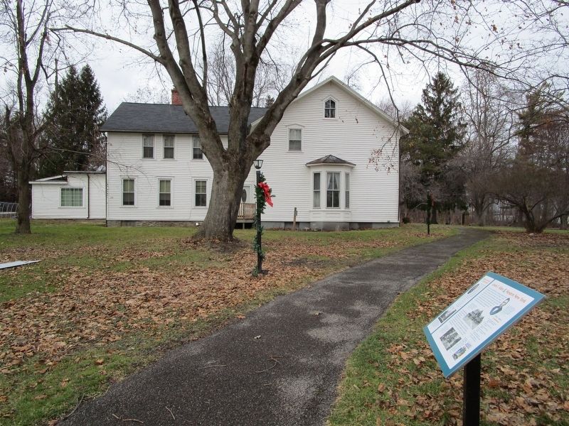
Grover Cleveland & Grand Island Young Grover Cleveland, inspired by his uncle Lewis F. Allen's experimental work with cattle, visited Allentown Farm and stayed to maintain the farm records. Cleveland eventually worked as an apprentice in a . . . — — Map (db m101199) HM
On Clark Street at Potter Avenue, on the right when traveling east on Clark Street.
Fairgrounds covered 4 acres in Potter's Grove, Town of East Hamburg (presently Orchard Park). The Fair was addressed by Horace Greely, Editor, New York Herald Tribune. Erected by the Orchard Park Historical Society and Village of Orchard . . . — — Map (db m80568) HM
On Pearl Street at Upper Terrace, on the left when traveling south on Pearl Street.
Buffalo and Black Rock Railroad Southern terminus of horse-drawn railroad over which first car traveled on May 16, 1834. Absorbed 1835 by Buffalo and Niagara Falls (steam) Railroad and, in 1853, became part of the New York Central Railroad. . . . — — Map (db m92799) HM
On Main Street at West Swan Street, on the right when traveling south on Main Street.
Grover Cleveland, 1837 - 1908, twenty-second President of the United States. Practiced law, 1874-1881, in an office on this site. — — Map (db m92873) HM
On Buffalo Road (County Route 413) 0.1 miles east of Springville Boston Road (County Route 228), on the left when traveling south.
Erie County's Gateway to the Allegheny Mountains. You are standing in the historic Concord Community Park. The land was donated and the park was created in 1952, becoming the home of the Springville Baseball Club. The club converted a 20 acre . . . — — Map (db m104197) HM
On East Quaker Street (U.S. 20A) 0.1 miles west of Freeman Road, on the left when traveling east.
The Quaker Meetinghouse, formally known as the "Meetinghouse of the Orchard Park Monthly Meeting of the Religious Society of friends", is home to Erie County's oldest active congregation. Known as "Quakers" they brought with them their lifestyle, . . . — — Map (db m80772) HM
On Hertel Avenue 0.2 miles west of Niagara Street (New York State Route 266), on the left when traveling east.
Tow Path Park The “Black Rock” The black rock that gave the area its name was situated in the Niagara River just north of where the Peace Bridge is now, near the foot of present-day School Street. It was 200 feet wide, rose about . . . — — Map (db m140711) HM
Be it for day use or for overnight camping adventure, the park is a southern Erie County treasure. Park and Area History. Sprague Brook Park was acquired by Erie County in 1963 by using state and federal aid programs to assume title to more . . . — — Map (db m104186) HM
Near Genesee Road (County Route 409) 0.2 miles east of Mehm Road.
Erie County owns and maintains several forested lands in various areas of the county, for preservation and public enjoyment. The Erie County Bureau of Forestry was established in 1927 in response to the acquisition of several thousand acres of . . . — — Map (db m133103) HM
Near Main Street (New York State Route 5) 0.1 miles north of West Delavan Avenue.
On this day of May 30, 1991, The Semper Fidelis Post #356 of the American Legion of Buffalo, New York, humbly dedicated this monument in honor of all men and women of Erie County who have lost their lives while defending our country in all wars. . . . — — Map (db m81217) WM
On Lake Avenue at James Place, on the left when traveling south on Lake Avenue.
On this site stood one of New York State's pioneer glass factories. Established in 1849, by a group of glass blowers from Pittsburgh, Penna., it operated until 1904. The principal output was glass bottles, bitters bottles and whimseys. Erected by . . . — — Map (db m75309) HM
Near Chestnut Ridge Road (New York State Route 277) 1 mile south of Newton Road.
Park and Area History. Chestnut Ridge Park is one of the original Erie County Parks, beginning its development back in the early 20th Century. Much of the park construction was handled through the WPA (Works Progress Administration) work force . . . — — Map (db m82396) HM
On Academy Street 0.1 miles north of East Main Street ( Route 39), on the left when traveling north.
Incorporated 1827, opened 1830. The first high school in Erie County, New York, it was named Griffith Institute in 1867 for Archibald Griffith, donor of a Scholarship Fund. Final classes at this site were held in 1970. — — Map (db m80794) HM
On East Main Street (New York State Route 39) at Mechanic Street, on the right when traveling west on East Main Street.
Bright Past, Brilliant Future. You are in the center of the Village of Springville, incorporated in 1834 to provide services for the growing manufacturing activities within the Town of Concord. This location was the former site of the Leland House . . . — — Map (db m80769) HM
First person buried in the Smithfield Cemetery, was born at Alder, Erie County, New York, in 1835, the son of Austin and Laura Wilder Harris Merrill, He was killed in an Indian attack July 29, 1880 as he and his brother Solyman were returning from . . . — — Map (db m44449) HM
On Brighton Road 0.1 miles west of Colvin Boulevard, on the right when traveling west.
Tonawanda Rails to Trails This 3.9 mile trail is composed of two segments on top of a former railroad bed in the Town of Tonawanda and the City of Tonawanda. The railroad corridor was operated for both freight and for passenger service dating back . . . — — Map (db m97929) HM
Near Creekside Drive 0.1 miles west of Old Niagara Falls Boulevard.
A Dam on Tonawanda Creek Tonawanda Creek was the only section of the original Erie Canal that was not man-made. The problem was that the creek level ran 4-½ feet too low. The alleviate this, a wooden dam was constructed in 1823 just west . . . — — Map (db m98569) HM
(side 1) Near this site lived William Austin Burt, inventor, legislator, surveyor, and millwright. Born in Massachusetts in 1792, Burt settled in this area in 1824, after spending several years in Erie County, New York. There he had been a . . . — — Map (db m154165) HM
On North Street at Irving Place, on the right when traveling west on North Street.
Near this location on August 7, 1981, Bob Uplinger (1951-1988) was arrested by an undercover police officer posing as a gay man, and charged and convicted with loitering for the purpose of engaging in deviate sexual activity. After consensual sex . . . — — Map (db m197455) HM
On Niagara Street (Route 266) at Collaton Street, on the right when traveling south on Niagara Street.
Residents of the "Towpath" fished and hunted the Erie Canal from a cluster of weather beaten homes, hunting and fishing clubs, taverns and stores leaning at strange angles, perched on wobbly stilts. Fishing was a popular pastime, as well as an . . . — — Map (db m80459) HM
On Buffalo Road (U.S. 20) at Municipal Drive, on the right when traveling west on Buffalo Road.
Earliest railroad activity along the Lake Erie shoreline began in the early 1840s, with local investors forming the Erie & North East Railroad. Finished in 1852, this 19-mile section of 6 foot gauge track ran from the City of Erie near 14th Street . . . — — Map (db m132202) HM
On Parkside Avenue at Jewett Parkway, on the right when traveling south on Parkside Avenue.
Menagerie to Habitat. The Buffalo Zoo, like other modern zoos, has become an educational facility that focuses on conservation and reproduction of endangered species. The Zoo has reintroduced some endangered animals to their native habitats. Today's . . . — — Map (db m75074) HM
Extending one mile north from Delaware Park Lake, between Elmwood and Delaware Avenues, the Pan-American Exposition was a spectacular sight to over eight million visitors from May 1 to November 2, 1901. Ornate buildings, embellished with . . . — — Map (db m57079) HM
On Marine Drive at Commercial Street, on the right when traveling east on Marine Drive.
You are looking across a restoration of the Commercial Slip, originally the western terminus of the Erie Canal. In its heyday, this area was one of the world's great transportation centers, teeming with canal, lake, and rail traffic, a busy port . . . — — Map (db m84559) HM
On Lloyd Street at Prime Street, on the left when traveling east on Lloyd Street.
There was fierce competition between Buffalo and Black Rock for the Canal's western terminus. Albany, the link to New York City, emerged as the perfect choice for the eastern end of the Canal. The western end was a far less obvious proposition. . . . — — Map (db m84496) HM
It was at this spot on the morning of October 26, 1825, that Governor DeWitt Clinton officially opened the waterway that transformed America. More than eight years had passed since he broke ground on the canal, and after 363 miles, the engineering . . . — — Map (db m84500)
On Pine Street 0.5 miles north of Porterville Road, on the right when traveling north.
The Sinking Ponds Site was home to Native Americans for thousands of years prior to the establishment of the Village of East Aurora by Euro-American settlers. Sinking Ponds is a Native American archeological site occupied repeatedly for thousands . . . — — Map (db m104153) HM
On South Buffalo Street (New York State Route 277) 0.2 miles south of West Highland Avenue, on the right when traveling south.
The Orchard Park Railroad Depot - One Hundred Years (1912 - 2012)- preserved for the next century to enjoy. The Village of Orchard Park, incorporated in 1921, exists today as a result of the vision and planning of Harry Yates, a local businessman . . . — — Map (db m82371) HM
On West Adams Street east of Jackson Street, on the right when traveling east.
Erie County Jail. The Erie County Jail was built in 1882-1883 in the Gothic style. Constructed of blue limestone, the $45,750 facility featured 26 cells, the sheriff’s residence, and boasted then modern innovations including chrome steel bars . . . — — Map (db m141925) HM
On East Front Street at Parade Street, on the right when traveling west on East Front Street.
Native American influence on this area of northwestern Pennsylvania pre-date the 1492 encounter by at least 13,500 years.
Erie County is named after its first known inhabitants, the Erie Nation.
The Erie Nation, also known as the Cat . . . — — Map (db m25977) HM
Oakland’s famed native son was the noted author of “The Call of the Wild”, “The Sea Wolf” and “South Sea Tales”. He was at various times a sailor, Alaskan gold miner, salmon fisher and longshoreman.
For a time he was politically involved in . . . — — Map (db m71295) HM
On Davis Road (New York State Route 240) at Bridge Street, on the left when traveling south on Davis Road.
Throughout the history of the area, Cazenovia Creek has played a vital role in the industry and natural beauty of the Town of Aurora and the Southtowns. Connecting the Town. Aurora, as it is today, would not have existed in the same form had . . . — — Map (db m104158) HM
On Museum Court at Nottingham Terrace, on the left when traveling south on Museum Court.
1655: Seneca Indians win control of Niagara Region from Erie tribes. 1678-79: French explorer Rene-Robert Cavelier, Sieur de la Salle, claims the region for France. He builds a sailing ship, Griffon, on the bank of the Niagara River and . . . — — Map (db m80361) HM
On New York State Route 240 0.2 miles Boston Colden Road (County Route 562), on the right when traveling south.
Originally named Buffum Mills, Colden was renamed after the post office was moved to the Buffum Inn in 1833. Colden residents have served their country in many conflicts from the American Revolution to the present time. In front of you is our . . . — — Map (db m104177) HM
On South Buffalo Street (New York State Route 240) 0.1 miles south of East Quaker Street (U.S. 20A), on the left when traveling south.
Ambrose C. Johnson (1823-1894) and his wife Mary Abbey (1826-1901) of Hamburg came to Orchard Park about 1855. In 1858 Ambrose began a partnership with Charles Hewson, founding Johnson & Hewson's Dry Goods. The store, located immediately north on . . . — — Map (db m80749) HM
On Franklin Street at Mechanic Street, on the right when traveling east on Franklin Street.
Godard Town Hall was gifted to the Town of Concord by local benefactress Calista Goddard in 1902, to be utilized for an opera house and office space. With the gift came the promise from the Town that the building always be for public use. The . . . — — Map (db m80750) HM
On Fuhrmann Boulevard 0.2 miles south of The Skyway ( Route 5), on the right when traveling south.
During the first half of the twentieth century, over 30 concrete grain elevators lined Buffalo's inner and outer harbors, representing the culmination of over 60 years of grain elevator design. Beginning in 1842 with entrepreneur Joseph Dart and . . . — — Map (db m85435) WM
On West 6th Street east of Walnut Street, on the right when traveling east.
This Victorian Eclectic style house was built c.1890 for Ricardo St. Philip Lowry (1864-1919), known as Richard Lowry, and his wife Annie Wrenton Maus (1865-1906).
Richard Lowry was born in Philadelphia, son of Venezuela-born Reigart . . . — — Map (db m308306) HM
On Goat Island Road, on the right when traveling south.
Goat Island is made up of dolostone bedrock covered with glacial deposits. For thousands of years, these deposits lay under deep lake and river waters. About 3,500 years ago, the water level of the Upper Niagara began to drop, eventually exposing . . . — — Map (db m74166) HM
On Hertel Avenue at Wallace Avenue, on the right when traveling east on Hertel Avenue.
The Sample Shop ——·•·—— Anne W. Bunis founded the Sample Shop in the front room of her home at this site in 1929. Two generations of the Bunis family operated the business from its flagship store, created by converting 8 . . . — — Map (db m80355) HM
Near East Harbor State Park Road 0.5 miles Ohio Route 269, on the right when traveling east.
The Lockwood farm is now East Harbor State Park. Edward and Lydia Lockwood are buried in marked and
maintained graves here within the park. The grave site is maintained by the State of Ohio.
Grave markers bear the following inscriptions:
. . . — — Map (db m170791) HM
On Woodland Avenue at East 66th Street, on the right when traveling west on Woodland Avenue.
Southwest quadrant:
Section 2 lot 7 Edward Wade (1802-1866) was born in Massachusetts and moved as a boy with his large family to Ashtabula. In 1832, he married Sarah Atkins, daughter of a prominent abolitionist, Josiah Atkins, who was . . . — — Map (db m297142) HM
CIVIL WAR
Frederick Alber · Army · Germany
Frank Dwight Baldwin · Army · Manchester, MI
Frederick A. Ballen · Army · Germany
Charles L. Barrell · Army · Conquest, NY
Joseph E. Brandle · Army · Seneca Co. OH
James Isaac Christianey . . . — — Map (db m236267) WM