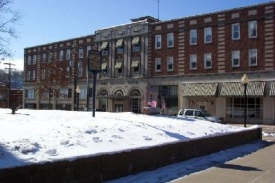
On High Street (U.S. 19) at Washington Street, on the right when traveling east on High Street.
Formed February 9, 1796 from Washington County. Named for Gen. Nathanael Greene. Waynesburg, the county seat named for Gen. Anthony Wayne, was incorporated in 1816. Site of Waynesburg College, founded 1849. Near Ten Mile is birthplace of Gov. . . . — — Map (db m16224) HM
Near Main Street north of Rices Landing Road (County Route 1010), on the left when traveling north.
Pennsylvania Railroad Company
Established in 1846, the Pennsylvania Railroad Company (PRR) was headquartered in Philadelphia, Pennsylvania. By 1882, it had become the largest railroad and transportation company in the world with a budget . . . — — Map (db m181582) HM
Near Main Street north of Rices Landing Road (County Route 1010), on the left when traveling north.
River Formation
Prior to the glaciers (more than 780,000 years ago), the ancestral Monongahela River flowed from present day north central West Virginia across Pennsylvania and northwest Ohio. Extensive ice sheets dammed the old north . . . — — Map (db m230986) HM
On 10 Mile Street at County Park Road, on the right when traveling east on 10 Mile Street.
Abraham (1718-1781) and Mary Parker Tegarden from Frederick County, Virginia 1753, made an 'improvement' opposite mouth of Tenmile Creek, Fayette County; Abraham, sutler for Colonel Bouquet 1759, fought in French and Indian War, Captain Virginia . . . — — Map (db m56944) HM
Near Main Street north of Rices Landing Road (County Route 1010), on the left when traveling north.
First Commercial Coal Mine
"Commercial" coal mining in Greene County began in 1902 when the Dilworth Coal Company produced 36,400 tons of Pittsburgh coal from its mine at Rices Landing on the Monongahela River. This appears to be the . . . — — Map (db m181902) HM
On North Richhill Street at West Wayne Street, on the right when traveling south on North Richhill Street.
Founded in 1849 by the Cumberland Presbyterian Church. Chartered by the State in 1850. One of the first two colleges in Pennsylvania to grant degrees to women, in 1857. — — Map (db m56957) HM
Near East George Street north of Old Ferry Road (County Route 1017), on the left when traveling north.
Coal Land Speculation
Interest in large scale mining in Greene County began in 1891 with the purchase of coal lands in the townships along the Monongahela River. Coal land speculation was at its height from the 1890s to the early 1900s. . . . — — Map (db m264107) HM
On River Hill Road (County Route 1017) 0.5 miles west of Crucible Road (County Route 1021), on the left when traveling west.
River Fording
In the early days of European settlement of western Pennsylvania, fording was the primary way to cross the river. This was only possible in certain locations and times of the year due to changing water levels.
As the area . . . — — Map (db m264043) HM
Near Main Street north of Rices Landing Road (County Route 1010), on the left when traveling north.
Edward Mine to Emerald Mine
When the mine first opened in 1921, it was known as the Edward Mine and was located near Clarksville and operated by the Chartiers Southern Coal Company. In 1923, the company constructed the initial 70 houses . . . — — Map (db m181680) HM
Site of the first fortified settlement in Anderson Township and one of the first in the Virginia Military District. John Garard and Joseph Martin were the founders of this Station, who, with Elias Garard, Joseph Frazee, and others, came by two . . . — — Map (db m19924) HM
Near River Hill Road (County Route 1017) 0.5 miles west of Crucible Road (County Route 1021), on the left when traveling west.
Coal Patches
The coal boom that began in the late nineteenth century and the tens of thousands of workers needed in the remote areas where the mines were located led to the development of small company towns known as "coal patches" or . . . — — Map (db m264075) HM
On East George Street north of Old Ferry Road (County Route 1017), on the right when traveling north.
1911-1944
In 1911, the Crucible Coal Company began to develop Greene County's second largest mine. Located along the Monongahela River, less than two miles south of Rices Landing, the high quality coal from the Pittsburgh seam was to be . . . — — Map (db m264099) HM
Near Main Street north of Rices Landing Road (County Route 1010), on the left when traveling north.
River Highways
Before roads, rivers were the highways of the world which allowed people to travel and transport goods.
A barge is a flat-bottomed boat, built primarily for transport of bulk goods on rivers and canals. Barges may be . . . — — Map (db m181901) HM
Near Main Street west of Rices Landing Road (County Route 1010), on the left when traveling north.
Watershed
A watershed is a geographic area that water moves towards a common water body. Several things determine
a watershed and what a watershed looks like. These include the unique geography and topography of an area,
networks of . . . — — Map (db m181370) HM
Near Main Street north of Rices Landing Road (County Route 1010), on the left when traveling north.
Bituminous Coal
Also known as Black Coal, it is an organic sedimentary rock formed by metamorphic compression of peat bog material.
Bituminous coal in the United States is between 100 and 300 million years old. It was formed during . . . — — Map (db m182137) HM
Near Main Street north of Rices Landing Road (County Road 1010), on the left when traveling north.
Coke
Coke is a gray, hard and porous fuel with a high carbon content and few impurities. It is used as a fuel and as a reducing agent in smelting iron ore in a blast furnace. The carbon monoxide produced by its combustion reduces iron . . . — — Map (db m182162) HM
Near Main Street north of Rices Landing Road (County Route 1010), on the left when traveling north.
Coal Seam
The Pittsburgh Coal Seam is the thickest and most extensive coal bed in the Appalachian Basin. The Upper Pennsylvanian Pittsburgh coal bed extends over 11,000 square miles through 63 counties. It extends from Allegany County, . . . — — Map (db m182022) HM
Near Main Street north of Rices Landing Road (County Route 1010), on the left when traveling north.
Settlement of Rices Landing
One of the earliest overnight visitors was George Washington, when he and his troops camped here on their way to Pittsburgh during the French & Indian War.
In 1786, John Rice purchased land on the east . . . — — Map (db m181527) HM
On Main Street (County Route 1010) at River Road, on the right when traveling north on Main Street.
National Historic Landmark
The W.A. Young & Sons Foundry and Machine Shop is a prime example of America's industrial heritage. William A. Young, owner and operator of the business built the Machine Shop with lumber from the family farm. . . . — — Map (db m181328) HM
On East Andrew Johnson Highway at Old Heritage Road, on the right when traveling east on East Andrew Johnson Highway. Reported missing.
This was built 1792 for George Gillespie by Seth Smith a Quaker stone mason from Lancaster County, Pennsylvania. An early fort originally stood on the site, and was the dividing line between Washington and Greene Counties in 1783. This house was . . . — — Map (db m158190) HM
On Lord Avenue/Homestead Street north of Reservoir Street, on the left when traveling north.
Crystal Lake circa 1906
Crystal Lake was one of the first settlements of Fell Township. In 1818, Peter F. Ball came from New York state and built a log house near the lake. During the next decade, seven other men established homesteads . . . — — Map (db m104283) HM
On Whitmire Highway (U.S. 176) north of Beatty's Bridge Road.
One mile east of this point, built by the pioneers of
Union County, was one of the several stockades used as refuges during the Cherokee War, 1759-1761. It was probably named for James Otterson, an early settler on Tyger River. — — Map (db m11110) HM
On W Roy Furman Highway (Pennsylvania Route 21) 0.1 miles west of Main Street, on the right when traveling east.
The Church
Unity Presbyterian Church, "Mother Presbyterian Church of Greene County, Pennsylvania" was organized August 27, 1814 at home of David Gray under direction of Reverend John Anderson and Reverend Joseph Stevenson, appointed by . . . — — Map (db m167091) HM
On Buckeye Road (County Route 39) east of Mason Dixon Highway (West Virginia Route 7), on the left when traveling east.
Start here
900 - 1200 AD
Monongahela village settled just outside borders of / near future site of Mason-Dixon Historical Park
1632
King Charles I issues a land grant, called Maryland, representing the area between . . . — — Map (db m256802) HM
On Interstate 79, on the right when traveling north.
John L. Lewis, President
United Mine Workers of America
1920 to 1960
Greene County, Pennsylvania
proudly dedicates this monument
to all coal miners
On December 6, 1962, 460 feet directly beneath this site, 37 miners lost . . . — — Map (db m16270) HM
On Buckeye Road (County Route 29) north of Mason-Dixon Highway (West Virginia Route 7), on the left when traveling north. Reported missing.
Branch of Warrior Trail of the Great Catawba Indian War Path located here where Mason and Dixon Survey crossed Dunkard Creek for third time. Guide, Six Nations Indians’ chief, declared he “would not proceed one step further,” because hostile . . . — — Map (db m175212) HM
On East Main Street (State Highway 123) at South William Hooker Drive, on the right when traveling east on East Main Street. Reported permanently removed.
(preface)
On July 18, 1863, Union Gen. Edward E. Potter led infantry and cavalry from New Bern to destroy the Wilmington and Weldon Railroad bridge at Rocky Mount. The infantry feinted toward Kinston and returned to New Bern. Potter raided . . . — — Map (db m232003) HM
Near Memorial Drive west of North East Street, on the left when traveling west.
He was born near Madison, Virginia in 1773, the
son of Joel Early and Lucy Smith. His cousin, Jubal
Early, was the grandfather of Confederate General
Jubal Anderson Early (1816-1894). Peter Early
graduated from the Lexington Academy (current . . . — — Map (db m267646) HM
On North Market Street/Millersburg Road (U.S. 52/62) at Mechanic Street (Ohio Route 586), on the right when traveling south on North Market Street/Millersburg Road.
This property
has been placed on the
National Register
of Historic Places
by the United States
Department of the Interior — — Map (db m247783) HM
On North Carolina Highway 58 (State Highway 58) at Fort Run Road (State Highway 1058), on the right when traveling south on North Carolina Highway 58.
Tuscarora stronghold. Site of decisive battle of the Tuscarora War, March 20-23, 1713, when 950 Indians were killed or captured. Site 1 mi. N. — — Map (db m222352) HM
Thin black lines indicate changes in relevance. Between each pair of lines entries are ordered geographically but all have the same relevance.
* Inflectional forms of words are their plurals, singulars, and possessives as well as gramatical tenses and similar variations.