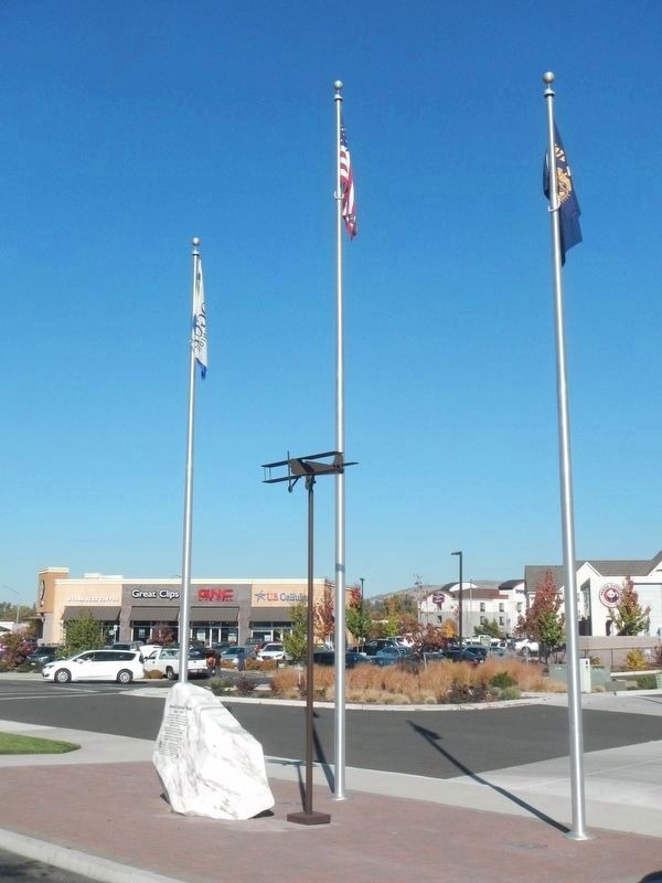
Near Center Drive near Garfield Street, on the left when traveling north.
"Newell Barber Field," Medford's first airport, was established in 1920 and remained in this area until 1929. The airport was named for Newell Barber (1900-1918), a young pilot who lost his life while flying a mission over France during WW I. . . . — — Map (db m113721) HM WM
First post office in Jackson County established October 15, 1852 in the cabin of Col. William G. T'Vault (1806-1869)
Col. T'Vault was the editor of Oregon's first newspaper "The Oregon Spectator". He was postmaster general of the Oregon . . . — — Map (db m113722) HM
On Green Springs Highway (Oregon Route 66), on the right when traveling west.
In July 1846 Jesse Applegate, Levi Scott and thirteen others known as "The South Road Party" located this pioneer trail. It was used by the emigrants traveling from Fort Hall on the Oregon Trail to the Rogue River and Willamette Valleys between . . . — — Map (db m88005) HM
On North River Road west of Route 99, on the right when traveling west.
J.B. White founded the small Community of Rock Point in the early 1850's. John fought in the Rouge Indian Wars. In exchange for his service he received land, and developed a homestead on the north side of the stage road. The land was sold to L. J. . . . — — Map (db m99258) HM
On North 4th Street at East C Street, on the left when traveling south on North 4th Street.
Built in 1866 as a one room schoolhouse for Catholic boys, it became the rectory for Father F.X. Blanchet in 1870. An addition was built in 1891. St. Joseph's Catholic Church became a mission of Medford in 1908 the rectory became a private . . . — — Map (db m91767) HM
At the beginning of World War II, the US Army established Camp George A. White in a part of Jackson County then known as the Agate Desert as a training cantonment. Soldiers from across the nation, including women and southern Oregon's first large . . . — — Map (db m112575) HM
Named for its hundreds of fresh water springs, lush glades and meadows, the Greensprings has for millenia been a seasonal gathering place for Native Americans and later provided refuge for travelers. In 1846, Levi Scott and the Applegate brothers, . . . — — Map (db m113544) HM
On Shawnee Mission Parkway near Melrose Lane, on the right when traveling east.
The Santa Fe Trail went through two decades of change in the Kansas City area before evolving into it's final form by about 1840. In the early years of that decade it also became the route of the Oregon Trail and California Trail.
1821 - . . . — — Map (db m50679) HM
On Old State Highway 99 South at Front Street, on the left when traveling north on Old State Highway 99 South.
In 1846, Jesse Applegate and fourteen others from near Dallas, Oregon, established a trail south from the Willamette Valley and east to Fort Hall. This route offered emigrants an alternative to the perilous "last leg" of the Oregon Trail down the . . . — — Map (db m114488) HM
On Fir Street at S Oregon St, on the left when traveling north on Fir Street.
This is the boyhood home of the famous Bozo the Clown.
Vance DeBar Colvig was born here in Jacksonville on September 11, 1892. He was the youngest of the seven children of Judge William and Helen Colvig. He was later nicknamed "Pinto" by his . . . — — Map (db m112903) HM
On Hickman Mills Drive west of Marion Park Drive, on the right when traveling north.
The shared corridor of three major trails-the Santa Fe, Oregon, and California-once passed this way. Here on Hart Grove Creek, trail travelers stopped for water, wood, and a night's rest. Within a day's walk to the west was the Missouri state . . . — — Map (db m245098) HM
(Marker 1) On this site, in the year 1859, Warren Lodge No. 10 Ancient Free and Accepted Masons erected the first Masonic temple in southern Oregon. Jackson County used the first floor as a courthouse and purchased the building in 1867. The . . . — — Map (db m112899) HM
On Main Street west of 3rd Street, on the left when traveling west.
Though the first known westbound wagon train led by William Sublette passed this way in 1827 following an old Kanza hunting trail, the Oregon Trail would not be well defined until 1842 when the report of John C. Fremont’s expedition became the . . . — — Map (db m81187) HM
On West College Street at North McCoy Street, on the right when traveling west on West College Street.
Being at leisure one day, I rode over to Independence [from Westport, in May 1846]. The town was crowded. A multitude of shops had sprang up to furnish the emigrants and Santa Fe traders with necessaries for the journey; and there was an . . . — — Map (db m208146) HM
On West College Street at North McCoy Street, on the right when traveling west on West College Street.
The Santa Fe Trail began in 1821 when William Becknell took trade items west and found a ready market in Mexico. He passed through this area before the village of Independence was platted in 1827 as the county seat for newly formed Jackson County. . . . — — Map (db m208242) HM
On Main Street north of East 2nd Street, on the right when traveling north.
On June 26, 1804 the Lewis & Clark Expedition known as President Jefferson's Corps of Discovery passed this place on their way west.
In 1825, treaties with the Kaw and Osage Indians opened up for settlement an area between Fort Osage to the . . . — — Map (db m252086) HM
On East Red Bridge Road, on the right when traveling east.
John Calvin McCoy (1811-1889), an enterprising young surveyor, built a two-story log trading post in the hills four miles south of the Missouri River in 1833. Later known as Westport, it became a trading and outfitting center for traders, fur . . . — — Map (db m199448) HM
On East 99th Street east of Holmes Road, on the right when traveling west.
Public/private partnerships preserve three National Historic Trails in south Kansas City, highlighting 19th century exploration and migration that shaped the nation. In the heart of the historic 3-Trails Corridor, the Trailside Center at East . . . — — Map (db m199522) HM
Near Interstate 5 at milepost 458, on the right when traveling north.
(Seven panels dealing with topics related to the Applegate Trail are found at this kiosk.)
The Applegate Trail
Southern Route to Oregon
In 1846, Jesse Applegate and fourteen others from near Dallas, Oregon, . . . — — Map (db m112656) HM
Casper M. Ruch started the Ruch settlement at this cross roads site between Crescent City and Jacksonville in 1896. On ten acres purchased from J.M. McDonough be built a home, blacksmith shop, warehouse, dance hall, store, and smoke house, curing . . . — — Map (db m112485) HM
On East Red Bridge Road, on the right when traveling west.
(This marker has two panels. From the left panel:)
Key Map
Traveling across this bridge, the fourth Red Bridge near this location since 1859, you may notice art panels attached to each of the large pillars that rise at both . . . — — Map (db m210568) HM
The first toll bridge near this site was built before 1859. The wooden covered bridge
was at one time operational by the Rock Point Bridge Company. It was later purchased
by Jackson County and operated as a free bridge until it was replaced by the . . . — — Map (db m112886) HM
On West C Street at N Oregon St, on the right when traveling west on West C Street.
Both horses and horsepower figure prominently in this site's past. In the 1860s, William J. Plymale (1837-1904) opened a livery stable at Oregon and "D" streets. He sold feed and kept horses and buggies on hand.
Steam Driven Horsepower . . . — — Map (db m112896) HM
The town was only a spark in 1834 when entrepreneur and tradesman John Calvin McCoy cut a primitive path from this store to a prominent rock ledge on the river – a perfect landing for riverboats. The steamboat John Hancock, laden with . . . — — Map (db m87450) HM
Near Northwest 87th Terrace east of Northwest 88th Street/Northwest Old Stagecoach Rd, on the left when traveling east. Reported missing.
Founded in 1829 during Andrew Jackson's presidency, this frontier town was named for Postmaster General William Taylor Barry. Marking the midpoint of the new Military Road between Liberty and Fort Leavenworth, the town played an important role in . . . — — Map (db m252141) HM
In 1863, on this site, Robert Vinton Beall, an Oregon Trail pioneer and relative to four Maryland governors, built one of the first frame buildings in Jackson County, a Gothic Revival house that is listed on the National Historic Register. Beall and . . . — — Map (db m129534) HM
On Delaware Street at U.S. 24, on the left when traveling north on Delaware Street. Reported missing.
Side A:
Independence, famed "City of the Trails," was for two decades the starting point of the great western trade and travel routes to Santa Fe, Oregon, and California. Settled mainly by Southerners on land ceded the U.S. by the Osage . . . — — Map (db m44323) HM
In the early evening hours of April 22, 1913,
Sheriff Singler left his office in Jacksonville
to serve an arrest warrant on 19 year old County
resident, Lester Jones. Singler traveled to Jones'
small cabin one mile south of town. . . . — — Map (db m286147) HM
Near Evergreen Street, on the right when traveling south.
James Williams
California Pioneer
James Williams, age 29 and a native of Cape Girardeau, Missouri, emigrated overland to California in 1843 along with his three brothers – John, age 25; Isaac, age 20; and Squire, age 19 – in a . . . — — Map (db m62440) HM
On Lexington Avenue near Main Street, on the right when traveling west.
A Century of Progress marks the development of Jackson County. In 1828 a log courthouse was built in Independence. In 1836 a brick building was erected as a permanent courthouse on this site. Soldiers returning from the Mexican War found an . . . — — Map (db m34898) HM
Near West 103rd Street 0.1 miles east of State Line Road, on the right when traveling east.
For more than a century, a mill thrived on the banks of Indian Creek, supporting early Jackson County settlers and contributing to the growth of south Kansas City.
What would become widely known as Watts Mill bears the name of the family who . . . — — Map (db m251736) HM