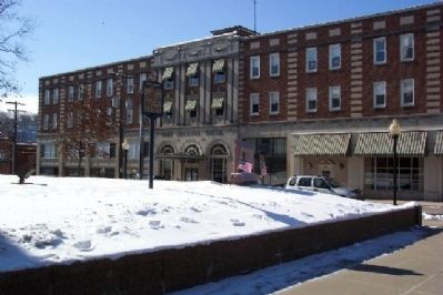
By William Fischer, Jr., January 31, 2009
Greene County Marker
RANKED BY RELEVANCE
On High Street (U.S. 19) at Washington Street, on the right when traveling east on High Street.
Near Main Street north of Rices Landing Road (County Route 1010), on the left when traveling north.
Near Main Street north of Rices Landing Road (County Route 1010), on the left when traveling north.
On E Roy Furman Highway (Pennsylvania Route 21) 0.3 miles east of Jensen Hollow Road ( Route 2013), on the right when traveling west.
On Roberts Run Road (County Route 604) 0.2 miles south of Garards Fort Road ( Route 2011), on the left when traveling south.
On 10 Mile Street at County Park Road, on the right when traveling east on 10 Mile Street.
Near Main Street north of Rices Landing Road (County Route 1010), on the left when traveling north.
On North Richhill Street at West Wayne Street, on the right when traveling south on North Richhill Street.
Near East George Street north of Old Ferry Road (County Route 1017), on the left when traveling north.
On River Hill Road (County Route 1017) 0.5 miles west of Crucible Road (County Route 1021), on the left when traveling west.
Near Main Street north of Rices Landing Road (County Route 1010), on the left when traveling north.
Near River Hill Road (County Route 1017) 0.5 miles west of Crucible Road (County Route 1021), on the left when traveling west.
On East George Street north of Old Ferry Road (County Route 1017), on the right when traveling north.
Near Main Street north of Rices Landing Road (County Route 1010), on the left when traveling north.
Paid Advertisement
Near Main Street west of Rices Landing Road (County Route 1010), on the left when traveling north.
Near Main Street north of Rices Landing Road (County Route 1010), on the left when traveling north.
Near Main Street north of Rices Landing Road (County Road 1010), on the left when traveling north.
Near Main Street north of Rices Landing Road (County Route 1010), on the left when traveling north.
Near Main Street north of Rices Landing Road (County Route 1010), on the left when traveling north.
On Main Street (County Route 1010) at River Road, on the right when traveling north on Main Street.
On East Andrew Johnson Highway at Old Heritage Road, on the right when traveling east on East Andrew Johnson Highway. Reported missing.
On Lord Avenue/Homestead Street north of Reservoir Street, on the left when traveling north.
On Whitmire Highway (U.S. 176) north of Beatty's Bridge Road.
On W Roy Furman Highway (Pennsylvania Route 21) 0.1 miles west of Main Street, on the right when traveling east.
On Buckeye Road (County Route 39) east of Mason Dixon Highway (West Virginia Route 7), on the left when traveling east.
On Interstate 79, on the right when traveling north.
On Buckeye Road (County Route 29) north of Mason-Dixon Highway (West Virginia Route 7), on the left when traveling north. Reported missing.
On East Main Street (State Highway 123) at South William Hooker Drive, on the right when traveling east on East Main Street. Reported permanently removed.
Near Memorial Drive west of North East Street, on the left when traveling west.
On North Market Street/Millersburg Road (U.S. 52/62) at Mechanic Street (Ohio Route 586), on the right when traveling south on North Market Street/Millersburg Road.
Paid Advertisement
On East Greene Street (U.S. 19) just west of North Woods, on the right when traveling east.
On North Carolina Highway 58 (State Highway 58) at Fort Run Road (State Highway 1058), on the right when traveling south on North Carolina Highway 58.
︽
Thin black lines indicate changes in relevance. Between each pair of lines entries are ordered geographically but all have the same relevance. * Inflectional forms of words are their plurals, singulars, and possessives as well as gramatical tenses and similar variations.
Nov. 13, 2026