36 entries match your criteria.
Entries Containing All of the Phrases «columbiana county» AND «ohio»
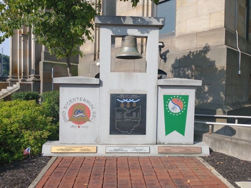
By Craig Doda, July 24, 2022
United States of America Congressional Medal of Honor Recipients Marker
RANKED BY RELEVANCE
1 ► Ohio, Columbiana County, Lisbon — United States of America Congressional Medal of Honor Recipients — State of Ohio, Columbiana County —  |
| On South Market Street (Ohio Route 164) at Lincoln Highway (U.S. 30), on the left when traveling north on South Market Street. | |||
| 2 ► Ohio, Columbiana County, Hanoverton — 3-15 — Canal Tunnels — |
| On Lincoln Highway (U.S. 30) 0.7 miles east of Haessly Road, on the right when traveling east. | |||
| 3 ► Ohio, Columbiana County, Leetonia, Salem Township — 13-22 — Cherry Valley Coke Ovens — |
| On Main Street at Butcher Road, on the right when traveling north on Main Street. | |||
| 4 ► Ohio, Columbiana County, Lisbon, Elkrun Township — 1-15 — Church Hill Road Bridge / Timber Covered Bridges — |
| On Ohio Route 154 east of Scroggs Road (Local Route 795), on the right when traveling east. | |||
| 5 ► Ohio, Morgan County, Rokeby Lock — 4-58 — Morgan's Raid — |
| On Ohio Route 60 at Greer Road, on the right when traveling south on Ohio Route 60. | |||
| 6 ► Ohio, Columbiana County, East Liverpool — 9-15 — Gateway To The Northwest — |
| On Harvey Avenue (Ohio Route 39) 0.4 miles east of Bushwick Street, on the right when traveling east. | |||
| 7 ► Ohio, Columbiana County, Hanoverton — 5-15 — Birthplace of Catholicism in Northern Ohio — |
| On Gavers Road at Railroad Street, on the left when traveling east on Gavers Road. | |||
| 8 ► Ohio, Franklin County, Columbus, Arena District — 33-25 — General John Hunt Morgan, CSA / Morgan's Escape — |
| On West Street at Spring Street (U.S. 33), on the right when traveling south on West Street. | |||
| 9 ► Ohio, Columbiana County, Williamsport — Lock 36 — Sandy & Beaver Canal — |
| On Echo Dell Road (County Road 929) south of Leslie Road, on the right when traveling south. | |||
| 10 ► Ohio, Columbiana County, Salem — Tract of the City of Alliance — Westville Division — |
| Near Valley Road (County Highway 405) 0.1 miles south of Walnut Street, on the left when traveling south. | |||
| 11 ► Pennsylvania, Fayette County, Masontown — Fort Mason — |
| On Main Street (Pennsylvania Route 166) at Middle Avenue (now closed), on the left when traveling north on Main Street. | |||
| 12 ► Ohio, Columbiana County, East Liverpool — Lock 36 — |
| On Echo Dell Road (Local Route 929) north of Bell School Road (Local Route 1131), on the left when traveling north. | |||
| 13 ► Ohio, Columbiana County, Calcutta — 4-15 — First Paper Mill / Little Beaver Creek Bridge |
| On Calcutta-Smith Ferry Road (County Route 430) 0.8 miles north of Harvey Avenue (Ohio Route 39), on the right when traveling north. Reported missing. | |||
| 14 ► Kansas, Chase County, Cottonwood Falls, Falls Township — Chase County and the City of Cottonwood Falls — |
| Near Mill Street. | |||
| 15 ► Ohio, Meigs County, Rutland, Salisbury Township — 9-53 — Morgan’s Raid Route — The Deaths of Hysell and Hudson — |
| On Bradbury Road 0.1 miles south of Ohio Route 124, on the right when traveling south. | |||
| 16 ► Ohio, Pike County, Bainbridge, Benton Township — 05 — An Unknown Soldier - Ohio And The Civil War — |
| On Pike Lake Road at Egypt Hollow Road, on the right when traveling north on Pike Lake Road. | |||
| 17 ► Ohio, Columbiana County, East Liverpool — Beaver Creek — |
| On Echo Dell Road (Local Route 929) north of Bell School Road (Local Route 1131), on the right when traveling north. | |||
| 18 ► Ohio, Columbiana County, Columbiana — The Supreme Court of the State of Ohio — |
| On Ohio Route 7 0.5 miles south of Route 46, on the right when traveling south. | |||
| 19 ► Ohio, Columbiana County, Lisbon — 55 — Gavers — A Premature Surrender — John Hunt Morgan Heritage Trail — |
| On Ohio Route 518, on the right when traveling east. | |||
| 20 ► Ohio, Columbiana County, Salem — 15-15 — Teegarden-Centennial Covered Bridge / Teegarden — |
| On Eagleton Road 0.1 miles south of Teegarden Road, on the right when traveling north. | |||
| 21 ► Ohio, Licking County, Outville — 15-45 — Outville — |
| Near Outville Road Southwest. | |||
| 22 ► Ohio, Columbiana County, East Liverpool — 12-15 — Riverview Cemetery — |
| Near St. Clair Avenue. | |||
| 23 ► Ohio, Columbiana County, Williamsport — Beaver Creek State Park — Welcome — |
| On Echo Dell Road (County Road 929) south of Leslie Road, on the left when traveling south. | |||
| 24 ► Ohio, Meigs County, Chester — 5-53 — Morgan's Raid Route / Chester Village Commons — |
| On Ohio Route 248 at Scout Camp Road (Local Route 112), on the left when traveling east on Ohio Route 248. | |||
| 25 ► Ohio, Guernsey County, Old Washington — 4-30 — Morgan’s Raid in Old Washington — |
| On Morgan Way (U.S. 40) near Exit 186 North (Interstate 70), on the left when traveling east. | |||
| 26 ► Ohio, Mahoning County, Canfield — 13-50 — Old Mahoning County Courthouse — |
| On Court Street at South Broad Street ( Route 46), on the right when traveling east on Court Street. | |||
| 27 ► Ohio, Fayette County, Jeffersonville, Jefferson Township — Ohio's Physiographic Regions — Ohio's Five Physiographic Regions Have Unique Geological Profiles — That Influence Plants & Animals — |
| On Interstate 71 at milepost 68, on the right when traveling south. | |||
| 28 ► Ohio, Madison County, Summerford, Somerford Township — Ohio's Physiographic Regions — Ohio's Five Physiographic Regions Have Unique Geological Profiles — That Influence Plants & Animals — |
| On Interstate 70 at milepost 70, on the right when traveling east. | |||
| 29 ► Ohio, Meigs County, Pomeroy — 8-53 — Morgan’s Raid Route — The “continued fight” near Pomeroy — |
| On Hiland Rd south of Laurel Cliff Road. | |||
| 30 ► Ohio, Meigs County, Pomeroy — 6-53 — Morgan's Raid Route — |
| On Rocksprings Road at County Road 51A, on the right when traveling north on Rocksprings Road. | |||
| 31 ► Ohio, Portage County, Rootstown, Edinburg Township — Ohio's Physiographic Regions — Ohio's Five Physiographic Regions Have Unique Geological Profiles — That Influence Plants & Animals — |
| On Interstate 70 at milepost 45, on the right when traveling west. | |||
| 32 ► Michigan, Monroe County, Luna Pier — Sylvania-Then & Now: History of one of Sylvania's bank robberies — |
| On Luna Pier Road at Norther Avenue, on the right when traveling west on Luna Pier Road. | |||
| 33 ► Ohio, Columbiana County, Lisbon — Firestone Bros. Bankers — |
| On North Park Avenue just west of North Nelson Avenue (East Parkway), on the right when traveling west. | |||
| 34 ► Ohio, Columbiana County, Williamsport — Site 45 — Thomas J. Malone Covered Bridge — Let's Get Historic — |
| On Echo Dell Road, on the right when traveling west. | |||
| 35 ► Ohio, Columbiana County, West Point — Morgan's Surrender — |
| On Ohio Route 518 0.2 miles east of Local Highway 784, on the left when traveling west. | |||
| 36 ► Ohio, Columbiana County, Wellsville — Wellsville Mural — |
| On Lisbon Street at 1st Street on Lisbon Street. | |||
Thin black lines indicate changes in relevance. Between each pair of lines entries are ordered geographically but all have the same relevance.
* Inflectional forms of words are their plurals, singulars, and possessives as well as gramatical tenses and similar variations.
Nov. 13, 2026