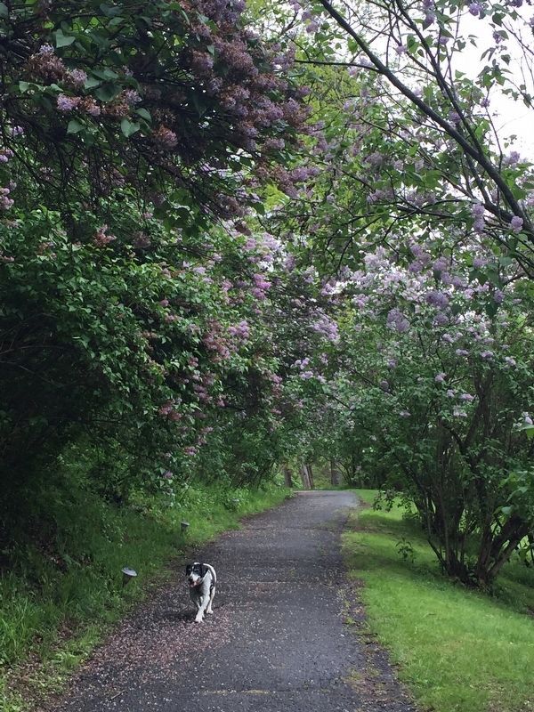
The Lilac Walk, which connects the mansion with the Locust Avenue, was planted in the 1820s by Edward P. Livingston (1779–1843). A son-in-law of Chancellor Robert R. Livingston, he became Lt. Governor of New York State; his Jamaican birth prevented . . . — — Map (db m149147) HM
Near Clermont Avenue 0.3 miles west of Woods Road.
Overlooking the Hudson River, this grassy strip paralleling the historic site's main parking lot was laid out as a road in the 18th century by Chancellor Robert R. Livingston. Meandering through the beautiful, irregularly planted locust trees for . . . — — Map (db m149863) HM
Near Clermont Avenue north of Clermont State Park, on the right when traveling north.
Begun by Alice Delafield Clarkson Livingston (1872-1964) in 1908 and perfected over ten years, the South Spring Garden was always her favorite. Its protected southern exposure between the mansion and the root cellar was ideal for tender, early . . . — — Map (db m303762) HM
Near Clermont Avenue north of Clermont State Park, on the right when traveling north.
Alice Delafield Clarkson Livingston (1872-1964) created this garden ca. 1930. It blends Italian design with plantings suggested by the early 20th-century English gardening authorities Gertrude Jekyll and William Robinson. Gardens that Alice . . . — — Map (db m303763) HM
Near Clermont Avenue north of Clermont State Park, on the right when traveling north.
The Wilderness Garden was created in the 1930s and is one of four gardens designed by Alice Delafield Clarkson Livingston (1872–1964) beginning in 1908. Covering roughly one-half acre, its meandering path connects the Cutting Garden and . . . — — Map (db m303778) HM
Near Clermont State Park west of Empire State Trail (County Road 35), on the right when traveling west.
Meet the Livingstons, one of America's most prominent founding families. Between 1728 and 1962, seven generations of the family made Clermont their home. It is the oldest of the great riverfront estates in the mid-Hudson Valley. Five hundred . . . — — Map (db m303761) HM
On Taconic State Parkway 0.5 miles north of New York State Route 217, on the right when traveling north.
Columbia County
Historic New York
Columbia County, which extends from the Hudson River to the New England border. was formed in the late 18th century from parts of two 17th century land patents. Early settlers came from Holland, followed by . . . — — Map (db m237040) HM
On New York State Route 66 south of Nelson Avenue, on the left when traveling north.
From ca. 1830-1953. Sheltered
approx. 150 of county's sick
and poor. 200 acres farmed
by residents. Barns sold 1955,
Home burned 1979. — — Map (db m236938) HM
On Union Turnpike (New York State Route 66) at Snyder Road, on the right when traveling south on Union Turnpike.
Through this place passed Gen. Henry Knox in the winter of 1775-1776 to deliver to Gen. George Washington at Cambridge the train of artillery from Fort Ticonderoga used to force the British Army to evacuate Boston Erected by The State of New York . . . — — Map (db m24003) HM
On Harlemville Road at Taconic State Pkwy ( Route 987G), on the left when traveling south on Harlemville Road.
Through this place passed Gen. Henry Knox in the winter of 1775-1776 to deliver to Gen. George Washington at Cambridge the train of artillery from Fort Ticonderoga used to force the British Army to evacuate Boston Erected by The State of New York . . . — — Map (db m24004) HM
On New York State Route 66 at Church Street, on the right when traveling south on New York State Route 66.
Honored Patriots
who answered the call of their country in the Great World War
1917-1918
The Government of the People, by the People, for the People, shall not perish from the Earth. --Abraham Lincoln(Names . . . — — Map (db m136010) WM
On New York State Route 66 at George Street, on the right when traveling south on New York State Route 66.
By 1858, two railroad lines
converged here. Bartlett
House, Ghent Hotel & other
businesses followed.
Service discontinued 1954. — — Map (db m235616) HM
On Route 66 at Town Hall Place, on the right when traveling north on Route 66.
By 1892, 3 horse-powered
hay presses operated here.
In 1894 fire destroyed barns
and 100 tons of hay and
straw stored for shipment. — — Map (db m235617) HM
On Nobletown Road (New York State Route 22) at Route 71, on the left when traveling east on Nobletown Road.
Through this place passed Gen. Henry Knox in the winter of 1775-1776 to deliver to Gen. George Washington at Cambridge the train of artillery from Fort Ticonderoga used to force the British Army to evacuate Boston Erected by The State of New York . . . — — Map (db m24005) HM
On New York State Route 71, on the right when traveling south.
New York Side:Through this place passed Gen. Henry Knox in the winter of 1775-1776 to deliver to Gen. George Washington at Cambridge the train of artillery from Fort Ticonderoga used to force the British Army to evacuate Boston Erected by . . . — — Map (db m24006) HM
On New York State Route 23 at Anthony Street, on the right when traveling east on New York State Route 23.
Erected by John K. Cullin in memory of the Soldiers and Sailors who defended our country and flag 1861 - 1865 [ Lower Plaque ] Hillsdale Comrades 14th N.Y. Regiment John K. Cullin • A. Frank B. Chace • Sylvanus Snyder 44th N.Y. . . . — — Map (db m268510) WM
On Harlemville Road at Wolf Hill Road, on the left when traveling north on Harlemville Road.
Krum Hollow was a German/Dutch
community settled around 1745.
Its population peaked in the 1790s and the
community was dispersed by the 1840s.
The church (long gone) began
services in 1776.
Earliest known stone:
Johan Gottfried . . . — — Map (db m261892) HM
On Harlemville Road at Wolf Hill Road, on the right when traveling south on Harlemville Road.
Revolutionary War Soldier
Philip Smith
Captain-Albany County Militia, 10th Regiment
under Cols. Livingston and Graham
Baptized on May 11, 1738
Died in 1823 in Hillsdale, Columbia Co., NY — — Map (db m247903) HM
On Main Street (New York State Route 23) 0.1 miles east of Anthony Street, on the right when traveling east.
[Central marker]
In honor of
the Men and Women of Hillsdale
who served in the Armed Forces
of our country
They gave the full measure of devotion
to preserve America's heritage of freedom
1917-18 [and] 1941-45
[Honor . . . — — Map (db m118753) WM
On Fairview Avenue (U.S. 9) at Oakwood Boulevard, on the left when traveling north on Fairview Avenue.
Here in 1862
the 128th. New York State
Volunteer Infantry, the
Columbia-Dutchess Regiment
was organized.
It served in the Union
Army until 1865. — — Map (db m118548) HM
Near Olana State Historic access road 0.6 miles north of Route 9G, on the right when traveling north.
In the 1860s and 1870s, Church transformed a poor, one-family farm into a 19th-century gentleman's farm. He did not plan to make a living from the farm, but expected it to run efficiently. He and Isabel took great pride in the farm operation. . . . — — Map (db m150219) HM
When Frederic Church purchased the 126-acre property that would become the farm at Olana, it included an old farmhouse located on this site and a modest house facing the Oak Hill-Hudson Road. Historically known as the
Wynsant Brezie farm, it was . . . — — Map (db m175834) HM
On New York State Route 23B 0.1 miles south of Spook Rock Road (County Route 29), on the right.
Claverack a district 1772.
Hillsdale taken off 1782,
Hudson 1785. Organized as
a town 1788. Greenport set
off from Hudson City 1837 — — Map (db m150383) HM
Near Olana State Historic access road 0.6 miles Route 9G, on the right when traveling south.
Frederic and Isabel Church built Cosy Cottage in 1860-61, their first year at Olana. Designed in the
office of New York City architect Richard Morris Hunt, this dwelling was the family's country residence until they moved into the large house on . . . — — Map (db m150225) HM
On Warren Street west of 4th Street, on the right when traveling west.
This building built for a jail in 1805. Changed to City Hall in 1835 In 1855 became "Davis Hall", a theater. Since 1862 it has been a printing shop — — Map (db m118544) HM
Near New York State Route 9G 0.8 miles south of Route 23.
Olana was the home of Hudson River School artist Frederic Edwin Church (1826-1900). Church's great talent was recognized early in his life. By age 20, he had his own studio and was a well-known artist. He traveled extensively in North and South . . . — — Map (db m143295) HM
Frederic Church designed his house and surroundings as a work of art, a home for his family, and a place of beauty and repose. The Churches first used the name Olana to refer to the house and grounds in 1878. Olana may be a variation of the name of . . . — — Map (db m242317) HM
In his fantastical tale, Rip Van Winkle, Washington Irving told of how the ghosts of Captain Henry Hudson and his crew appeared once every twenty years in the Catskill mountains, across the river from here. According to the story, the . . . — — Map (db m130614) HM
In July 1869, after the Church family returned to Olana from 18 months aboard, Frederic Church’s involvement in the farm’s activities increased. He completed several building projects, including the construction of a rectangular, wood-frame icehouse . . . — — Map (db m132328) HM
This panoramic image combines two photographs that show the kitchen garden and barnyard as they looked about 1900. Both photographs were taken from a location out in the field behind you (south) looking north. From the far right in the photograph, . . . — — Map (db m132329) HM
In honor of those men & women from Columbia County who served and in memory of those who died defending a country they never knew and a people they never met. Back of Marker: Korea The Forgotten War 1950-1953 Edward J. Aiken William Henry Doss . . . — — Map (db m130587) WM
On Water Street, on the left when traveling north.
On Sept. 17, 1824, General Lafayette was welcomed in Hudson on his way upriver to Albany. A procession led him around the main streets. — — Map (db m228826) HM
Livingston a manor 1686, a
dist. 1772, included Ancram,
Taghkanick, Gallatin, Copake,
Clermont. Town 1788. In 1837
Greenport formed from Hudson — — Map (db m137804) HM
Conceived as the dramatic main entrance to Olana, the North Road was laid out by Frederic Church in 1869. Just before he built the main house, he purchased a narrow, wooded corridor that extended from this point north to the public road. Today, . . . — — Map (db m150272) HM
On New York State Route 23 at Route 9G, on the right on New York State Route 23.
This landscape made famous
by Hudson River School painter
Frederic E. Church 1826-1900. Protected by the Scenic Hudson Land Trust. — — Map (db m137859) HM
On Greendale Road (County Route 14) 0.1 miles east of Rhinebeck-Hudson Road ( Route 9G), on the left when traveling east.
This landscape made famous
by Hudson River School painter
Frederic E. Church 1826-1900.
Protected by the Scenic Hudson Land Trust
with funding from the Lila Acheson & Dewitt Village
fund for the Hudson Highlands — — Map (db m150775) HM
In the mid-19th century, Frederic Church (1826-1900) emerged as the leading painter of the American landscape. Church's skill at artistic composition clearly influenced the development
of this landscape and the spectacular views that make up the . . . — — Map (db m242290) HM
Near Olana State Historic Site, on the right when traveling north.
Frederic Church transformed a treeless hillside into
the wooded park you see across the lake. There, on 31
acres, he planted hundreds of trees and shrubs, singly
and in clumps, in a landscape design conceived in
the Picturesque Style (a . . . — — Map (db m132074) HM
Near Olana State Historic access road 0.6 miles north of Route 9G, on the right when traveling north.
In 1878, Frederic Church purchased 50 acres north of this site (to the right) for hay fields and grazing. About six years later, he converted some of that open acreage to ornamental use with the creation of the Ridge Road. Wrapping around the . . . — — Map (db m150227) HM
Beautiful Indian maiden and her lover from opposing nation rests beneath this rock. When church bell rings, rock turns over, lovers appear. — — Map (db m129044) HM
Although Frederic Church painted at his
Hudson Valley farm from the time he
purchased it in 1860, he did not build a
studio here until about 1864-65. On the
site where you are standing, he erected a
"plain but ample” 24-foot-square, . . . — — Map (db m137805) HM
On Warren Street at Park Place, on the right when traveling west on Warren Street.
was dedicated May 3, 1975 to honor the volunteers
and the nation. This fountain was made possible
through the generosity of the following:
[Concerned Citizens and Organizations] . . . — — Map (db m118546) HM
On Warren Street at Park Place (U.S. 9), on the right when traveling west on Warren Street.
Erected by
the Citizens of Hudson
in grateful recognition of
her Sons' and Daughters' services
in the Armed Forces of
the United States. — — Map (db m118543) HM
When wood was the major fuel for heating and cooking, woodsheds like the one located here and elsewhere on the farm provided a place to store firewood and keep it dry. Harvested from Olana’s woodlots, trees were cut into logs and shorter lengths at . . . — — Map (db m132331) HM
Near Old Post Road, on the left when traveling north.
The view before you is much like the one Martin Van Buren enjoyed during the last 21 years of his life. Although in the course of his political career Van Buren traveled widely and kept company with heads of state and the foremost political figures . . . — — Map (db m56675) HM
On Sunny Side Road 0.1 miles east of U.S. 9 when traveling east.
"Bouwery”
of Jan Martense van Aelsteyn
established in 1659. from
Clavers Kill, Southeast
including Linderwald lands.
3000 acres in Bouwery. — — Map (db m258994) HM
On Old Post Road, on the right when traveling south.
Architect Richard Upjohn’s renovations to Lindenwald in 1849-50 had a tremendous influence on the main house, originally built in 1797 by Judge Peter Van Ness. The red brick was painted yellow and brown and a four-and-a-half story Italianate tower . . . — — Map (db m37784) HM
On Old Post Road, on the right when traveling south.
Lindenwald seems quiet today, but when Martin Van Buren lived here there was a stream of family, friends and political colleagues constantly coming and going. There was also an ever-changing mix of agricultural and domestic employees. Some workers . . . — — Map (db m37828) HM
On Old Post Road, on the right when traveling south.
In 1850, from where you now stand, you would have been able to view Van Buren’s house garden, farm office, fish ponds, green house, red hillside barn, hot house and carriage barn. The farm manager’s house (now altered) may still be seen. Van Buren . . . — — Map (db m37833) HM
Near New York State Route 9H 0.2 miles north of Fischer Road, on the right when traveling south.
Native to the southern Appalachian region of the United States, the black locust (Robinia. pseudoacacia) was the tree of choice for Dutch colonists in the New World and prized by Indigenous peoples for its versatility and durability. The graceful . . . — — Map (db m244715) HM
Near New York State Route 9H 0.2 miles north of Fisher Road, on the right when traveling south.
Dutch boeren (farmers) began settling the fertile lowlands southeast of Albany in the mid 1600s, establishing cultural strongholds along the Hudson River and its tributaries. For more than a century after the English takeover of New Netherland in . . . — — Map (db m243811) HM
On Broad Street (U.S. 9) at Hudson Street, on the right when traveling north on Broad Street.
Dunham Park is named in honor of James C. Dunham
and the Dunham family in recognition of the many ways
he and his family members have benefited Kinderhook
through public service and sacrifice. — — Map (db m298355) HM
Near New York State Route 9H 0.2 miles north of Fischer Road, on the right when traveling south.
The Dutch came to the New World in the early 1600s in search of riches, and quickly saw the vast potential of the fur and timber trades. Only after the need arose for a steady food supply did they realize the agricultural
possibilities of the . . . — — Map (db m244480) HM
Near New York State Route 9H 0.2 miles north of Fischer Road, on the right when traveling south.
From the early 1950s through the mid 1960s, the defunct Ichabod Crane Schoolhouse was revived as an ad hoc community meeting hall. On October 10, 1952, former First Lady Eleanor Roosevelt visited the schoolhouse to officially dedicate the Ichabod . . . — — Map (db m244478) HM
Near New York State Route 9H 0.2 miles north of Fischer Road, on the right when traveling south.
Enslavement in the New Netherland (New York) was an active slave society from the time the Dutch West Indies Company imported the first slaves in 1626. At that time, the Dutch controlled a sizable portion of the Trans-Atlantic Slave Trade, which . . . — — Map (db m243967) HM
Near Old Post Road, on the right when traveling south.
About 1861, this white mulberry tree (morus alba) was planted across the carriage path from the large sycamore tree. The tree flourished for just under 150 years until an ice storm over this past winter (2012) caused the tree to collapse. The . . . — — Map (db m56677) HM
On Old Post Road, on the right when traveling south.
As with most farms, the operations at Lindenwald varied with the seasons and the years and the constant effort to better the farm. The poles to your left are used to cultivate hops using the techniques of the nineteenth century. Over his years of . . . — — Map (db m37852) HM
On New York State Route 9H, on the right when traveling south.
Over the years, Martin Van Buren enlarged his farm from 137 acres to 221 acres through three transactions. Throughout his ownership he relied on employees to perform the labor necessary to make Lindenwald’s acreage productive. In September of 1843 . . . — — Map (db m37835) HM
On Old Post Road, on the right when traveling south.
Van Buren’s 1839 purchase of the fine eighteenth-century house and farm he renamed “Lindenwald” represented his drastic rise from tavern-keeper’s son to prominent gentleman. While the fields and orchards of Lindenwald proved to be bountiful, Van . . . — — Map (db m37810) HM
On Hudson Street (County Route 21) at Route 9, on the right when traveling south on Hudson Street.
Through this Place Passed
Gen. Henry Knox
In the Winter of 1775 - 1776
To Deliver To
Gen. George Washington
At Cambridge
The Train of Artillery
From Fort Ticonderoga
Used to Force the British
Army to Evacuate Boston . . . — — Map (db m23750) HM
On Broad Street (U.S. 9) at Church Street, on the right when traveling south on Broad Street.
as prisoner of war was entertained in this house on night of October 22, 1777 while being taken from Battle of Saratoga to Boston. — — Map (db m37478) HM
Near New York State Route 9H 0.2 miles north of Fischer Road, on the right when traveling south.
The Dutch who settled Kinderhook around 1660 were considered some of Europe's most accomplished planters and farmers. These first European settlers applied their agricultural and husbandry skills to the flat terraces that paralleled Kinderhook . . . — — Map (db m244774) HM
On Broad Street (U.S. 9) at Hudson Street (County Route 21), on the right when traveling north on Broad Street.
James Clark, who was born April 10th 1785 and died May 15th 1832, was, during the many years of his residence in the Village of Kinderhook, a public-spirited citizen, actively engaged in commercial pursuits and always foremost in every enterprise . . . — — Map (db m46702) HM
On Broad Street (U.S. 9) at Hudson Street (County Route 21), on the left when traveling south on Broad Street.
In memoriam John M. Dahm * Joseph B. Kennedy who died in the service of their country * * * and in honor of Harry G. Cole • Charles S. Collier • Everett Decker • George D. Earll • Harold Fowler • Nathan D. Garnsey • William . . . — — Map (db m42088) HM
On Old Post Road, on the right when traveling south.
You are standing along one of the few remaining unpaved stretches of the Old Post Road. In 1839 when Martin Van Buren bought this property, the Old Post Road was the main route on the east side of the Hudson River between Manhattan and Albany, the . . . — — Map (db m37746) HM
Near Old Post Road, on the right when traveling south.
Martin Van Buren enjoyed his life at Lindenwald immensely, especially horseback riding. Located to your right is a replica of the marble mounting block President Van Buren used to get on and off his favorite Thoroughbred, Duroc. Van Buren would . . . — — Map (db m56676) HM
On Broad Street (U.S. 9) at Hudson Street (County Route 21), on the left when traveling south on Broad Street.
Eighth President of the United States Born, Raised and Buried in the Village of Kinderhook Gift of: Friends of Lindenwald Sculptor: Edward Hlavka Dedicated July 14, 2007 — — Map (db m37982) HM
Near New York State Route 9H 0.2 miles north of Fischer Roaf, on the right when traveling south.
You are standing on ancestral lands of the Muh-He-Con-Neok, "the people of the waters that are never still." Called Mohicans by the English, these Algonquin-speaking peoples are now officially known as the Stockbridge-Munsee Community. By the . . . — — Map (db m244718) HM
Near New York State Route 9H north of Fischer Road, on the left when traveling north.
From the late 1700s through the mid 1900s, the one-room schoolhouse defined rural education in America. As late as 1913, half of America's schoolchildren attended one-room schools. The Ichabod Crane Schoolhouse served children of the town of . . . — — Map (db m244239) HM
2856 entries matched your criteria. Entries 101 through 200 are listed above. ⊲ Previous 100 — Next 100 ⊳