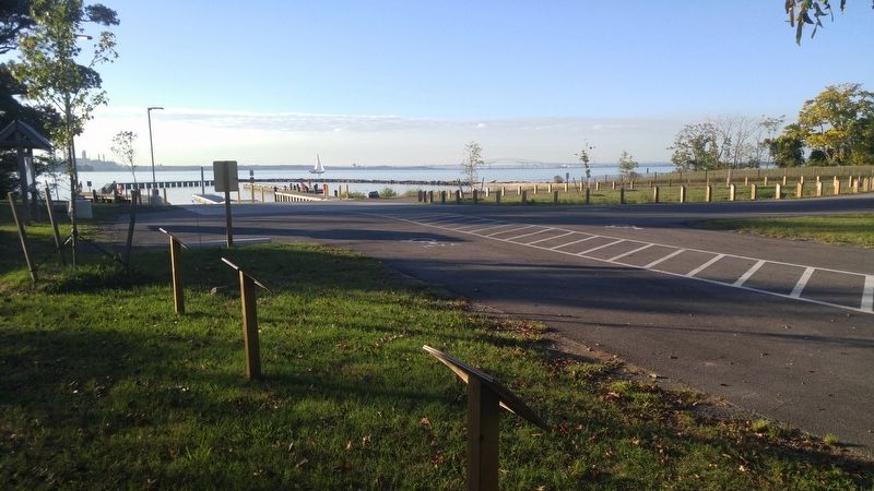
Near Fort Smallwood Road (Maryland Route 173) 0.1 miles north of Parkside Drive. Reported permanently removed.
The Public Park Era (1927-Present)
Recreation and places dedicated to its pursuit were a nation-wide phenomena in the early 20th Century. The shores of the Chesapeake Bay and its rivers were dotted with swimming beaches, waterfront . . . — — Map (db m98466) HM
On Chesapeake Bay Drive 0.2 miles north of John Downs Loop, on the left when traveling north.
This photo, probably taken in the 1930's, shows the old entrance road to Rocky Beach Farm. Access to the farm at that time was primarily via this road which extended out to Mountain Road.
Visible over Annette Thoms shoulder is the end of the . . . — — Map (db m147652) HM
Near Chesapeake Bay Drive 0.1 miles north of John Downs Loop, on the right when traveling north.
In 1913 this property belonged to a wealthy Baltimorean, Mr. H. R. Mayo Thom. He was the first person in Maryland to plant oysters on land leased from the state under the new Haman Oyster Culture Law. The Rocky Beach Oyster Farm was located . . . — — Map (db m147651) HM
Near Chesapeake Bay Drive 0.6 miles north of John Downs Loop, on the right when traveling north.
During the period 1913 to 1937 this property was the summer estate of H. R. Mayo Thom. Mr. Thom was a wealthy Baltimorean who made many improvements to the property. This boat, the Tonkaway was once of his greatest pleasures Catherine (Thom) . . . — — Map (db m147647) HM
Near Chesapeake Bay Drive at John Downs Loop, on the right when traveling west.
This bench was built for Ms. Thom around 1915 by Reginald Giddings.
Legend has it that if you sit quietly and make a secret wish, your wish will come true. — — Map (db m147655) HM
Near Bayside Beach Road 0.4 miles east of Fort Smallwood Road ( Route 173), on the left when traveling east.
Dedicate this monument Nov. 11, 1983
To all who made the supreme sacrifice.
To those of us who carry the wounds of war.
To those who's memories will live forever.
Let us with God's help never forget. — — Map (db m9282) WM
On Berlin Avenue at School Road, on the right when traveling north on Berlin Avenue.
The Patapsco Park area, widely known as Pumphrey, is an historic African American enclave with roots dating to well before the American Civil War. The largely Black community remained homogeneous for many years and prided itself with . . . — — Map (db m240357) HM
On Belle Grove Road (Maryland Route 170), on the right when traveling east.
Completed in 1923 on Berlin Avenue under the Rosenwald Program, which was instrumental in the education of African Americans in the early 20th century. The fund provided matching grants for more than 5,000 schools, shops, and teachers' residences . . . — — Map (db m79728) HM
On Belle Grove Road (Maryland Route 170) just east of Thomas Avenue, on the right when traveling west.
A grateful community remembers its veterans who sacrificed to preserve freedom for their neighbors. This memorial is a testament to their courage and devotion. — — Map (db m240360) WM
On Belle Grove Road (Maryland Route 170) just east of Thomas Avenue, on the right when traveling west.
In memory of
our departed comrades
in all wars
Dedicated July 4, 1976
American Legion
Patrick Henry Post 34
Linthicum, Maryland
A Bicentennial tribute — — Map (db m240361) WM
On WB&A Road at Donaldson Avenue ( Route 174), on the right when traveling north on WB&A Road.
WB&A Road was constructed on the right-of-way of the main line of the Washington, Baltimore & Annapolis Electric Railroad. Using the most advanced technology of the time, the high-speed line provided passenger and freight service between . . . — — Map (db m35050) HM
On Queenstown Road 0.1 miles south of Kearneys Lane, on the right when traveling north.
Built in 1932 on land provided by Sarah and Oscar Gaither, this three-room school, rare for the area, was the last Rosenwald school built in this county. After school consolidation, the building housed the Sunnyside School and later the Quarterfield . . . — — Map (db m244473) HM
On Earleigh Heights Road 0.2 miles west of Ritchie Highway ( Route 2), on the left when traveling west.
Earleigh Heights Store. Historic Home of Charles J. and Mary Novak Katlic and their children Marie, Charles, Eveylyn, James, Helen, Margie and Elizabeth. — — Map (db m2898) HM
On Randell Road, on the left when traveling south.
Built on a high embankment overlooking the Severn River, Fort Grey was pivotal in protecting Union interests during the earliest days of the Civil War. As a slave-holding state, Maryland was vulnerable to uprisings from local Confederate . . . — — Map (db m261367) HM
In 1889, business partners Gustav T. Hetschel and Henry Frost established a general store and post office just steps away from the Annapolis and Baltimore Short Line Railroad. This new rail service connected the state's economic and political . . . — — Map (db m239533) HM
On Baltimore Annapolis Boulevard, on the right when traveling south.
A Tribute to the Severna Park Heroes who served in Operation Iraqi Freedom and Operation Enduring Freedom. Never forget these brave heroes who have made the ultimate sacrifice defending the United States of America.
On Governor Stone Parkway at Benfield Boulevard, on the right when traveling north on Governor Stone Parkway.
Born in England about 1603, he emigrated to Virginia about 1628, and he came to Maryland about 1648. He brought with him nine settlers, and many others followed. He obtained about 5,000 acres located in St. Mary’s, Charles and Calvert counties.
. . . — — Map (db m2889) HM
On Baltimore and Annapolis Boulevard (Maryland Route 648) at Jones Station Road, on the right when traveling south on Baltimore and Annapolis Boulevard.
Jones Station was the eighth stop from Annapolis on the Baltimore & Annapolis Railroad and served as both a passenger and freight station. The railroad fueled growth in the Baltimore-Annapolis corridor by providing fast and frequent passenger . . . — — Map (db m76910) HM
On West McKinsey Road 0.1 miles east of Baltimore Annapolis Boulevard ( Route 648), on the right when traveling east.
Lynching in America
Thousands of black people were the victims of racial terror lynching in the United States between 1877 and 1950. The lynching of African Americans during this era was a form of racial terrorism intended to intimidate . . . — — Map (db m225927) HM
Site of former major league baseball park known as Terrapin Park. Home of Federal League Baltimore Terrapins from 1914 to 1915. Built on land owned by Ned Hanlon, manager of the world champion 1890s National League Baltimore Orioles and a . . . — — Map (db m175036) HM
On East 33rd Street at Greenmount Avenue ( Route 45), in the median on East 33rd Street.
In 1911, construction of East 33rd Street and The Alameda began to create the "Olmsted Parkways" — tree-lined boulevards that would connect a ring of parks around the city.
The parkways were designed and named after Frederick Law . . . — — Map (db m226273) HM
On Greenmount Avenue (Maryland Route 45) at East 33rd Street, on the right when traveling south on Greenmount Avenue.
The York road dates back to the 1740s when it was merely a dirt path following a trail worn down by Piscataway and Susquehannock tribes between the Jones Falls and the Herring Run above the Patapsco River and the Chesapeake Bay along the Fall . . . — — Map (db m195013) HM
On East North Avenue (U.S. 1) east of North Calvert Street, on the right when traveling west.
"You didn't go to Poly, you joined it." Such is the proud attitude of many Baltimoreans associated with this school, long considered to have one of the best college preparatory programs in the country. Conceived in 1883, the school opened its . . . — — Map (db m135068) HM
On East 25th Street east of Falls Street when traveling east.
This is the former site of Union Park, also known as Oriole Park III and Baltimore Baseball & Exhibition Grounds. The grandstand was located directly adjacent (west) of this building and a portion of the playing field directly behind it. Union Park . . . — — Map (db m267624) HM
On Belair Road (U.S. 1) south of Clifmont Avenue, on the right when traveling north.
Laurel Cemetery (1852-1958) was a burial ground for thousands of African Americans. Despite protest, the cemetery was demolished, and several burials, monuments, and markers were relocated to Carroll County. A small number were privately moved to . . . — — Map (db m289379) HM
On Sinclair Lane and St. Lo Drive, on the left when traveling north.
The Mayors of the two cities met here and named this drive to commemorate the high courage and valor of the Twenty-Ninth Infantry Division which assisted in the liberation of the enemy held city of Saint – Lo France during July 1944. . . . — — Map (db m201628) HM WM
This memorial is erected by the people of Belair Road and vicinity as a tribute to our boys who made the supreme sacrifice and those who served in Army and Navy in the Great World War 1917-1918.
(names listed-many not legible) — — Map (db m101529) WM
On the high bluff that overlooks this trail and now includes Eastwood Road, archeologists discovered evidence of an 11,000 year old campsite used by Indigenous Americans long before European settlers claim the land. Artifact analysis determined that . . . — — Map (db m307509) HM
The tree with its long lateral branch extending over the trail is a survivor of Dutch elm disease. Dutch elm disease is spread by beetles and had a devastating effect on this species of tree. The disease quickly spread throughout the eastern . . . — — Map (db m307511) HM
Emeline Jones was born enslaved int he 1830s on Colonel Benedict William Hall's estate, Eutaw Manor. By the 1860's she gained her freedom and met John Chamberlain, a hotelier and entrepreneur, when he was a guest in her employer's household. . . . — — Map (db m307512) HM
Look up and you will see the remnants of a small stone lodge on the hill above the trail! It was likely built during the 1930s by the Works Project Administration under Pres. Franklin D. Roosevelt. In its early years, the lodge was a gathering place . . . — — Map (db m307328) HM
The Good Shepherd in honor of: Lizette Woodworth Reese, Poetess, Grace Trunbull, Sculptress.
Dedicated by Eastern High School graduates in honor and memory of their teachers and alumni 1844-1986. — — Map (db m102703) HM
On Greenmount Avenue (Maryland Route 45) north of East 31st Street, on the left when traveling north.
As the villages around Waverly grew in the 1800s, religion played an important role in social, civil and political organizing.
Baptists, Episcopalians, Methodists, Presbyterians and Catholics regularly attended each other's church picnics . . . — — Map (db m262455) HM
Built around 1873, the Waverly Town Hall has served as a significant focal point for the Waverly community. Its two floors have been used as a meeting space for political and civic organizations, offices for dentists, a post office, several . . . — — Map (db m279306) HM
On Howard Street at Dolphin Street on Howard Street.
Charles Hazeltine Hammann Ens Air Service U.S. Navy March 16, 1892-June 14, 1919
Henry Gilbert Costin Pvt. Co. H, 115TH Inf., 29th Div June 15, 1898-October 8, 1918.
Ensign Hammann rescued a fellow pilot by landing his seaplane on a . . . — — Map (db m101516) WM
Advocate for the disabled. She founded and directed the Mary Lea Studio, a workshop of the Baltimore League for Crippled Children and Adults. — — Map (db m154846) HM
Archibald Coleman Rogers, FAIA 1917-2001
Founding Partner of the global architectural firm RTKL. President of the American Institute of Architects. First Executive Director of the Greater Baltimore Committee. He played a vital role in revitalizing . . . — — Map (db m142896) HM
A logician, mathematician, and psychologist, she developed a new theory of color vision. She was the first woman to complete Ph.D. requirements at Johns Hopkins, in 1882, although because of her gender, the University did not confer the degree until . . . — — Map (db m154833) HM
On West Lanvale Street at Jenkins Street, on the right when traveling east on West Lanvale Street.
Chief of Staff to General Robert E. Lee at Appomattox. Later a political reformer and one of nineteenth-century Baltimore's "Seven Great Lawyers." — — Map (db m6460) HM
During the Civil War, approximately 60,000 Marylanders fought for the Union and 25,000 fought for the Confederacy. After the war, Confederate sympathizers erected monuments such as this one to recognize Confederate soldiers and sailors and to . . . — — Map (db m101761) WM
On Park Avenue south of West Lafayette Avenue, on the right when traveling south.
Classicist author of The Greek Way. A leader in women's day-schooling First headmistress of Bryn Mawr School. *** Alice Hamilton, M.D. 1869-1970 Founder of industrial hygiene, pioneer in removing lead from paint. Harvard's first woman . . . — — Map (db m6466) HM
On West Lanvale Street at Park Avenue, on the right when traveling east on West Lanvale Street.
Early advisor to the World Health Organization. New York City Health Commissioner. Long time dean of Johns Hopkins School of Hygiene and Public Health. — — Map (db m6581) HM
On Park Avenue, on the right when traveling north.
Author of The Great Gatsby (1925). Works published while he resided here: Tender is the Night (1934), Raps At Reveille (1935), and essays (1934-1936) later collected in The Crack-Up. — — Map (db m6473) HM
Welcome to the Memorial Garden of Family and Children’s Services of Central Maryland. In Honor of Families and Children and their strivings to succeed-enter to enjoy, reflect, celebrate, remember and heal.
Established September 3, 1998 on the . . . — — Map (db m101956) HM
Artist and community activist. Leader in the renovation of Eutaw Place
Developer of the pneumococcal vaccine. Winner of the Albert Lasker Clinical Medical Research Award — — Map (db m154848) HM
On Park Avenue, on the right when traveling north.
First woman full professor at Johns Hopkins School of Medicine. Introducer of techniques for staining living cells. Reformer of Colorado's health laws. Her statue stands in the U.S. Capitol. — — Map (db m6475) HM
On Bolton Street just east of McMechen Street, on the right when traveling east.
Housing and city planning advocate. Published a seminal study of Baltimore neighborhoods. Co-founder and Executive Director of the Citizens Planning and Housing Association. Co-founder of the Better Air Coalition. — — Map (db m142890) HM
On Bolton Street, on the right when traveling south.
First Johns Hopkins Professor of Anatomy. After 1914, also first Director of the Department of Embryology at Washington's Carnegie Institution, where he pioneered embryological research. — — Map (db m6480) HM
On John Street, on the right when traveling south.
Born Thomas Garrison Morfit, he was an early host and star of 1950s and 1960s television variety shows, including I've Got a Secret and The Garry Moore Show. — — Map (db m6589) HM
Journalist, historian and biography. His political commentary, in print and on television, led Adlai Stevenson to call him "the critic and conscience of the nation." — — Map (db m6478) HM
Hans Froehlicher, Jr. 1891-1976 Civic educator and activist. Headmaster of Park School. Co-founder and President of the Citizens Planning and Housing Association. With his wife Frances, founded the Better Air Coalition. — — Map (db m142891) HM
On West Lanvale Street, on the right when traveling east.
Stalwart supporter of President Lincoln and of Emancipation. Chief Judge in the U.S. Fourth Circuit Court, where he was nicknamed "The Curse of the K.K.K" for his harsh sentences. — — Map (db m6462) HM
Innovative wholesale merchant to the South and collector of Old Master paintings. As a philanthropist, he inaugurated the system of matching charitable grants. — — Map (db m6568) HM
On Bolton Street, on the right when traveling south.
Pioneer researcher on adrenalin, insulin, and the artificial kidney. First Professor of Pharmacology at Johns Hopkins School of Medicine. For 40 years the leading pharmacologist in America. — — Map (db m277954) HM
On West Lanvale Street, on the right when traveling east.
Johns Hopkins researcher in Cuba. To find the cause of yellow fever he courageously exposed himself to virus-infected mosquitoes and died of the disease, thereby proving the route of transmission. — — Map (db m6583) HM
On Rutter Street at West Lanvale Street, on the right when traveling north on Rutter Street.
Dedicated to the loving memory of
Dr. Joseph J. Costa
Chief of Critical Care Medicine
Mercy Hospital
who died while unselfishly
treating those with COVID 19
July 25, 2020 — — Map (db m212327) HM
Laurance Page Roberts
1907-2002
Director of the Brooklyn Museum, the American Academy in Rome, and the New York State Council on the Arts, Scholar of Japanese art.
Isabel Spaulding Roberts 1911-2003First woman Director of the . . . — — Map (db m142863) HM
On West Lanvale Street, on the right when traveling east.
From 1894 to 1899, this house was the residence of Ottmar Mergenthaler, a German immigrant who revolutionized the art of printing with his invention of the Linotype. Previously a typesetter searched for a single character, then placed it in a line . . . — — Map (db m6582) HM
Housing and civil rights advocate. Field Secretary of the Citizens Planning and Housing Association. Director of Christian Social Relations for the Maryland Council of Churches — — Map (db m154845) HM
On Dolphin Street at Bolton Street, on the right when traveling west on Dolphin Street.
William Gailes Contee and Edward Wilson Parago, Sr.
Contee-Parago Park is one of the first City parks to be named after Black Baltimoreans: Edward Wilson Parago, Sr. (1898-1983), a postal worker, and William Gailes Contee, an upholsterer . . . — — Map (db m212325) HM
Concert pianist and musicologist, he founded the music history department at the Peabody Conservatory, where he taught from 1985-2011. — — Map (db m154837) HM
On West Lafayette Avenue near John Street, on the right when traveling west.
Southern States heavyweight champion professional wrestler. A pioneer art director in early television, his Baltimore team created the hit children's show Romper Room. — — Map (db m212888) HM
On Eutaw Place at West Lanvale Street, on the right when traveling north on Eutaw Place.
"The Md. Prince Hall Masons acquired this Temple from the congregation of Oheb Shalom, November 1960, built by them in 1891." Williard W. Allen, Grand Master Emeritus Samuel T. Daniels, Grand Master — — Map (db m6551) HM
Dean of the Johns Hopkins University School if Medicine. He performed important research on yaws, syphilis and polio. In his 75-year association with Hopkins, his career spanned the modern history clinical and academic medicine — — Map (db m154831) HM
Thomas J. O’Neill 1849-1919-Founder of O’Neill & Company Department Store. He left the business to his employees. He bequeathed the funds that built Good Samaritan Hospital and the Cathedral of Mary Our Queen. — — Map (db m142861) HM
Founders of the Irish Railroad Workers Museum and ardent preservationists. Their efforts helped save Baltimore's historic neighborhoods and parks. — — Map (db m154842) HM
Boyhood home of the President of Oberlin College and head of Aspen Humanities Institute. Ambassador to the Philippines. Olympic Gold Medalist for the 1600 meter relay in 1924. — — Map (db m6468) HM
On West Lanvale Street, on the right when traveling south.
Discoverer of the anticoagulant heparin. First Professor of Physiology and early Dean at Johns Hopkins School of Medicine. Second director of the Hopkins School of Hygiene and Public Health. — — Map (db m6464) HM
Congregation of the Sisters of Bon Secours, a nursing order founded in France in 1824, sent three members to Baltimore in May, 1881, at the request of Cardinal Gibbons. Their first U.S. convent opened at West Baltimore and Payson Streets the . . . — — Map (db m2451) HM
On Dundalk Avenue at Chandlery Street, on the right when traveling south on Dundalk Avenue.
Named for Quartermaster General Samuel B. Holabird (1826-1907) and established in 1917 as the Army's first motor transport training center and depot. Supplied World War I American Expeditionary Forces in France with Detroit-made vehicles. Trained . . . — — Map (db m294810) HM
On West Lexington Street west of North Eutaw Street, on the right when traveling west.
The merchant mix at Lexington Market has always included large numbers of immigrant-owned businesses, dating back to the Market's founding. Early records depict a melting pot of business owner nationalities—from German-owned butcher shops to Italian . . . — — Map (db m243487) HM
On West Lexington Street just west of North Eutaw Street, on the right when traveling east.
Located squarely in the Bromo Arts & Entertainment District, Lexington Market has always been more than just a home for the culinary arts, but a place for the best of arts and culture in Baltimore City. From murals, to sculptures, to even a . . . — — Map (db m243478) HM
On West Lexington Street just west of North Eutaw Street, in the median.
Lexington Market is a place nearly as old as America itself—and its history of local food, community-rooted small business, and a space for all is the legacy we are proud to continue on today. Taking a walk through Lexington Market's . . . — — Map (db m243489) HM
On West Lexington Street just west of North Eutaw Street, on the left when traveling west.
Slavery and a domestic slave trade formed essential aspects of nineteenth-century Baltimore life. Some businesses used slave labor, but most slaves worked as domestic servants for elites. In Lexington Market's precinct, for example, one in four . . . — — Map (db m243485) HM
On West Lexington Street at North Paca Street, on the left when traveling east on West Lexington Street.
Baltimore's hyper-local mural festival, created for artists, by artists.
We are proud to present five of Baltimore's most talented female and non-binary teams made up of nine Pro muralists and four Rising Stars (emerging artists mentored by . . . — — Map (db m243475) HM
On West Lexington Street at North Paca Street, on the left when traveling east on West Lexington Street.
Back when Lexington got its start in the late 1700s, it sat on the western edges of Baltimore City, the perfect destination for rural farmers to bring their fresh produce and sell to city dwellers. Some traveled by horse-drawn wagon for over three . . . — — Map (db m243474) HM
On West Lexington Street at North Paca Street, on the left when traveling west on West Lexington Street.
In 1886 at the age of 19, John W. Faidley went into business with fish dealer Peter B. Smith, opening as Smith & Faidley—now known simply as Faidley's. Faidley's granddaughter, Nancy Devine, and her husband, Bill, continue to operate what is the . . . — — Map (db m243469) HM
On West Lexington Street just west of North Eutaw Street, on the right when traveling west.
Over the years, the Market has had at least 10 different buildings and countless carts and stalls from the vendors on the street. At times, sheds of wood, stone, and concrete have stretched entire city blocks. Lexington Market's heart and soul, . . . — — Map (db m243488) HM
On West Lexington Street west of North Eutaw Street, on the left when traveling west.
In a different time, Lexington Market was not only the place to get wild caught seafood from the Chesapeake Bay, but also wild game caught by hunters and trappers up and down the East Coast. In the late 1800s, market goers could get all manner of . . . — — Map (db m243529) HM
2419 entries matched your criteria. Entries 101 through 200 are listed above. ⊲ Previous 100 — Next 100 ⊳