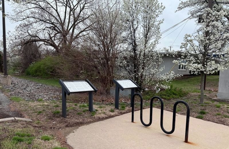
On Bannard Street just west of Industrial Highway, on the right when traveling east.
Controlling the movement of trains, avoiding collisions, and ensuring the safety of railroad operations has always been the primary mission of railroad signal engineering. The Camden and Amboy Railroad contributed to the improved safety of the . . . — — Map (db m269581) HM
On U.S. 130 at Riverton Road, on the right when traveling east on U.S. 130.
Swedish farmers from across the Delaware settled among the English here in the 1680's. The name Cinnaminson is Native American.
1664 · 1964 — — Map (db m285275) HM
On Columbus Road (County Route 543) 0.3 miles east of Petticoat Bridge Road, on the right when traveling east.
On a tree south of this spot British Corporal John Fisher, 28th. Regiment
who had deserted the British to join the Rebels
was caught, tried and convicted. He was hung
at 10 AM June 22, 1778 — — Map (db m34200) HM
On Columbus Road at Petticoat Bridge Road on Columbus Road.
The Keeler Oak is a White Oak (Genus: Quercus, Species: alba) 88' tall with a drip line of 120'. This 300 year old tree was witness to the Colonial troops and Hessian soldiers as they marched through Black Horse down to Petticoat Bridge where a . . . — — Map (db m244457) HM WM
On June 23, 1778, General Dickinson’s Jersey Troops destroyed bridge, fighting a skirmish to delay the British march to New York. — — Map (db m93719) WM
Quakers settled Crosswicks in 1677 and purchased this land toward the end of that century. Friends have worshiped on this site continuously since that time. The smaller building was erected in the mid 1780's for use as a Quaker school and is now . . . — — Map (db m311973) HM
On Cooper Street at Hickory Street, on the right when traveling north on Cooper Street.
On July 1, 1924, Babe Ruth hit a home run on this Athletic Field in a game between Delanco and the Burlington County All-Stars. Over 5000 baseball fans attended this historical baseball game. — — Map (db m140537) HM
On Burlington Avenue (County Route 543) at Richard Avenue, on the right when traveling west on Burlington Avenue.
In honor and remembrance
Steel recovered from the World Trade Center after September 11, 2001 courtesy of the Port Authority of NY & NJ is displayed in the memory of 2,752 Victims including:
On Burlington Avenue (County Route 543) at Rancocas Avenue, on the right when traveling north on Burlington Avenue.
This Tablet is Erected in Honor of the Boys of Delanco N.J. Who Served Their Country in the Victorious World War for Democracy 1917 - 1918
Army Rufus Alden; Frederick Austin; Daniel Blackburn; Albert Borden; Walter Bracey; Clarence I. . . . — — Map (db m102200) WM
On Burlington Avenue (County Route 543) at Rancocas Avenue, on the left when traveling south on Burlington Avenue.
Riverside-Delanco
Bridge
Over The Rancocas Creek
dedicated as the
Landon-Stone
Memorial Bridge
Opened September 14, 1935
First bridge 1870
Second bridge 1901 — — Map (db m194821) HM
Site of hotel erected by Manassas Dellett in 1880. Town meetings and social affairs held here. Later known as Patterson's Hotel. Demolished in 1975. — — Map (db m79511) HM
On Burlington Pike (U.S. 130), on the right when traveling west.
Originally a ferry site, a covered bridge was erected here in 1793. Rebuilt in 1838 and replaced with a concrete span in 1928. The current bridge was opened in 1986. — — Map (db m102897) HM
Built in 1905 with four rooms and two additions in later years, it was renamed Aronson Bell School in 1957. Demolished in 1994 and replaced with the Delran Intermediate School. — — Map (db m102592) HM
On Main Street near Third Street, on the right when traveling north.
Built in 1918 as a four room schoolhouse for grades 1-7. Brick veneered in the late 1930's during a WPA project. Closed in 1995 and demolished. — — Map (db m102895) HM
Opened in 1840 and originally owned by a group called the Christian Brethren. Later named Fairview Christian Cemetery. Currently, has no owner but maintained by the members of Trinity Church. — — Map (db m102401) HM
Land purchased from Samuel and Hannah Louden in 1859. The Methodist Cemetery Association owned it and supervised burials for many decades. Currently, Methodist Church Trustees oversee care. — — Map (db m102607) HM
On South Bridgeboro Street, on the right when traveling east.
First named the Laurel Run Methodist Episcopal Church. Erected near Laurel Run in 1841, the original building was moved to this site in 1869. The present church was built in 1880. — — Map (db m102654) HM
In 1912, eight acres of land were made into a park-like cemetery. Unattended, it fell into disrepair. By 1971, the last remains were moved to Monument Cemetery in Edgewater Park. — — Map (db m102894) HM
On Conrow Road, on the right when traveling north.
The original section was built in 1733 by Darling Conrow. A larger section was added in 1751 when he married his wife Deliverance This home is the oldest structure in Delran Township. — — Map (db m102593) HM
Property originally owned by a local religious group. The church was built in 1838 and sold to the Episcopalians in 1845. The congregation continues to celebrate its historic use. — — Map (db m102398) HM
On Bridgeboro Street, on the right when traveling west.
Erected by American Legion Post #146 in 1942. Located on the former Asa Austin Farm, volunteers observed and reported planes overhead and traffic on the Rancocas Creek. Removed at the end of war. — — Map (db m102892) HM
H.B. Smith purchased the old village of Shreveville in 1865 and renamed it “Smithville.” The map of Shreveville, which accompanied the notice of sale, depicts three rows of houses. Shortly after Smith purchased the property, he razed the . . . — — Map (db m92460) HM
Village on the Rancocas Creek The industrial history of this site goes back to the days of the early colonists who set up sawmills and gristmills, harnessing the natural power of the Rancocas Creek. In the 1830s, the Shreve Brothers, Jonathan . . . — — Map (db m92459) HM
H.B. Smith’s machinery warehouse was the largest structure in the lower village. It stood across the main road from the Smithville railroad station.
The construction of new houses on Forest Avenue in the lower village took place in 1886. These new . . . — — Map (db m92457) HM
On Smithville Road at Railroad Avenue on Smithville Road.
The Burlington County Railroad completed its line to Pembarton in 1861. The benefits of the railroad had a great influence on the village of Smithville. The route provided access to Philadelphia with only an hour’s ride and connections to Boston . . . — — Map (db m92456) HM
On 4th Street at Washington Street, on the right when traveling west on 4th Street. Reported permanently removed.
Ashworth, Harry Bailey, Charles Bailey, Robert Bell, Donald Bell, Frank, Jr Bell, Gerald Bell, Gordon Bentz, George Bentz, Russell Billingham, Neil Bozarth, Clarence Bozarth, Harry Bozarth, Jack Bozarth, William Brettel, Jack Brettel, William . . . — — Map (db m37011) HM
On 4th Street (County Road 622) at Washington Street, on the right when traveling west on 4th Street.
Fieldsboro, incorporated in 1850, is the smallest municipality in Burlington County. Early land records identify the area as White Hill. One of its early settlers was Robert Field, who owned a wharf on the Delaware River, several businesses and a . . . — — Map (db m253478) HM
On 4th Street (County Road 662) at Washington Street, on the right when traveling west on 4th Street.
Alvord, Corinne •
Ashworth, Harry •
Atkinson, Russell •
Bailey, Charles •
Bailey, Robert •
Bell, Donald •
Bell, Frank, Jr. •
Bell, Gerald •
Bell, Gordon •
Bentz, George •
Bentz, Russell •
Billingham, Neil •
Bozarth, . . . — — Map (db m160136) WM
On 4th Street (County Road 662) at White Hill Mansion Road, on the right when traveling south on 4th Street.
White Hill Mansion stands at the end of a long avenue on a bluff overlooking the Delaware River. The earliest known sections of the house were built in the eighteenth century and there were many subsequent additions and changes over the following . . . — — Map (db m194816) HM
On Broad Street at East Front Street/West Front Street, in the median on Broad Street.
[Upper Plaque - Side 1:]
We the people of
Florence Township
Dedicate this tablet as visible evidence of our lasting and eternal gratitude for these men who made the supreme sacrifice while serving in the Armed Forces of our . . . — — Map (db m37101) HM
On Hornberger Avenue just north of Alden Avenue, on the right when traveling west.
Safety has always been the primary concern of the railroads to protect the pedestrians and vehicles crossing railroad tracks. The Camden and Amboy Railroad began operating on these tracks in 1835 and after 1871, became a part of the vast . . . — — Map (db m212541) HM
On Hornberger Avenue at Sixth Avenue, on the right when traveling east on Hornberger Avenue.
Main Cable
1906 - 1980
George Washington Bridge 1927 - 1931
Golden Gate Bridge 1933 - 1937
Fabricated By John A. Roebling & Sons — — Map (db m237171) HM
On East Front Street 0.1 miles east of Broad Street, on the right when traveling east.
This plaque commemorates the birth of Richard J. Hughes in this house on August 10, 1909. He became Governor of New Jersey from 1962 to 1970. He served as Chief Justice of the New Jersey Supreme Court from 1973 to 1979. — — Map (db m35923) HM
On Main Street at 7th Avenue, on the right when traveling west on Main Street.
Built in 1915, entertainment in the auditorium included vaudeville shows, minstrels, boxing matches and movies. It was one of the first centrally air-conditioned buildings in the United States. — — Map (db m237170) HM
On Tenth Avenue at Hornberger Avenue, on the right when traveling north on Tenth Avenue.
Built in the 1920's, this field was one of the nicest ball parks in New Jersey. Originally a wooden fence surrounded the playing field. There was also a large grandstand that could seat 1,200 fans. — — Map (db m244460) HM
On Main Street just west of 4th Avenue, on the right when traveling west.
The John A. Roebling's Sons "Company Store" opened for business in 1906 and was the largest and best stocked regional enterprise. It created a bustling center of commerce for the villagers. — — Map (db m160133) HM
On Riverside Avenue at 3rd Avenue, on the right when traveling east on Riverside Avenue.
Built in 1905, men working in the construction of the plant and village paid $2.00 a week for room and board. At one time there were two bowling lanes in the cellar. — — Map (db m33577) HM
On Riverside Avenue at 4th Avenue, on the left when traveling east on Riverside Avenue.
This memorial erected by the citizens of the Town of Roebling in honor and in memory of the founders, sons of John A. Roebling 1905 - 1930 — — Map (db m33584) HM
On Hornberger Avenue at Alden Avenue, on the left when traveling west on Hornberger Avenue. Reported permanently removed.
Abrams, Walter R. •
Abrams, Howard •
Agoes, Joseph •
Alesander, James •
Alexander, William •
Anchak, Joseph •
*Andrews, Alexander W. •
Andrews, Malcolm, Jr. •
*Arnold, Robert L. •
Arnold, Frank •
Austin, Lawrence R. . . . — — Map (db m33309) HM
On Hornberger Avenue at Alden Avenue, on the right when traveling east on Hornberger Avenue.
Abrams, Walter R. •
Abrams, Howard •
Agoes, Joseph •
Alexander, James •
Alexander, William •
Anchak, Joseph •
Andrews, Alexander W. * •
Andrews, Malcolm, Jr. •
Arnold, Robert L. * •
Arnold, Frank •
Austin, Lawrence R. . . . — — Map (db m160224) WM
On West Third Street 0.1 miles west of Broad Street, on the right when traveling west.
In honor of the members of
Florence Volunteer Fire Co. No. 1
who served their country in World War II
J. Allen • J Baird • W. Boyle • N. Brown • R. Cavanaugh • R. Coates • J. Crammer • C. Dennis • J. Downey • F. Duffy • C. Gesemyer • T. . . . — — Map (db m35958) HM
On 4th Avenue just north of Hornberger Avenue, on the right when traveling north.
Dedicated to the memory of those who made the Supreme Sacrifice and in honor of those who served in the Armed Forces of our Country — — Map (db m160130) WM
In memory of our Roebling village men who made the Supreme Sacrifice in WW II
Robert Arnold •
Richard Engel •
Herbert Larson •
Joseph Seaman •
James Tonne •
Joseph Varga
Walter Andrews •
Carl Larson •
Ralph Pigott • . . . — — Map (db m160135) WM
On Pennsylvania Avenue at West 8th Street on Pennsylvania Avenue.
World War II
Mobilized at Fort Dix 16 September 1940
Campaigns
Northern France–Rhineland–Central Europe
In memory of
our comrades who paid the supreme sacrifice — — Map (db m7263) HM
On South Scott Plaza 0.2 miles east of Delaware Avenue, on the right when traveling east.
In memory of
Florence MacDonald
U.S. Army Nurse Corps
Heroine of Corregidor
Veteran of two World Wars
Fort Dix Station Hospital
Chief Nurse
1942-44 — — Map (db m97606) HM WM
On Pennsylvania Avenue at West 8th Street on Pennsylvania Avenue.
This monument is dedicated to the only indispensable instrument of war, The American Soldier---
The Ultimate Weapon
“If they are not there, you don't own it.”
17 August 1990
[A nearby companion marker, shown in pictures . . . — — Map (db m7265) WM
Near Batsto Road, on the right when traveling north.
This series of belts and jackshafts were installed in the late 19th century. They were powered by the gristmill’s turbine, Their purpose was to turn grindstones for sharpening tools and to power the corn sheller housed in the adjacent corncrib. — — Map (db m307122) HM
Near Batsto Village Road, on the left when traveling north.
This boat is typical of the barges used to carry bog iron ore to the Batsto Furnace. It is estimated to be 150 years old and is 43 ft. long, with an 11 ft. beam. The boat was excavated from the north side of the Batsto Dam in 1957. — — Map (db m307125) HM
Near Washington Turnpike south of Goodwater Road, on the left when traveling south.
Although the exact date and manufacturer of this wagon are not known, it is possible that it was made by the Auburn Wagon Works in Martinsburg, WV around 1900.
Wagons were used to transport goods both on the farm and to local markets, boat . . . — — Map (db m307128) HM
Near Batsto Road, on the left when traveling north.
In the 1840s, Batsto’s iron industry was failing due to competition from new iron industries using coal and iron ore (magnetite) rather than charcoal and bog ore (limonite). Looking for another industry to keep Batsto profitable, Jesse Richards . . . — — Map (db m307153) HM
On U.S. 130 0.4 miles south of Kinkora Road (County Route 678), on the right when traveling north.
Running from the Delaware River to New Lisbon, the historic Kinkora Branch RR carried produce in the 1800s. Later it was used to transport troops to Camp Dix during WW I and Fort Dix during WW II. — — Map (db m34359) HM
Site of grist and sawmill complex erected by Thomas Bedford in 1807. Once was site of original Indian Gristmill which burned in 1762. — — Map (db m79474) HM
On Willow Grove Road at Forked Neck Road on Willow Grove Road.
A general store was maintained continuously at this location since Civil War Days. A Post Office was also located here in the late 1800s. — — Map (db m79480) HM
Celebrated Ann Roberts, last of the Delawares in this State, resided here until her death in 1894. She has become a legend in the Pines. — — Map (db m79473) HM
Log Meeting House, where John Brainerd preached to the Reservation Indians, was located near here. Later used by Whites for worship. Burned in 1809. — — Map (db m79507) HM
Originally constructed for use as a Baptist Church in 1876. Later maintained by Improved Order of Red Men. Elections and town meetings held here for many years. — — Map (db m79509) HM
Site of sawmill in operation for more than two centuries. Had been site of original Indian sawmill.
Operations ceased in early 1900's. — — Map (db m79482) HM
Edward T. Thompson, former State Assemblyman (1871-73) Township Official, resided here. Home built 1807 by Thomas Bedford. Also a store and Post Office. — — Map (db m79476) HM
On Main Street (County Route 669) at Lewistown Road, on the left when traveling east on Main Street.
Erected as a tribute to
the men of this community
who served in World War II
————————
* In Memoriam *
Henry D. Hoffman
Thomas B. Hopkins
Honor Roll
Harry Allen • Leslie . . . — — Map (db m35949) HM
On Petticoat Bridge Road at Columbus Road (County Route 656), on the left when traveling north on Petticoat Bridge Road.
The Keeler Oak is a White Oak (Genus: Quercus, Species: alba) 88' tall with a drip line of 120'. This 300 year old tree was witness to the Colonial troops and Hessian soldiers as they marched through Black Horse down to Petticoat Bridge where a . . . — — Map (db m312961) HM
On South Cropwell Road at Old Marlton Pike N on South Cropwell Road.
Cropwell Friends has been placed on the National Register of Historic Places by the United States Department of the Interior. Built 1809. — — Map (db m79434) HM
Samuel Lippincott took title to a large tract of land from the proprietors of South Jersey about 1700 and developed the site with orchards and a cider mill. A large farmhouse was built c. 1820 by John Lippincott. In the late Georgian/Federal style, . . . — — Map (db m79414) HM
On West Main Street at North Maple Street on West Main Street.
The original building on this site was the Rising Sun Tavern, built in 1820, by Samuel Swain, tavernkeeper and postmaster. Samuel Swain was instrumental in the naming of the village Marlton. The village was named for Marlton, a local soil, utilized . . . — — Map (db m79433) HM
Thomas & Mary Even House has been placed on the National Register of Historic Places by the United States Department of the Interior. Built 1785. — — Map (db m79432) HM
Thomas Hollinshead House has been placed on the National Register of Historic Places by the United States Department of the Interior.
Built 1776 — — Map (db m79415) HM
On Branch Street east of Charles Street, on the left when traveling east.
This home was built by Albert and Belle Ballinger in 1911. All construction materials were shipped in two freight cars on the rail line that used to run through Mt. Holly to Medford. — — Map (db m44718) HM
On Stokes Road (County Route 541) south of Mohawk Trail, on the left when traveling south.
Started by Charles Read in 1766, the ironworks closed in 1773. The site included sawmill, gristmill, smithy and 9000 acres of land. — — Map (db m44989) HM
On Mill Street, on the right when traveling south.
This was the head of navigation on the Rancocas. Before 1800 iron and charcoal were unloaded here from wagon to barge for shipment to Philadelphia. 1847-1997 — — Map (db m45026) HM
On Tansborough Road, on the right when traveling south.
An up-and-down sawmill was running here before 1800. Charcoal burned from native oak trees filled the needs of the Philadelphia Mint. — — Map (db m45077) HM
On Tuckerton Road west of Christopher Mill Road, on the left when traveling west.
In 1678, the tract was 40,000 acres. The present 1743 house was built by the Hewlings family near the earlier mill. Signs of an early Indian camp ground exist across the road. 1847-1997 — — Map (db m44668) HM
On Mill Street at Enclave Court, on the right when traveling north on Mill Street.
Built by Lester Gager in 1857 at the corner of Dixontown Road, the school was moved here by the township in 1976. Former students called it the “Knowledge Box”. — — Map (db m45028) HM
On Church Road at Mt. Holly/Medford Road (County Route 541), on the right when traveling west on Church Road.
On February 4, 1847 Medford was set apart from Evesham Township and on March 9, 1847 the first meeting of Medford Township was held here at Crossroads, near the earliest homes. 1847-1997 — — Map (db m44965) HM
On Taunton Blvd at Falls Road, on the left when traveling north on Taunton Blvd.
In 1920 Lake Pine was a cranberry bog and Taunton Blvd was a sand road. This log cabin, built in 1926, was converted from a summer cottage to year-round, c. 1950. — — Map (db m45022) HM
On Church Road (County Road 616 Frontage Road) east of Medford-Mount Hoolly Road, on the right when traveling west.
Dr. James Still (1812-1882) was born to formerly enslaved parents in Washington Township, New Jersey. Dr. Still, known as the “Black Doctor of the Pines,” was also an older brother to Underground Railroad conductor and author William Still. With . . . — — Map (db m291662) HM
About 1860, James Still, “The Black Doctor of the Pines” a self-taught son of slaves, made and dispensed his famous herbal remedies from this site 1847-1997 — — Map (db m44968) HM
On N Main Street (County Route 541) at Cedar Street, on the right when traveling south on N Main Street.
Dr. Henry P. Ely built the house about 1844. The mansard roof was added after a fire in 1893. This 2 and ½ story home shows fine workmanship both inside and outside the building. — — Map (db m44717) HM
On Filbert Street at Church Street, on the right when traveling south on Filbert Street.
The 2-story grammar school, built in 1876, had four more rooms added in 1907. Medford High School offered a 2-3 year program here, 1889-1917. The school closed in 1927. — — Map (db m44729) HM
On Bank Street at Charles Street, on the right when traveling east on Bank Street.
Jacob Prickett built this home in 1827. Many windows have early glass. Original corner fireplaces in the living and dining rooms still operate efficiently. — — Map (db m44736) HM
On Filbert Street at Mulberry Street, on the left when traveling south on Filbert Street.
Built in 1842 by Mahlon Reeve, this home was bought by Everett Mickle in 1955. He preserved and shared an invaluable collection of old Medford photographs. — — Map (db m44732) HM
The Religious Society of Friends (Quakers) established this graveyard in 1759 along with the beginning of Upper Evesham Meeting that now is called Medford Monthly Meeting. The first recorded burial was that of Mark Stratton in the same year. Plain, . . . — — Map (db m79451) HM
On Union Street east of Cherry Street, on the right when traveling east.
Established in 1759, the first Meeting House was built in 1762 The present Meeting House dates from 1814, with the newest addition completed in 1984. 1847-1997 — — Map (db m44780) HM
On S Main Street (County Route 541) at Trimble Street, on the left when traveling north on S Main Street.
22 company-owned houses were built c. 1850 to 1864. Corner fireplaces provided heat and 3 outdoor wells supplied water. Rent was $5.00 to $6.00 per month. — — Map (db m44665) HM
On Old Marlton Pike at Jones Road, on the right when traveling west on Old Marlton Pike.
Inherited by Elwood Haines in 1847 from his father Jonathan Haines, the property was later sold to the Cochley family, who sold it to the Singer family in the 1930’s. — — Map (db m44775) HM
837 entries matched your criteria. Entries 101 through 200 are listed above. ⊲ Previous 100 — Next 100 ⊳