128 entries match your criteria. Entries 101 through 128 are listed.⊲ Previous 100
The Washington-Rochambeau Route Historical Markers
In 1781 the two Generals met in White Plains, New York, crossed the Hudson River and marched 450 miles south to Yorktown in Virginia where their and Lafayette’s armies defeated the British, ending the war.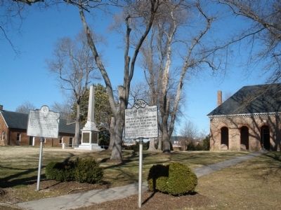
By Bernard Fisher, February 2, 2009
Washington-Rochambeau Route Marker
| 101 ► Virginia, Hanover County, Hanover — Washington-Rochambeau Route — Reported permanently removed |
102 ► Virginia, James City County, Toano — W-33 — Burnt Ordinary —  |
| 103 ► Virginia, James City County, Toano — W-167 — Doncastle's Ordinary — |
| 104 ► Virginia, James City County, Williamsburg — W-49 — Trebell's Landing — |
| 105 ► Virginia, King William County, West Point — OC-22 — Campaign of 1781 — Lafayette's Encampment — |
| 106 ► Virginia, New Kent County, New Kent — WO-16 — New Kent Courthouse — Reported permanently removed |
| 107 ► Virginia, Prince William County, Dumfries — E-53 — Revolutionary War Campaign of 1781 — |
| 108 ► Virginia, Prince William County, Lake Ridge — Washington-Rochambeau Wagon Route — |
| 109 ► Virginia, Prince William County, Leesylvania — Passing Blackburn House — |
| 110 ► Virginia, Prince William County, Leesylvania — 6 — Potomac Path — |
| 111 ► Virginia, Prince William County, Leesylvania — Supplying an Army — The King's Highway — |
| 112 ► Virginia, Prince William County, Leesylvania — The King's Highway — |
| 113 ► Virginia, Prince William County, Leesylvania — The Potomac Path — The King's Highway — Reported missing |
| 114 ► Virginia, Prince William County, Montclair — Potomac Path — |
| 115 ► Virginia, Prince William County, Triangle — Road to Yorktown — The King’s Highway — |
| 116 ► Virginia, Prince William County, Triangle — Road to Yorktown — The Kings Highway — |
| 117 ► Virginia, Prince William County, Triangle — The Potomac Path — The King’s Highway — Reported missing |
| 118 ► Virginia, Prince William County, Triangle, Prince William Forest Park — The Crossing Trail — National Park Service, U.S. Department of the Interior — |
| 119 ► Virginia, Stafford County, Stafford — E-79 — Peyton’s Ordinary — |
| 120 ► Virginia, Virginia Beach, Fort Story — Battle of the Capes — U.S. Department of the Army — Fort Story, Virginia — |
| 121 ► Virginia, Virginia Beach, Fort Story — Battle of the Capes 1781 — |
| 122 ► Virginia, Virginia Beach, Fort Story — François Joseph Paul de Grasse — [Cape Henry Memorial, Colonial National Historical Park] — |
| 123 ► Virginia, Virginia Beach, Fort Story — French British Naval Engagement Off the Virginia Capes — September 5, 1781 — |
| 124 ► Virginia, Williamsburg — Washington–Rochambeau Route — |
| 125 ► Virginia, York County, Yorktown — American Encampment — 1781 Siege of Yorktown — Colonial National Historical Park — |
| 126 ► Virginia, York County, Yorktown — Comte de Rochambeau — 1781 Siege of Yorktown — Colonial National Historical Park — |
| 127 ► Virginia, York County, Yorktown — The Washington-Rochambeau Route to Victory — Yorktown Battlefield — Colonial National Historical Park — |
| 128 ► Virginia, York County, Yorktown — Washington-Rochambeau Route — |
128 entries matched your criteria. Entries 101 through 128 are listed above. ⊲ Previous 100