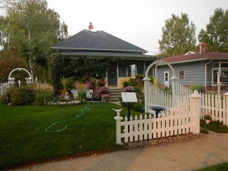
Carpenter Gustav Hoff purchased this lot in 1900, and sometime before 1920 he built this one-story, hipped roof house, likely as an investment. Robert “Shorty” Meredith and his wife Mary bought the residence in 1920 for $2,500. The . . . — — Map (db m164855) HM
Emmett and Anna Meyerhoff arrived in Forsyth in 1902 and quickly became prominent in Forsyth society. The assistant cashier of the newly organized Forsyth State Bank (later First National Bank), Meyerhoff was bank president by 1913. Anna was active . . . — — Map (db m165149) HM
A truncated hipped roof reflects this circa 1895 home’s modest beginnings. Carpenters used shorter, less expensive pieces of lumber for hipped roofs than for triangular-shaped gable roofs. Owners added a full-length front porch (since removed) and a . . . — — Map (db m164924) HM
The Northern Pacific Railroad surveyed along the north side of the Yellowstone River during the summers of 1871 and 1873, a time when the still-powerful Lakota controlled the unceded land south of the river. A a result, the survey crews required . . . — — Map (db m188744) HM
Scandal and intrigue surrounded the construction of Rosebud County Courthouse in 1914. Rosebud County citizens recognized the need for a new courthouse when they passed a $125,000 bond issue in 1911 to fund the building. To design a suitable . . . — — Map (db m164668) HM
“Remember the Flu epidemic” declared a notice advocating support for Rosebud County Hospital. In 1918 and 1919 influenza killed over 5,000 Montanans. Flu victims in Forsyth received care at the Masonic Hall, temporarily converted into an . . . — — Map (db m164791) HM
“May You Prosper Well in Your New Theatre with Your Steadfast Faith in Forsyth,” read one of the many ads that filled the August 28, 1930, Forsyth Times. Car and clothing merchants joined building contractors and suppliers in congratulating Anthony . . . — — Map (db m164689) HM
Northern Pacific Railroad engineer Thomas Sorenson and his wife Hannah built this one-and-one-half-story residence circa 1910. That year the Norwegian immigrant couple lived here with their five children and two boarders, both of whom also worked . . . — — Map (db m164835) HM
Civil engineer Charles Taber helped survey the original Northern Pacific line through Forsyth in 1881. He must have liked what he saw because he soon returned to Forsyth, becoming the town’s first mayor after it incorporated in 1904. Taber purchased . . . — — Map (db m165047) HM
When General Terry, Custer and Gibbon met on the steamer Far West to coordinate the final plan of action against the hostiles, it was decided that the Indians were probably camped along the Little Bighorn. Custer was to lead the Seventh Cavalry to . . . — — Map (db m165235) HM
The history of Forsyth depends heavily on two men - Thomas Alexander and Hiram Marcyes - very different individuals yet both dedicated to creative and aggressive growth. Thomas Alexander began as a pioneer sheep, cattle and horse rancher and . . . — — Map (db m165231) HM
Small touches add elegance to this one-and-one-half-story Colonial Revival residence and matching garage. Particularly noteworthy are its overall symmetry, prominent eave returns, shingled gabled ends, and classical pillars supporting the hipped . . . — — Map (db m165143) HM
Symmetrical facades, conservative design, and the use of durable material, particularly stone and brick, typified small-town Montana bank buildings like this one, originally constructed in Vananda, seventeen miles northwest of Forsyth. In the days . . . — — Map (db m164685) HM
Dr. Arthur C. Wilson moved to Forsyth after graduating medical school in 1891. He worked as a surgeon for the Northern Pacific Railroad, as a medical examiner for insurance companies, and as the county health officer. Forsyth’s first resident . . . — — Map (db m165042) HM
Many a dogie * (not doggie - dudes please note) has been decorated with one of these famous Montana irons.
(Click on the photograph to enlarge it and have a closer look at the brands.)
* A dogie is a little calf who has lost . . . — — Map (db m164408) HM
In the years following the Korean War, tensions heightened between the United States and Soviet Union. To prevent a surprise communist attack, the U.S. Air Force established a network of radar stations to protect American air space. Using the most . . . — — Map (db m164493) HM
Founded in 1908, Ingomar became a hub of commerce when the Milwaukee Road Railroad completed its line across Montana. The community had no source of water and relied on the railroad to provide 22,000 gallon water tank cars each week for the town . . . — — Map (db m189089) HM
Founded in 1908, Ingomar became a hub of commerce when the Milwaukee Road Railroad completed its line across Montana. The community had no source of water and relied on the railroad to provide 22,000 gallon water tank cars each week for the town . . . — — Map (db m189095) HM
As hundreds of farmers and ranchers homesteaded the arid, treeless plains of northwestern Rosebud County, the townsite of Ingomar was platted along the tracks of the Chicago, Milwaukee & St. Paul Railway in 1912. That year, one teacher and a . . . — — Map (db m189103) HM
J. Abraham “Abe” Bookman came from Ireland with his wife, Anna, and brother-in-law, Simon Sigman. By 1912, they had settled in Ingomar, where Bookman operated the town mercantile and Sigman served as postmaster. The business was so prosperous that . . . — — Map (db m189091) HM
Completion of the “Milwaukee Road” brought hundreds of homesteaders to Ingomar during the 1910s. By 1914, wood-frame homes and a small commercial district proclaimed the town a permanent settlement. On July 2, 1914, the Ingomar Index announced that . . . — — Map (db m189093) HM
In the aftermath of the Rosebud and Little Bighorn battles, both Generals Terry and Crook withdrew to their respective base camps waiting for additional troops and supplies. Even though the commands were only about 100 miles apart, communication . . . — — Map (db m189247) HM
At noon on June 22, 1876, the Seventh Cavalry under the command of Lieutenant Colonel George Armstrong Custer began its ill-fated march to the Little Bighorn near this location.
General Alfred Terry, having ordered a parade review send-off for . . . — — Map (db m189167) HM
At noon, on June 22, 1876, Lt. Colonel George Armstrong Custer's command broke camp along the Yellowstone River, passed in review of General Terry and Colonel Gibbon, and marched to the mouth of Rosebud Creek. The Seventh Cavalry then proceeded . . . — — Map (db m189172) WM
In 1886, ranchers buried near here what many believe to be the remains of Private Nathan Short, Co. C, 7th U.S. Cavalry. Short was believed to be carrying a message from General Custer at the Battle of the Little Bighorn, 70 miles S.W, of this . . . — — Map (db m313337) HM WM
Wherever you are in Montana, you stand in the pathway of Lewis and Clark. Their 1804-1806 expedition was a grand adventure to investigate the people and resources of the newly acquired Louisiana Purchase and to seek a navigable passage across the . . . — — Map (db m164417) HM
A few days after the Custer disaster on June 25, 1876, General Alfred Terry moved the decimated Seventh Cavalry to Fort Pease on the Yellowstone waiting nearly a month for additional troops and supplies.
By late July, the steamboats contracted . . . — — Map (db m164626) HM
From July 28, 1806, when William Clark passed Rosebud Creek on his way down the Yellowstone, this river valley has served as one of the major avenues for development and trade in eastern Montana. Innumerable trappers and traders followed Clark's . . . — — Map (db m164409) HM
In June 1876, the column of General John Gibbon and Lieutenant Colonel George Armstrong Custer, both under the command of General Alfred Terry, met near here at the mouth of Rosebud Creek aboard the steamer Far West. They were under orders to . . . — — Map (db m164624) HM
Beginning in early May, 1876 when the Lakota ran off about thirty horsed belonging to the Crow scouts, patrols from the Montana Column reported Indian sightings almost every day from the Big Horn River on down to Rosebud Creek. All signs indicated a . . . — — Map (db m164542) HM
From its origins as a railroad siding established by the Northern Pacific in 1882, Rosebud grew into a bustling homesteading community. The town boasted 300 residents when Fred and Mary Mefford arrived from the Midwest in 1896, bringing with them a . . . — — Map (db m164619) HM
About 65 million years ago, the inland sea receded as the Rocky Mountains rose, pushing the shoreline further east. Great rivers meandered through the coastal plain in a warm and humid climate, depositing sediment which would later become known as . . . — — Map (db m164492) HM
When the Dakota Column arrived at the confluence of the Powder River and the Yellowstone, General Alfred Terry wanted to be certain that the Lakota had not moved south and east even though Gibbon's scouts had already located the big village on the . . . — — Map (db m189245) HM
Children first attended school in a log cabin at this site in 1882, the year the Northern Pacific Railroad completed its line through the Yellowstone Valley. The railroad brought growing numbers of homesteaders, and in 1904 the community replaced . . . — — Map (db m165242) HM
As late as mid-June 1876, the military still considered Tullock's Creek as a possible location for the big Indian village even though most of the planning by General Terry and Custer a few days prior to the battle focused on the Little Big Horn . . . — — Map (db m165443) HM
Fort Pease was established in June of 1875 a few miles below the mouth of the Bighorn by Bozeman businessmen speculating that the fort would serve as the head of steamboat navigation on the Yellowstone.
For much of the winter of 1875-76, the . . . — — Map (db m165326) HM
Montana's small towns have traditionally been places where people by supplies and services, socialize, and ship their products to markets on the railroads or highways. Hysham is typical of those many rural communities scattered across this great . . . — — Map (db m165442) HM
One of the most famous trappers of the Rocky Mountain fur trade era was Jedediah Smith, who came west with St. Louis trader William Ashley in 1822. He spent his first winter in Montana at the mouth of the Musselshell River about 100 miles northwest . . . — — Map (db m165328) HM
One of the most famous trappers of the Rocky Mountain fur trade era was Jedediah Smith, who came west with St. Louis trader William Ashley in 1822. He spent his first winter in Montana at the mouth of the Musselshell River about 100 miles . . . — — Map (db m165329) HM
An optimistic, cheerful nature and keen sense of humor helped make legislator, contractor, and engineer David Manning instrumental in getting Montana “out of the mud.” A champion of Montana’s rural communities, Manning initiated significant . . . — — Map (db m165324) HM
Custer's first skirmishes with the Lakota occurred along the Yellowstone River during
the summer of 1873. At this time the Seventh Cavalry was assigned to Colonel David Stanley command to protect Northern Pacific railroad surveyors operating on the . . . — — Map (db m189442) HM
A sense of community and a place to gather were essential in homesteading settlements like Sanders. In 1910, the area’s residents rallied together to build a club house on this site. Each donated $15 or its equivalent in labor, and the building, . . . — — Map (db m165323) HM
When William Clark passed through this area on July 27, 1806, he described "estonishingly noumerous" bison and elk as well as his last glimpse of the snow-clad Big Horn Mountains. Most importantly, his report of abundant beaver "sign" quickly drew . . . — — Map (db m165322) HM
Harold G. Clark and Orlando Burgess, owners of the Clark Hardware Company, constructed this one-story brick and stucco commercial building in 1916. Representative of the period of Wibaux’s major economic development, it originally housed the . . . — — Map (db m163449) HM
Wherever you are in Montana, you stand in the pathway of Lewis and Clark. Their 1804-1806 expedition was a grand adventure to investigate the people and resources of the newly acquired Louisiana Purchase and to seek a navigable passage across the . . . — — Map (db m163384) HM
In 1876, this was strictly buffalo and Indian country. From 1876 to 1881, the U.S. Army rounded up the Indians and forced them onto reservations while buffalo hunters cleared the range for the cattle boom of the Eighties.
Pierre Wibaux ran one of . . . — — Map (db m163386) HM
In 1876 this was strictly buffalo and Indian country, There wasn't a ranch between Bismarck, North Dakota and Bozeman, Montana. But the U.S. Cavalry rounded up the hostile Indians from 1876 and 1881 and forced them onto reservations while the . . . — — Map (db m163389) HM
Constructed during Wibaux’s transition period from a cattle town into an agricultural center, this Queen Anne commercial style building originally housed the Smith Saloon. Partners William H. Smith, John R. Cornell, and W. H. North built the saloon . . . — — Map (db m163448) HM
Dismayed that his son’s adoptive home had no Catholic Church, Frenchman Achille Wibaux instructed Pierre to build one here. The rancher contributed $2,000 for the construction of this wood-frame, vernacular Gothic Revival structure. It was built in . . . — — Map (db m163451) HM
Montana is famous for its dinosaur fossils. Paleontologists have discovered seventy-five different species of dinosaurs in Montana, more than any other state in America. The oldest dinosaur fossils are found in rocks of the Jurassic Period, which . . . — — Map (db m163385) HM
From its roots as a pre-1900s cattle town to a farming community after the turn of the century, Wibaux well illustrates the transformation borne by many small Montana towns. This historic district reflects the high point of the town’s influence as . . . — — Map (db m163388) HM
Pierre Wibaux, scion of a distinguished French textile family, arrived here at the settlement of Mingusville in 1883, establishing a cattle ranch about 12 miles north. His herds fared well during the devastating “Hard Winter of 1886-1887,” after . . . — — Map (db m163387) HM
252 entries matched your criteria. Entries 201 through 252 are listed above. ⊲ Previous 100