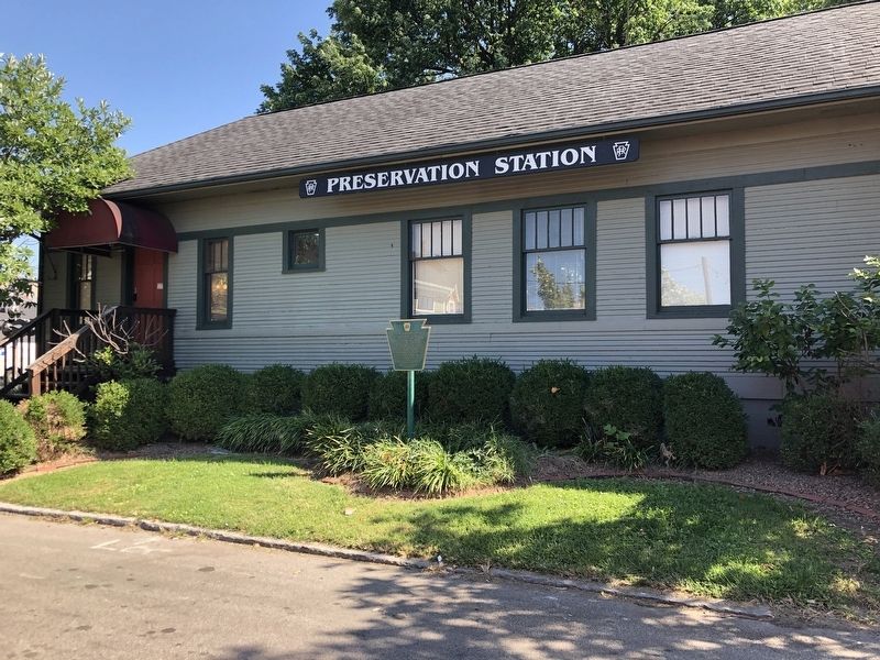
In 1929, the Pennsylvania Railroad built a station on Mitchell Avenue to serve as a freight and passenger depot for Jeffersonville and Clarksville.
During the 1937 flood, many of those displaced by the flood waters were taken north by train from . . . — — Map (db m206915) HM
Jeffersonville is named for President Thomas Jefferson, who had a profound influence on the city. As a Virginia legislator, Jefferson was a strong supporter of General George Rogers Clark's Illinois campaign from 1778 to 1779, which resulted in the . . . — — Map (db m241638) HM
Thomas Jefferson was born on April 13, 1743 in Shadwell, Virginia. He was a draftsman of the U.S. Declaration of Independence; the nation's first secretary of state (1789-94); second vice president (1797-1801); and as the third president . . . — — Map (db m245086) HM
Created in 2004 to commemorate the restoration of the Jeffersonville Carnegie Library, the Timeline reflects 2,500 years of contributions to the liberty and dignity of man. The has reliefs showcase portraits of history's legends of democracy and . . . — — Map (db m241637) HM
Located on 10th Street, the Jeffersonville Quartermaster Depot was built 1871-74 on land donated by the city to the Federal government.
It served from the Indian Wars of the 1870s through the Korean War and made many contributions to America, . . . — — Map (db m186827) HM
In Honor of
those who
Served
( Bronze Plaque )
United Spanish War Veterans
Veterans of Foreign Wars
The American Legion
Dedicated May 30, 1955 — — Map (db m46730) WM
The first Methodist sermon was preached in Indiana in 1802. A Methodist circuit rider first preached in Jeffersonville in 1803.
Our congregation grew out of that circuit, which was served by Peter Cartwright in 1804. There was no regular meeting . . . — — Map (db m206949) HM
Named in honor of
Luther Fairfax Warder
Mayor of Jeffersonville, six (6) terms
(1875 – 1883 ) – • – (1887 – 1891)
He converted the small town into a prosperous, progressive city, was foremost in bringing the . . . — — Map (db m46767) HM
Many "cafes" in the 1930's were a front for what was really happening within. The gambling in Clark County goes as far back as 1809 when Major John Harrison developed the Jeffersonville Springs. It was about a mile and a half north of Jeffersonville . . . — — Map (db m241649) HM
Denton Floyd Real Estate Group formerly the Masonic Temple has been placed on the National Register of Historic Places by the United States Department of the Interior — — Map (db m241857) HM
Was born in Clark Co., Ind. Appointed colonel of the 22nd Indiana Infantry. After promotion to brigadier general for service at Pea Ridge, he saw action at Corinth, Murfreesboro, and Chickamauga and the Atlantic Campaign. — — Map (db m161455) HM
“Lest We Forget”
In honor of the courageous men and women who served their country in the Korean War and in memory of those who Sacrificed All.
PVT Robert E. Landreth, Jr.
Oct. 4, 1951
PFC Thomas K. Jenkins
July . . . — — Map (db m46699) WM
Dedicated to those from this community who so courageously served and gave their lives. They did so with unselfish Honor and Patriotism. May God bless them.
PFC Wm. Gary Smith • USMC 02/21/68
SGT. Willard Skaggs, Jr. • USA . . . — — Map (db m46698) HM
( Upper Section )
They lived to bear their Country’s
arms and died to save it’s Honor.
Sgt Charles W. Snider • 11-4-43
Pfc Lester J. Beyl • 1-31-44
S/Sgt William J. Summers, AAF • 3-8-44
Sgt Kenneth N. Broady • . . . — — Map (db m46721) WM
These Civil War Cannons
were rededicated after
restoration by the
American Legion Post #2
Brazil, Indiana
on May 30th, 1998 by
Commander Thomas W. Owen — — Map (db m18910) WM
County formed by Indiana General Assembly 1825; named for national statesman Henry Clay. First county seat at Bowling Green; had three courthouses: first built 1827 was two-story log structure; second and third built 1839-1840 and 1852-1853 were . . . — — Map (db m18883) HM
Jimmy Hoffa was born in Brazil, Indiana in 1913. His family struggled with poverty, inspiring him to become an organized labor leader during the Great Depression. He became active in the International Brotherhood of Teamsters in the 1930s and served . . . — — Map (db m238479) HM
(On Stone Bench)
To Keep forever living the freedom for which they served
we dedicate this symbol to those men and women who served in Vietnam.
(Left - Bronze Plaque)
Dedicated to the memory of these men who gave . . . — — Map (db m18912) HM
Brazil, just like her sister US 40 communities, prospered due to its location on the National Road. With the 1926 designation of the National Road as US 40, Brazil instantly became linked with the rest of the nation. Almost every raw material, . . . — — Map (db m233271) HM
( Center Panel )
Clinton County
War Memorial
All Gave Some.
Some Gave All.
Dedicated to All
Clinton County
Veterans
( Left - Large Panel )
Civil War * 1861 - - 1865
( Row One )
Wm. H. Abbott • Alfred R. . . . — — Map (db m21436) WM
Dedicated to the distinguished Air Force Generals from Clinton County
Brigadier Generals •
James W. Lucas •
James P. Ulm
Lieutenant Generals
Jay W. Kelley •
James F. Record — — Map (db m232384) WM
Hall of Famer Everett Case, known for his basketball strategies and promotion of the sport, began his high school coaching career at age 19. After stints at Columbus and Smithville, he coached Frankfort for 17 seasons starting in 1922. He led his . . . — — Map (db m238480) HM
Old Stoney was built in 1892 and served as the Frankfort High School. On February 24, 1922 there was a fire that completely gutted the building, leaving only the four walls. Using the original walls, the building was rebuilt and reopened on . . . — — Map (db m232389) HM
( Top has Insignia of the "Navy Club U.S.A." )
This memorial is erected to
revere, honor, and perpetuate
the memory of our departed Shipmates
Roy E. Boggess
Ship No. 11 — — Map (db m21430) WM
(Upper - Bronze Plaque:)
This Tablet Is Dedicated
To The Memory Of
The Revolution Soldiers
Buried in
Clinton County
Captain Harmon Aughe •
John Applegate •
William Carter •
Thomas Harris •
John Reed •
Frederick . . . — — Map (db m21438) WM
Captain Winfield Scott Paris piloted riverboats for 45 years, including many of the famous steamboats and paddlewheelers that navigated the Ohio River.
Captain Paris, born May 20, 1848 in Kentucky to Dabner Cosby and Mary ReynoldsParis, was one . . . — — Map (db m207102) HM
Chert and aragonite were mined prehistorically. Land containing Wyandotte and Saltpeter Caves was purchased by Levi Brashear on September 30, 1810 for saltpeter mining and by Dr. Benjamin Adams on December 27, 1815 for epsomite mining. — — Map (db m207097) HM
Founded 1818 by Seth and Zebulon Leavenworth. Ohio River port for keelboats, flatboats, packets. Shipped pork, spirits, produce, corn, lumber, etc. Manufactured skiffs, flatboats, pearl buttons. Crawford County seat, 1843-c. 1895, when "stolen" by . . . — — Map (db m207137) HM
This town of Leavenworth was mainly known for two things, skiffs and buttons. In 1814, Zebulon Leavenworth laid out the town here because of the large fresh water spring at the base of the hill.
Two years later, Daniel Lyon had set up a boat . . . — — Map (db m207098) HM
Construction of locks and dams on the Ohio began in Louisville with a canal around the Falls of the Ohio, a major obstacle to boat traffic, in 1825. The Louisville and Portland Canal was privately financed, and completed in 1830. Constructed by . . . — — Map (db m207101) HM
This area has been inhabited continuously by humans for 12,000 years, American Indians hunted and camped here. Later, they settled in villages and cultivated native crops.
Then the settlers came, clearing and burning the land, In 1899 Indiana led . . . — — Map (db m207099) HM
Button making was once big business in this area. There were 14 local species of mussels used for buttons. Today most are gone and some are extinct.
The 1910 Census of 166 families in Leavenworth showed 32 men worked as button-cutters, 4 were . . . — — Map (db m207100) HM
Discovered September 6, 1883 by Blanche & Orris Hiestand who descended into the first room. The following Sunday, Mitch Stewart and friends explored the main passageways. The next day, local residents descended in mass on the cave. Owner Samuel . . . — — Map (db m70554) HM
A canal from Terre Haute to Evansville authorized 1846. Maysville Division along White River was over 23 miles long from Newberry through Owl Prairie (now Elnora) to Maysville; part of it paralleled what is now S.R. 57. Contracts were let June . . . — — Map (db m23203) HM
This flag continues to fly in memoriam gratitude to all community residents- kin and friend- for loyal service in the United States military.
All gave some, some gave all.
May God bless and keep them. — — Map (db m176088) WM
Born in Odon, on July 17, 1889, Joseph Crook Dawson was one of the most acclaimed “Daredevils of The Speedways”, during the formative years of auto racing in this country. His most memorable accomplishment came in 1912, when he gained . . . — — Map (db m176080) HM
Dedicated to all Odon Indiana and surrounding area veterans.
In honor and memory of our men and women in our armed forces who rendered service to our country during wartime and peacetime; at home and overseas. We must never forget those who . . . — — Map (db m99101) WM
Platted in 1846 by John Hastings; town named Clarksburg reportedly after George Rogers Clark; post office name was Clark’s Prairie, 1858-1881. Both names changed to Odon, 1881; Odon incorporated, 1885. By tradition, name Odon coined by combining . . . — — Map (db m99006) HM
Mission Revival Style depot, built 1906, restored 1990; part of Washington Commercial Historic District. Link to city's trading and industrial history, with substantial railroad machine shops and car works. Indiana stop of former President Dwight D. . . . — — Map (db m23214) HM
( Front - Center Panel )
This memorial is the tribute of the people of Daviess County to the memory of her Brave Soldiers who endured the hardships and fought the battles of 1861 to 1865 that the Union might be preserved
( Front . . . — — Map (db m23352) WM
Built on this site by civilians to protect approximately ten families during War of 1812. Named for landowner David Flora. Ten such forts were built circa 1811-1813 in area that became Daviess County. Area was Knox County, part of Indiana Territory . . . — — Map (db m23211) HM
Side A
Homer E. Capehart
Born into Indiana farming family 1897. Manufactured and pioneered sales of automatic phonographs, creating Capehart Corporation. Executive of Rudolph Wurlitzer Company 1933-1944. Organized 1938 Republican . . . — — Map (db m23206) HM
Residence of Robert C. Graham (1885-1967), pioneer glass, truck and auto manufacturer. Placed on the National Register of Historic Places in 1983 by the U.S. Department of the Interior because of its history and Prairie Style architecture. — — Map (db m23208) HM
Robert Cabel Graham (1885-1967), a native of Washington, Daviess County, with his brothers Joseph and Ray, contributed much to the economy and quality of life in that city, Evansville, and other towns. Glass factories, truck manufacturing, and . . . — — Map (db m98936) HM
In 1788 Congress granted 400 acres of land to each French family of this area. The tract was laid off in a square containing 160 separate plots. Additional grants were made affecting the five counties shown. — — Map (db m98935) HM
Aurora was laid out by Jesse L. Holman, trustee for the “Aurora Association for Internal Improvements” in 1819. Judge Holman was an early statesman, preacher, educator, and federal justice.
His son, U.S. Congressman William S. Holman served . . . — — Map (db m22105) HM
Ephraim Morrison Canoe at Aurora Landing •
Phillip Craig •
Capt. Marcus Colling •
Frank Klopp Horse Powered until 1918 then built the Etta Belle •
Van Landingham Etta Belle 1935 to 1936 • . . . — — Map (db m201077) HM
At the mouth of Hogan Creek, a short distance from here, Samuel Morrison, first white child born in the county—March 1, 1798. He was a gifted historian, inventor and map-maker, and drew a number of early maps published for Indiana. — — Map (db m206646) HM
Oldest church building in Aurora
Built in 1848
First Evangelical United Church of Christ
(First German Evangelical Protestant Church)
Founded 1874
has been placed on the
National Register of Historic Places
by the . . . — — Map (db m201091) HM
First Presbyterian Church
of Aurora
1844
has been placed on the
National Register
of Historic Places
by the United States
Department of the Interior — — Map (db m201098) HM
George Street
Bridge
1887
has been placed on the
National Register
of Historic Places
by the United States
Department of the Interior — — Map (db m201075) HM
Originally called Forest Hill, Hillforest was completed in 1855 for local industrialist and steamboat owner Thomas Gaff and his family. Emigrants from Scotland in 1811, the six Gaff children moved with their mother to Aurora in the 1840s and . . . — — Map (db m22125) HM
Legend has it that a ferry has operated near this location close to the mouth of Hogan Creek since 1802. The early ferries were powered by two horses walking on treadmills connected to a paddle wheel. The relationship between the small town of . . . — — Map (db m66904) HM
In memory of Col. Archibald Lochry and the members of the Westmoreland County, Pennsylvania Militia, who were defeated near here August 24, 1781 by Chief Joseph Brant and a coalition of Ohio Indians.
Killed
Col. Archibald Lochry • . . . — — Map (db m243827) WM
Lest we forget
Freedom is not free
This Korean War Memorial is dedicated to those men and women who answered the call to defend a country they never knew and a people they never met.
American Casualties
Killed in . . . — — Map (db m201090) WM
On the bank of the Ohio near here, opposite the Eagle Hotel, Pinkney James
built the steamboat Clinton 1823-24. The launching July 4, 1824 occasioned a great celebration and firing of cannon. — — Map (db m172613) HM
Hillforest
Following the Panic of 1837, Philadelphia Distiller Thomas Gaff and his brothers James and John sought new opportunity in southern Indiana, where in 1843 they established T. & J.W. Gaff & Co. Distillery in Aurora, Indiana. Soon . . . — — Map (db m201095) HM
"Dedicated with appreciation
to the
Veterans of Dearborn County
in honor of
those who gave their lives
and in memory of
those unaccounted for."
"You are not forgotten." — — Map (db m201089) WM
Architect William Tinsley of Cincinnati was known throughout the Midwest for his outstanding landscape designs, including Fountain Square in Cincinnati. Riverview Cemetery on the banks of the Ohio is a splendid example of his work. It is reflective . . . — — Map (db m222258) HM
Founded 1816 as Methodist Episcopal church
Present building constructed 1853
National Register of Historic Places 1994
Plaque in memory of Kenneth Pitts — — Map (db m222252) HM
Dr. George Sutton was prominent in
Aurora and far and wide. A forward
thinker, he was instrumental in bringing
an end to cholera which wiped put a
large percentage of the population in
the Ohio Valley in 1849. Dr. Sutton did
extensive study . . . — — Map (db m222254) HM
In memory of
Col. Archibald Lochry
and the members of the Westmoreland County, Pennsylvania
Militia, who were defeated near here August 24, 1781
by Chief Joseph Brant and a coalition of Ohio Indians.
Killed
Col. Archibald Lochry . . . — — Map (db m222279) WM
In memory of
Colonel Archibald Lochry
and his command who were massacred by the Indians and
British near this site August 24, 1781
Major Creacroft • Adjt Guthrie • Quartermaster Wallace • Capt. Campbell • Capt. Thomas Stokely • Capt. . . . — — Map (db m244090) WM
Col. Archibald Lochry and his regiment were defeated near this site on August 24, 1781 by Chief Joseph Brant and a coalition of Ohio Indians. — — Map (db m222287) HM
The large brick house nearby was Baker's Drovers Inn. This highway was the early state Manchester & Lawrenceburg Turnpike. A short distance from here was a Toll-Gate house. — — Map (db m143035) HM
From atop the schoolhouse, built in 1905, my voice has rung out - beckoning boys and girls to school: clanged out the call for help to fight fires: peeled forth joyous tunes of victory at wars ends: tolled the old year out and rung in the new. . . . — — Map (db m45993) HM
The town was laid out by Mathias Whetstone in 1830, and named for General James Dill, soldier in the War of 1812, first county recorder, a member of the Indiana 1816 Constitutional Convention, military associate and friend of Generals William . . . — — Map (db m45884) HM
On July 13, 1863, General Morgan's raiders looted a tavern in this Community. The Irish-born and agitated proprietor, James Murtaugh, protested, but without any luck. The tavern was an Inn with a dance hall on the second floor, which could be . . . — — Map (db m86240) HM
Second Oldest Roman Catholic Church in Indiana. Established 1824. Original log meeting house replaced by frame church in 1842. First brick edifice erected 1847. Present church dedicated October 19, 1879. — — Map (db m86237) HM
Side 1 Veterans of the Revolution buried here include Capt. Joseph Hayes, Lt. Solomon Hayes, and Thomas Miller, Sr. (PA), and Alexander Guard (NJ).
These patriots were among the first pioneers in the Northwest Territory. The Guard family . . . — — Map (db m149372) HM
Erected 1821 by early settlers as a Methodist Church on land donated by John Ewbank. Services were held continuously for more than 125 years. Maintained by endowment fund. — — Map (db m86236) HM
Built 1879
Original Design by Archibald M. Kennedy and Sons
Additional Structural Supports added in the early 1900s to sustain heavier loads produced by Guilford's rail commerce
Moved from Yorkridge Rd to park in 1960
Damaged by . . . — — Map (db m87947) HM
In 1922, both storefronts of this c. 1860 Italianate building housed a bakery. The ovens and baking rooms stretched to the alley. Earlier, other businesses occupied one storefront, including a confectionary and a book and stationary seller. — — Map (db m226656) HM
Abraham Lincoln made a famous pre-inaugural speech from his train platform near here Feb. 12, 1861, placing emphasis on the people's part in justice and good government. — — Map (db m20600) HM
Plaque One
Captain Samuel C. Vance
Our Founder Plaque Two
In memory of Captain Vance and the pioneer families who endured the hardships of flatboat travel to reach this place in the wilderness.
They lived in log cabins . . . — — Map (db m20604) HM
Formed by proclamation of Indiana Territorial Governor William Henry Harrison March 7, 1803. Named in honor of Major General Henry Dearborn, Secretary of War.
The third county to be formed, it was originally much larger. Its present boundaries . . . — — Map (db m22103) HM
In Honor of the Soldiers of
the American Revolution
buried in Dearborn County
Their names are recorded in the
County Auditor's Office
Book 29 - Page 250. — — Map (db m22174) HM
KOREAN WAR
This plaque is dedicated
in grateful remembrance
of the men of Dearborn
County who served their
Country in the Korean War.
In God we trust — — Map (db m22173) WM
Honor Roll
In Grateful remembrance of the boys of Dearborn County who gave their lives in the World War 1917 - 1918.
Erected by the Citizens of Dearborn County, Indiana
Walter Ahrens • Henry Fred Amm • Elmer Andrews • Hobart S. . . . — — Map (db m22203) WM
3978 entries matched your criteria. Entries 401 through 500 are listed above. ⊲ Previous 100 — Next 100 ⊳