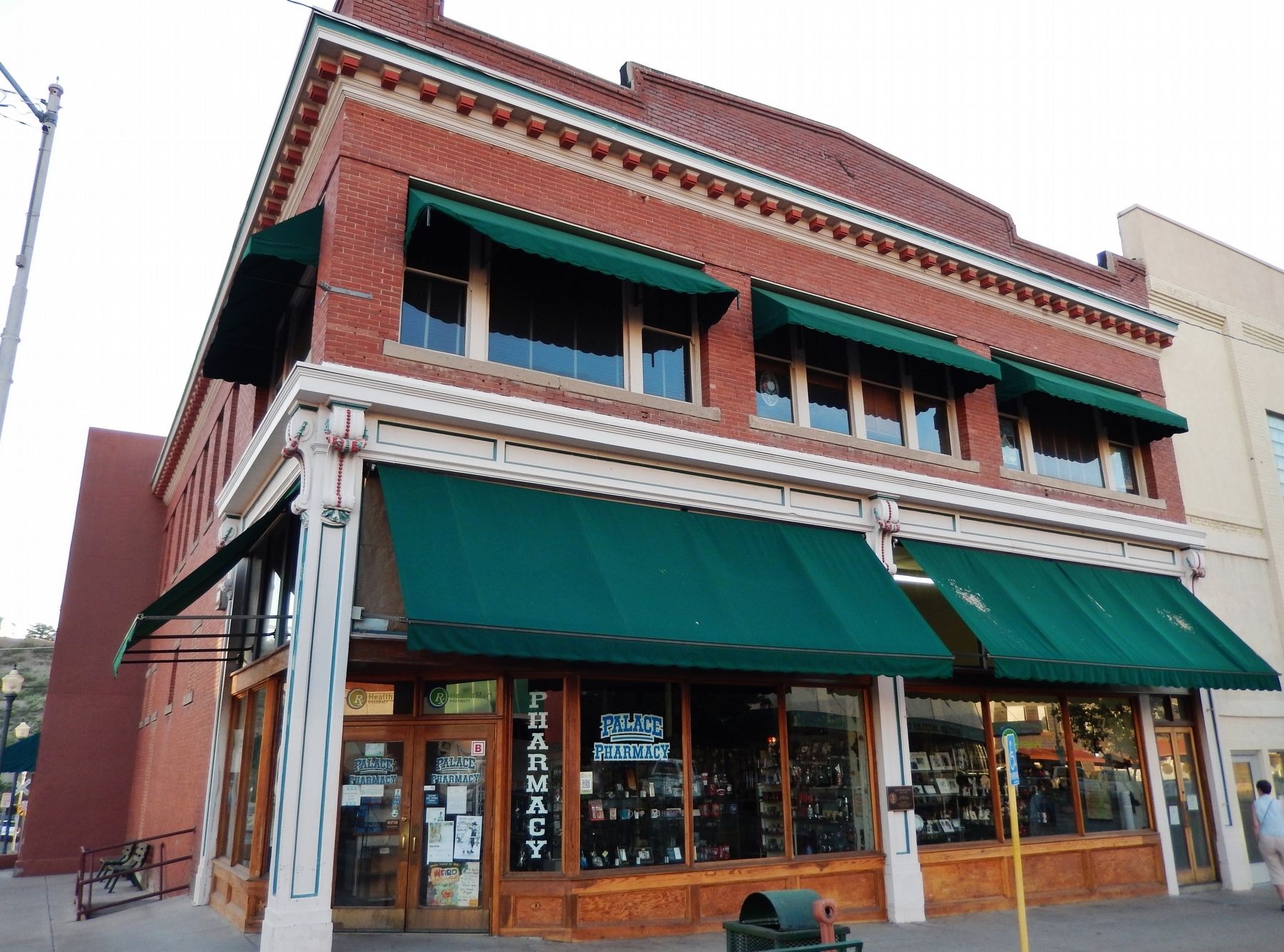
Welcome to Globe's Historic Downtown District, a designated Main Street City which once played a vital role in the saga of the Old West. We invite you to walk the steps of Historic Gila County Courthouse where you can enjoy the breathtaking . . . — — Map (db m28048) HM
You are standing next to the Cobre Valley Center for the Arts, located in the Old Gila County Courthouse. In 1905, stone masons working on Roosevelt Dam were contracted to build this imposing structure which is on the National Register of . . . — — Map (db m28193) HM
This pass was used by Kearny's Army of the West in a march to California in 1846. Guided by Kit Carson it was described in a journal of the trip as "Carson's Old Trail”. The pass led around the impassable canyon on the Gila River where . . . — — Map (db m28045) HM
George W.P. Hunt, Arizona's first Governor, arrived in Globe as a poor prospector. His first job was sweeping out a Saloon, but he eventually served four terms as Governor, beginning at Statehood in 1912. He campaigned on the back of a burro and . . . — — Map (db m67465) HM
This property
has been placed on the
National Register
of Historic Places
By the United States
Department of the Interior
Circa 1919 — — Map (db m67462) HM
Globe, Gila County, Arizona
Apache Warrior Stronghold
and Pioneer Home of
Hon. George W. P. Hunt
1859 – 1934
Member various Territorial Legislatures, President Arizona Constitutional Convention, Arizona's 1st, 2nd, 3rd, 6th, . . . — — Map (db m28047) HM
Colorful Arizona pioneer and faithful Gila County public servant. At intervals from 1885 to 1947, within the walls of three courthouses erected on this spot, he occupied various offices. His last office was Clerk of the Superior Court 1912 to 1947. . . . — — Map (db m28046) HM
Located along this road
McMillenville
Ghost Mining Camp
In 1874 native silver was discovered in what became the fabulous Stonewall Jackson Ledge. This discovery brought boom conditions that lasted less than 10 years. An Indian attack on . . . — — Map (db m36905) HM
Included in this historic copper mine are the Globe ledge silver claims. Discovered in 1873, the first to yield profitable ore in the Globe-Miami district. The Old Dominion included many other early claims. Production ceased in the 30s, due to . . . — — Map (db m67463) HM
John Henry Thompson, a noted Gila County pioneer, brought his bride, Carrie Louise Nash, to Globe to live in the house he had built on this site, one of the town's early adobe buildings. Thompson was active in mining, cattle ranching and the feed . . . — — Map (db m34119) HM
In 1916, Jakes Corner originally called Felton, started as a stage stop, on the Annie Hardt homestead.
As a pull out on the road to Globe, stages used to stop and wait as the occasional flooding Salt River receded. Annie Hardt had a vegetable . . . — — Map (db m48354) HM
In Remembrance of the Quasquicentennial of the Spanish-American War
To Spanish-American War Veterans of Gila County and the Woman's Relief Corps of Arizona who Helped in the War Effort
2023
Buckey O'Neill Camp No. 175 - AZ
Sons of . . . — — Map (db m278886) WM
This property
has been placed on the
National Register
of Historic Places
By the United States
Department of the Interior
Bullion Plaza
School
1923
— — Map (db m67493) HM
This wall is to honor the memory of all of the veterans who have served in the Armed Forces of this great nation, in war and in peace. They have placed themselves in harms way to serve a cause greater than themselves. Ensuring that the freedom we . . . — — Map (db m67472) WM
This property
has been placed on the
National Register
of Historic Places
By the United States
Department of the Interior
Soderman
Building
1917 -1921
— — Map (db m67474) HM
This historic mail trail is dedicated to the memory of the mail riders named below and unknown mail carriers that braved weather, rough terrain and the Verde River to deliver mail 52 miles from Camp Verde to Payson, Arizona from 1884 to 1914.
. . . — — Map (db m36063) HM
Dedicated
to
Firefighters
who made the
Ultimate Sacrifice
to protect our magnificent
Mogollon Rim Country
Date - Fire Name - Victim's Name - Remarks
6/15/61 - Roberts - Chuck Cochane - Pilot TBM Air Tanker
6/21/61 - . . . — — Map (db m67406) HM
In 1932 a log building named the Payson Hotel was built on this site. In 1954 it was remodeled, together with the building to the west, as the Ox Bow Inn and Saloon. The name comes from Oxbow Hill, the gateway to Payson, named when soldiers in the . . . — — Map (db m67403) HM
The Rim Country Museum complex is the site of the first headquarters for the Payson Ranger District, Tonto National Forest. The original buildings were placed here in 1907. The Ranger's family house is the second one, built in 1933. The ranger . . . — — Map (db m67407) HM
Shoofly Village Ruin is the remains of a large masonry and Jacal prehistoric community. It contains 80+ rooms and covers 4 acres. Between A.D. 1000 and 1200 as many as 250 people may once have lived inside its walls. The people made their living by . . . — — Map (db m67415) HM
On this strategic site, J.W. Boardman built a rock building and constructed a mercantile business. McLane Road, going north along the property, was the road to Pine and points north and west. The store was gutted by fire in 1938. Refrigerator . . . — — Map (db m67405) HM
The two-story Herron Hotel burned down in 1918 at this location. Subsequently a series of businesses were established on this block. Among them were Payson's first gasoline station, an ice cream parlor, barber shop, mercantile store, and finally the . . . — — Map (db m67404) HM
On June 25, 1990 a lightning caused fire entrapped ten members of the Perryville fire crew in this canyon, resulting in six fatalities. Before the fire was contained it had burned more than 24,000 acres and destroyed over 70 structures.
This . . . — — Map (db m28210) HM
The deadliest natural disaster in Arizona history occurred over Labor Day weekend in 1970 when a tropical storm named Norma swept north into Arizona and turned deadly releasing a downpour of heavy rain. One weather station measured nearly 12 . . . — — Map (db m157859) HM
These Trees Planted in Memory of the Firefighters Who Died in the Dude Fire June 26, 1990
Sandra J. Bachman • Joseph Chacon • Alex S. Contreras • James L. Denny • James E. Ellis • Curtis E. Springfield — — Map (db m28211) HM
In memory of
William H. Goettl
April 17, 1915 September 17, 1979
With his own sweat and love he restored Zane Grey's Cabin. Bill was an Arizona outdoorsman, conversationalist and pioneer in the air conditioning industry. A true man of . . . — — Map (db m157857) HM
An Ohio born dentist, Zane Grey spent many years under the Mogollon Rim, writing "To the Last Man" and a dozen other westerns with Arizona settings and characters. His prolific writings popularized the American cowboy as a taciturn, romantic . . . — — Map (db m67413) HM
This historic mail trail is dedicated to the memory of the mail riders named below and unknown mail carriers that braved weather, rough terrain and the Verde River to deliver mail 52 miles from Camp Verde to Payson, Arizona from 1884 to 1914.
. . . — — Map (db m67417) HM
The Pine Community Center Historic District is listed on the National Register of Historic Places. The historic buildings of the district are the LDS (Latter Day Saints/Mormon) Ward Chapel, built in 1915-1916, the Cultural Hall, completed in 1931, . . . — — Map (db m67416) HM
Veteran of the Civil War and for twenty years a leader of Scouts for the U.S. Army in Arizona Indian troubles. Was killed on this spot February 19th, 1907 by a rolling rock during construction of the Tonto Road. His body is buried in the cemetery at . . . — — Map (db m34114) HM
The Salt River begins high in the White Mountains as runoff from melting snow, finding its way into streams and creeks that eventually form the White and Black rivers. The confluence of the two rivers marks the beginning of the Salt.
Early . . . — — Map (db m34110) HM
Before dam modifications could begin, a $21.3 million bridge was built to relocate traffic off the top of Roosevelt Dam. Roosevelt Lake Bridge is the longest two-lane, single-span, steel-arch bridge in North America. The bridge, spanning 1,080 feet . . . — — Map (db m134161) HM
Over six million years ago, the mountains surrounding you were lifted skyward. As they rose, the land in between sank, creating the valley known as Tonto Basin.
Melting snow and summer rains drain from the vast Salt River watershed toward the . . . — — Map (db m34111) HM
Built by
The United States of America
Department of Interior
Bureau of Indian Affairs
Irrigation Service
Calvin Coolidge
President of the United States of America
Roy O. West Secretary of the Interior • Hubert Work Secretary of . . . — — Map (db m81530) HM
The Strawberry School is listed on the National Register of Historic Places. Built by pioneers in 1885, this one-room cabin provided elementary instruction to students until 1916. The building represents the effort to teach the "Three Rs" in rural . . . — — Map (db m35837) HM
One of the West’s Longest and Bloodiest feuds took
place here and around Pleasant Valley. The Grahams and
the Tewksburys had been in the cattle business and it
seems probable that they first fell out over the division of cattle they jointly . . . — — Map (db m78742) HM
Built of adobe bricks in 1876, this is the third oldest surviving building at Fort Apache. Originally the Adjutant's Office (administrative office) of the post, it also served variously as post headquarters, military Post Office, telegraph office, . . . — — Map (db m36799) HM
The Club House was constructed by the Bureau of Indian Affairs in 1930 to provide housing and kitchen facilities for unmarried teachers employed at the Theodore Roosevelt School. The building was later converted to a clubhouse for use by the school . . . — — Map (db m36784) HM
These ruins represent the last surviving enlisted men's barracks, on the east end of Barracks Row. Much like Officers' Row defined the north side of the Parade Ground, Barracks Row made up the south side. This adobe barracks was one of two . . . — — Map (db m209362) HM
Throughout the military history of Fort Apache, enlisted men were housed with their units to the south of Officers' Row. The first company quarters, completed in February 1871, were 18 by 20 foot log squad huts built in rows running north and south . . . — — Map (db m36807) HM
The Boys' Dormitory was constructed in 1932. Located on the east end of the fort's Parade Ground, it is on the site of earlier military structures including a telegraph office. Sandstone was quarried for the building's construction from a site . . . — — Map (db m36875) HM
An 1891 fire, sparked by a defective chimney and fanned by high winds, destroyed five sets of wood frame officers' quarters that had been constructed in this area between 1883 and 1886.
Using sandstone quarried just east of the Fort, these two . . . — — Map (db m36779) HM
A classic Victorian mansion, this building clearly represents some of the Army's architectural motivations. Recognizing the difficulties for officers and their families of being assigned to remote posts, the Army built homes such as this one to . . . — — Map (db m36782) HM
Built in 1889 to replace a smaller adobe structure, the Commissary Storehouse served as the Fort's food storage and distribution point until its closure in 1922. A solid building, the storehouse includes a stone cellar that extends three-fourth of . . . — — Map (db m36804) HM
This log cabin is the oldest surviving building at Fort Apache. The westernmost of a series of eight log cabins built in 1871 to form Officers' Row, this cabin was designated the Commanding Officer's Quarters. It was originally an 18 by 20 foot log . . . — — Map (db m36778) HM
During the first decade of the Theodore Roosevelt School, girls were housed in the old fort hospital. Since the old barracks that housed the boys was inadequate, a new boys' dormitory was scheduled for construction in 1931. Before that construction . . . — — Map (db m36878) HM
This stone guard house was built around 1891 to replace the earlier, bed-bug infested structure still standing about 300 feet to the west of this site. Placed near the original main entrance to the fort, this building provided housing for guards . . . — — Map (db m36805) HM
Constructed in 1888 in the architectural style of Fort Apache's Officers' Row, these residences housed junior officers or non-commissioned officers and their families.
Like other quarters on the east end of Officers' Row, these residences were . . . — — Map (db m36800) HM
This frame officer's quarters in the only one of seven built between 1883 and 1886 to have survived without significant modifications. Like many of the post's residences, it was built around a large central hallway that runs the length of the . . . — — Map (db m36794) HM
These three officers' quarters were constructed between 1883 and 1888 to house junior officers and their families. With clipped-corner porches and symmetrical front elevations, these quarters reflect the architectural style established by the . . . — — Map (db m36796) HM
The first guardhouse at Fort Apache was built of logs and located on this site. In 1876, this stone building – the second oldest surviving structure on the post – was constructed to replace the original log structure. It was replaced as . . . — — Map (db m36806) HM
This large open field between Officers' Row and the enlisted men's Barracks Row was used by the army for drill practice, training, and review. When called to action, troops would assemble here prior to departure. It also provided a prime location . . . — — Map (db m36781) HM
This stone cafeteria building was constructed in 1948-1949 to serve the students of the Theodore Roosevelt School. It is the last building constructed here that is part of the Fort Apache Historic District. Before the construction of this building, . . . — — Map (db m36877) HM
This house was constructed by the Bureau of Indian Affairs around 1930 to house Theodore Roosevelt School teachers and families. It deviates in style, though not in size, from the typical Officers' Row quarters.
Initially the house had a flat . . . — — Map (db m36803) HM
On January 24, 1923 an act was passed by Congress authorizing the Secretary of the Interior to establish and maintain an Indian boarding school on the site of Fort Apache. The first students were Dine' (Navajo) children brought from the Navajo . . . — — Map (db m36876) HM
Has been designated a
National Historic Landmark
This site possesses national significance
in commemorating the history of the
United States of America
1964 — — Map (db m36885) HM