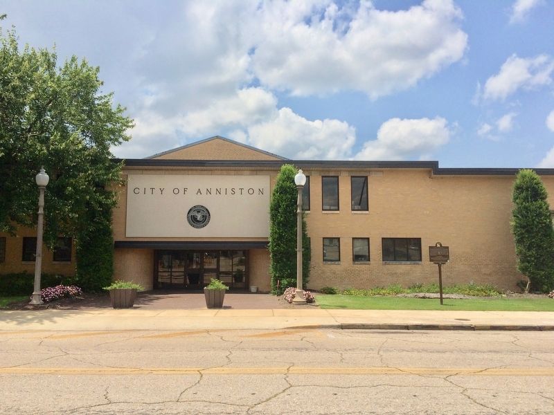
On Gurnee Avenue south of 12th Street, on the right when traveling south.
The Anniston City Commission, on May 16, 1963, established by resolution the Human Relations Council, consisting of five white men and four black men. The Council's purpose was to "make recommendations concerning human relations," and its members . . . — — Map (db m106627) HM
On Sterling Boulevard near Southeast 11th Avenue, on the left when traveling east.
Sheffield Colored School
Public education for Sheffield's black children began in 1889 in a framed building at E. 20th St. and S. Atlanta Ave. with Henry Hopkins as teacher. Professor Benjamin J. Sterling (1847-1941), a former slave, became . . . — — Map (db m193430) HM
Bull Connor ordered the fearless "Child Crusaders" to be blasted with high-pressure fire hoses, and he once again loosed the dogs on the young demonstrators. When the media finally exposed the nation to the cruel scene, President John F. Kennedy . . . — — Map (db m73019) HM
Near Tranquility Base, 0.5 miles west of Old Madison Pike NW, on the left when traveling west.
Neil Armstrong, Apollo 11 commander, spoke his famous words as he stepped onto the surface of the Moon.
On July 20, 1969, President John F. Kennedy's mandate that America go to the Moon was fulfilled - Apollo 11's lunar module Eagle . . . — — Map (db m85465) HM
On Monroe Street at Williams Avenue, on the right when traveling south on Monroe Street.
Tom Goodman Thrasher
August 4, 1916
December 19, 1999
-Grew up in Birmingham, Alabama
-Studied Engineering at the University of Alabama in Tuscaloosa
-Married the former Dorothy Wright of Belmont, Mississippi
-Served in the Army in North . . . — — Map (db m85611) HM
On St. Anthony Street west of North Scott Street, on the right when traveling west.
Side 1
On May 30, 1965, Vivian Malone, became the first African-American to graduate from the University of Alabama. To achieve admission at the all-White university, she was forced to confront then Governor, George C. Wallace, in what has . . . — — Map (db m111392) HM
Foster Auditorium is the site of the June 11, 1963, “stand in the schoolhouse door” by Governor George C. Wallace in defiance of a court order requiring The University of Alabama to admit African-American students Vivian Malone and James . . . — — Map (db m37917) HM
On 59th Avenue at Brown Street, on the left when traveling north on 59th Avenue.
USS Arizona (BB-39)
Launched June 19, 1915
Commissioned October 17, 1916
This memorial honors the human sacrifice and courage of every military veteran who defends the freedom of all Americans, regardless of the battlefront. This is . . . — — Map (db m40586) HM
On Cactus Forest Drive, 0.2 miles north of South Old Spanish Trail, on the right when traveling north.
The saguaro cactus before you owes its existence to the foresight of local residents. In the 1920s grazing and development threatened the saguaro's future. Saguaro forests began to disappear as mature cactuses were chopped to make way for new . . . — — Map (db m85355) HM
[Written on the initial marker, provided for context]
Our Constitution names the President of the United States the Commander in Chief of all the Armed Forces. Presidents who have served in our military are displayed on the following . . . — — Map (db m92423) HM WM
This plaque honors
John Fitzgerald Kennedy
President of the United States
Principal speaker at the
Charter Day ceremony
held in the stadium
March 23, 1962
Edmund G. Brown
Governor of California
Edwin W. Pauley . . . — — Map (db m152612) HM
Near Figueroa Street south of Exposition Boulevard, on the right when traveling south.
July 15, 1960, John F. Kennedy
accepted the nomination of the
Democratic party for President
at this approximate location.
"My fellow Americans, ask not
what your country can do for
you -- ask what you can do for
your country." . . . — — Map (db m238193) HM
On Scripps Terrace, on the right when traveling east.
In 1960 the state legislature authorized the California State colleges to grant honorary doctoral degrees to individuals who have made unusual contributions toward learning and civilization. On June 6, 1963 San Diego State College was the first of . . . — — Map (db m51099) HM
On Drumm Street at Market Street, on the right when traveling north on Drumm Street.
1874–1963.
This great poet was born in San Francisco, March 26, 1874. First child of William Prescott Frost Jr. and Isabelle Moodie Frost. He lived in seven houses here all east of Van Ness Avenue and North of Market Street. Upon his . . . — — Map (db m639) HM
On California Route 41 at Portola Road, on the left when traveling west on State Route 41.
Throughout history patriotic Americans have been drawn together to serve a cause greater than themselves. Some came because of common experiences. Most came because of common values. All came because they shared a dream.
The people who . . . — — Map (db m61431) WM
On September 28, 1963, less than two months before his assassination, President John F. Kennedy made his last official visit to California to dedicate Whiskeytown Dam. The dedication completed the Central Valley Project, a 500-mile-long water . . . — — Map (db m63356) HM
On Main Street at Library Place, on the right when traveling north on Main Street.
Marian Anderson was born in Philadelphia on February 27, 1897. Although her early musical training was sporadic, a scholarship enabled her to study abroad under distinguished teachers.
When Arturo Toscanini heard her perform at the Salzburg . . . — — Map (db m193431) HM
On Atlantic Street at Main Street, on the right when traveling north on Atlantic Street.
Freedom Shrine
Created by the National Exchange Club
to strengthen citizen appreciation
of our American heritage
Presented by the Exchange Club of Stamford
Dedicated June 14, 1979
[ Reproductions of historic American documents are . . . — — Map (db m38610) HM
On deKoven Drive at Court Street, on the right when traveling south on deKoven Drive.
This bell was originally part of the clock located in the old city hall tower at 255 Main Street. In 1958, the municipal building was erected at this site.
In a joint venture, the city administration appropriated and various citizens donated . . . — — Map (db m98555) HM
On West Main Street at Prospect Street, on the right when traveling west on West Main Street.
"I must say, having been here at three o'clock in the morning and now at six-thirty in the evening, that Waterbury is either the easiest city in the United States to get a crowd in, or it has the best democrats in the United States. In any case, . . . — — Map (db m36066) HM
On 16th Street Northwest south of Euclid Street Northwest, on the right when traveling south.
During the Civil War (1861-1865), the Union Army Carver Hospital and barracks occupied Meridian Hill. The facilities attracted African American freedom seekers looking for protection and employment. By war’s end, a Black community had put down . . . — — Map (db m130705) HM
On Ward Circle Northwest east of Nebraska Avenue Northwest, on the right when traveling north.
Beyond Ward Circle to your left is the campus of American University, chartered by Congress in 1893. Methodist Bishop John Fletcher Hurst guided the university’s development as a center for training future public servants. With its schools in . . . — — Map (db m130932) HM
On Nebraska Avenue Northwest south of Van Ness Street Northwest, on the left when traveling south.
When NBC radio and television and its local affiliate,
WRC, moved to these new headquarters in 1958, the average TV screen measured 12 inches. The facility opened with six studios—three TV and three radio. Soon history happened here.
. . . — — Map (db m47866) HM
On 16th Street Northwest near Kalmia Road Northwest, on the right when traveling south.
Frank D. Reeves (1916–1973), a lawyer and civil rights activist, was part of the team that shaped the 1954 Brown v. Board of Education Supreme Court case outlawing school segregation. He advised Senator John F. Kennedy on minority affairs . . . — — Map (db m24679) HM
On Jackson Place Northwest at H Street Northwest, on the right when traveling south on Jackson Place Northwest. Reported permanently removed.
When the historic character of Lafayette Square was severely threatened during her husband’s administration, it was preserved with the vision and dedicated efforts of Jacqueline Bouvier Kennedy. This view from Decatur House is dedicated to . . . — — Map (db m32135) HM
On Jackson Place Northwest at H Street Northwest, on the right when traveling south on Jackson Place Northwest.
When President John F. Kennedy took office in 1961, the historic residences surrounding Lafayette Square were facing near-certain demolition for new office buildings. It was through the vision and dedicated efforts of First Lady Jacqueline Kennedy . . . — — Map (db m206475) HM
On Jackson Place Northwest south of H Street Northwest.
[Sketch of townhouses along Jackson Place, NW - the western border of Lafayette Square - behind which the White House Conference Center was constructed in the 1960s & 70s.]
Dedicated to those whose spirit and vision helped to preserve . . . — — Map (db m32421) HM
On Rhode Island Avenue Northwest at St. Matthews Court Northwest, on the left when traveling east on Rhode Island Avenue Northwest.
The Cathedral of
St. Matthew the Apostle
has been placed on the
National Register
of Historic Places
by the United States
Department of the Interior
Construction begun 1893, dedicated 1913.
Built to replace the . . . — — Map (db m32131) HM
On 14th Street Northwest north of Constitution Avenue Northwest (U.S. 1/50), on the right when traveling north.
The Ronald Reagan Building and International Trade Center honoring the 40th president, filled the last open space in the Federal Triangle. When former First Lady Nancy Reagan dedicated it in 1998, the redevelopment of this area of . . . — — Map (db m57205) HM
On Pennsylvania Avenue Northwest east of 13th Street Northwest, on the right when traveling east.
Senator
Daniel Patrick Moynihan wrote the Guiding Principles for Federal Architecture and the proposal for the redevelopment of Pennsylvania Avenue, which President John F. Kennedy proclaimed on May 23, 1962.
He served in the . . . — — Map (db m49586) HM
On 21st Street Northwest south of H Street Northwest, on the left when traveling south.
This plaque commemorates the seminal research of the renowned Dr. Edward Teller during his tenure at The George Washington University.
By agreement with GW Professor George Gamow, President Cloyd Heck Marvin invited the Hungarian-born Teller to . . . — — Map (db m47326) HM
On Q Street Northwest just west of 34th Street Northwest, on the right when traveling west.
On Sunday, May 13, 1951 (Mother's Day), a third term congressman from Massachusetts, John F. Kennedy, met his future wife, Jacqueline Bouvier at a dinner party in this Georgetown townhouse hosted by their mutual friend and reporter, Charles . . . — — Map (db m199527) HM
On Dent Place Northwest at 34th Street Northwest, on the right when traveling east on Dent Place Northwest.
At the turn of the 19th century, Yarrow Mamout, a slave granted his freedom a few years earlier, amassed $200 and purchased a piece of property and a house at what is now 3330-3332 Dent Place. Born in West Africa, Yarrow worked for 50 years for . . . — — Map (db m112139) HM
On Wisconsin Avenue Northwest at N Street Northwest, on the right when traveling south on Wisconsin Avenue Northwest.
Among the first businesses in historic Georgetown were its inns and taverns. They not only offered food, drink and lodging, but were focal points of community life where political debate and civic meetings took place and business deals were made. . . . — — Map (db m121195) HM
On N Street Northwest at 36th Street Northwest, on the right when traveling west on N Street Northwest.
"Holy Hill," the site of Georgetown University, the Convent of the Visitation, and Holy Trinity Church, has been the center of Catholic spiritual life in the nation's capital since its beginnings in the late-18th century.
Shortly after the . . . — — Map (db m112129) HM
On 36th Street Northwest north of N Street Northwest, on the left when traveling south.
[Rendering of the Seal of the President of the United States]
In Memoriam
Within the hallowed walls of the historic Church of the Holy Trinity in
Georgetown, D.C. worshipped the late President of the United States, John
Fitzgerald . . . — — Map (db m193433) HM
On 34th Street Northwest at O Street Northwest, on the right when traveling south on 34th Street Northwest.
Throughout its history, Georgetown has been at the center of Washington’s political and social life. As early as 1789, Washington and Jefferson met in a local tavern to plan the new capital. The Marquis de Lafayette, who fought with us in the . . . — — Map (db m97757) HM
On N Street Northwest at 33rd Street Northwest, on the left when traveling west on N Street Northwest.
In the cold winter of 1960-61
this house had an important role
in history. From it was flashed to
the world news of pre-Inaugural
announcements by
President John F. Kennedy
Presented by
The grateful newsmen who were
given . . . — — Map (db m112127) HM
On N Street Northwest at 30th Street Northwest, on the right when traveling west on N Street Northwest.
Hidden behind the grand houses of N Street — and many others large and small — are tranquil walled gardens with brick terraces, old shade trees, lily ponds, swimming pools, and a tennis court or two.
Behind you stands the Edes Home, . . . — — Map (db m113641) HM
On Logan Circle Northwest west of 13th Street Northwest when traveling west.
Belford V. Lawson (1909–1985) and Marjorie M. Lawson (1912–2002) were prominent attorneys. Mr. Lawson helped win landmark civil rights cases before the U.S. Supreme Court, including New Negro Alliance v. Sanitary Grocery (1938) and . . . — — Map (db m79362) HM
On Pennsylvania Avenue Northwest at 7th Street Northwest, on the right when traveling west on Pennsylvania Avenue Northwest.
The broadest and most important street in Pierre L'Enfant's Plan of 1791 for the nation's capital connects to the Capitol and the White House. Pennsylvania Avenue. Almost every American knows its name. Almost every visitor to the Washington . . . — — Map (db m57215) HM
On Pennsylvania Avenue Northwest west of 7th Street Northwest, on the right when traveling west.
"Any man who may be asked…what he did to make his life worthwhile, I think can respond with a good deal and pride and satisfaction: 'I served in the United States Navy.'" — President John F. Kennedy
On 7th Street Northwest at O Street Northwest, on the right when traveling north on 7th Street Northwest. Reported damaged.
Across the intersection stands the tower of O Street Market. When the market opened in 1881, and refrigerators had not been invented, people shopped here daily for everything from live chickens to fresh tomatoes. At first the vendors were . . . — — Map (db m130893) HM
Near Indian Lane Northwest north of Rockwood Parkway Northwest, on the left when traveling north.
Delivered by
John Fitzgerald Kennedy
President of the United States 1961-63
This address contained the policy declaration which led to the treaty banning nuclear weapon tests in the atmosphere, outer space, and under water signed in . . . — — Map (db m130034) HM
On Pennsylvania Avenue Southeast east of 7th Street Southeast, on the right when traveling east.
America’s oldest navy and marine installations are just blocks from where you are standing.
This is the northern edge of a Capitol Hill community shaped by the presence of the U.S. military. Eighth Street is its commercial center. The . . . — — Map (db m130729) HM
On Martin Luther King Jr. Avenue Southeast north of Stanton Road Southeast, on the right when traveling north.
In the early evening of November 22, 1963, a clutch of people stood forlornly on this bridge spanning Suitland Parkway. They awaited the procession carrying the body of slain President John F. Kennedy from Andrews Air Force Base to Bethesda . . . — — Map (db m130723) HM
On 7th Street Southwest south of G Street Southwest, on the left when traveling south.
Dr. Dorothy Height worked to advance women's, civil, and human rights with many of our nation's leaders. How many can you recognize?
Back
Dr. Dorothy Height
Has lived at 700 7th Street, SW since 1983. As President Emmerita . . . — — Map (db m112797) HM
On 6th Street Southwest east of Water Street Southwest, on the right when traveling east.
More than 50 years after it opened in 1964, Tiber Island stands as a tribute to the idealism that marked the new Southwest. Planners hoped the neighborhood's mid-20th-century modern architecture, mix of high- and low-rise structures, balance . . . — — Map (db m130607) HM
On Independence Avenue Southwest, 0.1 miles west of Lincoln Memorial Circle Southwest, on the right when traveling west.
As an important link between the National Mall and Arlington National Cemetery, the bridge itself is a memorial to those who have given their lives for their country. As the ceremonial entrance to Arlington National Cemetery, numerous dignitaries, . . . — — Map (db m140991) HM
Vc = Ro √(g/Ro+h)
"… one of the most complex tasks ever presented to man in this country -- the achievement of manned flight in orbit around the earth." - John F. Kennedy
Thirty-Fifth President of the United States
This marker . . . — — Map (db m69963) HM
On W. Monroe St., 0.1 miles west of N. Laura Street when traveling west.
In Memory Of
John Fitzgerald Kennedy
1917-1963
Thirty-Fifth President Of The United States
1961-1963
This memorial erected by the Jacksonville
Building and Construction Trade Council
to commemorate John F. Kennedy’s . . . — — Map (db m138337) HM
Near U.S. 301, 0.2 miles south of East Dr. Martin Luther King Jr. Boulevard, on the right when traveling south.
The Cuban missile crisis — known as the October crisis in Cuba and the Caribbean crisis (Russian: к ариский кризис, tr. Karibskiy krizis) in the USSR — was a . . . — — Map (db m193986) HM WM
Near North Ashley Drive north of East Whiting Street, on the left when traveling north.
3 F-80 Shooting Stars Fly to Korea In February 1951, MacDill's 307th deployed to Okinawa for the Korean conflict. It was one of the first units to move its fighting forces overseas. MacDill During Vietnam During the Vietnam conflict, . . . — — Map (db m34149) HM
On NW 14th Street at NW 2nd Avenue, on the right when traveling east on NW 14th Street.
On this site, which was officially known as the Florida City Shelter of the Catholic Welfare Bureau’s Children’s Program, thousands of Operation Pedro Pan children found refuge from Communist Cuba between 1961 and 1966. Operation Pedro Pan . . . — — Map (db m71917) HM
On Front Street at Caroline Street, on the right when traveling south on Front Street.
Built in 1890 as quarters for Navy officers, the Little White House later was used by American Presidents William Howard Taft, Harry S. Truman, Dwight Eisenhower, John F. Kennedy, Jimmy Carter and Bill Clinton. Truman used the facility as a vacation . . . — — Map (db m32655) HM
On Seminole Boulevard north of North Park Avenue, on the right when traveling west.
The Vietnam War began when Vietnamese nationalists ended one hundred years of colonial rule by forcing the French out of the country. The 1954 Geneva Peace Accords divided the country into North and South Vietnam to separate the opposing groups . . . — — Map (db m57568) HM
“…In honor, and in commemoration of the
members of the armed forces of the United
States who gave their lives to their
country during the attack on Pearl
Harbor, Hawaii on December 7, 1941.”
Public Law 87-201
Construction . . . — — Map (db m111524) HM WM
On East Balboa Avenue near South Michigan Avenue, on the right when traveling west.
An outstanding example of Modern French style of Beaux-Arts Classical architecture. As one of the city's earliest luxury hotels, it became the "Hotel of Presidents," serving as host to a dozen U.S. Presidents, including Woodrow Wilson, Franklin D. . . . — — Map (db m94409) HM
On Tavernier Way, 0.2 miles south of West MacArthur Drive (Illinois Route 111/140), on the left when traveling south.
Theodore Roosevelt Letter On Cuba
On January 22, 1907, President Theodore Roosevelt wrote to Secretary of War William Howard Taft rejecting the idea of a protectorate over Cuba and expressing his determination that the United States should . . . — — Map (db m169581) HM
On North MacArthur Blvd. just north of West Oak Ridge Street.
In memory of Our fallen Illinois service members in Operation Enduring Freedom and Operation Iraqi freedom"The torch has been passed to a new generation of Americans - born in this century, tempered by war, disciplined by a hard and bitter . . . — — Map (db m57341) WM
On East Wesley Drive at Prairie Crossing when traveling west on East Wesley Drive.
"Our debt to the heroic men and valiant women in the service of our country can never be repaid. They have earned our undying gratitude: America will never forget their sacrifices."
Harry S. Truman, 1945
Near Seibert Road, 0.7 miles east of Air Mobility Drive (Illinois Route 158).
President John F. Kennedy pushed a golden telegraph key at the White House that sent a signal to open the hanger doors in Marietta, Georgia, for the August 22, 1963, official rollout of the first C-141A Starlifter (61-2775). That aircraft flew for . . . — — Map (db m162243) HM
On West Walnut Street east of North Capital Avenue, in the median.
Franklin Delano Roosevelt (FDR) and Anna Eleanor Roosevelt (AER) were one of the first power couples in American politics. FDR's sweeping vision helped rescue the United States from the worst economic depression in its history and led the country . . . — — Map (db m132850) HM
On North Meridian Street north of East North Street, on the right when traveling north.
In Memory of Those Who Gave Their Lives
August 5, 1950
Hi Folks,
Things are going smooth here today and it wouldn't hurt my feelings any if they stayed that way.
Your loving son,
Jim
(James W. Farmer)
Killed in . . . — — Map (db m132839) WM
On Ellsworth Street at Garfield Street, on the right when traveling east on Ellsworth Street.
As we express our gratitude,
we must never forget that the
highest appreciation is not to
utter words, but to live by them.
- J. F. Kennedy
————————
For those veterans
who never heard . . . — — Map (db m89397) WM
On East Main Street (U.S. 60) at North Limestone, on the left when traveling north on East Main Street.
Most famous of all hostelries in Lexington was Postlethwait's, which was located on this site. Started in 1797, the inn was known for its fine beverages, bountiful table and attentive services.
In 1820, a fire destroyed 38 rooms of the inn and . . . — — Map (db m119116) HM
On Moscow Street (State Highway 94), on the right when traveling west.
Born in Hickman, Mr. Stahr became one of the towns most decorated citizens. Having studied in England as a Rhodes Scholar, Mr. Stahr went on to become President John F. Kennedy's selection as Secretary of the Army in 1961. During his tenure, the . . . — — Map (db m18448) HM
On South Main Street at East 4th Street (Kentucky Route 3519), on the left when traveling north on South Main Street.
Civil Rights Activist Author
In 1948, Alice Dunnigan was first black reporter on campaign trail with a president--Truman. Under Presidents Kennedy and Johnson, she was member of President's Committee on Equal Opportunity. Author of: A . . . — — Map (db m123369) HM
On Court Circle (State Highway 13) at North Parkenson Avenue on Court Circle.
On Friday October 19, 1959, Sen. John F. Kennedy (D) from Massachusetts, delivered a campaign speech in pursuit of the 1960 Democratic Party's nomination for the office of President of the United States. From the stage of the 23rd International Rice . . . — — Map (db m87865) HM
Near South Irma Boulevard, 0.3 miles north of East Worthey Street, on the right when traveling north.
Panel 1 Much like the Korean War before it, the Vietnam War started as a civil war in Asia, but quickly evolved into an international matter because it became yet another manifestation of the Cold War. By 1954, a communist regime controlled . . . — — Map (db m208813) WM
Plaque 1
"Let every nation know, whether it wishes us well or ill that we shall pay any price, bear any burden, meet any hardship support any friend, oppose any foe to assure the survival and the success of liberty. - . . . — — Map (db m106003) WM
1954 Communist forces win decisive victory over French at Dien Bien Phu. Geneva Accords divide Vietnam. Southeast Asia Treaty Organization is formed. President Dwight D. Eisenhower offers aid to South Vietnam. 1955 One Million Vietnamese . . . — — Map (db m106032) HM WM
[Inscription in dark circle on plaza deck.] Thurgood Marshall's first major victory in his life-long struggle for equality under the law for all Americans took place in the Maryland Court of Appeals which then stood near this memorial. In . . . — — Map (db m7706) HM
Near Taylor Avenue (Maryland Route 435) north of Melrose Street, on the right when traveling south.
Navy-Marine Corps Memorial Stadium has been called a "Memorial that happens to be a stadium". While visitors and athletes for nearly 50 years have been inspired by the campaigns and battles emblazoned around the stadium facade, much more needed . . . — — Map (db m127935) HM WM
On Division Street, on the left when traveling north.
"Why, of all the multitudinous groups of people in this country, do you have to single out Negroes and give them separate treatment?" Thurgood Marshall reproached the Supreme Court with this and other questions in the landmark civil rights case . . . — — Map (db m6636) HM
On Solomons Island Road (Maryland Route 2) 0.7 miles south of Lore Road, on the left when traveling south.
1885 Marcellus M. Davis established his shipyard at this location, in 1913 the yard was moved to larger quarters across the harbor on Mill Creek. During the 1930’s, Davis’ yard produced many outstanding wooden yachts which brought international fame . . . — — Map (db m3460) HM
Dedicated to the memory of John F. Kennedy, 35th President of the United States who on this spot May 14, 1960, addressed the people of Dorchester County.
"Ask not what your country can do for you, but ask what you can do for your country." — — Map (db m73050) HM
Near Capital Beltway (Interstate 95) west of National Harbor Boulevard, on the right when traveling east.
Since World War II, Andrews Air Force Base in Camp Springs, Maryland has been known for its special mission — the air transport of senior U.S. government officials, foreign heads of state and other visiting dignitaries. During John F. Kennedy's . . . — — Map (db m127715) HM
On Toledo Road just west of America Boulevard, on the left when traveling west.
The Declaration of Independence
On June 7, 1776, forty-four-year-old Richard Henry Lee, Senior Member of the Virginia Delegation, submitted a resolution to the Continental Congress:
Resolved, that these United Colonies . . . — — Map (db m145903) HM
"A nation reveals itself not only by the men it produces but also by the men it honors, the men it remembers."
President John F. Kennedy — — Map (db m183323) WM
Near Ocean Street, 0.2 miles south of South Street, on the left when traveling south.
The Kennedys Sailing Tradition
One of the most well-known Kennedy pastimes is sailing, often from Hyannis Harbor into Nantucket Sound. JFK and Jacqueline spent many summers sailing with their family in Hyannis Port. U.S. Senator Ted . . . — — Map (db m157364) HM
On Ocean St, 0.1 miles south of Harbor Bluff Rd, on the left when traveling south.
The 35th President of the United States, 1961 - 1963
John Fitzgerald “Jack” Kennedy (JFK) was the 35th President of the United States, serving from 1961 until his assassination in 1963. At age 43, he was the youngest . . . — — Map (db m144082) HM
On Main St at Pearl St, on the left when traveling south on Main St.
Main Street, Hyannis in the 1960s was filled with activity. Shops were bustling, and supporters of John F. Kennedy, running for president, lined the streets. Since JFK based much of his campaigning out of the Kennedy Compound in Hyannis Port, . . . — — Map (db m144001) HM
On Ocean Street at South Street, on the left when traveling south on Ocean Street.
President John F. Kennedy loved Cape Cod and its unique natural environment. In 1961, he signed legislation establishing an American treasure, the Cape Cod National Seashore, protecting the fragile coastline from Chatham to Provincetown. The . . . — — Map (db m144005) HM
Near Ocean St, 0.1 miles south of South Street, on the left when traveling south.
Engaging The Next Generation
The Peace Corps was established by President John F. Kennedy on March 1, 1961. JFK sought to encourage mutual understanding between Americans and people of nations and cultures by sending volunteers . . . — — Map (db m144009) HM
On Pearl Street, 0.1 miles north of South Street, on the right when traveling north.
Rose Fitzgerald Kennedy, Matriarch of the Kennedy Family.
Did you notice the amount of roses on Main Street and Pearl Street in Hyannis? Many people on Cape Cod associate roses here with Rose Fitzgerald Kennedy, the matriarch of the . . . — — Map (db m157310) HM
On Bowdoin Street at Ashburton Place, on the right when traveling north on Bowdoin Street.
This corner of the City of Boston is dedicated to
William "Billy" Sutton
a fixture in Boston's political landscape. A confidant to politicians both young and old, including a young Congressman named John F. Kennedy, Billy ruled the corridors . . . — — Map (db m215100) HM
On School Street at Province Street, on the right when traveling east on School Street.
One of Boston’s luxury hotels, opened by innovative hosteller Harvey Parker, the Parker House has been operating on this site since 1856. Parker introduced the European Plan, started the practice of scrod, the fresh white fish catch of the day. The . . . — — Map (db m18510) HM
Near Commercial Street east of Charter Street, on the right when traveling west.
For over 50 years residents enjoyed a sandy harbor beach here. Designed by Charles Eliot, of Olmsted, Olmsted and Eliot, North End Park transformed an area of wharves and industrial buildings into a "neighborhood pleasure ground" that included . . . — — Map (db m215182) HM
On Garden Court at Prince Street, on the right when traveling north on Garden Court.
This street was long noted for its gardens and governors. At No. 4, opposite the site of Governor Hutchinson’s mansion, lived one of Boston’s “Irish governors,” John J. (“Honey Fitz”) Fitzgerald, ward boss, congressman and . . . — — Map (db m18072) HM
On Pleasant Street just north of Front Street (Massachusetts Route 12), on the left when traveling north.
This
monument is
dedicated to
all from
Winchendon
who served
honorably
in the defense
of our country
in the
Army
Navy
Marine Corps
Air Force
Coast Guard
"And so, my fellow
Americans,
ask . . . — — Map (db m151880) WM
On South State Street at South University Avenue, on the right when traveling north on South State Street.
At 2 a.m., October 14, 1960, three weeks before the election, presidential candidate John F. Kennedy addressed a densely packed crowd in front of the Michigan Union. In a three-minute impromptu speech, he challenged them to contribute a part of . . . — — Map (db m134565) HM
On Shuttle Parkway (State Highway 607) near Old Highway 43, on the left when traveling north.
In 1961 President John F. Kennedy announced plans to send humans to the moon. NASA selected this site for an engine testing facility for the Apollo Moon program. During its construction in 1963, nearly 6,100 workers began building three . . . — — Map (db m107881) HM
On Margaret W Alexander Drive east of Missouri Street, on the left when traveling east.
Front
Medgar and Myrlie Evers moved into this
home with their children - Darrell and Reena -
in 1955 after Medgar became Mississippi's first
NAACP Field Secretary. Son Van was born in
1960. Evers was an outspoken activist for . . . — — Map (db m115401) HM
186 entries matched your criteria. The first 100 are listed above. The final 86 ⊳