On East End Avenue, on the right when traveling north.
Despite the threat of Indian attack and the hardships of life on the frontier, early white settlers began trickling into the area south of the
Ohio River, attracted by fertile farmland, river transportation, and an abundance of natural resources. . . . — — Map (db m176916) HM
On River Road east of Market Street, on the right when traveling east.
1778 — • — 1916
This Marks the Site of
Fort McIntosh
First United States Military Fort
On the north side of the Ohio River
——————————
Erected by
The . . . — — Map (db m44745) HM
On East End Avenue, on the right when traveling north.
Beaver County was built by the labor of many generations of people who moved here to begin a
new life. It began with the earliest pioneers who braved the wilderness and its dangers to clear the
land for farms, on which they built a foundation for . . . — — Map (db m177024) HM
On 3rd Street (Pennsylvania Route 68) at Wilson Avenue, on the right when traveling west on 3rd Street.
Present Beaver perpetuates the name of a Delaware chief and of his village near here. Its location along the Ohio-Beaver River trails gave it importance in the fur trade. — — Map (db m40238) HM
On East End Avenue, on the right when traveling north.
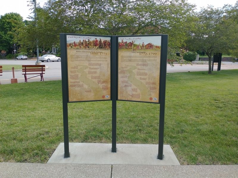
Prior to the 17th century, the area we know today as Beaver County was inhabited by the Monongahela People, of whom we
know little. These early natives disappeared from the area sometime in the early 1600s.
The earliest European visitors to the . . . — — Map (db m176915) HM
On 7th Avenue (Pennsylvania Route 18) at 3rd Street, on the right when traveling north on 7th Avenue.
Following labor disputes with their local employees, the Beaver Falls Cutlery Company contracted with Chinese workers from San Francisco and New Orleans in 1872. Hired to work at the Harmonist-owned factory, they were among the first Chinese . . . — — Map (db m194380) HM
On State Street at 3rd Avenue, on the right when traveling north on State Street.
Founded 1859 as Homewood Junction of Pittsburgh, Fort Wayne and Chicago and Erie and Pittsburgh Railroads. Named for Ironmaker James Wood.
Incorporated in 1910. Post Office was known as Racine Pennsylvania. Historic Saint Cloud Hotel, . . . — — Map (db m49401) HM
On Ridge Road at Cannelton Road, on the left when traveling north on Ridge Road.
Settled in 1795. Named for the Cannel coal found here. Mine opened 1838. Homestead of Ira Mansfield, mine owner, author and state senator. Producer of shale oil for many years. Harmony Society built a railroad in 1850 to ship coal and oil to distant . . . — — Map (db m49422) HM
On Cannelton Road, 0.1 miles west of Allison Drive.
Captured by Indians in 1780. Escaped to help country. Outstanding character bold woodsman. Furbuyer Indian Scout and thrifty businessman. Married C. Ullery 1796. Built stone house, mills, and first brick house in area later known as Fennel House. — — Map (db m49423) HM
On New Galilee Road at Haney Road, on the right when traveling south on New Galilee Road.
Site of one of the first mills built on the Little Beaver River. Erected by Robert and Mary McMinn in 1796-1797. Mary was said to be the first white woman to settle in the Darlington area following the treaty with the Indians in 1795. — — Map (db m49417) HM
On Market Street at Wallace Drive, on the left when traveling north on Market Street.
Built by Thomas Sprott in 1804 on land granted him in 1802 by the Commonwealth of Pennsylvania. Named "Sprotts Delight," it overlooked the borough of Greersburg, laid out on the lands of Sprott, Greer, and Martin. — — Map (db m49419) HM
On Old Furnace Road, 0 miles west of Lend Street, on the right when traveling west.
Built 1829 by Alexander Fombell on land purchased from Stephen Stone. Later passed into Phillis family. First Fombell Post Office located in house. Later moved to adjacent store, built in 1894. The kilns remain where handmade bricks were fired to . . . — — Map (db m51137) HM
On Chapel Drive at Hart Road, on the right when traveling west on Chapel Drive.
Built 1805 by early settler Stephen Stone III, a retired schooner captain who traded in New England and the West Indies. A nearby village, Stonesville was laid out in 1810. The house was in the Stone family until 1880. — — Map (db m51136) HM
On Pennsylvania Route 168, 0.4 miles north of Pennsylvania Route 18, on the right when traveling south.
Levi Dungan, first settler of Hanover Township, blazed out a 1000 acre tract in 1772. The log cabin and a fine spring were surrounded by the stockade. His wife, Mary Davis, journied by horseback to Philadelphia in 1789 to secure the land patent. — — Map (db m49701) HM
Near Swearingen Road, 0.6 miles east of Hardin Run Road.
Victims of the last Indian murder in Beaver County are buried here. Samuel Swearingen settled here in 1785 and in 1790 near this site his only daughter Mary, wife of Jacob Colvin, and her infant child were scalped and killed. They are buried here . . . — — Map (db m51603) HM
On Frankfort Road (Pennsylvania Route 18) 0.3 miles south of Bocktown Road (Pennsylvania Route 151), on the right when traveling north.
Build 1851 on 1796 land grant called Chestnut Flats. Fourth house on this site. Tannery was operated here 1819-1860. Littells were among first settlers in area. Significant example of 19th century architecture. Named to National Historic Register . . . — — Map (db m49698) HM
Mill Creek was an important part of pioneer life during the early settlement of Hookstown and the surrounding area. Numerous saw mills, woolen mills and grain mills utilized the water power of Mill Creek to operate, thus the basis for its name. — — Map (db m53892) HM
On Atlantic Avenue at 5th Street, on the right when traveling east on Atlantic Avenue.
Founded 1832 by dissadent members of the Harmony Society of Economy. The house on this corner was the home of the society leader Count Maxmillian DeLeon and is believed to be the oldest house in Monaca. — — Map (db m45778) HM
On Pennsylvania Route 68, 0.4 miles south of Benvenue Road, on the right when traveling north.
Benvenue Manor was built in 1816 by George Henry Mueller near the Old Venango Trail. Stone for the manor was quarried on the property. Saint Paul's Lutheran Church, Zelienople, was founded here. Also on the property is Sunrise Cottage, built in . . . — — Map (db m50287) HM
On South Julian Street south of Penn Street, on the right when traveling south.
This Plaque Commemorates the 250th Anniversary of the Survey of the Town of Bedford by John Lukens
John Lukens was directed to survey and lay out a town by Lt. Gov. John Penn on 05 May 1766. Lukens laid out 200 lots
between 04 June and 14 June . . . — — Map (db m176293) HM
On Pitt Street (Business U.S. 30), on the right when traveling west.
Built in 1815. East room housed the first bank in Bedford, known as the Allegheny Bank of Pennsylvania, from 1815 to 1832. Original vault can still be seen. Since 1924, used as public library and community center. — — Map (db m13986) HM
On Juliana Street at Penn Street, on the right when traveling south on Juliana Street.
Formed on March 9, 1771 from Cumberland County, it first embraced most of western Pennsylvania. Named for its county seat (formerly Raystown) incorporated 1795. In 1758, Fort Bedford was erected here, and Forbes Road - to become a major highway . . . — — Map (db m13990) HM
On Business U.S. 220 at Broad Street, on the right when traveling south on U.S. 220Business .
Settled about 1750, known then as Raystown. Site of an early trade post and Fort Bedford, 1758. Base for Forbes, Bouquet expeditions. In 1794 Washington here reviewed forces in Whiskey Rebellion. — — Map (db m52662) HM
On Juliana Street at Penn Street, on the right when traveling south on Juliana Street.
This tablet marks the site of the First Court House and Prison Built in 1774 in the prison yard around which was a high stone wall were The Pillory and Whipping Post used in those days for the punishment of criminals.
Prior to the . . . — — Map (db m14000) HM
On East John Street at Huntingdon Avenue, on the right when traveling east on East John Street.
(Statement):
A full transcript of the original Presbyterian Burial Ground Patent is available to all those interested from the Memorial Park Conservancy
In June, 1766, in pursuance of an order from his Honour the Governor John Penn, . . . — — Map (db m176390) HM
On Business Pennsylvania Route 220, on the right when traveling south.
Medicinal values of these springs discovered about 1796. It soon became a leading resort visited by numerous notables. James Buchanan used the Springs as his summer White House while President. — — Map (db m202853) HM
On Business Pennsylvania Route 220, on the right when traveling south.
The Bedford Springs Historic District consists of a mineral springs resort established c.1806 by Dr. John Anderson. The district's oldest extant buildings are the stone Nawgel's Mill, c.1796, and the log Miller's House, c.1800. In 1804, Nawgel . . . — — Map (db m202855) HM
On Pitt Street (Business U.S. 30) at Telegraph Road, on the left when traveling west on Pitt Street.
Settled about 1750, known then as Raystown. Site of an early trading post and Fort Bedford, 1758. Base for Forbes, Bouquet expeditions. In 1794 Washington here reviewed forces in Whiskey Rebellion. — — Map (db m13995) HM
On East Pitt Street at East Penn Street, on the right when traveling west on East Pitt Street.
Settled about 1750, known then as Raystown. Site of an early trade post and Fort Bedford, 1758. Base for Forbes, Bouquet expeditions. In 1794 Washington here reviewed forces in Whiskey Rebellion. — — Map (db m82781) HM
Near Sweet Root Road, 1.6 miles south of Business U.S. 220, on the left when traveling south.
Generating pristine water for centuries, The Black Spring is named for the Black family who lived on the land over 200 years ago. Producing over 600,000 gallons of water per day, it supplies nearby Red Oak Lake as well as potable water used to . . . — — Map (db m224848) HM
Near Lincoln Highway (U.S. 30) at the Pennsylvania Turnpike's Breezewood Interchange (Interstate 70,76), on the right when traveling west.
Shortly after the Pennsylvania Turnpike opened in 1941, Snyder's Gateway Inn was one of the first businesses to appear. Merle and Marian Snyder opened the restaurant shortly before World War II began and eventually supplied fuel to the military . . . — — Map (db m167357) HM
On Lincoln Highway (U.S. 30) 0.2 miles west of Market Street (Pennsylvania Route 96), on the left when traveling west.
A village site nearby on the Raystown Path. Named for a group of Shawnee Indians who halted here on their retreat from the Potomac to the lower Allegheny valley in the early 18th century. — — Map (db m8290) HM
On Helixville Road at Byrne Road, on the left when traveling north on Helixville Road.
Ninety feet north of this spot stood the first log house in this community, erected in the year 1795 by Jacob and Elizabeth Kemp Kinsey (Kintzy) who were born in Germany in 1769. The homestead contained 439 acres and 87 perches. Patent for the land . . . — — Map (db m14020) HM
Near Lincoln Highway (U.S. 30) 0.6 miles west of Market Street (Pennsylvania Route 96), on the left when traveling west.
This log church, built in 1806, on land donated by John Schell, the founder of Schellsburg, is the oldest church structure in Bedford County. Two congregations, the German Reformed and Lutherans, shared this church until both congregations moved to . . . — — Map (db m120991) HM
On Main St. (PA 100) at 7th Street on Main St. (PA 100).
Re-named Bally for Father Augustin Bally. The third Roman Catholic mission and first Catholic school in the State were established here in 1743 by Father Theodore Schneider — — Map (db m84570) HM
On Lancaster Avenue (Pennsylvania Route 501) at Fort Henry Road (Local Road 956), on the left when traveling north on Lancaster Avenue.
Built 1756; garrisoned during the French and Indian War by troops under Capt. Christian Busse. Pennsylvania's major frontier defense east of Ft. Augusta (Sunbury). The site is 3/4 mile to the northwest. — — Map (db m29547) HM
Near Lancaster Avenue (Pennsylvania Route 501) at Pilger Ruh Road.
1742
Pilger Ruh (Pilgram's Rest)
Named by Count
Nicholas Ludwig von Zinzendorf
who with Conrad Weiser and
Moravian Missionaries rested here
besides this spring (Ludwig's Brunne)
on their way to visit Shawnee Indians
in Wyoming . . . — — Map (db m158052) HM
On East Main Street (Pennsylvania Route 345) just west of North Water Street, on the right when traveling west.
Birdsboro Trailhead
The trailhead here at Birdsboro was developed for use by trail users through the efforts of the Community of Birdsboro and Schuylkill River Heritage Area. The trailhead provides visitors with easy access and . . . — — Map (db m160540) HM
On Water Street at East Main Street (Pennsylvania Route 724/345), on the right when traveling south on Water Street.
By the mid nineteenth century, the industrial iron community of Birds-Borough had developed into an area with distinctly organized neighborhoods. Each had its own pride and identity, each its own ethnic character, and each its own special title. . . . — — Map (db m158350) HM
On Baumstown Road (U.S. 422), on the right when traveling east.
Greatest American pioneer and wilderness scout. Born Nov. 2, 1734. Spent the first 16 years of his life on the Boone Homestead a few miles north. Now a State historical shrine dedicated to American youth. — — Map (db m23776) HM
On Benjamin Franklin Highway (U.S. 422) at Church Lane, on the right when traveling east on Benjamin Franklin Highway.
Polish pioneer, Indian trader, settled along Schuylkill River in this area, 1712. He served the Provincial government as a messenger-interpreter during negotiations with Indian tribes in 1728. He was buried, 1736, in graveyard of St. Gabriel's . . . — — Map (db m25273) HM
In memory of
Anthony Sadowski
Born c.1669 in Poland
Died April 22, 1736
Whether or not he opened an Indian trading post on the shores of Lake Erie, and gave his name to Sandusky, Ohio, here lies the greatest Polish frontiersman of . . . — — Map (db m25276) HM
On Old Philadelphia Pike, 0.1 miles north of Britton Street, on the right when traveling north.
A Country Manor
George Douglass (1726-1799) was from a prosperous Chester County farm family. After working as a saddler and innkeeper in Reading, he moved to Morlatton by 1762 with his wife, Mary Piersol Douglass (1731-1798). Douglas soon . . . — — Map (db m160505) HM
Near Old Philadelphia Pike, 0.1 miles north of Britton Street, on the left when traveling north.
A Humble Dwelling
This modest stone house was built for Michael Fulk (c. 1743 - 1808) around 1783. Unlike the mansion owned by Fulp's wealthier neighbors, such as the Douglass family just up the lane, it offers insight into the lives of the . . . — — Map (db m160527) HM
On Old Philadelphia Pike, 0.1 miles north of Britton Street, on the left when traveling north.
Located along a ford on the Schuylkill River, Morlatton Village was established in the 18th century with the arrival of Mouns Jones and his family from modern Philadelphia. Others soon followed, becoming a part of a diverse regional settlement . . . — — Map (db m160513) HM
On Old Philadelphia Pike, 0.1 miles north of Britton Street, on the left when traveling north.
Morlatton Village Trailhead
Morlatton Village Trailhead was developed for use by trail users though the efforts of the Schuylkill River Heritage Area and the Historic Preservation Trust of Berks County. The trailhead provides with . . . — — Map (db m160514) HM
Near Old Philadelphia Pike, 0.1 miles north of Britton Street, on the left when traveling north.
Oldest Documented House in Berks County
Mans Jonasson (1663-1727) was descended from Swedes who settled in present day Philadelphia, along with the lower Delaware and Schuylkill Rivers, in 1638. Later known as Mouns Jones he was the first . . . — — Map (db m160529) HM
Near Old Philadelphia Pike, 0.1 miles north of Britton Street, on the left when traveling north.
An Early Riverside Settlement
The Schuylkill River played an important role in the settlement and growth of Amity and Union Townships. A shallow crossing at this location allowed people and wagons to ford the river and may have been one . . . — — Map (db m160535) HM
On Old Philadelphia Pike just north of Britton Street, on the left when traveling north.
In 1701 William Penn granted 10,000 acres of land to seventeen colonists of Swedish descent who were living in present day Philadelphia. The village within the Swedes' Tract was called Morlatton and by 1719 the entire tract became Amity Township, . . . — — Map (db m160499) HM
First European settlers in present Berks County on land granted by William Penn, 1704-5. The home of Mounce and Ingeborg Jones, built 1716 and the oldest house in the county, stands at the opposite end of the river bridge. — — Map (db m84538) HM
Near Furnace Road, 0.5 miles east of Morgantown Road (Pennsylvania Route 10), on the right when traveling east.
The Ironmaster's House
Constructed around 1792 [,] the Joanna Furnace Mansion was the home to the ironmaster and his family. Originally, a federal style home, the house was Victorianized in 1877 by the last ironmaster and his wife -- L. Heber . . . — — Map (db m158257) HM
Near Front Street north of State Street (Old U.S. Highway 22), on the left when traveling north.
This is a photo of the canal and tow path approaching Jacob Geiger’s mill. Mr. Geiger’s mill was steam operated and located on Schuylkill Avenue, the street that angles off just below the WWII monument north of State Street. The mill was later . . . — — Map (db m138473) HM
On Front Street north of State Street (Old U.S. Highway 22), on the left when traveling north.
Martin Kaercher Sr. from Germany purchased 250 acres of land called "Hamburg" in 1772. Its natural wonders made it an ideal area for agriculture and farming. Because of this attribute, "milling" is a prevalent theme in the region's history, . . . — — Map (db m138471) HM
On Church Street north of Pine Street, on the right when traveling north.
To the memory of
Martin Kaercher Jr.
Founder of Hamburg
Martin Kaercher Sr., born in Germany in 1718, emigrated to Berks County in 1738. On Dec. 23, 1772 he acquired 'a certain tract of land called Hamburg' embracing 250 acres of . . . — — Map (db m141067) HM
On Hex Highway (Old Pennsylvania Route 22) 0.5 miles west of Roadside Drive, on the left when traveling east.
The first organized Amish Mennonite congregation in America. Established by 1740. Disbanded following Indian attack, September 29, 1757, in which a Provincial soldier and three members of the Jacob Hochstetler family were killed near this point. — — Map (db m174965) HM
Brick-end decorated barns are one of the finest classics of rural American architecture. These southern & central Pennsylvania barns were very expensive to build. The brick ends were constructed with designs which were formed by the gaps, or . . . — — Map (db m105321) HM
Although many Pa. Dutch colour their Easter eggs with commercial dyes, some still use the traditional methods. To get the different colours, various vegetables and roots are boiled with the eggs.
Adler [sic - Alder] catkins and hickory . . . — — Map (db m105318) HM
For the Pa. Dutch, the dew which falls from heaven on the anniversary of the coming of the Christ child is supposed to have beneficial effects. Here are several examples: since the number 3 is considered lucky, three pieces of bread are hung on . . . — — Map (db m105511) HM
The Dutch Country, like the rest of singinging [sic] America, has a two-fold folksong tradition: secular & religious. The Pennsylvania Spiritual is an original contribution to American hymns. Of the two folksong traditions the most important in . . . — — Map (db m105455) HM
Raisin pie is still known as leicht (funeral pie). This pie was a favorite at the gathering of family & friends which was held after the funeral services. In fact, raisin pie was rarely served except at these funeral gatherings.
The Big Valley . . . — — Map (db m105454) HM
Literally, in the Pa. Dutch dialect this means Green Thursday. The day is also known as Holy Thursday, or Maunday Thursday. For the Pa. Dutch, the day before Good Friday became known as Green Thursday because you had to eat something green that . . . — — Map (db m105323) HM
On New Year's Day, you must say, "Happy New Year" to the flowers in your garden. If you don't, they will not bloom in the spring.
To insure good luck & health all year, you should eat sauerkraut on New Year's Day.
Note: To this day, roast pork, . . . — — Map (db m105398) HM
The ballad is a narrative song which deals with murder, suicide, natural calamities, & unrequited love. Although ballads were sung throughout Europe, most American ballads parallel the British Isle's ballads. Pa. Dutch ballads were often of a . . . — — Map (db m105313) HM
Although English villages such as Stratford-on-Avon, are the most famous examples of half-timbering, Pa. also has its share of these structures. There are two styles of Pa. half-timbering. The country-style has plastering between the exposed, . . . — — Map (db m105512) HM
New England Puritans celebrated their November Thanksgiving as a substitute for Christmas which was forbidden to them. Pa. Gay Dutch celebrated Christmas & had their own Thanksgiving called Harvest Home.
A cultural conflict resulted when New . . . — — Map (db m105451) HM
Shortly after the American Revolution revivalism struck the American frontier & kindled a new, totally American institution, the camp meeting. Born on the Southern frontier, the camp meeting soon invaded the Pa. Dutch Country where it was known as . . . — — Map (db m105450) HM
The Mennonites were named for Menno Simmons, a 16th century Dutch leader. They are descendants of the 16th century religious radicals who were known as Anabaptists. They wanted to reserve the rite of baptism for those adults who had made a . . . — — Map (db m105513) HM
In 1741, the Moravians, or the Unitas Fratrum, settled in Bethlehem Pa. Other settlements were founded in Lehigh, Northampton, & Lancaster Counties. Although they immigrated [from] Germany, & settled among other Germans in Pa., they never . . . — — Map (db m105514) HM
The Pa. Dutch folk-culture is divided into two distinct elements: the "Plain" Dutch, who are in the minority, are the Amish & Mennonites: the "Gay" Dutch are, for the most part, Lutheran & Reformed.
The "Plain" Dutch are biblicists: they strictly . . . — — Map (db m105394) HM
The Dutch folk culture is divided into two completely different ways of life. The Amish & related religious sects represent a minority of the Dutch population & are known as Plain Dutch. The majority of Pa. Dutch Lutherans & Reformed denominations . . . — — Map (db m105320) HM
A popular form of gambling in the Old Dutch Country was the Wheelbarrow Match. Each participant would pay a fee, usually 10¢ or 15¢, to co[m]pete.
A post was planted in a field about 100 yards from the starting point. Each contestant takes his . . . — — Map (db m105354) HM
On Luckenbill Drive, 0.2 miles west of Kutztown Road, on the left when traveling west.
relocated from
Exeter Township, Berks County, PA
in honor of
Sterling G. & Florence M. Zimmerman
with generous support from the
Grundsau Lodges. — — Map (db m105345) HM
President Lincoln’s great-great grand-father Mordecai purchased Andrew Robeson’s land and built the stone house that stands about 1¼ miles south of here in 1733. Mordecai Lincoln served as Justice of the Peace of Philadelphia County from 1733 to . . . — — Map (db m84505) HM
On Sally Ann Furnace Road at Mine Road, on the right when traveling south on Sally Ann Furnace Road.
Originally built as a charcoal furnace by
Valentine Eckert 1791
Nicholas Hunter owner 1803
Operated by
Nicholas Hunter and Son 1804-1825
Jacob Van Reed Hunter (son) 1825-1861
J.Nicholas Hunter and Henry A. Hunter 1861-1869
(Changed . . . — — Map (db m216394) HM
On Memorial Highway at Blacksmith Road on Memorial Highway.
Built 1745 by Dr. George de Benneville, preacher in this area 1743-55, and founder of Universalism in America. He died in Philadelphia in 1793. The house is 2.25 miles away on a side road. — — Map (db m84526) HM
On Memorial Hwy. (PA 73/662), at DeTurk Road on Memorial Hwy. (PA 73/662),. Reported missing.
Built in 1767 by John de Turk, son of Isaac de Turk, a Huguenot who settled here in 1712 and was one of a number of French Protestants who were pioneers in this part of Berks County. — — Map (db m179602) HM
1571 entries matched your criteria. Entries 101 through 200 are listed above. ⊲ Previous 100 — Next 100 ⊳