A building erected about 1748 by Moravians, for use as a church and school, stands on the side road, about 1.5 miles away. Here they conducted a boarding school, 1745-51; and built a later schoolhouse, since demolished, in 1776. — — Map (db m84525) HM
Site of house occupied by Joseph Hiester from about 1792 until his death, 1832; a Lt. Col. in Continental Army; Delegate to Provincial Convention in 1776; Member of Congress for 14 years; Governor of Pennsylvania, 1820-23. — — Map (db m25211) HM
On Penn Street at South 2nd Street, on the right when traveling east on Penn Street.
Laid out 1748 by direction of Thomas Penn. Seat of Berks County since 1752. Incorporated borough, 1783. Soon became, and has remained, center of the Pennsylvania-Dutch area. An old and progressive industrial community. — — Map (db m161067) HM
On Schuylkill River Trail, 0.2 miles east of Brentwood Drive, on the left when traveling east.
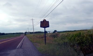
Birth of Berks County
Settlement began with the Lenni-Lenape of the Delaware Nation. In 1681 William Penn founded Pennsylvania and in 1748 his sons Thomas and Richard established Readingtown. It became the county seat when Berks County was . . . — — Map (db m160558) HM
Near Red Bridge Road, 0.1 miles north of Union Canal Trail.
The Reeser house and farm at the Berks County Heritage Center survives as a witness to the agricultural lifestyle of early Berks County. First settled in the 1730s by English
Quakers, it was purchased by Abraham Reeser in 1774 and remained in the . . . — — Map (db m208905) HM
On North 9th Street at Pike Street, on the right when traveling north on North 9th Street.
Founder of the family-owned department store chain. An immigrant from Russia, 1911, he came to Reading as a peddler. His first store began here after WWI and gradually expanded. New stores opened starting in 1962. In 1969 he died; thirty years . . . — — Map (db m71370) HM
On Washington Street (U.S. 422) west of 6th Street, on the right when traveling west.
Dedicated to all who rest
in unmarked graves
One generation shall laud
thy works to another...
Psalm 145:4
———————————
Under this chapel lie the remains of
[Roll of . . . — — Map (db m111832) HM
On Union Canal Trail at Columbia Street, on the right when traveling north on Union Canal Trail.
Connecting Progress and History
In 1690, there were few navigable inland waterways in the Quaker colony established by William Penn. Penn recognized the need for a route by which to access and settle the lush countryside and harvest its . . . — — Map (db m160655) HM
Near Parkside Drive South, 0.2 miles west of Museum Road, on the right when traveling west.
Lenni Lenape: The Original People
Thousands of years before the first Europeans arrived in Northern America. North American Indians known as Lenni Lenape occupied parts of New Jersey, Delaware, and Pennsylvania, including Reading and Berks . . . — — Map (db m161109) HM
Near River Road at Ashbourne Drive, on the left when traveling west.
The First Settlers
The Lenni-Lenape, or "original people", were the first to inhabit the banks of Ganshowahanna, or "falling waters", their name for the Schuylkill River. The Lenni-Lenapes in this area were members of the peaceful tribes . . . — — Map (db m161131) HM
On Penn Avenue (U.S. 422) at Freeman Street, on the right when traveling east on Penn Avenue.
Founded 1794 as Reading Furnace by ironmaster George Ege. In 1845 Henry P. Robeson expanded the furnace, spurring establishment in 1855 of the town of Robesonia. Although the furnace itself ceased operation and was razed in 1927, the Georgian-style . . . — — Map (db m157244) HM
On Penn Avenue (U.S. 422) at Elm Street, on the left when traveling west on Penn Avenue.
This property has been
placed on the
National Register
of Historic Places
by the United States
Department of the Interior
———————
Union Canal Milestone
A gift to honor the . . . — — Map (db m39322) HM
Erected to the memory of
Wilhelm Fischer
Born in the Palatinate April 11, 1706
Arrived at Philadelphia Aug. 17, 1733
Died October 23, 1771
and his wife
Elizabeth Gertrude
The daughter of
George and Veronica Hain
Born . . . — — Map (db m39298) HM
On Penn Avenue/Benjamin Franklin Highway (U.S. 422), on the right when traveling east.
Pioneer, Indian interpreter, treaty maker, 1732-1760. The Indians called him the "Holder of the Heavens." He lived, died, and is buried on this property, now a State Park devoted to his memory. — — Map (db m38777) HM
Churchman, Counsellor, Soldier, Indian-Interpreter, Agent, Diplomat and First Judge of Berks County.
Here were held many conferences with Indian chiefs, missionaries, colonial governors and leaders.
Here were reared his children of whom the . . . — — Map (db m39286) HM
We can't be sure. We know that Conrad Weiser owned this land and lived on the property from 1729 to about 1750. And there is a strong oral tradition indicating that Weiser's house stood on this spot. But archaeology conducted in 2000 found few . . . — — Map (db m39287) HM
On Penn Avenue/Benjamin Franklin Highway (U.S. 422), on the right when traveling east.
An Indian path from Shamokin (Sunbury) came over the mts. by way of Klingerstown and Pine Grove to Weiser's place in the Tulpehocken Valley. Chiefs of the Six Nations, carrying "words of wampum" to Brother Onas (Penn) at Philadelphia, traveled this . . . — — Map (db m38797) HM
The Livingood family came from Switzerland to the Palatinate. Jacob and his father, John Wendell Leibengut embarked for America with the first party of Palatines, May 6, 1709 from London, England. In 1728 Jacob Sr. arrived in the Tulpehocken Valley . . . — — Map (db m39285) HM
The Three Sisters played an important part in the development of the early colonies.
The Three Sisters originate from Native American legend. According to the legend, CORN, BEANS, and SQUASH are three inseparable sisters that can only grow . . . — — Map (db m226846) HM
On Foot of Ten Road at Willowbridge Lane, on the right when traveling east on Foot of Ten Road.
Erected 1785 by Thomas Blair. Residence of his son, John Blair, for whom Blair County was named in 1846. John Blair was a member of the General Assembly and until his death, 1832, a leading citizen of the region. — — Map (db m52309) HM
The spring opposite here was a favorite stopping place of Prince Gallitzin, famous missionary and founder of the Loretto Settlement. He was often known as Father Smith. — — Map (db m52473) HM
The spring opposite here was a favorite stopping place of Prince Gallitzin, noted prince-priest and missionary who founded the settlement at Loretto in 1792. He was also known as Father Smith. Buried at Loretto, site of his chapel. — — Map (db m52474) HM
Near Union Street just north of Allegheny Street, on the left when traveling north.
This pioneer family, created for the bicentennial, 1976, represents the basic fundamentals of our American life — courage — faith in God — education — love of family and liberty. These qualities in our American pioneers won . . . — — Map (db m162043) HM
On West 10th Street west of Pennsylvania Avenue, on the right when traveling west.
Situated on the site of the former historic City Hotel, this park was made possible through a generous gift from Charles Philip Judge to his beloved "adopted hometown", Tyrone. The City Hotel Courtyard will serve as a memorial to the . . . — — Map (db m134809) HM
Known also as Tioga Point. Connecticut settlers laid out the village in 1786. Site of ancient Indian village of Teaoga. Base for the Sullivan Campaign into central N.Y. Gateway from Southern N.Y. into Pennsylvania for centuries. — — Map (db m90294) HM
Leader of Connecticut land claimants. Served in Sullivan Campaign, 1779. Imprisoned in 1787-89 for leading new state movement. Later served in Pa. legislature. Moved here in 1789; died in 1831. Homesite and grave are east of road. — — Map (db m90297) HM
[Front]
Dedicated to the memory
of the McKinney Family
buried in the family plot
on the McKinney Farm
east of Athens.
[Back]
1769 Henry McKinney 1806
His wife . . . — — Map (db m154052) HM
On Roosevelt Highway at Mac Road (Local Route 4007), on the left when traveling east on Roosevelt Highway.
In May, 1790, Abraham DeWitt and his brother Isaac, with James McKean, came from "Johnny Cake Hollow," Chemung County, N.Y. to the mouth of Sugar Creek (Oscalui). They made their way up the creek to the present borough of Burlington. Here they . . . — — Map (db m222685) HM
On South Lehigh Avenue just south of Desmond Street, on the left when traveling south.
Sayre's lengthy history has progressed a long way from the early days when horse-drawn wagons with drivers making home deliveries were common. The iceman, (Image No. 1) coalman, milkman, and breadman made home deliveries on a regular schedule by . . . — — Map (db m216298) HM
Prince Bryant’s gristmill became Shepards mill in 1788. The only mill between Binghamton, NY and Wilkes-Barre, PA. Shipping point for oil, lumber and plaster by raft to settlements on the Susquehanna. Later, there were nine mills operating at . . . — — Map (db m90293) HM
This area was known by pioneers as the "Pine Plains." In 1790 near this spot Timothy Pickering met Red Jacket and his Senecas. They were on the way to the peace council at Tioga Point. — — Map (db m90242) HM
On South Lehigh Avenue just south of Desmond Street, on the left when traveling south.
The hamlet of Sayre began in Athens Township in 1870 near the Susquehanna River and at the junction of three small railroads in back of where you are now standing. Activity at and near the junction, called Southern Central Junction, led to the . . . — — Map (db m216289) HM
Near South Lehigh Avenue just south of Desmond Street, on the left when traveling south.
The Victorian-era, Queen Ann architectural style Sayre Passenger Station, built in 1881 for the Lehigh Valley Railroad, was adjacent to the very ornate three-story brick Seneca Division Office Building, constructed in 1876. Image No. 1 shows the . . . — — Map (db m216406) HM
On River Street/Merrill Parkway south of Bridge Street, on the right when traveling south.
The American Hotel is the oldest remaining hotel site in Towanda. This imposing 20- room hotel was built in the early 1800's by General William Patton, a leading Democrat, lawyer, author and biographer. The Greek Revival three-story structure is . . . — — Map (db m109675) HM
A settlement of French Royalists, who fled the French Revolution in 1793, was established in this valley directly opposite this marker. It was laid out and settled under the direction of Viscount de Noailles and Marquis Antoine Omer Talon.
It . . . — — Map (db m78907) HM
On Main Street (U.S. 6) at Court Street, on the right when traveling north on Main Street.
In 1949, the Bradford County Historical
Society, then located in the courthouse
annex, initiated the first Century Farm
program in Pa. Based on NY's Order of
Century Farmers, the program recognized
farms that had been owned and operated . . . — — Map (db m201059) HM
On York Avenue (U.S. 6) at Huston Street, on the left when traveling north on York Avenue.
Dr. Samuel Huston (also spelled Houston) came to Towanda with David F. Barstow and John C. Adams in 1827 from Essex County, Massachusetts. Dr. Huston married Emeline Mix, oldest daughter of Col. Hiram Mix of a prominent Towanda family. Huston . . . — — Map (db m153951) HM
On Main Street (U.S. 6) north of Jefferson Street, on the right when traveling north.
In 1820 a lawyer named Edward Overton came to Towanda from Athens. His father, Thomas Overton, was one of the principal owners of the land in the new town of Towanda. Edward also became interested in land and owned the coal deposits, which Barclay . . . — — Map (db m109744) HM
On 2nd Street at Bridge Street, on the right when traveling north on 2nd Street.
On land once owned by William Means, Frank Overton had this handsome residence designed by architect W. B. Camp of Athens. The contractor was William Welch of Towanda. Frank Overton was married to Elizabeth Means who inherited the land from her . . . — — Map (db m153935) HM
On River Street/Merrill Parkway at Pine Street, on the right when traveling north on River Street/Merrill Parkway.
When the first European settlers came to Towanda it was covered with a dense growth of timber and shrubs from which came its first name "Canewood." The name Towanda is an Indian term. Awandae in the Nanticoke tongue signified "a burial place." . . . — — Map (db m109677) HM
On York Avenue (U.S. 6) at Mix Avenue, on the right when traveling south on York Avenue.
Col. Harry Spalding built one of the town’s few structures of federal style architecture in 1812. He erected a combination tavern and dwelling at 1 York Ave. It is the oldest house in this borough and third oldest in the county. The building was . . . — — Map (db m129817) HM
A settlement of French Royalists, who fled the French Revolution in 1793, was established in this valley directly opposite this marker. It was laid out and settled under the direction of Viscount de Noailles and Marquis Antoine Omer Talon.
It was . . . — — Map (db m90368) HM
The broad plain which can be seen from this point was the site, 1793-1803, of the French refugee colony. The Great House, built for Marie Antoinette and her son, was there and an entire village founded. — — Map (db m90367) HM
On Marsh Street north of Church Street/Taylor Avenue (Pennsylvania Route 706), on the right when traveling north.
has been placed on the
National Register
of Historic Places
by the United States
Department of the Interior
Listed
September 15, 2003 — — Map (db m109607) HM
On Church Street (Pennsylvania Route 706) 0.1 miles north of State Street (U.S. 6), on the right when traveling north.
This edifice was known for much of its existence as the Odd Fellows Hall because it belonged for decades to the Independent Order of Odd Fellows (IOOF). In more recent years it was known simply as the Lodge Hall because occupants have included . . . — — Map (db m201035) HM
On Grand Army of the Republic Hwy (US 6) at Rome Road (PA 187) on Grand Army of the Republic Hwy (US 6).
Site of the famed French refugee colony is a few miles south. Here exiles laid out a town and built La Grande Maison for the Queen and her son, the heir to the throne of France. — — Map (db m90331) HM
This church was organized October 3, 1791 as Congregational by the Reverend Jabez Culver, a Connecticut missionary.
This was the first church of white people in Pennsylvania north of Wilkes-Barre and the mother of the Towanda Presbyterian Church. . . . — — Map (db m90348) HM
This monument was erected by the citizens of the 140th legislative district in tribute to Christopher Columbus and those who followed him to America.
Celebration
We celebrate the 500th anniversary of the 1st voyage of Christopher . . . — — Map (db m31448) HM
On Radcliffe Street at Walnut Street, on the right when traveling east on Radcliffe Street.
Marker 19T (replica)
indicates distance
between here and
Market St. in Phila.
along the Phila.-
Frankford Turnpike
to Morrisville, PA.
Road through Bristol
was finished in 1810 — — Map (db m31173) HM
This monument is a replica of the Spanish Garitas, or guardhouses, that lined the forts of San Juan, Puerto Rico, and is dedicated to the Puerto Rican people who have made their homes in Bristol.
In March of 1509 a ship . . . — — Map (db m80537) HM
“This day [June 11] the first clearance on the Delaware Division of the Pennsylvania Canal was issued from his office to the Mauch Chunk Canal Boat No. 30, Capt. William C. Zanes, bound to Bristol with 30 tons of coal.”
The . . . — — Map (db m31224) HM
On Otter Street at Old U.S. 13, on the right when traveling east on Otter Street.
Early river port laid out as Buckingham, 1697. The third oldest borough in Pennsylvania, chartered Nov. 14, 1720. County seat of Bucks, 1705-26. Travel and trade center for over two hundred years. — — Map (db m28383) HM
On Green Lane south of Bristol Pike (U.S. 13), on the right when traveling south.
"Besides, I want to tell you there were pretty good times and many a heart broken and rough life on the canal."
Flora Henry, Locktender
Shouts of "Gid-Up" echo along the canal. Pairs of mules strain at their . . . — — Map (db m131430) HM
On Main Street at State Street, on the left when traveling north on Main Street.
Here stood an ancient crossroads, the meeting place of two major Lenape trade routes dating back before 1000 AD. The route extended from Shackamaxon (Philadelphia) to Lechauwekink (Easton) and connected the Delaware and Schuylkill Rivers to the . . . — — Map (db m114612) HM
On Easton Road at New Britain Road, on the left when traveling north on Easton Road.
This monument honors the citizens of Doylestown Township and surrounding Central Bucks municipalities who through public service and volunteerism have devoted themselves to the betterment and welfare of their communities as well as those who have . . . — — Map (db m23458) HM
On New Falls Road just north of Tyburn Road, on the right when traveling north.
One of the first places settled in Pennsylvania, this village has retained a great many of the fine houses of its provincial period. The Friends Meeting organized in 1683 was attended by William Penn in 1701. The original building of 1692 stood near . . . — — Map (db m160197) HM
Unfortunately, there are few contemporary descriptions of the area at that time. The local “Scotch-Irish” of the 18th century were not as concerned with keeping records of their daily activities as they were with keeping records of their . . . — — Map (db m167757) HM
On Trenton Road just north of Main Street, on the right when traveling north.
This Borough was named in honor of John Hulme, Jr., a leading industrialist, who purchased the village in 1795. He established here the Farmers National Bank, the first bank in Bucks County, in 1814. At the time, the community was a center of . . . — — Map (db m208051) HM
On Bellevue Avenue (Pennsylvania Route 513) just north of Neshaminy Street, on the left when traveling north.
This Borough was named in honor of John Hulme, Jr., a leading industrialist, who purchased the village in 1795. He established here the Farmers National Bank, the first bank in Bucks County, in 1814. At the time, the community was a center of . . . — — Map (db m208053) HM
On Bridgetown Pike (Pennsylvania Route 213), on the right when traveling east.
was located
to the south in the vale
by the run and springs.
The Chief
Tammany
of the Unami Group
• their totem • the tortoise •
of the Lenni Lenape or Delawares
sold to
William Penn
the land between
Neshaminy and . . . — — Map (db m31193) HM
On Newtown-Langhorne Road (Pennsylvania Route 413) south of Crestview Avenue, on the right when traveling south.
Bearing the inscription "1 M to N" (one mile to Newtown) this milestone is believed to have been placed before 1741. It is one of two such markers still located on the historical 43-mile road from Bristol to Durham Furnace. Newtown, an important . . . — — Map (db m31158) HM
On Highland Avenue at Crown Street, in the median on Highland Avenue.
Near this spot stood the white oak tree that marked the starting point of the survey of the first tract of land purchased of the Indians by William Penn July 15, 1682 on land in the tenure of John Wood and by him called Gray Stones over against the . . . — — Map (db m113529) HM
On Bridge Street at Central Avenue, on the left when traveling east on Bridge Street.
Founded 1681 by William Penn
as a Quaker Commonwealth.
Birthplace of
The Declaration of Independence
and
The Constitution of
the United States. — — Map (db m28401) HM
Water craft were the major means of communications within the colony and it is probable that Governor [William] Penn traveled the 20 miles or so which separated him from his capital city largely with the tides. The Port of Philadelphia was the . . . — — Map (db m82169) HM
Shipbuilder's tools in the 16th and 17th Century were primitive but generally efficient. Shipbuilding was big business with an estimated 300 sailing ships built at the Port of Philadelphia between 1670 and 1710. — — Map (db m82171) HM
Accompanying William Penn on his arrival in America aboard "The Welcome" at New Castle, Delaware in October of 1682 was William Best, a shipbuilder. Best built his first ship for the Governor at "Penny-Pot Free Landing", at the foot of Vine Street . . . — — Map (db m82168) HM
To celebrate the 300th birthday of Pennsylvania
Founded by William Penn
Presented to the Citizens of the Commonwealth
through the generosity of the Grundy Foundation
October 1982 — — Map (db m82175) HM
[William] Penn was fond of his Indian neighbors and they returned the compliment. He treated them as equals and they were as welcome in the rich halls of Pennsbury as any of his other guests. The Lenape were constantly amazed by the Governor's . . . — — Map (db m82172) HM
William Penn was a shipbuilder in partnership with a Bartholemew Penrose...in Philadelphia. Here we show the Governor, his wife, Hannah, and his small son, John who was born in Philadelphia, returning to Pennsbury in the graceful barge which has . . . — — Map (db m82170) HM
In 1718 King George I granted to John Wells a license to operate a ferry on this site, which provided an essential link in the establishment of the principal Stage Coach Route between Philadelphia and New York. The Landing became known as . . . — — Map (db m77999) HM
On State Street at Mercer Street, on the left when traveling south on State Street.
The Bird in Hand (formerly the "Red Lion Inn" and "Old Frame House") has played a rich and diverse role in the history of Newtown. There is record of a tavern on this site dating back to 1686, and it is considered the oldest frame structure still . . . — — Map (db m32278) HM
On Washington Avenue at State Street, on the left when traveling east on Washington Avenue.
Prior to 1750, there existed a dwelling on this site, 1 East Washington Avenue, which had been built by Shadrach Walley, Newtown's first settler. Amos Strickland, a farmer and entrepreneur from Philadelphia, bought the property in 1760. In 1763, he . . . — — Map (db m32510) HM
On Court Street at Centre Avenue, on the right when traveling north on Court Street.
The Half-Moon Inn (popularly known as the Court Inn) is located at 101-103 Court Street. The south portion of the Inn was the original one and one-half story frame cottage of Margaret and Joseph Thornton built in 1733 and later used as a tavern. . . . — — Map (db m32355) HM
On State Street, on the left when traveling south.
This colonial inn, built 1768
by Anthony Siddons,
became headquarters of
the American General
William Alexander,
"Lord Stirling,"
after the battle of Trenton
December 26, 1776 — — Map (db m32386) HM
On State Street, on the left when traveling south.
On Feb. 19, 1778, while the British occupied Philadelphia, some 40 armed Loyalists raided the tavern here. The fighting left 5 American soldiers dead, 4 wounded, 11 captured. Tailors here were making uniforms for use at Valley Forge, and 2,000 . . . — — Map (db m32262) HM
On State Street, on the left when traveling south.
The buildings at 35 South State Street are situated on the tract of land on which the three main public buildings in Newtown were erected in 1726 when Newtown became the County Seat (Jail Keeper's House & Records Office, Jail, Court House). . . . — — Map (db m32428) HM
On State Street at Greene Street, on the left when traveling north on State Street.
In 1684, William Penn planned his new town, which was later called Newtown. About 30 acres, on both sides of Newtown Creek, were reserved for common use. The town was designed to resemble an open fan of lots surrounding a narrow, rectangular town . . . — — Map (db m32609) HM
On State Street, on the left when traveling south.
Although some historians believe there may have been a tavern at this location fifty years earlier, Andrew and Nancy McMinn built the first part of the Temperance House, located at 5 South State Street, circa 1772. Part of the building was used as . . . — — Map (db m32432) HM
On Sycamore Street at Silo Drive, on the left when traveling north on Sycamore Street.
The original structure on this property was likely built in about 1725 as the early settlers cabin of William Buckman. In 1918, John Goodnoe purchased the 78 acre farm located at 298 North Sycamore Street and started delivering produce grown from . . . — — Map (db m28133) HM
On Sycamore Street, on the right when traveling north.
On March 4, 1681, Charles II granted William Penn a vast tract of land in the New World as payment for the debt the King owed Penn's father. The tract awarded to Penn included all of the land west of New Jersey, north of Maryland and south of New . . . — — Map (db m29833) HM
Measured 1737, according to a supposed Indian deed of 1686, granting lands extending a day-and-a-half walk. Using picked men to force this measure to its limit, Thomas Penn reversed his father's Indian policy losing Indian friendship. — — Map (db m86295) HM
On Mill Street east of 4th Street, on the left when traveling east.
The Borough of Quakertown was originally settled as Richland and the Great Swamp by members of the Society of Friends in the early 18th century. It was part of William Penn's original land holdings, a 1,000 acre tract called the Manor of . . . — — Map (db m116072) HM
On Main Street at Broad Street (Pennsylvania Route 313), on the right when traveling south on Main Street.
Site of early challenge to federal government's authority. This armed resistance by Pennsylvania-German farmers to the 1798 federal house tax was suppressed by soldiers. Leader John Fries was arrested for treason, condemned to death, and pardoned . . . — — Map (db m26846) HM
The Borough of Riegelsville was formed in 1916, thanks to a petition by local citizens who sought the right of self-government for their thriving river and canal community.
During the late 18th century, a village slowly evolved around what was . . . — — Map (db m44764) HM
On Levittown Parkway at Bristol Pike (U.S. 13), on the left when traveling east on Levittown Parkway.
This fully planned, six-home style residential community was conceived by the builder William J. Levitt. The first family moved in, June 23, 1952. When completed in 1957, Levittown contained 17,311 homes on 5,750 acres, designed for a population of . . . — — Map (db m30975) HM
On Bordentown Road at Main Street, on the left when traveling east on Bordentown Road.
William Penn's country home in Pennsylvania, built 1683-1700. Here he often resided while in America. Re-created by the State as a historic shrine. Follow this road for 3.5 miles. — — Map (db m31169) HM
1572 entries matched your criteria. Entries 201 through 300 are listed above. ⊲ Previous 100 — Next 100 ⊳