commander of Fort Fred Steele from October, 1871 until September, 1873; was born an aristocrat in Tours, France, but came to America as a soldier of fortune to fight in the Civil War. Commissioned as Colonel in 31st Infantry, he commanded . . . — — Map (db m89845) HM
Major Thomas Tipton Thornburgh, 4th Infantry... left Fort Fred Steele on September 21, 1879 with his regiment's Company E, plus Company E, 3rd Cavalry and Companies D and F, 5th Cavalry, in response to a complaint by U.S. Indian Agent N.C. . . . — — Map (db m89828) HM
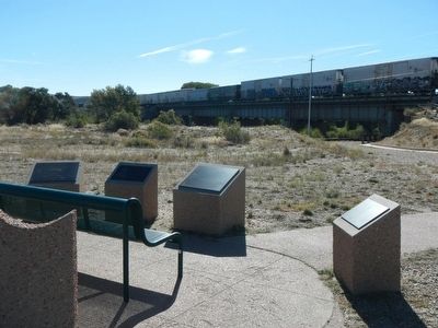
Thornburgh's Command Defended Themselves Behind a Breastwork....
of barrels, sacks of flour, wagons and dead horses as Ute Indians rained bullets down bluffs along Milk Creek. The battle that raged from about noon on Monday, September 29, . . . — — Map (db m89824) HM
This plateau above LaPrele Creek and the North Platte River was chosen as an Army post by Major Dye who described it as “…being neither so low as to be seriously affected by the rains or snow; nor so high and unprotected as to suffer from the . . . — — Map (db m80092) HM
Three men named Sharp,
Franklin, and Taylor, and
one unknown man were
killed by Indians July 12,
1864 where the Oregon
Trail crosses Little Box
Elder Creek 2 1/2 miles S.W.
of here. They were buried
4 miles S.W. by the grave . . . — — Map (db m92087) HM
During the summer of 1874, General George Armstrong Custer led the first official government expedition to the Black Hills, which the Sioux Indians claimed as their territory. Although the United States Government officially sent this expedition of . . . — — Map (db m34586) HM
In July 1874 Lieutenant Colonel George Armstrong Custer, and more that 1000 soldiers, camped near here while engaged in a military expedition to explore the Black Hills. The expedition's official purpose was to locate a suitable site for an army . . . — — Map (db m98140) HM
Lieutenant Colonel George A. Custer's Black Hills Expedition crossed northeastern Wyoming from July 17-25, 1874, camping within three miles of this location. forged by 1000 men (cavalry, infantry, teamsters, scientists, miners, newspaper reporters, . . . — — Map (db m45381) HM
was established to protect from Indians the gold mining camps of South Pass City, Atlantic City, Miners’ Delight, and others. It was named for 1st Lt. Charles B. Stambaugh, 2nd Cavalry, U.S.A. who was shot from his horse by Indians when defending a . . . — — Map (db m80145) HM
Sacred to the Memory of
Mrs. Maggie Richards
and
Mrs. Hall
Pioneer White Settlers
Killed July 23rd, A.D. 1873
by a raiding band of hostile Sioux Indians
in their ranch home
on the site of
the present city of . . . — — Map (db m96197) HM
The building before you is the only surviving enlisted men's barracks at Fort Laramie. The building proper was completed in late 1874 and was designed to provide quarters and other needed support facilities for two companies of soldiers, The . . . — — Map (db m71018) HM WM
This building was completed in 1884. It was built as a commissary storage facility. As such it would have been primarily divided into two large storerooms: one for meat and one for flour, rice, and beans. Three or four smaller rooms would have been . . . — — Map (db m71017) WM
Fort Laramie was perhaps the single most important location in America’s expansion into the west. Founded in 1834 as a trading post, it became a military fort in 1849. Until it closed in 1890, Fort Laramie influenced major events in the history of . . . — — Map (db m71016) HM
Here on December 25, 1866
John (Portugee) Phillips
finished his 236 mile ride to obtain troops for the relief of Fort Phil Kearny after the Fetterman Massacre. — — Map (db m79773) HM
In memory of the Thoroughbred horse
ridden by
John “Portugee” Phillips
from Fort Phil Kearny Wyoming to Fort Laramie Wyoming December 24, and 25, 1866, when he's sought aid for the garrison at Fort Phil Kearny, which was . . . — — Map (db m79746) HM
The Rustic Hotel opened in 1876. During that year it probably provided the best accommodations for travelers between Cheyenne and the Black Hills. It also served as a station for the Cheyenne-Black Hills Stage and Express Line. By 1883, when this . . . — — Map (db m71020) HM
Sioux Indians massacred
29 Soldiers with their
Officer
Brevet 2nd Lt. L. Grattan,
on Aug. 19, 1854. Site is
½ mile north-west.
An Indian killed a cow from a Mormon caravan. The detachment of soldiers was sent to receive . . . — — Map (db m79706) HM
On July 21(sic), 1866, five officers, three women, several children and ten enlisted men of the 18th Infantry came under attack from Lakota Indians as they approached CrazyWoman Creek in wagons and ambulances. Lieutenants George Templeton and . . . — — Map (db m91534) HM
Buffalo, Wyoming, the Johnson County seat, chartered March 3, 1884, started as a trading center for Fort McKinney, located two miles west of town, which was founded July 18, 1887 and is now the Veterans' Home of Wyoming.
The court house was . . . — — Map (db m91499) HM
To the Glory of
God
and in memory
of
Lieut.
N.P. Daniels, U.S.A.
Sergt.
Terrell, U.S.A.
Killed
On this Spot
July 20th 1866,
by Sioux Indians — — Map (db m91533) HM WM
The year was 1876. Armies marched from every direction of the compass to confront Native Americans in the Powder River Country. One command under General George Crook marched three times that year from Fort Fetterman to the Powder River and points . . . — — Map (db m97942) HM
In the months following Custer's defeat at the Battle of the Little Big Horn, a group of Native American members of the Northern Cheyenne Tribe left their allies along the Little Big Horn River and traveled south to encamp for the winter. Led by . . . — — Map (db m91561) HM
right side
In 1866, following the American Civil War, Congress created six all African American Army units which later merged into four (9th and 10th Cavalry - 24th and 25th Infantry Regiments). Composed of former slaves, freemen, and . . . — — Map (db m95173) HM
The United States Army came to Cheyenne in 1867 on the heels of the Union Pacific Railroad's westward expansion and established two separated military operations: Camp Carlin just west of Cheyenne and Fort D.A. Russell adjacent to Camp Carlin and . . . — — Map (db m95171) HM
Commemorating
Battle of Red Buttes
which occurred across
North Platte River
July 26, 1865
Erected by
Headquarters 2d, Corps Area
United States Army
which reenacted the battle at
Governor's Island N.Y.
June 21, and 22, . . . — — Map (db m170504) HM
Built by Louis Gurnard
1858-59
Immediately south and west are the sites of Platte Bridge Station, First Overland Telegraph, Stage, and Pony Express Stations on the Old Oregon Trail
opposite side:
One half mile north and . . . — — Map (db m91710) HM
Early on the morning of July 26, 1865 Lt. Caspar Collins led a troop of men to reinforce an army supply train coming into Platte Bridge Station. Only a mile west of the post, the group was ambushed by members of the Sioux, Cheyenne and Arapahoe . . . — — Map (db m164501) HM
A desperate battle to save a supply train ended tragically the same day as the Battle at Platte Bridge. Sgt. Amos Custard and his men were bringing five supply wagons from the Sweetwater Station near Independence Rock. The group came into view of . . . — — Map (db m164502) HM
Several area landmarks, including Bennett Buttes, Bennett Creek, and Little Rock Creek, are now named for Captain Andrew S. Bennett and Little Rock, a Crow interpreter for the U.S. Army, who lost their lives when the Army attacked a camp of Bannock . . . — — Map (db m167161) HM
In 1877, The Nez Perce Indians of Idaho led by Chief Joseph, fled the U.S. Army. They crossed the Clark's River near this point, while trying to outrun the soldiers to Canada. — — Map (db m167145) HM
Three panels make up this marker.
(panel 1:)
For thousands of years the fertile Wallowa Valley was home to many Nimiipuu, or Nez Perce people. A treaty in 1855 affirmed Nez Perce ownership of this homeland. Competition for . . . — — Map (db m167146) HM
This pass is the summit of Dead Indian Hill. Through this portal great herds of wild game seasonally migrant from the mountains to the plains. This high pass was the gate way for countless Indian hunting and war parties, and through this portal . . . — — Map (db m189985) HM
The ridge you are standing on was the last significant barrier for more than 600 Nez Perce Indians and their 2,000 horses as they fled the pursuing U.S. Cavalry. After the battle of the Big Hoel a month earlier, they drew knew the Army did not . . . — — Map (db m190091) HM
As a band of Nez Perce Indians out (missing word(s)) and outmaneuver the U.S. Cavalry in the fall of 1877, newspapers picked up on the drama (missing word(s)) headlines read: "Comic Opera, Bungling of Pursuer, Salutes to a Most . . . — — Map (db m190092) HM
Across the meadow, a fire burned in the campsite of nine tourists on the night of August 23, 1877. The Cowan party had unknowingly camped near hundreds of Nez Perce men, women, and children who were under violent pursuit by the United States Army. . . . — — Map (db m86788) HM
Rock quarries, visible from several points near this location, were used beginning in 1849 to supply stone and lime for construction projects at Fort Laramie, about 15 miles east. Workers in the quarries were protected by soldiers stationed in . . . — — Map (db m85753) HM
The U.S. Army's Role in Protecting the Oregon Trail in Wyoming 1842 to 1870
Lieutenant John C. Fremont led an expedition west in 1842 to map a route to Oregon Territory. The scout, Kit Carson, guided the expedition. Lieutenant . . . — — Map (db m85771) HM
Three plaques, under the same title, describe how the U.S. Army protected immigrants on the Oregon Trail.
Panel 1:
“If it is in contemplation to keep open communications with Oregon Territory, a show of military force in this . . . — — Map (db m85766) HM
One of history’s great but little celebrated rides was made between midnight December 21st and Christmas night December 25th in the year 1866. From here at Fort Phil Kearny, where annihilation of Fetterman’s force had left the garrison in desperate . . . — — Map (db m87700) HM
. . . you dress lightly because the weather is clear. You are carrying your recently issued seven shot Spencer repeater and a saber. Lt. Grummond will command and he carries a saber and revolver. Wheatley and Fisher, who are with you, carry 15 . . . — — Map (db m87522) HM
. . . your preparations for the battle began two weeks ago when some leaders, including Red Leaf, High Back Bone and Black Leg, determined that the soldiers from the Buffalo Creek Fort could be ambushed. At your main camp on the Tongue River two . . . — — Map (db m87526) HM
. . . you are part of a detail formed this morning consisting of 49 men from companies A, C, E, and H of the 18th Infantry Regiment, you are told you will relieve a wood train under attack on Sullivan Hill for the third time in three weeks. On . . . — — Map (db m87520) HM
… the command retreats up the hill to this point, stopping only once or twice to fire at the pursuing warriors. Civilians Wheatley and Fisher, along with some non-commissioned officers, are making a stand 250 yards to the north, slowing the . . . — — Map (db m87523) HM
. . . you and fellow warriors prepare for battle. You wear your fines dress which includes your war shirt. The war pony you selected is painted and readied for battle as well. All of this preparation will give you spiritual strength and . . . — — Map (db m87528) HM
. . . one of the Cheyenne members of the decoy party, is with you. He is riding a black horse belonging to Little Wolf, his brother, and is wearing Sweet Medicine Chief’s scalp shirt. His horse, tired from decoying the soldiers, stumbles . . . — — Map (db m87524) HM
Because of a healthy climate plus a short existence, Phil Kearny’s cemetery might have remained an almost vacant place. But warfare prevented that idea. Here rested eighty-one victims of Fetterman’s impetuosity; three heros of the masterful Wagon . . . — — Map (db m87703) HM
. . . like you, will die today. History will record that he is of German descent and a combat veteran of the Civil War and Plains Indian Wars. Two weeks ago, on December 6th, he helped Col. Carrington rescue Lt. Grummond from certain death. . . . — — Map (db m87525) HM
. . . you are joined by 27 more soldiers of Company C, 2nd U.S. Cavalry, under the command of Lt. George Grummond. Captain Fred Brown and two civilian volunteers, James Wheatley and Isaac Fisher, also join up. Your detail heads up Piney Creek . . . — — Map (db m87521) HM
On this field on the 21st day of December, 1866, three commissioned officers and seventy six privates of the 18th U.S. Infantry, and of the 2nd U.S. Cavalry, and four civilians, under the command of Captain Brevet-Lieutenant Colonel William J. . . . — — Map (db m85998) HM
On July 3, 1908, Henry B. Carrington, Frances Grummond Carrington and veterans of the Fort Phil Kearny garrison attended a memorial ceremony to dedicate this monument. Colonel Carrington and others recounted the events surrounding the battle of . . . — — Map (db m87407) HM
The Land
The land under view where the Great Plains meets the Rocky Mountains was once the Red Man's land of milk and honey, then as now teaming with wildlife. It was a most productive--thus favorite--hunting ground. But it was also a . . . — — Map (db m153150) HM
. . . the soldiers are surrounded and defeated. You begin gathering used arrows, soldier weapons, loose horses and tending your injured. Some warriors were hit by accident when warriors attacked from both sides of the trail. Other warriors . . . — — Map (db m87531) HM
Lodge Trail Ridge divided the drainages of both Piney Creeks with the drainage of Peno (now Prairie Dog) Creek. Up this divide, north beyond Phil Kearny, climbed the Bozeman Trail on its route to Montana. There, December 21, 1866, in violation of . . . — — Map (db m87698) HM
< Marker #1 : >
By 1866, Twenty Years of Confrontation . . . . . . had occurred on the Northern Plains. Indian tribes clashed over the vast resources of food, water and grass. European Americans pressured all the tribes on the quest . . . — — Map (db m87421) HM
Pilot Hill – overlooking Piney and Little Piney Creek Valleys, the Bozeman Road, the Sullivant Ridge with its wood roads was a constantly manned lookout. From this post the sentry signaled to the Fort news of events as they occurred – . . . — — Map (db m87702) HM
In honor of John (Portugee) Phillips who Dec. 22-24, 1866, rode 236 miles in sub-zero weather through Indian infested country to Fort Laramie to summon aid for the garrison of Fort Phil Kearny beleaguered by Indians following the Fetterman . . . — — Map (db m86069) HM
In 1863, a party led by John Bozeman blazed a trail from the North Platte River, northwest across the Powder River Basin and along the foothills of the Big Horn Mountains to the gold fields of Montana. Established in violation of the 1851 . . . — — Map (db m86159) WM
The Bozeman Trail was established in 1863 by John Bozeman and John Jacobs as a shortcut to the Montana goldfields. It started from Virginia City, at Adler Gulch, in Montana, heading southward across Wyoming and the Powder River country where it . . . — — Map (db m87519) HM
It is a false perception that the frontier posts of the American West were garrisoned with large troops of cavalry. Actually a post’s usual population was largely infantry with a few cavalry for support, reconnaissance, escort, or mail delivery. . . . — — Map (db m87641) HM
Because the regulations would not allow non-military dependent civilians to reside inside Fort Phil Kearny, several civilian dwellings existed outside the post stockade on the valley plain below, and in the Quartermaster corral to the south. These . . . — — Map (db m87638) HM
The average age of an enlisted man in the United States Army was twenty-three years old. Although Fetterman’s command included veterans of the Civil War, many of the men were inexperienced in Indian warfare and had limited training with their . . . — — Map (db m87514) HM
Plains Indian warriors varied in age from teens into their thirties. Being superb horsemen and skilled marksmen with bow and arrow, these warriors used their athletic skills and knowledge of the terrain to trap their enemies. Although they often . . . — — Map (db m87515) HM
Upon hearing rifle volleys north of Lodge Trail Ridge, Col. Carrington sent Captain Tenodor Ten Eyck with a relief column of 75 men to assist Fetterman. After the battle, Ten Eyck’s testimony described the discovery of a valley full of Indians in . . . — — Map (db m87532) HM
The Fetterman Fight was a clash of forces using different warfare tactics. In 1866, the military used Civil War tactics of massed soldiers formations under a central command using concentrated gunfire. The skirmish lines had men placed at . . . — — Map (db m87517) HM
Officers generally carried Models 1860 Colt or 1858 Remington .44 caliber revolvers. They also carried M-1860 Light Cavalry sabers, like the cavalry. An Infantry Soldier carried a Springfield Model 1863 rifle-musket, .58 caliber. He was . . . — — Map (db m87518) HM
. . . the soldiers from Peno Creek. They retreat south up the hill along their road. A small group of them stop among some rocks to the north. Their fast shooting guns slow the attack, causing many casualties. The remaining soldiers retreat . . . — — Map (db m87529) HM
At this site on Tongue River, August 29, 1865, Brigadier General Patrick E. Connor. 125 cavalrymen, and 90 Indian scouts attacked an Arapaho village of several hundred lodges. After a swift night march, Connor’s men surprised and stormed the . . . — — Map (db m86053) HM
In 1865 General Patrick E. Connor led the “Powder River Expedition” into this area. This expedition was a part of a broad military program to bring the Indians north of the Platte River under control and halt their depredations along the . . . — — Map (db m92720) WM
Here Aug. 29,1865, troops and Indian scouts commanded by Gen. P.E. Connor destroyed an Arapahoe Indian village. Erected by The Historical Landmark Commission of Wyoming 1936 — — Map (db m86892) HM
On this site during the early morning hours of August 29, 1865, General Patrick Edward Connor led over 200 troops in an attack on Chief Black Bear’s Arapaho village. Connor had departed from Fort Laramie on July 30th with 184 wagons, a . . . — — Map (db m86058) HM
Historically, this area of the Tongue River served as a trail and stage road crossing. The Boseman Trail, road to the Montana gold fields, crossed here beginning in 1864. The Bozeman cut through the Powder River Basin, violating the Fort . . . — — Map (db m86276) HM
Dedicated to the memory of
General George Crook
his gallant soldiers and
scouts who, in June, 1876,
camped in the valley of
the Goose Creeks on the
present site of Sheridan
while waiting for their
Crow and Shoshoni . . . — — Map (db m91393) HM
Jim Bridger first came west in 1822, working in the fur trade until that industry declined. He traveled throughout the west, becoming an expert on the Indians and the land. After working as a trader, he established the Bridger Trail through the . . . — — Map (db m86164) HM
The warfare and enmity which existed for generations between the
Cheyenne and Absaroka Nations
was solemnly terminated here on July 20 1932 when the chiefs of both Nations smoked the Pipe of Peace and took each others hands in friendship. . . . — — Map (db m91449) HM
Inside the corral the small body of soldiers expected defeat and the same fate as Fetterman’s command. As they took up positions of their choosing, between, behind, or inside the wagon boxes, the men prepared for the worst. Some removed their shoe . . . — — Map (db m87381) HM
By 1868 the Union Pacific Rail Road had been completed through southern Wyoming and northern Utah and a new shorter road ran north to the southwestern Montana gold fields. The Bozeman Trail became obsolete. The U.S. Government once again sought . . . — — Map (db m87399) HM
By the end of the fight the Indians, through the heroics of fellow warriors, managed to remove all but one or two of their dead and wounded from the battlefield. These were taken to a spring near the present day Fish Hatchery for cleansing and . . . — — Map (db m87396) HM
On August 2, 1867, 51 men of Company C, 27th Infantry under the command of Captain James Powell and Lieutenant John Jenness are assigned to the wood cutting detail. Fourteen of these men escort a wood train toward the fort. Another 13 are . . . — — Map (db m87375) HM
Over the years a controversy has arisen about the exact location of the Wagon Box Corral, Indian casualties and the length of the battle. The most disputed fact is the location of the corral. In the early 1900’s area residents brought survivors of . . . — — Map (db m87398) HM
In July, 1867, many Lakotas of the Ogalala, Miniconjou and Sans Arc tribes gathered with the Cheyennes along the Rosebud Valley to participate in the sacred Sun Dance ceremony. After fulfilling the religious duties, the headmen and fighting chiefs . . . — — Map (db m87368) HM
The Indian leaders had hoped the soldiers would pursue a small decoy party of warriors led by Hump into an ambush, but the soldiers refused to follow, and the last pickets retreated safely into the corral after wounding the Ogalala warrior . . . — — Map (db m87385) HM
This monument is erected to perpetuate the memory of one of the famous battles of history. It is dedicated to the courage and bravery of twenty-eight soldiers in Company C, 27th United States Infantry, and four civilians, who held their . . . — — Map (db m86050) HM
In August 1867, a war party of hundreds of Sioux and Cheyenne warriors, led by Ogallala chief Red Cloud, left their camp on the Big Horn River, hoping to destroy military posts along the Bozeman trail. Some of the warriors rode toward Fort . . . — — Map (db m86062) HM
Before you stands a monument dedicated to the courage and bravery of the defenders in the Wagon Box Fight of August 2, 1867. This monument was built in 1936 by the Civilian Conservation Corps. The legend was written by local historians and although . . . — — Map (db m87401) HM
Though construction of Fort Phil Kearny was complete by August of 1867, the need of wood for burning and alterations continued. Colonel John E. Smith, the post commander, located wood cutting camps on Big and Little Piney Creeks five miles west of . . . — — Map (db m87369) HM
Across the meadow, a fire burned in the campsite of nine tourists on the night of August 23, 1877. The Cowan party had unknowingly camped near hundreds of Nez Perce men, women, and children who were under violent pursuit by the United States Army. . . . — — Map (db m45254) HM
Journey through Yellowstone
On August 23, 1887, more than 600 men, women, and children camped in the woods near here. Sustained by courage, social structure, and knowledge of the land, they were midway from their homeland in . . . — — Map (db m45256) HM
In 1864 an alternate route to the goldfields of western Montana was needed due to frequent hostile actions along the Bozeman Trail. Though the Civil War raged on, the Nation continued its westward expansion through the efforts of men like Jim . . . — — Map (db m97827) HM