English:
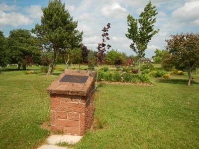
The Honorable Andrew Archibald (A.A.) Macdonald
was born February 14, 1829 in Three Rivers.
He carried on the family business in Georgetown
until called to serve in the Legislature.
He was in Ottawa, a member of the . . . — — Map (db m80295) HM
The bottom of the bay is like a giant compost bin. Seaweed and shellfish collect here when they
die, and form a thick, black mud. The decomposing shells create high lime content, making "mussel
mud” a perfect fertilizer for the . . . — — Map (db m139444) HM
English:
Cape Bear is located on the Northumberland Strait side of the southeast corner of Prince Edward Island. The name survives in translation from the French period of Island history. The lighthouse was built in 1881, one of . . . — — Map (db m147964) HM
English:
Murray Harbour began to achieve status as an important PEI port in the late 1700s. The earliest settlers in the area sustained themselves by fishing and farming but John Cambridge, the proprietor of Lot 64, was actively . . . — — Map (db m140239) HM
English:
A well-protected fishing harbour lies a short distance down the South River from the end of the trail. Fishing boats are lined up on both sides of the waterway and storage sheds dominate the wharves. The quiet ripple-free . . . — — Map (db m147963) HM
English:
The original planners of the P.E.I. Railway in the early 1870s were very focused on connecting all of the major Island ports. The export of farm produce was at the heart of the economy. The railway made it easier for . . . — — Map (db m147965) HM
English: James Colledge Pope was born in Bedeque. A successful merchant and shipbuilder, he entered political life in 1857. Premier of the Island on two previous occasions (1865-7 and 1870-2), he again assumed that office in April, 1873, and . . . — — Map (db m137724) HM
English: The silver fox industry is a fascinating era in Island farming history. By the turn of the century, P.E.I. had gained attention as the world leader in this rare commodity. Robert Humphrey, of Kensington, was one of the . . . — — Map (db m150000) HM
English: With new amenities that allowed farmers to heighten production, and rising market demand, the local farming sector responded by developing a wide range of new institutions and organizations. Canada Packers opened a branch . . . — — Map (db m149993) HM
English: With its rich soil, Prince Edward Island is tailor-made for the cultivation of potatoes. Early settlers planted potatoes because they would grow on the newly-cleared land, thriving even when planted amongst the tree stumps. . . . — — Map (db m149998) HM
English: Despite its challenges, the PEI Railway began operation on 25 May, 1875… …and Kensington Station was a major stop and switchyard. Before plans for the PEIR had been announced, Kensington had been little more than a . . . — — Map (db m148803) HM
English:
The first settlers in Kinkora were farmers. The community that developed has depended upon agriculture ever since. After the Dominion Government launched a dairy initiative in 1891, Kinkora responded and in 1900 opened a . . . — — Map (db m141171) HM
This granite mill stone was mfg in France in the late 1800’s and imported to PEI in 1890’s. Mill stones were used in cereal grain grist mills to crush various cereal grains to yield flour for bread. This mill stone was purchased and used by Patrick . . . — — Map (db m151773) HM
Français:
En 1890, la paroisse de Miscouche compte 683 Acadiens francophones et 137 anglophones, principalement d'origine écossaise. La majorité des paroissiens vivent sur la ferme, bien que les activités économiques sont assez . . . — — Map (db m142396) HM
Français:
La Base militaire de Summerside a eu un impact important sur la vie socio-économique de Miscouche pendant les 50 années de son existence (1941-1991). De nombreux paroissiens y ont trouvé de l'emploi et la communauté . . . — — Map (db m142395) HM
English: About the time of Confederation, Wellington was a small rural community located around Goodwin's Corner on the western road. It was named after Arthur Wellesley, the Duke of Wellington; the British general who defeated . . . — — Map (db m151770) HM
The Prince Edward Island Railway began operating in 1875. Its establishment was accomplished largely through the efforts of two Summerside brothers, James Colledge Pope, who was Premier when the Railway Bill was passed in 1871, and William Henry . . . — — Map (db m141019) HM
The Prince Edward Island Railway was established in 1871. By 1874 there were 70 stations across the Island, including an open-ended "Terminal" Station about a mile north of the Summerside harbour. A track ran down to the waterfront where the . . . — — Map (db m141017) HM
English:
Prince Edward Island's contribution to Nova Scotia's lighthouses inspired the question: What about building a lighthouse here?
Petitions for lighthouses began to appear before government by the late 1830s. Concerned . . . — — Map (db m140246) HM
English:
At the same time that the Island was grappling with the issue of lighthouses, it found itself dealing with an issue of a different sort: Mail delivery.
Mail delivery was very important, representing the Island's . . . — — Map (db m140247) HM
English:
Imagine being aboard a ship on a dark, stormy night. The wind is howling fiercely, pushing large waves over the sides of your vessel. You are at the mercy of the elements. Picture a lack of navigational aids, creating a . . . — — Map (db m140245) HM
Toward the end of the 1800s, Prince Edward Island became known as an excellent vacation spot. Its clean air, rural landscapes and beautiful beaches were offered to travellers made weary by the stress of urban
life. By the 1920s, thanks . . . — — Map (db m139431) HM
English: The Bonded Warehouse across the street was often at the centre of one of Charlottetown's most controversial issues: prohibition. In 1901 Prince Edward Island was the first Canadian province to make it illegal to possess, . . . — — Map (db m149598) HM
In 1786 John Cambridge purchased approximately 300 acres along Wright's Creek, which was then called Bird Island Creek. Around 1800 he built a 22 foot-high mill dam at the head of tide on the creek, and went on to build a saw mill, grist mill and . . . — — Map (db m140303) HM
English:
On December 24, 1810, Thomas Desbrisay Jr. opened an apothecary shop on this site to supply drugs and medicine to the people of Prince Edward Island. Until then, many Islanders relied more on home remedies or obtained medicines . . . — — Map (db m80262) HM
Built of Island and Wallace Sandstone, the Charlottetown railway station opened July 8, 1907. At a time when both people and goods travelled extensively by train, the station was a busy place indeed. Housing public facilities and administrative . . . — — Map (db m201323) HM
Born in Charlottetown, Davies studied law at the Inner Temple and was admitted to the bar in 1867. A member of the Legislative Assembly (1872-9) and Premier for the last three years of that period, he defended the rights of tenant farmers while . . . — — Map (db m80206) HM
English: The Port of Charlottetown has a history of wooden shipbuilding, local ferry wharves and shipping connections with the world. Family connections with the Westcountry of England made it a prime destination. Shipbuilders, . . . — — Map (db m149906) HM
English: The Railway Station stands not far from where you now stand. The air was once full of steam, the sound of train whistles and shunting rail cars. It was a busy place with the Western train, the Eastern train and the Murray . . . — — Map (db m149898) HM
English: There has been an aboriginal presence on the Island for at least ten thousand years. The Mi’kmaq became allies and important trading partners with the French in the 1600s and later sided with them in battles against the . . . — — Map (db m151798) HM