Capital-Montgomery
Although the French settled Alabama, they ceded it to England after the French and Indian War. In 1783, England ceded the northern part to the United States and the southern part to Spain, but by 1795 most of the area was . . . — — Map (db m98070) HM
Capital-Juneau
The Russians were the first to settle Alaska, and maintained control of the region until the mid 19th century, despite Spanish and British claims. In 1867 Russia sold Alaska to the United States and an administrative district was . . . — — Map (db m97821) HM
Angelo (Angela) was likely born in the West African kingdom of Ndongo, part of present-day Angola, Captured and sold to slave traders, she was forced onto a Portuguese ship. Two English privateers, the White Lion and the Treasurer, . . . — — Map (db m184276) HM
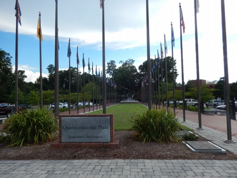
About 1617, Deputy Governor Samuel Argall established a settlement on 300 acres near here. Situated on land that had been formerly inhabited by the Paspahegh Indians, the group of dispersed buildings was incorporated into the 3,000-acre Governor's . . . — — Map (db m66909) HM
Capital-Phoenix
Spanish Jesuits organized missions in the area after 1700, but Spain did not establish settlements until 1775-76 with the founding of Tucson. When Mexico won its independence from Spain in 1821, the area was controlled by Mexico. . . . — — Map (db m97819) HM
Capital-Little Rock
In 1673, Jacques Marquette and Louis Jolliet visited the Arkansas region. After La Salle claimed it for France in 1682, colonization began. The first settlement was established in 1686 by Henri de Tonti. Although France ceded . . . — — Map (db m98074) HM
In the first few years of the English settlement at Jamestown, colonists built small, isolated, fortified structures—called blockhouses—around the perimeter of the main settlement to provide refuges, observation posts, and rallying . . . — — Map (db m66908) HM
Capital-Sacramento
Although explored primarily by Spain, Sir Francis Drake, sailing for England, also touched the California coast in 1579. After the establishment of Spanish missions, California became a territory of Mexico in 1825 following . . . — — Map (db m194657) HM
Capital-Denver
Although the region was explored first by the Spanish, this possession was controlled by the French. The dispute was settled in 1763 in favor of the French. Few attempts were made to colonize it until the mid-19th century. The . . . — — Map (db m97579) HM
One of the original colonies
Capital-Hartford
Dutch residents from New Amsterdam established a trading post near present-day Hartford in 1633, but it was the English from the Massachusetts Bay Colony who made the initial move to colonize the . . . — — Map (db m97843) HM
One of the thirteen original colonies.
Capital-Dover
Delaware was explored by Henry Hudson for the Dutch in 1609, but was named for Lord De la Warr, an early English governor of Virginia. In 1638 Peter Minuit established the first successful . . . — — Map (db m97831) HM
The first documented Africans in mainland English America arrived at Point Comfort (in present-day Hampton) late in Aug. 1619. Colonial officials traded food for these “20 and odd” Africans, who had been seized from a Portuguese slave ship en route . . . — — Map (db m194714) HM
Skilled craftsmen of Polish origin recruited by the Virginia Company began arriving in Jamestown aboard the Mary and Margaret about 1 Oct. 1608. Poles contributed to the development of a glass factory and the production of potash, . . . — — Map (db m66905) HM
Capitol-TallahasseeThe first permanent European settlement in America was established by the Spanish in 1565 at St. Augustine. In 1763 following the French and Indian War (in which Spain sided with France), Britain received Florida but returned it . . . — — Map (db m97413) HM
On 2 Sept. 1781, about 3,000 French troops of the Gatinois, Agenois, and Touraine Regiments arrived at Jamestown from the West Indies. Commanded by the Marquis de Saint-Simon, they camped near here before participating in the siege of Yorktown. On . . . — — Map (db m90954) HM
One of the thirteen original colonies
Capital-Atlanta
To stop French claims to the area, Pedro Menendez de Aviles attempted a coastal Spanish settlement in 1565. England claimed the territory in the 17th century, but did not colonize it until . . . — — Map (db m194653) HM
Capital-Honolulu
The islands were first settled by Polynesians from other Pacific islands by the 9th century. After James Cook first visited the islands in 1778, they were frequented by traders, but the British made no effort to colonize . . . — — Map (db m194656) HM
Capital-Boise
Lewis and Clark blazed a trail through Idaho in 1805, followed by English and American fur traders. Thousands of pioneers followed the Oregon Trail through southeast Idaho in the 1830s and 1840s, although the first settlement was . . . — — Map (db m97656) HM
Capital-Springfield
The French established settlements at Cahokia in 1699 and at Kaskaskia in 1720, in what was then the province of Louisiana. After the French and Indian War, the region was ceded to the English. During the American Revolution, . . . — — Map (db m97970) HM
Capital-Indianapolis
In the early 18th century, French occupation of the area began with the construction of three forts between 1715 and 1733: Miami, Quiatenon, and Vincennes, the latter becoming a permanent settlement. In 1763 France ceded . . . — — Map (db m194679) HM
Capital-Des Moines
The area was a part of the Louisiana Purchase of 1803. After the defeat of the Indian chief, Black Hawk in 1832, settlers flocked to the region. Dubuque was permanently founded in 1833. Iowa was included in the boundaries of . . . — — Map (db m97416) HM
Capital-Topeka
Claimed by France in 1682, the area was ceded to Spain in 1763, reverted back to France in 1800, and in 1803 became part of the Louisiana Purchase. In 1817 it became part of the unorganized Indian Territory. A battleground for . . . — — Map (db m194647) HM
Capital-Frankfort
Following possible visits to the area in the 17th century, particularly by Gabriel Arthur, actual exploration was not made until Thomas Walker went to the region in 1750. He was followed in 1751 by Christopher Gist. In 1767, . . . — — Map (db m97960) HM
On behalf of a grateful nation, President James Monroe invited the Marquis de Lafayette to visit the United States, his adopted country. Lafayette’s tour of all 24 states in 1824 and 1825 drew large crowds and sparked a renewal of patriotism. On 22 . . . — — Map (db m90955) HM
Capital-Baton Rouge
Following Cabeza de Vaca, this area was further explored by Hernando de Soto in 1541, and claimed for France in 1682 by La Salle, whose attempt at establishing a colony five years later ended in his death. In 1699 Pierre . . . — — Map (db m97965) HM
Capital-Augusta
John Cabot probably explored Maine for the English in 1498, and in 1607 a temporary English colony was established on the Kennebec River. In 1622 Sir Ferdinando Gorges and John Mason received a land grant in the area. After a . . . — — Map (db m194680) HM
One of the thirteen original colonies
Capital-Annapolis
In 1632, King Charles I of England granted land to George Calvert, Lord Baltimore. At Calvert’s death, his son succeeded to the title and organized a colonial expedition. Settlers . . . — — Map (db m97858) HM
One of the thirteen original colonies
Capital-Boston
A group of zealous Puritans known as the Separatists or “Pilgrims” left England and established a colony at Plymouth in New England in 1620. In 1626, a Puritan settlement was . . . — — Map (db m97856) HM
Capital-Lansing
Although settled by French missionaries and fur traders, the area came under British control after the French and Indian War. When the United States took charge after the American Revolution, Michigan became part of the Northwest . . . — — Map (db m194681) HM
Capital-St. Paul
Daniel Greysolon, Sieur Duluth, let an expedition to the area in 1679. French fur traders worked in the region until France ceded it to England after the French and Indian War in 1763. The eastern portion became part of the . . . — — Map (db m194660) HM
Capital-Jackson
The first permanent settlement in this area was established near present day Biloxi. After the French and Indian War, the territory was ceded by the French to the English, who in turn surrendered it to Spain following the American . . . — — Map (db m97967) HM
Capital-Jefferson City
Permanent settlement in the area was not established by France until the 1730s. In 1763 France ceded this region which was part of the Louisiana territory to Spain, who ceded it back in 1800. France sold the region to the . . . — — Map (db m98072) HM
Capital-Helena
Fur trappers worked in the region as early as the 1740s. Acquired as a portion of the Louisiana Purchase in 1803, Lewis and Clark explored the area in 1805. The region offered American fur traders a profitable business and the . . . — — Map (db m97610) HM
Capital-Lincoln
After La Salle claimed much of the region in 1682, France controlled the territory for a time and then ceded it to Spain. The area was sold back to France and then to the United States in 1803 as part of the Louisiana Purchase. . . . — — Map (db m194911) HM
Capital-Carson City
This area was claimed by Mexico in 1820. In 1825 Jedediah Smith entered the region and in 1845 John Fremont led an expedition there. This area was ceded to the United States in 1848 after the Mexican War and was originally . . . — — Map (db m194659) HM
One of the thirteen original colonies
Capital-Concord
While the French were the first to explore this area, it was John Smith’s explorations, maps, and reports of the region in 1614 which led to its eventual settlement. In 1622, John Mason . . . — — Map (db m194678) HM
One of the thirteen original colonies
Capital-Trenton
Dutch merchants established trade with the Lenape Indians and set up trading posts at present day Jersey City in 1618 and Fort Nassau in 1624. Swedish settlers came to the area in 1638. . . . — — Map (db m194655) HM
Capital-Santa Fe
The region was controlled by the Spanish and in 1609-10 Santa Fe was founded and became the colony’s capital. Mexico won its independence in 1821 and controlled the region after that. Most of New Mexico was acquired by the United . . . — — Map (db m97668) HM
One of the thirteen original colonies
Capital-Albany
Following the explorations of Verrazano in New York Bay, French explorer Samuel de Champlain and English explorer Henry Hudson (employed by the Dutch) investigated this area in 1609. By the . . . — — Map (db m97934) HM
One of the thirteen original colonies
Capital-Raleigh
Queen Elizabeth I of England granted Sir Walter Raleigh the right to establish a colony in 1584. Two settlements at Roanoke Island (1585, 1587) were unsuccessful, the second now known as . . . — — Map (db m97936) HM
Capital-Bismarck
This area was sold to the United States in 1803 as part of the Louisiana Purchase. Lewis and Clark explored the region in 1804-5 and settlement attempts were made around 1812 by Scottish and Irish families. In 1818 the United . . . — — Map (db m194649) HM
Capital-Columbus
In the late 17th and early 18th centuries, French and English traders competed and clashed in the region. In 1763, at the end of the French and Indian War, the land was ceded to the English. The United States acquired the area . . . — — Map (db m97964) HM
Capital-Oklahoma City
Though claimed by Robert LaSalle for France in 1682, the region remained inhabited primarily by Indians. In 1803 the United States bought the area in the Louisiana Purchase. First set aside as a new homeland for displaced . . . — — Map (db m97666) HM
Capital-Salem
After England claimed the region, fur trading posts were established in the 1790s. Meriwether Lewis and William Clark explored the region in 1805, and John Jacob Astor founded his fur trading post in 1811. The first American . . . — — Map (db m194648) HM
One of the thirteen original colonies
Capital-Harrisburg
Although Captain John Smith entered the Susquehanna River in 1608 and Henry Hudson entered Delaware Bay in 1609, the region was not explored extensively until Cornelius Hendricksen came . . . — — Map (db m97833) HM
The Middle Passage
For more than 350 years, approximately 12 million Africans were transported across the Atlantic Ocean in the largest forced migration in history. Two million, unknown and forgotten, died during the voyage. Of the ten . . . — — Map (db m147817) HM
One of the original colonies
Capital-Providence
Roger Williams established the first settlement at Providence in 1636 with a group of followers from Massachusetts Bay Colony who sought freedom of worship. Portsmouth and Newport were founded . . . — — Map (db m97943) HM
“…announce the landing of three thousand French troops under the Marquis [de Saint-Simon] at Burrels Ferry.... They... will... proceed with flat bottom boats and the others where they will again land at James Island their troops this . . . — — Map (db m209690) HM
One of the original colonies
Capital-Columbia
The Spanish attempted a settlement in 1526, but it was shortly abandoned. A group of French Huguenots established a colony on Parris Island in Port Royal Sound in 1562 which lasted about a year. . . . — — Map (db m97893) HM
Capital-Pierre
The Dakotas became a part of the United States as a result of the Louisiana Purchase in 1803. Fur traders moved into the area following the Lewis and Clark expedition in 1804. The state was formed from the 1861 Dakota Territory, . . . — — Map (db m97583) HM
Capital-Nashville
King Charles II of England included this territory in the Carolina grants made in 1663 and 1665. Following French explorations, Englishmen James Needham and Gabriel Arthur explored the region in 1673 and visited Cherokee Indian . . . — — Map (db m97962) HM
Capital-Austin
Spain established several missions and controlled the region until 1821 when Mexico gained its independence. At that time, the United States reached agreement with Mexico allowing Americans to colonize the territory, and Stephen . . . — — Map (db m194912) HM
The Greate Road, also called the Maine Cart Road and the Great Old Road, connected the isthmus of Jamestown with the mainland between the James and Back Rivers. Originally, it was a path established and used by Native Americans.
In May 1607, . . . — — Map (db m66898) HM
Capital-Salt Lake City
Although the Spanish first explored the area, English and American fur traders soon entered the region. Mass migrations of Mormons driven from eastern states began in the 1840s. In 1848 the territory was ceded to the . . . — — Map (db m194651) HM
Capital-Montpelier
English colonists from nearby Massachusetts established the first permanent settlement in 1724. Following a dispute over the territory between New Hampshire and New York, King George III granted it to New York. New Hampshire . . . — — Map (db m97944) HM
The first permanent English settlement in North America and the first of the thirteen original colonies.
Capital-Richmond
A permanent settlement was established by England’s Virginia Company of London in 1607 under its original charter. In . . . — — Map (db m194654) HM
Capital-Olympia
Washington was explored in the 18th century by Spanish, American and British travelers, specifically Captain George Vancouver in the 1790s. Lewis and Clark opened the area for American activity in their 1805 explorations. In 1818, . . . — — Map (db m97654) HM
Capital-Charleston
The region was a part of the original colony of Virginia, but was settled primarily by Scotch-Irish and German settlers. Conflicts arose between western Virginians and those in the east after the American Revolution, . . . — — Map (db m97456) HM
Capital-Madison
After France formally claimed the region, fur trading posts were established in the area. As a result of the French and Indian War, French supremacy in Wisconsin ended with the occupation of the region by the British in 1763. The . . . — — Map (db m97418) HM
Capital-Cheyenne
Wyoming was home to more than a dozen Indian tribes when the first American traders entered the area. The region was acquired in portions by the United States: the east in the Louisiana Purchase in 1803, the west in the Oregon . . . — — Map (db m97657) HM
(panel 1)
John Smith Explores the Chesapeake
Captain John Smith explored the Chesapeake Bay in the early 1600s seeking precious metals and a passage to Asia. He traveled the James, Chickahominy, and York rivers in 1607, and led two . . . — — Map (db m97301) HM
"In the middest {of the fort} is a…pretty chapel.... It is in length threescore foot, in breadth twenty-four, and shall have a chancel in it of cedar."
—William Strachey, 1610
The human history of Jamestown Island begins much earlier than 1607. The first native inhabitants walked this site 10,000 years ago. At that time, the James River was nearly 100 feet lower, a fast moving stream at the bottom of a narrow ravine. Sea . . . — — Map (db m17269) HM
By 1624, William Peirce, a “beloved friend” of governor Francis Wyatt, built a house – “one of the fairest in Virginia” – on this lot. Peirce, captain of the governor’s guard and the colony’s cape merchant, also . . . — — Map (db m17356) HM
The earliest African-American national radio and television minister and advisor of three American presidents, the Elder Lightfoot Solomon Michaux purchased the lands around you in 1936. His dream was to establish a farm and a national memorial to . . . — — Map (db m31084) HM
That at last Christmas we had trading here ten ships from London, two from Bristoll, twelve Hollanders, and seven from New-England. A Perfect Description of Virginia, 1649 Jamestown’s waterfront property was prime real estate. Governor . . . — — Map (db m17203) HM
This small structure played a part in the industrial activity along the Pitch and Tar Swamp, but the exact use of its three furnaces is unknown. Chemical analysis of the soil ruled out high-temperature industry, such as a forge. Perhaps the best . . . — — Map (db m17217) HM
Who discarded refuse into this ditch and why may never be known. The ditch was full or artifacts dating to about 1670-1700, including 10 “HH” wine bottle seals, over 1,000 clay pipe pieces, three window leads dated 1669, and the largest . . . — — Map (db m17311) HM
Thousands of years ago, when the island was larger and drier, Jamestown was more suitable for permanent habitation. In fact, archaeologists have excavated hearths from the 2,000-year-old campsites. Nearby, they found pottery and evidence of stone . . . — — Map (db m89337) HM
The American Coaster Enthusiasts recognize Loch Ness Monster as an ACE Roller Coaster Landmark, a designation reserved for rides of historic significance. Acknowledged as the world's first continuous track interlocking loop roller coaster, the . . . — — Map (db m220463) HM
This exhibition traces the religious heritage of transported Africans and their descendants in Virginia and the development of an African American Baptist congregation in Williamsburg in the late eighteenth century. Drawn to the message of equality . . . — — Map (db m228996) HM
From the 1630s to the end of the 17th century, this area along Backstreete boasted some of the finest dwellings in Jamestown. Governors, councilmen, burgesses, and lawyers all made this neighborhood home. Richard Kemp, an ardent supporter of . . . — — Map (db m17357) HM
The great Indian massacre of March 22, 1622, during which a quarter of the population of Virginia was slain came nearest to Jamestown here in a community known as Archer's Hope. At the house of Ensign William Spence five persons were killed-- John . . . — — Map (db m31085) HM
At Jamestown began: the Expansion overseas of the English speaking peoples; the Commonwealth of Virginia; the United States of America; the British Commonwealth of Nations — — Map (db m17006) HM
A small group of Spanish Jesuits attempted a settlement in Virginia in September, 1570. They are said to have entered James river and landed along this creek and crossed the peninsula to establish a mission near York River. Six months later all were . . . — — Map (db m30732) HM
Christopher and Anne Ayscough opened a tavern here in 1768. They purchased the house with money left by Governor Faquier to Anne, his head cook “in recompence to her great fidelity and attention” in all his “illnesses.” — — Map (db m227971) HM
In 1676 the colony became embroiled in the popular uprising known as Bacon's Rebellion. Frontier settlers
whose homesteads were attacked by hostile Indians, asked Governor Berkeley's government for protection. Fearful and frustrated by the lack of . . . — — Map (db m99078) HM
Hear the crack of flintlock muskets and smell the smoke from cannon fire! On this site, on July 6, 1781, 5,000 British troops under General Charles Cornwallis and Colonel Banastre Tarleton clashed with 900 American soldiers led by the Marquis de . . . — — Map (db m30651) HM
In memory of the 6 Virginia & 22 Pennsylvania Line Patriots who died in The Battle of Green Spring on July 6, 1781 & are buried near here.
By their sacrifices they made possible the establishment of a free United States of America. — — Map (db m99079) WM
To the east of the road here, centering at Fort Magruder, was fought the Battle of Williamsburg on May 5, 1862. The Union General McClellan was pursuing General Johnston’s retiring army, the rearguard of which was commanded by General Longstreet. . . . — — Map (db m130379) HM
Carpenter and constable Richard Booker built this structure as a rental. He began renting out rooms in his “new” house at “one dollar per month” in March 1826. Altered in the 1950s, the house has not been restored. — — Map (db m228200) HM
The Rev. John Bracken, Rector of Bruton Parish for 45 years, purchased this rental property in 1787. Married to Sally Burrell of Carters Grove he held extensive real estate along Francis Street until his death in 1818. — — Map (db m227982) HM
John Smith was born about 1580 the son of a yeoman farmer of modest means. As a young man he traveled throughout Europe and fought as a soldier in the Netherlands and in Hungary. There he was captured, taken to Turkey and sold into slavery in . . . — — Map (db m11367) HM
During the 17th century Carter's Grove was part of the Martin's Hundred Plantation. In the early 1720's, Robert "King" Carter purchased it and later named the tract Carter's Grove. Between 1730 and 1735 Carter Burwell, grandson of Robert "King" . . . — — Map (db m9503) HM
Catherine Orr Lived here from 1743 to 1788. After the 1764 death of her husband, blacksmith Hugh Orr, she took in William & Mary students as lodgers. She also educated several enslaved children at the Bray School. — — Map (db m227044) HM
Planter and businessman John Chiswell owned the property until his death in 1766. By the mid-1770s, cabinetmaker Benjamin Bucktrout lived and operated his furniture retail business here. — — Map (db m227977) HM
The Church on the Main, which lies ahead, was built of brick in about 1750, along the main road connecting Jamestown and Williamsburg. It replaced the fifth church at Jamestown and was used by James City Parish, the community in this vicinity. . . . — — Map (db m99084) HM
This 30 x60' brick church, marked by the remnants of a builder’s trench, was constructed in a simple rectangular plan with doors on the west and the south. Holes marking the location of scaffolding employed during construction flank the perimeter of . . . — — Map (db m99085) HM
This archaeological site consists of the remains of the church, the cemetery, and the surrounding fences. All that remains to indicate the location and size of the church below grade is a small remnant of the foundation builder's trench. The 30' x . . . — — Map (db m99086) HM
Less than one mile to the east is the site of the Church on the Main, a brick Anglican church built by the 1750s to serve James City Parish as replacement for the church on Jamestown Island, which had become difficult for communicants to reach. The . . . — — Map (db m194711) HM
The Jamestown Church had..."a tower and a bell"
—Francis Louis Michel, 1702
For centuries, the Church Tower ruin stood as the most iconic symbol of Jamestown's past. The structure survived despite fires, abandonment, occupation during . . . — — Map (db m240211) HM
This 18th-century farmhouse was moved here in 1947 from King & Queen County, Virginia. Originally called “Rosewood,” it is now named for its 20th owner, James Cogar, the first curator at Colonial Williamsburg. — — Map (db m227963) HM
On May 12, 1607 the colonists who were the next day to establish Jamestown, landed at the mouth of this creek. Captain Gabriel Archer, one of the councilors, liked the spot and would have settled here but was outvoted. For more than a century the . . . — — Map (db m30730) HM
The James River was a lifeline. Ships from England brought tools, seeds, cloth, food, more settlers – and hope. The colonists sent back timber, tobacco, pitch, potash, furs, iron ore – and stories. By 1650, wharves reached out to the . . . — — Map (db m17119) HM
In 1930, Congress established Colonial National Monument (designated Colonial National Historical Park in 1936) to preserve and interpret the beginning and end of the British colonial experience in North America. The park included Jamestown, the . . . — — Map (db m89336) HM
Early in the 17th century, colonists began settling beyond Jamestown Island. In 1619, for example, Reverend Richard Buck received a patent of land here at Neck of Land, between Mill and Powhatan creeks.
When Buck and his wife died, their . . . — — Map (db m31058) HM
After the Civil War, in the area that later became known as the Community of Grove, the Freedmen’s Bureau confiscated land for displaced newly freed slaves and free blacks. In 1867, the government restored the land to its previous owners. Some . . . — — Map (db m66911) HM
These earthworks were erected by Confederate troops in 1861 as part of the defense system to block Union penetration of the James River. — — Map (db m17052) HM
307 entries matched your criteria. The first 100 are listed above. Next 100 ⊳