When Mexican Dictator Santa Anna revoked national rights, 30 or more men from this sparsely settled area left to resist his armies: in Grass Fight (Nov. 26, 1835), Siege of Bexar (Dec. 5-9) and other actions. While able men were absent, the foe . . . — — Map (db m201851) HM
In rich Brazos River basin; had settlers early as 1825. Site in 1830 of Tenoxtitlan, one of 3 forts built by Mexico in Texas, situated above El Camino Real (The King's Highway) crossing on Brazos River. North of the road was Sterling Robertson's . . . — — Map (db m201845) HM
Set among rolling hills in Manor, the Boyce Family Cemetery only has five graves, consisting of the family patriarch, Aaron Boyce (1800-1846), his wife, Elizabeth Judah (Ely) Boyce (1804-1884), their son, James Boyce (1826-1841), their daughter, . . . — — Map (db m169829) HM
This congregation was organized by the Rev. Hugh Wilson, an early Presbyterian missionary noted for his active work on the Texas frontier. Although the first account of the church appears in an 1850 document, it is likely that the congregation was . . . — — Map (db m204236) HM
Farmed early as 1744 by Indians under guidance of Spanish missionaries. In 1830, Ft. Tenoxtitlan, guarding Brazos crossing, San Antonio Road, attracted Anglo-Texans, who lived off wild game in early years.
County created and organized in 1846. . . . — — Map (db m129339) HM
Established in 1886 on a two-acre site deeded to Cornhill Masonic Lodge No. 567 by Mr. and Mrs. B. F. Bridges. Interred here are community leaders, three Civil War soldiers, and veterans of other wars. Maintained by Cornhill Cemetery Association . . . — — Map (db m2844) HM
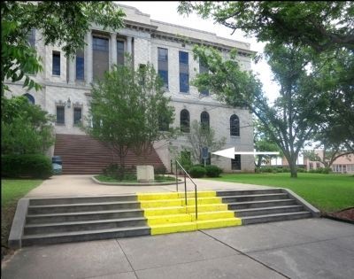
Founded 1840 by Lewis L. Chiles, a veteran of Battle of San Jacinto. Named for Mathew "Old Paint" Caldwell, Indian fighter and signer of the Texas Declaration of Independence. This was county seat, Milam County, in 1845; since 1846 county seat of . . . — — Map (db m286766) HM
Colonial statesman, Methodist lay leader, pioneer in Burleson County. Came to Texas in 1822 from Kentucky. Had office of surveyor, Austin's Colony, 1823 - 1836; was a military officer in Indian conflicts and also Army of Gen. Sam Houston during . . . — — Map (db m210617) HM
Born in Tennessee c. 1836-37, John Mitchell came to Texas in 1846. He began purchasing land in this area in 1870, the same year he married Viney Cox. As a member of both the 12th and 14th Legislatures, Mitchell championed increased educational . . . — — Map (db m125669) HM
Built around 1890, this American four-square house with offset entry was the home of Edward “Ed” R. Sinks (1854-1936), son of George Washington Sinks (1812-1892) and Julia Lee Sinks (1817-1904). George and Julia, both friends of Sam Houston, were . . . — — Map (db m179064) HM
Milton Garrett York was born in East Texas (San Augustine County) on Sept. 5, 1843. After the death of his parents, Aaron and Ruth (Lucas) York, he went to live with an uncle in Arkansas. Milton returned to Texas about 1860 and briefly taught school . . . — — Map (db m126746) HM
Born in South Carolina December 12, 1793 Killed by Indians October 8, 1848 Served in the Army of Texas, 1835-36 Signed the Texas Declaration of Independence, 36 Member of the Senate of the Second, Third, Fourth, Fifth, Sixth, and Seventh Congresses . . . — — Map (db m239507) HM
In 1840 the Republic of Texas Congress annexed to Milam County all of Washington County north of Yegua Creek and west of the Brazos River. The name Caldwell, which honored Mathew "Old Paint" Caldwell, a noted pioneer and a signer of the Texas . . . — — Map (db m125666) HM
This railroad bell was given in memory of James W. Lauderdale (1854-1914), Burleson County pioneer. He came by covered wagon caravan from Mississippi to Texas. In 1888 he married Florence Brooks. They had four children: Cyrus, Davis, Charles and . . . — — Map (db m74296) HM
The Chisholm Trail, which was developed following the Civil War, allowed Texas cattle to be driven to railheads in Kansas for shipment to eastern markets. An arm of the celebrated route, reaching from Matagorda County to the main trail near present . . . — — Map (db m135746) HM
Given to Methodist church as a camp-meeting site, by the Isaac S. Addison family. Mrs. Addison named camp in honor of Bishop Beverly Waugh, who presided at first Methodist Conference in Texas, and who, like the Addisons, was from Baltimore, Md. Site . . . — — Map (db m267499) HM
Prussian born Johann Joachim Giesenschlag (1817-80), his wife Anna (Schulze), and their children came to Texas in 1855. Settling first in Washington County, they moved to Burleson County in the 1870s and bought over 1,000 acres here. Giesenschlag . . . — — Map (db m220041) HM
Chartered in 1854, when Lexington was part of Burleson County, the community's Masonic lodge was first named in honor of Andrew Neill, a Texas War for Independence veteran. The lodge's first officers were John M. Doak, Titus H. Mundine and John B. . . . — — Map (db m205360) HM
Rudolph and Anna Duewall established a family farm here in the 1880s upon moving to Burleson County. Their son Edward (1885-1944) and his wife, Lizzie (Herrmann) (1890-1947), continued the farm operations. In 1928, they built this house on the site . . . — — Map (db m210799) HM
Burleson County was established in 1846 with Caldwell as the county seat. By the late 1840s Caldwell had a population of about three hundred. Local Masons began organizing and in October 1848 nine Freemasons petitioned George M. Patrick, Grand . . . — — Map (db m204219) HM
In 1884, several Moravian Czech families established farms in this area, naming the community Frenstat, or Friendsted, for Frenštát, Czechoslovakia, Alois and Veronica Polansky deeded 20 acres for a school, church and cemetery in 1887. . . . — — Map (db m219877) HM
In 1884, Catholic settlers from Czechoslovakia first arrived in this area. They named their settlement Frenstat for the community they had left, Frenstat Rod Radhost, Moravia. By 1887 the Rev. Joseph Chromcik regularly visited Frenstat. That year, . . . — — Map (db m219882) HM
About 1870 this area of Burleson County was settled by Czech-Moravian immigrants in search of fertile land and the religious freedom denied them in their native European homeland. Informal services were held twice a year in the family home of Joseph . . . — — Map (db m220013) HM
Settled by Alexander Thomson, Jr., early Texas patriot and partner of the colonizer Sterling C. Robertson. When railroad came through in 1880, the settlers moved to tracks.
Renamed, 1884, after Capt. H.C. Chriesman, surveyor for Stephen F. . . . — — Map (db m210616) HM
An 1878 railway work camp; in 1880 became town of Lyon's Station, named for site donor, W.A. Lyon. Soon had 3 cotton gins, an oil mill, many businesses. In 1894 hosted first auto ever seen in this county, with rides for the daring. Now gateway to . . . — — Map (db m204216) HM
Organized at High Prairie (5 mi NW) before 1880. The Rev. John R. Dunn was the first pastor. After the railroad came to Lyons, moved here.
Erected 1887, this is the oldest church building in regular use in this areas. Recorded Texas . . . — — Map (db m204215) HM
Following Emancipation in 1865, formerly enslaved African Americans established independent communities known as Freedom Colonies or Freedmen's Towns. Between 1865 and 1920, more than 500 of these settlements were established in Texas. These safe . . . — — Map (db m220060) HM
First shovel of earth for Somerville Dam was turned Sept. 22, 1962, by Lyndon B. Johnson then Vice President of United States.
Dam was built to control flooding on Yegua Creek in the 46 years prior to 1958, Yegua had flooded 43 times, costing . . . — — Map (db m203943) HM
As the Somerville Independent School District (SISD) emerged from the great depression, the school board filed a Works Progress Administration project proposal on October 3, 1938, to build a gymnasium. The proposal was accepted and construction on . . . — — Map (db m203941) HM
David Dorward arrived in Borden County in 1892. He was born December 15, 1872, in Burleson County, TX, to David and Anna Atkinson Dorward. In 1893 David began working as a wagon cook for the Square and Compass Ranch; a year later he began work for . . . — — Map (db m294555) HM
Thin black lines indicate changes in relevance. Between each pair of lines entries are ordered geographically but all have the same relevance.
* Inflectional forms of words are their plurals, singulars, and possessives as well as gramatical tenses and similar variations.