Established in 1880 by the Farley family, the Post stayed in the family for 100 years. It has served as Post Office, General Store and focal point for the Village of Mountainville. — — Map (db m16670) HM
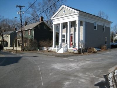
Early taverns near the Musconetcong River Crossings
served travelers between Trenton and the Oxford furnaces. Birthplace of Daniel Morgan, one of Washington’s Generals. — — Map (db m16611) HM
Settled in 1700'S. By 1873 only a gristmill, sawmill,
post office and a few homes remained. Town named for oak forests surrounding it. — — Map (db m16691) HM
English settler John Taylor established a gristmill c. 1760 approximately 0.7 miles downstream on Taylor's Mill Road. The mill supplied flour to American troops during the Revolutionary War and continued to operate into the early 20th century. This . . . — — Map (db m20329) HM
John Garrison, later known as John Johnston, born here c. 1830. Killed many of the Crow Tribe, slayers of his Indian wife. Robert Redford movie “Jeremiah Johnson” popularized his life. — — Map (db m91046) HM
[Newer, Blue Marker]:
Built in 1813. Named in honor of Admiral Perry’s Lake Erie victory. Later called Brick Tavern. In 1969 moved from Rt. 78 site to this location.
[Older, Red Marker]:
Built, 1813, Named for Perry’s Lake . . . — — Map (db m16614) HM
Commissioner General Moore Furman supervised bakery near here for George Washington’s troops. Later he built this stone inn in 1800. Building renovated in 2001. — — Map (db m36349) HM
Tavern lot purchased by
J. Robeson in 1752 from the
“Great Society.” Tavern and
farm were in Mechlin’s family
ownership from 1810 to 1934. — — Map (db m36350) HM
Named for Rockhill family who lived here on 846 acres as early as 1731. Original stone arch bridge built c1867 by H. Johnson. Reconstructed 2013/ — — Map (db m70021) HM
Located at crossroads of the West Jersey Society’s boundary line and old Raritan Path. First German Lutheran Church in New Jersey was built here c. 1730. — — Map (db m16767) HM
Named for prominent Potter family, the village was known early as “Lamington Falls.” Three counties merge at the river, Hunterdon, Morris, Somerset. — — Map (db m16915) HM
This building served as a school from 1837 to 1871 on Old Franklin School Road. It was used as a variable storage shed on Locust Grove Road until 1977, when it was moved here and restored. Its structural frame and windows remain original to the . . . — — Map (db m94961) HM
An early 1700S log meeting here was replaced by a stone structure in 1754. This was torn down and rebuilt in 1862, reusing the original stones. This Friends' meeting is still in use today with its extant records dating back to 1744. — — Map (db m16678) HM
Found here in 1956 near Raven Rock. Mining company formed by prospectors responding to the cold war craze was never commercially viable. — — Map (db m34266) HM
N.J. Central Railroad completed in 1875 to bring iron ore from Morris County to forges at High Bridge. In use until 1976 when the track right-of-way was sold. — — Map (db m5292) HM
Established in 1719 in North Branch. Moved to Readington 1738. Oldest Dutch Reformed Church in Hunterdon. Present building circa 1864. — — Map (db m16743) HM
Conducted 1876-1909 by Dr. Conrnelius Larison.
Also publishing house for his “Fonic Speling Wurks in Orthoepy.” His old home lies to the east. — — Map (db m16697) HM
Site of the first Presbyterian Church built in 1738. Here, George Whitefield’s sermon to 3000 people in 1740 inspired religious zeal. — — Map (db m62456) HM
In an 1889 Ringoes magazine, James Monroe Hoagland wrote of a cemetery of about 100 graves. It has been obliterated by plowing but was located in the field to your right. John Hoagland and other early farmers and settlers are said to have been . . . — — Map (db m92448) HM
Village named for John Ringo’s tavern, on the Old York Road. Sons of Liberty and Committee of Correspondence met here during the Revolutionary War. — — Map (db m16695) HM
Built in 1878 of cast & wrought iron by Lambertville Iron Works. One of the earliest Iron Pratt Through Truss bridges with Phoenix columns in the U.S. — — Map (db m83106) HM
This 12-acre nonsectarian plot was established in 1729 when George Fox set aside 1/4 acre as a resting place for locals who had passed from life. Captain Daniel Bray, the Revolutionary War here is among those interred here. — — Map (db m83141) HM
The first burial on this former farm of John Barber, Esq. was circa 1750. Early settlers, prominent citizens, slaves, war veterans, and politicians such as U.S. Senator & NJ Governor John Lambert Sr. are buried here. — — Map (db m83104) HM
Long the Sergeantsville Hotel. Gordon's Tavern in 1780. It has been the site of every town meeting since 1838. The township bought it in 1948. — — Map (db m72208) HM
The old part of this plot is also known as the Dunkard Cemetery. The 1840 will of Gideon Moore donated the property including a wall. Many early church members lie here, including its 50 year pastor, Rev. Israel Poulson. — — Map (db m83103) HM
Of Madison Square Garden in NYC was reconstructed here in 1932. Its steeply banked sides provided a racing venue to local cyclists until its wood fell apart from exposure. — — Map (db m30636) HM
Previous to 1817, known variously as Godley's Mills and Helltown for a rowdy tavern operating nearby. A grist mill and saw mill were built here about 1800. — — Map (db m21781) HM
The nation's first artificially inseminated calf was born near here in 1939 on the Richard Schomp farm. This was a revolution in dairy breeding. — — Map (db m30632) HM
Laid out on the farm of Johannes Nuhl (later Anglicized to Newell) who had come from Staten Island c. 1730, this is the burial ground of many of his descendants over the years and now serves as an area community cemetery. — — Map (db m101528) HM
Island in the river served as a site for clam bakes, picnics, and other public affairs. A flax mill located on the island in the mid-1800s. — — Map (db m60785) HM
Originally called “The Dutch Reformed Church of Mt. Pleasant.” First building erected 1834. Name of village changed to Stanton in 1849. — — Map (db m16744) HM
The only bridge of this design in Hunterdon County.
It spans the Musconetcong River and joins Hunterdon
to Warren County.
Also known as Wydner Farm Bridge — — Map (db m17411) HM
Begun in 1832, canal follows Delaware River to Trenton then New Brunswick. Built by Irish immigrants, canal fell into disuse with advent of railroads in 1850. — — Map (db m16658) HM
The Belvidere-Delaware Railroad c.1852. Later leased to the Penn R.R. System, the line allowed transit of
Lehigh & Hudson R.R. passenger trains. — — Map (db m16656) HM
Established as a summer camp in 1936 by Robert and Hermia Lechner. Site developed through federal government's Works Progress Administration (WPA) and Civilian Conservation Corps (CCC) programs. — — Map (db m16822) HM
Town was center point for Swift Sure Stagecoach Line running on the Old York Road between Philadelphia and New York in mid 1700's. — — Map (db m19185) HM
Arrival in 1864 spawned the town of Three Bridges.
Huge quantities of livestock and meats were shipped from here. Passenger service ended 1953. Station dismantled in 1955. — — Map (db m16741) HM
Daniel Sebring bought this land in 1711, and operated a tavern here by 1738. In 1769, it became the first overnight stage stop along the Old York Road
between NY and Philadelphia. — — Map (db m16739) HM
Early Indian trail known after 1711 survey as “The York Road,” later as “The Old York Road.” A third bridge added west of here in 1813 provided town’s official name in 1866. — — Map (db m16740) HM
Before 1813 a 16' X 16' schoolhoouse stood here. Rebuilt in 1840, it served until 1872 when a new building which has housed the town's fire company since 1954 was erected on this site. — — Map (db m35673) HM
Said to be the largest uncovered rock in the state. Named for land owner Hannah Quick. Legend says that during the Revolution, a shoemaker & ladder maker lived and worked their trades in a cave beneath. — — Map (db m62291) HM
West Portal Mines, Inc. mined magnetite here, producing over 250,000 tons of ore a year from 1939 to 1943. Rock dumps still remain, along with some building ruins. — — Map (db m16701) HM
Known as Jugtown for its 1761 "Jug" tavern, became Bethlehem by 1843 & West End by 1880 for its iron works. Named Ferndean & then West Portal by 1888. The 1870's 4900' LVRR tunnel was then the longest in the East. — — Map (db m62290) HM
New Jersey was the first to propose naming a highway in honor of WWII veterans. The Blue Star sign placed here was the nation's first to identify a highway as such. — — Map (db m46027) HM
Ran from Central R.R. in Whitehouse Station, to Oldwick, and on to Morristown. By 1917 the twenty-five mile line was out of business. — — Map (db m16763) HM
Opened here in the mid-1800s in “Whitehall” --
later known as “Iron Dale” and now “Woodglen.”
Typical of its kind, and one of the few still in business. — — Map (db m16613) HM