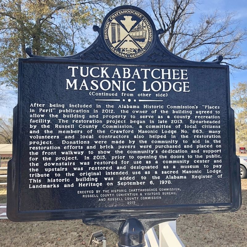
On U.S. 80 at Bleeker Road, on the right when traveling east on U.S. 80.
This historic building was erected in 1848 to serve as the
Tuckabatchee Masonic Lodge No. 96. At the time, this community
of Crawford, Alabama (formerly known as Crockettsville from 1832 -
1843, named after Davy Crockett) was the county seat of . . . — — Map (db m111586) HM
This tablet placed by the descendants of Edmund King, Jr. and the Alabama Writers Conclave. To commemorate his life and services. First brick house and first with glass windows built in this section of the state. Formerly known as the Mansion House. . . . — — Map (db m37353) HM
On North Broadway Avenue (Alabama Route 21) at East 1st Street, on the right when traveling north on North Broadway Avenue.
The district contains a collection of late-19th to mid-20th century commercial buildings representing over 60 years of Sylacauga's commercial history. On December 1, 1886, the Anniston and Atlantic Railroad became the first railroad to come through . . . — — Map (db m131719) HM
On North Broadway Avenue (Alabama Route 21) at West 8th Street, on the left when traveling north on North Broadway Avenue.
The Works Progress Administration (WPA), the Sylacauga community, and the state of Alabama, constructed this library in 1939. The building is the result of $16,588 from raised local funds including a $5000 donation for furnishings from the family of . . . — — Map (db m131721) HM
On North Broadnax Street (Alabama Route 49) north of Green Street, on the right when traveling north.
Called the United States Hotel until the 1890s,
the Dennis Hotel was owned by a Dadeville
family by that name for well over a century. It
began as a stage stop, and gained fame as the
living quarters for mid-19th-century humorist
Johnson Jones . . . — — Map (db m223969) HM
On Rev James Arter Smith Highway (County Road 50) at Stillwaters Highway (County Road 49), on the right when traveling west on Rev James Arter Smith Highway.
The Rock Store
Built in the late 1890s by Wingfield Terrell Cosby, Sr., his wife Drusilla, and their seven children, the Rock Store was a Tallapoosa County institution for more than a half century. Local rocks crudely stacked and joined with . . . — — Map (db m223944) HM
On Confederate Parkway 0.3 miles south of Tannehill Road, on the left when traveling south.
Built in the late 1870s near Vernon, Alabama by Edward Francis Collins. Logs were cut from timber on the family farm and hand hewed.
The house remained in the Collins family until it was moved to this site in the spring of 1984.
It was . . . — — Map (db m107501) HM
On Gary Fitts Street at 29th Ave, on the right when traveling west on Gary Fitts Street.
Newbern Hobbs Browne built this Gothic cottage in 1870. It is one of the first residences built in Tuscaloosa following the conclusion of the Civil War. Browne served four terms in the Alabama Legislature (1853-1859; 1873), and as Tuscaloosa County . . . — — Map (db m263006) HM
On Greensboro Avenue (State Highway 215) at 13th Street, on the right when traveling south on Greensboro Avenue.
The Chabannes - Sealy House was built in 1847 by Hollis C. Kidder. The house passed through several owners until it was sold in 1920 to Julia Nuzon Morris. Her daughter, Julia Morris, married Norbert Chabannes. That family lived here until the house . . . — — Map (db m35323) HM
On Hackberry Lane at 4th Street, on the left when traveling south on Hackberry Lane.
Constructed in 1923 through gift of J. T. Horne, this building occupied by Druid City Hospital School of Nursing from 1923 to 1947. Used by University of Alabama from 1951 to 1954 to house first state supported collegiate school of nursing in . . . — — Map (db m29608) HM
On Capitol School Lane 0 miles north of Gary Fitts Street, on the right when traveling north.
The oldest wooden structure in Tuscaloosa, the McGuire-Strickland House was built in 1820 for Caroline and Moses McGuire, Tuscaloosa County's first Probate Judge and a state representative until 1845. Dr. Reuben and Marian Searcy purchased the home . . . — — Map (db m262596) HM
On 28th Avenue at University Blvd, on the right on 28th Avenue.
Built in 1827 three blocks east on Broad Street. Stage stop and inn frequented by many political leaders while Tuscaloosa was State Capital. Moved to Capitol Park, 1966. — — Map (db m29119) HM
On 8th Street at 20th Avenue, on the right when traveling east on 8th Street.
Residence of many prominent Alabama families. Originally built by James Jenkins in 1822 as a two-room “cabin.” David Scott, prominent merchant and church leader, purchased the property in 1832 and added the four story brick structure. Occupied by . . . — — Map (db m203559) HM
On 6th Street at 28th Avenue, on the right when traveling west on 6th Street.
This stone commemorates the
City of Tuscaloosa as the second
state capital, January 1826
to January 1846.
Erected by the Alabama Centen-
nial Commission and the citizens of
Tuscaloosa, and dedicated December
14, 1919. On . . . — — Map (db m28996) HM
On University Blvd at 22nd Avenue, on the right when traveling east on University Blvd.
Constructed in 1909 as US Post Office. First occupied April 1910, with Mrs. Maggie Miller as Postmistress. Federal courtroom, now City Council Chamber, with magnificent design and detail, on second floor, 1910-1968. Thomas A. Jones first Federal . . . — — Map (db m35376) HM
On Court Street at Central Avenue ( Route 56), on the left when traveling north on Court Street.
The Washington County Courthouse as it was
built in 1908. It was razed in 1963. This memorial
cornerstone was placed by the Washington County
Historical Society and the Washington County Museum. — — Map (db m122737) HM
On Jefferson Davis Highway (U.S. 43) 0.2 miles north of Batley Road, on the right when traveling north.
Built circa 1841 by Walter Taylor on Commerce Street in Jackson. In 1985, it was removed from its original site to make way for a new City Hall Complex and was brought to this site and restored as the Leroy Branch of the Washington County State . . . — — Map (db m70598) HM
On Alabama Route 56 0.8 miles west of U.S. 43, on the right when traveling east.
The Sullivan Cabin was built on the east side of Bassett Creek, in
1874 by Gibeon Jefferson Sullivan, a Confederate soldier who served
in Co. A. 32nd Ala Infantry, an all-volunteer company made up of
men from Washington County. The cabin is a . . . — — Map (db m122341) HM
On State Highway 10 at Adams Street on State Highway 10.
Founded in 1882 by John Trotwood Moore, who became a famous author, archeologist, and poet laureate of the State of Tennessee, the original two-story wood frame building served the Pine Apple area from 1882 until the present brick structure was . . . — — Map (db m47705) HM
On County Road 63 at County Road 61, on the left when traveling south on County Road 63.
The Jail at Houston
The Houston Jail is the only surviving log jail in north Alabama. The jail, constructed around 1868 from hand-hewn hardwood logs, replaced an earlier one destroyed by pro-Union men in the county during the Civil War. The . . . — — Map (db m182919) HM
On 4th Avenue at D Street, on the right when traveling east on 4th Avenue.
Built in 1915, this is the first permanent building constructed in Anchorage and is now the oldest building still standing here. It was erected to house the Larson-Wendler Company, the city's first general merchandise store. — — Map (db m254280) HM
This cabin was moved
from 7th Avenue, and
has not been identified.
The original records
for all of these cabins
were lost during
the 1967 flood. — — Map (db m256864) HM
Originally located between
Lacey & Cushman Streets,
this cabin was built
in the early 1900's.
It was generously donated
by Edgar Philleo. — — Map (db m256941) HM
This replica is believed
to have been part of the
original homestead owned
by Dr. Young, one of the
first Dairy Farmers in
Fairbanks. It was moved to
this site from 11th Avenue. — — Map (db m256713) HM
One of the earliest in
Fairbanks, this cabin was built
around 1904 by two Finns.
It was located on Second Avenue.
The original mud can still be
seen between some of the logs.
It was owned by Lena Ferguson
until 1954, and donated by . . . — — Map (db m256714) HM
Home of Lee B. Loomis,
of Loomis Security:
built in 1903 for $800.
Note the leaded windows.
This cabin was also the
home of Louis Golden, and
later the Paul Palfy family. — — Map (db m256865) HM
Built in 1948, and used
as motels that were
later rented as homes.
It is rumored that many
lively parties were
held in these cabins. — — Map (db m256735) HM
This cabin was built in 1908
and purchased in the early 30's
by Nick Nagengast who traveled
to Alaska with Elam Harrish,
the hero of Jack London's
Burning Daylight — — Map (db m256856) HM
This cabin was moved
from 7th Avenue.
Martin Nunner,
a miner from Coal Creek
bought it from
a Russian family in
the mid nineteen fifties. — — Map (db m256869) HM
Moved from the 1400 block of 2nd and Badger. Willed to Carl Erickson by Lawrence Olson. Robert Service was never in the cabin, but his literary works were introduced here. — — Map (db m256867) HM
Constructed in 1906 as
the Palace Hotel and
Bath House. Located on
4th Avenue. First floor
was used as a bath house.
Cost of a Tub Bath
was fifty cents. — — Map (db m256876) HM
Owned by Henry (Harry) Peter Karstens.
He was co-leader of the 1st climb on
Mt. McKinley/Denali, and Pioneer
Superintendent of Mt. McKinley
National Park from 1921-1928.
Karstens returned to private
business in Fairbanks in 1928, and . . . — — Map (db m256931) HM
Bill Sherwin's home.
Originally located on
1st Avenue & State Street.
Bill's Saw Shop, building
number 20, was located
behind the house. — — Map (db m256888) HM
This cabin, originally
located on Wendell Street,
is said to have been
the home of Skagway Jim;
a member of Soapy Smith's
gang. Jim died in Fairbanks
around 1909 of an
old gunshot wound. — — Map (db m256860) HM
Suter, “The Live Jeweler” and E.R. Peoples, owner of E.R. Peoples General Merchandise, married two sisters in 1910.They built these two adjoining houses, together one of the first modern homes in town. — — Map (db m47408) HM
Wold family home from 1946 to 1969.
Joanne [Jo Ann], one of the daughters,
is known for her writing talents:
"This Old House",
and "Gold City Girl". — — Map (db m256935) HM
On Cowles Street at 5th Avenue, on the left when traveling south on Cowles Street.
This solidly built, almost square, two-story home was constructed in the 1904 to
1905 time period as a family home for Falcon Joslin and his family. Falcon Joslin was
born in Tennessee and was educated as a lawyer. He practiced law in Seattle . . . — — Map (db m257184) HM
This is the site of the original cabin of James J. Wickersham. He was an author, pioneer judge, congressional delegate and Alaska Visionary.
Alaska Centennial 1867-1967
State of Alaska
Governor Walter J. Hickel
Alaska Centennial Commission — — Map (db m47384) HM
[Stylized map of downtown Juneau]
[Illustration captions, clockwise from top center, read]
Last Chance Mining Museum
Originally the support buildings for the
Alaska Juneau Gold Mining Company
End of Basin Road • Built 1914-1916 . . . — — Map (db m257933) HM
On Chickaloon Way north of Glenn Highway Milepost 61.6 (Alaska Highway 1), on the right when traveling north.
In 1899 the U.S. Army documented the coal findings at Chickaloon and in 1916 the area was set aside by the United
States Secretary of the Interior as a designated coal-mining area. A town sprang up, the town of Chickaloon, peopled with
miners, . . . — — Map (db m254982) HM
On Glenn Highway (State Highway 1 at milepost 61.6) east of Chickaloon Way, on the left when traveling east.
In 1899 the U.S. Army documented coal along the Chickaloon River and in 1916 the area was set aside by the United States
Secretary of the Interior as a designated coal-mining area. The town of Chickaloon sprang up peopled with miners, . . . — — Map (db m255018) HM
On Glenn Highway (Alaska Route 1 at milepost 61.6) east of Chickaloon Way, on the left when traveling east.
Made of spruce logs harvested on his Caribou Creek property, Jim Hitchcock
constructed this cabin in the mid to late 1960's. It was designed to be used for
bathrooms with showers at a City of Palmer RV Park (now the site of the Palmer
Court . . . — — Map (db m255172) HM
On Chickaloon Way north of Glenn Highway Milepost 61.6 ( Highway 1), on the right when traveling north.
The "Lucas House" was built by the US Navy in 1917 in Chickaloon. Until about
1922 it served as an officer's quarters during the Navy's short period of coal
production in Chickaloon. At that time, the downstairs was two rooms, a kitchen . . . — — Map (db m254984) HM
Brothers Rasmus and Jon Enge floated this building across
the Wrangell Narrows to its current location. The family used it for a home and warehouse.
1998 Centennial Project/TRT Grant — — Map (db m301496) HM
On Sing Lee Alley, on the left when traveling north.
Newcomers called Rasmus and Anna Enge's boarding
house-home. Built over tidelands, it had a skiff float
alongside for high water landings and a street level cafe.
1998 Centennial Project/TRT Grant — — Map (db m301499) HM
On Harbor Drive (Local Route F-99) south of Lincoln Street, on the left when traveling south.
(Side 1):
Russian Bishop's House
Built in 1842 by the Russian American Company as a residence for the bishop of the Orthodox Church, the Russian Bishop's House is one of the few surviving examples of Russian colonial architecture . . . — — Map (db m308639) HM
On Lincoln Street east of Barracks Street, on the right when traveling east.
Norman E. Staton, Sr. and Ethel L. (Milonich) Staton purchased Building 29 in 1983, the same year it was registered by the National Park Service. With his love of architecture and his interest in preservation of historical sites, and as a . . . — — Map (db m308429) HM
The building before you is an historical structure known as “Jeff. Smith’s Parlor.” It has recently been acquired by Klondike Gold Rush National Historical Park, a unit of the National Park Service. Jeff. Smith’s Parlor, a part of the extensive . . . — — Map (db m72785) HM
On 5th Avenue west of Broadway, on the right when traveling west.
Built in 1897, this one-and-one-half story log structure served as
Skagway's first city hall and jail, the first courthouse, and the first U.S. Marshal's office. It was also the site of the land transfer for the railroad . . . — — Map (db m257763) HM
Measuring 50’ X 100’, this was once the largest buildings in Dyea. I was built on pilings for fear of high tide coming up that far in 1898. Warehouses were used to sort out massive piles of mining supplies and bring order to the chaos that had . . . — — Map (db m72788) HM
Built as McCabe College for Women in 1899-1900. This is the first granite building in Alaska. It served as a Federal Court House from 1901 until statehood when it was purchased by the city of Skagway for a museum. — — Map (db m72789) HM
On Richardson Highway (State Highway 4 at milepost 266), 0.1 miles north of 2nd Street, on the right when traveling north.
John Sullivan built his roadhouse out of unpeeled white spruce logs. It was originally chinked with moss and had a pole decked, sod roof covered with galvanized corrugated steel panels. The logs were crudely notched and pegged together. The . . . — — Map (db m255635) HM
On Richardson Highway (State Highway 4 at milepost 266), 0.1 miles north of 2nd Street, on the right when traveling north.
Today, the Sullivan Roadhouse appears much as it did during the early 1900's. The Roadhouse was carefully marked before it was dismantled and relocated to Delta Junction in the summer of 1996.
During the reassembly, the bottom three tiers of . . . — — Map (db m255640) HM
On Richardson Highway (State Highway 4 at milepost 266), 0.1 miles north of 2nd Street, on the right when traveling north.
The Sullivan Roadhouse was originally comprised of a main lodge and several out buildings. It was a main stop for the passenger and freight lines. A large barn and blacksmith shop were essential for maintaining horses and sleds. The Sullivan was . . . — — Map (db m255643) HM
On Apache Street at Supai, on the left when traveling east on Apache Street.
Gregorio Baca bought this house from G. Becker in 1907 for his bride, Chona Ortega. It's walls are 16" thick adobe. The wealthy Bacas & Ortegas ran large herds of cattle & sheep on vast tracts of land in Concho, St. Johns & The R.V. area. — — Map (db m36383) HM
Near Village Loop Drive. Reported permanently removed.
The Fred Harvey Company built Lookout Studio in 1914, in part to compete with the Kolb Brothers Studio located slightly west along the rim. Called "The Lookout," Fred Harvey's studio offered telescopic views, photographs, and books about the . . . — — Map (db m39544) HM
John G. Verkamp rented a tent from the Bright Angel Hotel in 1898 and began selling curios and Indian crafts for Babbitt Brothers' Trading Company. After several slow weeks he closed and sold his stock to the hotel. But he sensed Grand Canyon's . . . — — Map (db m39571) HM
Leo and Hazel Weaver had big plans for their newly purchased ranch as they flipped old cabins into rentals for guests. They hired Hopi stonemason Poli Hugavi to build this house which acted as the main lodge. The rustic Paradise Canyon Ranch was . . . — — Map (db m289949) HM
This home of Walter and Ruth Jordan began as a one-room cabin in 1931. It grew by three rooms in 1937, and grew in 1947 to its present size. It was opened as the Sedona Heritage Museum in 1998. It exemplifies early Sedona red rock construction. — — Map (db m94846) HM
On State Highway 89A, on the right when traveling north.
Built circa 1938 by George Jordan as a co-op retail outlet for fruit produced and marketed by local orchard farmers, including George and his brother Walter. It was a key part in the early commercial development of Uptown Sedona and is a good . . . — — Map (db m40921) HM
Near Brewer Road at Cypress Lane, on the left when traveling south.
Harold and Christine Strohm built their Old-West style building and opened 'Museum, Et Cetera.' to showcase their collection of antiques. The Strohms named the building 'Pushmataha' after a Choctaw Chief. It means “He has won all the honors of . . . — — Map (db m94831) HM
Near Arizona Route 89A, on the right when traveling south.
This was originally Bob Bradshaw's photo shop and living quarters. Bradshaw's photos appeared often in Arizona Highways, and he published several books of Arizona images. Bob was involved in Sedona's film-making business for 50 years. He sold . . . — — Map (db m94834) HM
On West Grand Canyon / West Route 66 at South 3rd Steet, on the left when traveling east on West Grand Canyon / West Route 66.
The wood framed 1894 Polson Bros. General Store burned down in the 1901 fire and was replaced by this brick building in 1907. The Babbitt and Polson families were pioneer merchants in the area. In 1930 the building was stuccoed to create the only . . . — — Map (db m33384) HM
On Bill Williams Avenue / Route 66 west of North 1st Avenue, on the right when traveling east.
Built by C. E. Boyce in 1907, this structure was a general merchandise and hardware store and shared a common wall with the Old Post Office to the west. In 1929 it became a dry cleaners with a huge array of belt driven machinery and an adobe . . . — — Map (db m33366) HM
On West Bill Williams Avenue / West Route 66 at South 2nd Street, on the left when traveling east on West Bill Williams Avenue / West Route 66.
This Neo-Classical Revival style building opened with much fanfare on Armistice Day, November 11, 1918. The bank was the financial center of the lumber, ranching and railroad operations in the area until it closed in 1958. The extensive terra cotta . . . — — Map (db m33381) HM
On West Railroad Avenue (U.S. 66) 0.1 miles east of South 2nd Street, on the left when traveling west.
One-story saloon of native stone ca. 1901-03. Second story of brick added in 1904 to house prostitutes' "Cribs". Storefront distinguished by classically designed pressed metal facade. Wrought iron balcony added in later years. — — Map (db m185230) HM
On West Bill Williams Avenue/West Route 66 west of South 2nd Street, on the right when traveling east.
In 1901, a great fire swept through Williams, burning 36 business buildings, 2 hotels and 10 homes in less than an hour. Major fires in 1903 and 1908 further dictated the need for fire-resistant stone, concrete, and brick buildings. Many of those, . . . — — Map (db m33392) HM
On West Bill Williams Boulevard/West Route 66 east of North 3rd Street, on the right when traveling east.
Bill Williams Mountain was named in 1851 after fabled mountain man William S. Williams, who is said to have trapped beaver in this area. In its shadow, this building circa 1912, served local needs with a pharmacy and soda fountain at the front of . . . — — Map (db m33389) HM
On West Bill Williams Avenue/West Route 66 west of South 2nd Street, on the right when traveling east.
The Atlantic and Pacific Railroad arrived in 1882, starting a stampede of commercial enterprise. The development of Williams as a community is indicated in part, by this ice cream and confectionery store built by Albert Lebsch in 1914. For a number . . . — — Map (db m33391) HM
On Bill Williams Avenue / Route 66 west of North 1st Street, on the right when traveling east.
Beginning in 1926, this vintage 1907 building served as the U.S. Post Office for 36 years. This was one of the many structures built by Cormick E. Boyce, who arrived in 1881 as a freight hauler and became one of the area's leading merchants and . . . — — Map (db m33368) HM
On Grand Canyon Avenue / West Route 66 east of North 3rd Street, on the left when traveling east.
Built of locally quarried volcanic rock in 1901, this edifice housed a bank and many businesses displaced by the 1901 fire. These included the local newspaper, telegraph office, and eventually Arnold's, a famous Route 66 eatery. In 1928, the Masonic . . . — — Map (db m33382) HM
On West Bill Williams Avenue west of North Grand Canyon Boulevard, on the left when traveling west.
Built of native rock with brick facades, this 1913 garage served travelers at the end of the wagon age and beginning of the automobile era. By 1930, automobiles carried more people to the Grand Canyon than did the railroad. The opposite end of this . . . — — Map (db m33380) HM
On West Bill Williams Boulevard/West Route 66 west of South 3rd Street, on the right when traveling east.
In 1901, a 60-mile long railroad spur line to the Grand Canyon secured Williams the title "Gateway to the Grand Canyon." Train tickets at that time cost $3.95 serving world travelers and locals alike, this pre-1910 structure was home to a men's . . . — — Map (db m33388) HM
On West Bill Williams Avenue at North Grand Canyon Boulevard, on the right when traveling west on West Bill Williams Avenue.
Built in 1901, this brick structure was the first train depot in Williams. After the Fray Marcos depot was built in 1908, this building took on freight arriving to and departing from Williams. It was moved here from across the railroad tracks in . . . — — Map (db m33379) HM
On west Bill Williams Boulevard/West Route 66 east of South 3rd Street, on the right when traveling east.
Telegraph service came to Williams in 1894. The Postal Telegraph Co. was located here in 1910, when this office was built, until the 1940's. At some time the building was divided to share space with Ziriax Photo Shop. The town bandstand was located . . . — — Map (db m33387) HM
On West Bill Williams Avenue east of North Grand Canyon Boulevard, on the left when traveling west.
This Victorian-Romanesque style building, designed as a saloon and bordello was built in 1897 by German tailor August Tetzlaff. Offering female company in eight cribs and an elegant parlor, it also boasted a two-story outhouse. Whiskey, pool tables . . . — — Map (db m33377) HM
On North Chisholm Avenue, on the left when traveling north.
This property
has been placed on the
National Register
of Historic Places
By the United States
Department of the Interior
Soderman
Building
1917 -1921
— — Map (db m67474) HM
On West Main Street, on the left when traveling west.
In 1932 a log building named the Payson Hotel was built on this site. In 1954 it was remodeled, together with the building to the west, as the Ox Bow Inn and Saloon. The name comes from Oxbow Hill, the gateway to Payson, named when soldiers in the . . . — — Map (db m67403) HM
On West Main Street at South McLane Road, on the right when traveling west on West Main Street.
On this strategic site, J.W. Boardman built a rock building and constructed a mercantile business. McLane Road, going north along the property, was the road to Pine and points north and west. The store was gutted by fire in 1938. Refrigerator . . . — — Map (db m67405) HM
On West Main Street, on the right when traveling west.
The two-story Herron Hotel burned down in 1918 at this location. Subsequently a series of businesses were established on this block. Among them were Payson's first gasoline station, an ice cream parlor, barber shop, mercantile store, and finally the . . . — — Map (db m67404) HM
On West Main Street at South 5th Avenue, on the right when traveling east on West Main Street.
A well-known Tucson architect, H. O. Jaastad, designed this imposing neo-classical revival structure in 1920. Snell & Harvey of Phoenix erected the building for around $50,000. The concrete foundation is capped by brick construction. Two terra cotta . . . — — Map (db m61511) HM
14312 entries matched your criteria. Entries 201 through 300 are listed above. ⊲ Previous 100 — Next 100 ⊳