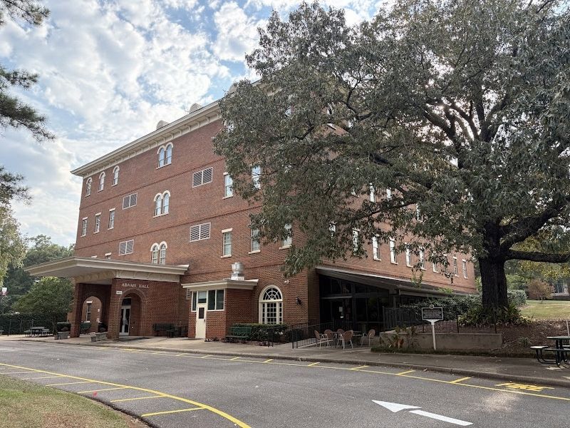
On University Drive, on the right when traveling south.
As early as 1907, salted green peanuts boiled in brine were sold during the summer months throughout Dothan, "Peanut Capital of the World." — — Map (db m284830) HM
On 4th Avenue North, on the left when traveling west.
Businesses that occupied this building between 1908 - 1970
1908 - 1913 Southern Bell Telephone Company Stockroom
1915 - 1926 OK French Dry Cleaning Company
1927 - 1938 George Kanelis Billiards
1940 - 1945 Alex’s Steak House
1946 - . . . — — Map (db m27521) HM
On Dexter Avenue east of South Perry Street, on the right when traveling east.
Greek immigrant Christopher Anastasios Katechis opened Chris’ Hot Dogs on May 1, 1917, at 138 Dexter Avenue. Until the 1960’s, Chris offered curb service for its hot dogs, leading to long lines of cars cued for service. The hot dogs featured Chris’ . . . — — Map (db m312089) HM
On South Main Street (Alabama Route 93) 0.1 miles south of SA Graham Boulevard ( Route 10), on the right when traveling south.
City of Brundidge and the Bass House. Brundidge was founded in 1851 and incorporated in 1890. Brundidge City Hall has been located in the former Bass House on South Main Street in downtown Brundidge since November 1992. The entire house was . . . — — Map (db m315779) HM
Palatable food during the fort's early days was a constant problem; the soil was poor quality, lacking nutrients, and other sources of fresh food were distant. Though neighboring ranches supplied some vegetables and meats, they were still a day's . . . — — Map (db m313667) HM
Near North Pipe Spring Road 0.3 miles north of Arizona Route 389, on the left when traveling north.
Baskets and cradleboards were made from the stems of the three-leaf sumac, but its tart berries bring back Paiute people's best memories. Also called lemonadeberry, the small fruits were pounded into a pulp, then squeezed. Mixed with water, the . . . — — Map (db m314496) HM
On College Road, on the left when traveling north.
Archie Leonard Reed is a life-long Cane Hill resident. As a Cane Hill Harvest Festival committee member and longtime festival volunteer, Archie helped train the next generation of sorghum cookers. In 2024, Historic Cane Hill dedicated this sorghum . . . — — Map (db m311416) HM
Mortar Rock takes its name from the many holes worn in these hard lavas by Native American women pounding and grinding acorns and other seeds into meal. This staple food could be stored and later cooked into cakes or porridge.
Native . . . — — Map (db m313677) HM
Here, Charles A. Wetmore planted his vineyard in 1882. The Cresta Blanca wine he made from its fruit won for California the first international award, the highest honor at the 1889 Paris Exposition, first bringing assurance to California wine . . . — — Map (db m315859) HM
On Clayton Road, on the right when traveling west.
Paul De Martini built Clayton Vineyards Winery in 1885 on land formerly owned by Joel Clayton, the area’s first vintner. An Austrian stone mason directed construction, using stone quarried on Mount Diablo and hauled here by wagon teams. This was . . . — — Map (db m312022) HM
On San Pablo Avenue near El Dorado Street, on the right when traveling north.
After running kitchens in early hotspots such as the "IT" Club and Six Bells, Violet Wong went on to become a culinary pioneer in El Cerrito by introducing Chinese American food. In 1945, Violet and her husband, Albert Wong, opened Violet's . . . — — Map (db m311793) HM
On Alhambra Avenue at Masonic Street, on the right when traveling north on Alhambra Avenue.
On this site in 1874, Julio Richelieu, bartender, served up the first martini when a miner came into his saloon with a fistful of nuggets and asked for something special. He was served a "Martinez Special." After three or four drinks, however, the . . . — — Map (db m312023) HM
On Locust Street, on the right when traveling north.
A popular café for more than 20 years, Kitty Milk Bar was particularly renowned for its ice cream and donuts. The café took its name from the nickname of the proprietor's sister, Catherine. — — Map (db m315310) HM
On Rodeo Drive 0.2 miles south of Santa Monica Boulevard, on the right when traveling south.
This was the site of a beloved Beverly Hills toy emporium that operated from 1947 to 1965. The fanciful store was famous for its lemonade tree that dispensed ice cold lemonade, the multi-colored lollipop tree with limbs full of lollipops . . . — — Map (db m314497) HM
On Beverly Drive at Charleville Boulevard, on the left when traveling south on Beverly Drive.
The slogan "It's Heavenly!" defined one of the small chain of the upscale, old-style ice cream parlors located here. At this corner location was one of the first Wil Wright's Ice Cream shops that opened at 200 South Beverly Drive in 1949. The . . . — — Map (db m311771) HM
On Lakewood Boulevard at East Florence Avenue, on the right when traveling south on Lakewood Boulevard.
This is the oldest existing McDonald's hamburger stand in the world. Its neon arches and red and white tile have become an icon of the California car culture of the 1950s. The towering neon chef, "Speedee," was McDonald's first mascot and . . . — — Map (db m51959) HM
On East 4th Street, on the right when traveling west.
Formerly called the Hot Cha Cafe, this unique building is shaped like a coffee pot. Fantasy architecture based on an object became popular in the 1920's and 1930's in small-scale commercial buildings, to attract attention and sell a product. Most . . . — — Map (db m312028) HM
On Figueroa Street north of 7th Street, on the right when traveling north.
From A Fire Station To A Diners' Hot Spot
In a city where, as the joke goes,
any waiter might be an actor,
there's no reason why a venerable fire station shouldn't be
turned into a restaurant.
And in a city that . . . — — Map (db m312230) HM
On Figueroa Street north of Avenue 55, on the right when traveling north.
America’s Mother Road
U.S. Route 66, established in 1926, was one of the original highways of the United States Highway System. It originally ran from Chicago, Illinois in the east to its western terminus in Downtown Los Angeles, on . . . — — Map (db m312177) HM
On Hollywood Boulevard just west of Orange Drive, on the right when traveling west.
As the birthplace of the hot fudge sundae, C.C.Brown's was a Hollywood landmark. It was located at this site from 1929 to 1996 and was popular with celebrities who dropped in after movie premieres at the Chinese Theatre. Fans lined up outside for . . . — — Map (db m315728) HM
On 1st Street at Alameda Street, on the right when traveling east on 1st Street.
Birth of the Atomic
Atomic Cafe is popularly known in the cultural history of Little Tokyo as ground
zero of the 1970s and 1980s punk rock and Downtown LA Arts movements.
But dig deeper and you'll unearth a shared history of the . . . — — Map (db m227986) HM
On Sunset Boulevard at Hyperion Avenue, on the right when traveling west on Sunset Boulevard.
At midnight on January 1, 1967, undercover LAPD officers raided the Black Cat Tavern in Silver Lake. 14 men were beaten, dragged outside, and arrested. Six men were charged with lewd conduct for same-sex kissing. Outrage over the raid spurred . . . — — Map (db m233806) HM
On Sunset Boulevard just west of Hyperion Avenue, on the right when traveling west.
Site of the first documented LGBT civil rights demonstration in the nation, held on February 11, 1967.
Declared 2008, Historic-Cultural Monument No. 939, Cultural Heritage Commission, City of Los Angeles. — — Map (db m180370) HM
On South Central Avenue at East 42nd Place, on the right when traveling south on South Central Avenue.
Curtis Mosby, the conductor of the Dixieland Blue Blowers, opened the Apex on Thanksgiving 1928. The classy nightclub was home to revues featuring beautiful showgirls in extravagant costumes. Johnny Otis led the house band, but Alabam . . . — — Map (db m144912) HM
On Pacific Coast Highway 0.5 miles east of the Harbor Freeway (Interstate 110), on the right when traveling east.
Der Wienerschnitzel
Original location. Excellent example of a
walk-up food stand and
drive-thru. Built 1961. Declared 2013, Historic-Cultural
Monument No. 1046, Cultural Heritage Commission, City of Los Angeles.
Der . . . — — Map (db m312126) HM
On West Colorado Boulevard 0.4 miles east of Figueroa Street, on the right when traveling east.
On this site in 1924, sixteen year-old Lionel Sternberger first put cheese on a hamburger and served it to a customer, thereby inventing the cheeseburger. The 'Aristocratic Burger' at the Rite Spot is the first instance of a hamburger with cheese . . . — — Map (db m156407) HM
On Santa Monica Boulevard just west of La Cienega Boulevard, on the left when traveling west.
The famous Tail o' the Pup hot dog stand debuted in Los Angeles in 1946. Originally located at La Cienega and Beverly Blvd.
Designed by architect Milton Black in 1939, this original building has been carefully preserved and fully restored . . . — — Map (db m312099) HM
On Road 19 1/2 at Avenue 21 1/2, on the right when traveling south on Road 19 1/2.
In the early days of highway travel, there was very little in the way of convenience for hot and tired travelers. In 1926, Frank “Pops” Pohl got the idea to open a giant orange shaped juice stand in Tracy, Ca. The stand sold orange juice, . . . — — Map (db m314502) HM
Enlisted men enjoyed few privileges and even fewer comforts at Camp Reynolds. Officers lived in the houses lining the parade ground, with the Post Commander closest to the water. Soldiers lived in barracks opposite officer’s row. One comfort the . . . — — Map (db m311968) HM
Near Redwood Road, on the right when traveling south.
The Christian Brothers started their wine business September 2, 1882, at Martinez, California. On May 29, 1930, they bought the Mont La Salle property from Theodore Gier and began to move winery equipment and 54,000 gallons of wine from Martinez . . . — — Map (db m315860) HM
James Frasinetti, an Italian immigrant, founded this winery in 1897. Frasinetti’s is the oldest family owned and operated wine producer in the Sacramento Valley. At its peak, the winery had over 400 acres of grapes.
Today, grapes have . . . — — Map (db m315867) HM
On Franklin Boulevard at 3rd Avenue, on the right when traveling north on Franklin Boulevard.
Built in 1949
Gunther's Quality Ice Cream
Est. 1940 by Iva and William Gunther
Owned & operated since 1974 by Richard and Marlena Klopp
Googie design by William Koblik & Alfred Fisher
Jugglin Joe Neon Sign: Samuel Stover (EPCO) in . . . — — Map (db m311773) HM
On San Felipe Road (State Highway 156) at Wright Road, on the left when traveling north on San Felipe Road.
First saloon serving steam beer in this area. Has been here for over 100 years. Owned and operated for many years by Steve Kaelin. Presently owned by Lydia C. and Ray L. Dassel. — — Map (db m315872) HM
Near Airline Highway (California Route 25) south of Tres Pinos, on the right when traveling south.
First saloon serving steam beer in this area. Has been here for over 100 years. Owned and operated for many years by Steve Kaelin. Presently owned by Lydia C. and Ray L. Dassel. — — Map (db m315873) HM
1839: Cucamonga Rancho Winery (Thomas Vineyard Company Winery). California's oldest winery. Built some time after March 3, 1839 by Tiburcio Tapia. Construction began when Governor Juan B. Alvarado granted Rancho de Cucamonga to Tapia.
1882: . . . — — Map (db m315850) HM
On North E Street near West 14th Street, on the right when traveling south.
McDonalds hamburgers and fries represent a true slice of Americana. This site is ground zero for all modern day fast food chains.
Museum owned and operated by Juan Pollo restaurants — — Map (db m204525) HM
On North E Street at West 14th Street, on the left when traveling north on North E Street.
Dick and Mac McDonald opened the world’s first McDonald’s Self-Service, Drive-In Restaurant on this site in San Bernardino, California, December 1948.
They previously operated a successful Drive-In Barbeque Restaurant with Carhop Service on . . . — — Map (db m120644) HM
The golden arches were removed from this sign in 1961 when Multi-Mixer salesman Ray Knoc purchased the rights to McDonald's Hamburgers from Dick and "Mac" McDonald for $ 2.7 million dollars. The sign was saved from complete demolition in 1972 when a . . . — — Map (db m282362) HM
On 4th Ave south of Market Street, on the left when traveling north.
Originally known as the San Diego Steam Cracker Factory, this brick structure has remained a bakery since its construction in 1884. During the first part of the 20th century, when the Gaslamp was deteriorating into a red-light district, the upper . . . — — Map (db m311783) HM
On Broadway at Kearny, on the right when traveling west on Broadway.
"Welcome to the world-famous Finocchio's, where the most beautiful women onstage are men." Opened in 1936, Finocchio's cabaret featured female impersonators, both gay and straight, performing in, elaborateshows that drew in sailors and tourists . . . — — Map (db m116050) HM
Originally opened in 1934, Mona's Club moved to 440 Broadway in 1939 and is credited with being San Francisco's first openly lesbian club. The venue featured female entertainers dressed as men, an inverse to the transgender theme of nearby . . . — — Map (db m116012) HM
For 30 years (1933-1963) The Black Cat Café was at the heart of the City’s Bohemian life – providing a welcoming saloon for artists, gay people and North Beach characters, often entertained by the operatic voice and bawdy humor of Jose Sarria, later . . . — — Map (db m98102) HM
Near The Embarcadero at Beach Street, on the right when traveling north.
In 1849, Isadore Boudin baked the first sourdough French loaf. Saving a bit of the dough for the next day’s batch, he began a tradition that continues 150 years later. Today, sourdough is as much a part of San Francisco as cable cars and the . . . — — Map (db m311904) HM
One August evening in 1966, transgender women and gay men banded together to fight back against oppression after a police officer harassed one of them at Gene Compton's Cafeteria. This confrontation was the first known full-scale riot for . . . — — Map (db m90982) HM
Here marks the site of Gene Compton's Cafeteria where a riot took place one August night when transgender women and gay men stood up for their rights and fought against police brutality, poverty, oppression and discrimination in the Tenderloin. . . . — — Map (db m91015) HM
John's Grill site where Dashiell Hammett wrote "The Maltese Falcon"
"Spade went to John's Grill and asked the waiter to hurry his order of chops, baked potatoes, sliced tomatoes… and was smoking a cigarette with his coffee . . . — — Map (db m316255) HM
On West Pine Street near Sacramento Street, on the right when traveling west.
On this site
One hot day in June of 1919
Roy Allen
served the
first frosty
mug of
creamy
A&W Root Beer
in Lodi, California
Dedicated to the City of Lodi, this 14th day of July, 2001 — — Map (db m41492) HM
Along the coast from Morro Bay to Canada there are estuaries where tidal changes expose and then recover the mud flats. In many of these places people are farming oysters. Morro Bay is one of those places.
Oysters have been cultivated here . . . — — Map (db m311322) HM
On South Spruce Avenue at Centennial Way Trail, on the left when traveling east on South Spruce Avenue.
Did you know that prior to World War II, the area you’re standing on was a prolific mushroom farm! McFarland and Nesbit Mushroom Company operated from 1921 through 1945 on the land between what is now Centennial Way Trail and Colma Creek. . . . — — Map (db m313678) HM
On State Street west of La Cumbre Road, on the right when traveling west.
On January 31, 1972, our creation -
Egg McMuffin -
was first introduced to America at this restaurant.
Proudly - McDonald's, Santa Barbara. — — Map (db m236032) HM
The Fitzsimmons & Twisselman families have been operating their concessions at the Santa Cruz Beach Boardwalk since 1934. Over the years, Charles J. Fitzsimmons moved from games to retail food. Today, Charles’s grandson, Matt Twisselman, . . . — — Map (db m312094) HM
On 4551 north of Dog Valley Road, on the right when traveling north.
Wheeler Sheep Camp was one of the main sheep camps of the Wheeler Sheep Company based in Reno, Nevada. Sheep camps were the summer bases of operation for sheep grazing in the high Sierra meadows. This camp was built and managed by John Martin . . . — — Map (db m311969) HM
Our Press House, the first stone winery building in America, was built in 1862 from volcanic stone cut out of the solid wall of the Mayacamas Mountains. Wine was made in this building the grapes were brought to the front door by horse-drawn . . . — — Map (db m315875) HM
Near Old Winery Road east of Lovall Valley Road, on the right when traveling east.
Marker One:
Father Junipero Serra: 1713 - 1784
Founder of the Missions of California, this Franciscan priest was the first to bring the grape to California, beginning with the first vineyard planted at Mission San Diego in 1779. His . . . — — Map (db m231450) HM
Near Old Winery Road east of Lovall Valley Road, on the right when traveling east.
Marker One:
St. Vincent of Saragossa: ? - 304 AD
St. Vincent of Saragossa died in the year 304, martyred during the last persecution of Christians by Roman Emperor Maximilian. By the early middle ages he had been adopted by grape . . . — — Map (db m231453) HM
Near Old Winery Road east of Lovall Valley Road, on the right when traveling east.
The founder of the winery, the Count of Buena Vista, Agoston Haraszthy de Mokesa, was a vivacious pioneer whose love affair with grape-growing started in his homeland of Hungary. The Count immigrated to the burgeoning American West in 1840 in . . . — — Map (db m315852) HM
On G Street at 11th Street, on the right when traveling east on G Street.
“A neon drive-in casts long shadows across a vast parking lot as the sun drops behind a distant hill. A large neon sign buzzes in the foreground of MEL’S DRIVE-IN, while in the background, “Rock Around The Clock” blares from the radio of a beautiful . . . — — Map (db m223768) HM
In May of 1949, Bill and Dorothy Harmsen purchased an ice cream machine and leased a storefront on the east side of Washington Ave. The Harmsens chose the name Jolly Rancher for their store to reflect a spirit of western hospitality. High quality . . . — — Map (db m315730) HM
Near State Highway 184 at milepost 7 north of Lebanon Road, on the right when traveling west.
The pungent smell of the leaves gives this plant its common name. Ripe red berries make a tart lemon-tasting drink when mixed with water, providing another common name of lemonade-bush.
Sumac branches (K' ii') are used for . . . — — Map (db m314499) HM
Near Meadow Road Northeast 0.1 miles east of Eagle Nest Road Northeast, on the left when traveling west.
Rosemary was a favorite herb for cooking and strewing. As a symbol of remembrance and fidelity, it was added to wedding cakes and puddings, as well as tossed into coffins at funerals. — — Map (db m313668) HM
On 11th Street Northwest north of Kenyon Street Northwest, on the right when traveling south.
For nearly 50 years, this corner was home to Nob Hill Restaurant, one of the nation's first openly gay bars for-and run by-African Americans.
Started in the 1950s as a private social club, Nob Hill went public in 1957. Patrons enjoyed . . . — — Map (db m86014) HM
On Georgia Avenue Northwest (U.S. 29) south of Randolph Street Northwest, on the right when traveling north.
Billy Simpson's provided DC's African American community with an upscale venue for dining and socializing in the period when segregation was ending and African Americans claimed a larger role in city affairs. The restaurant (open 1956-1978) . . . — — Map (db m316250) HM
On Georgia Avenue Northwest (U.S. 29) at Barry Place Northwest, on the right when traveling south on Georgia Avenue Northwest.
The area west of this spot once was an Irish and German immigrant neighborhood known as “Cowtown.” That's because, before 1871, cows, pigs, and sheep roamed freely here, while those kept in Washington City, south of Boundary Street (today's . . . — — Map (db m311916) HM
Near Jefferson Drive Southwest at 12th Street Southwest, on the right when traveling east.
For as long as people have farmed the land, pests, weeds, and plant diseases have threatened the food we grow. Today, these challenges remain one of the biggest risks to agriculture. In fact, up to 40 percent of the world's potential crop . . . — — Map (db m315131) HM
Near Jefferson Drive Southwest at 12th Street Southwest, on the right.
The U.S. has a significant livestock industry, and some ofthe crops grown in this garden support the sector by forming the basis of animal feed. U.S. livestock farms range from large-scale operations with thousands of animals, to smaller farms . . . — — Map (db m315130) HM
On Beck Avenue (Florida Route 30) south of West 14th Street, on the right when traveling north.
This fast food ice cream and hamburger shop was established by Harold L. & Dorothy Dunton. Tastee-Freez was one of the first soft serve franchises in the Nation. Subsequent owners included Mrs. Roberta Elder, Dana E. Wright and Galen Mielke. In . . . — — Map (db m245505) HM
Near Halsema Road North 0.4 miles Old Plank Road, on the right when traveling north.
Confronting the enemy
"In this imposing waterfront home lived Mrs. Sarah Reed and her younger sister , Miss Julianna James. Miss James, a beauty of her day, hurriedly dressed in her best in time to answer the captain’s knock. . . . — — Map (db m312178) HM
On East 9th Avenue near North 19th Street, on the right when traveling west.
Francisco Ferlita, a native of Santo Stefano, Sicily, established a bakery on this site in 1896. Bread sold for three cents and five cents, and often on credit. In 1922 the wooden structure was destroyed by fire, and a yellow brick building was . . . — — Map (db m311923) HM
On East 7th Avenue (Florida Route 574) west of North 15th Street, on the right when traveling west.
Near this location, Federico Arnavat founded Las Novedades (The Novelties), the first candy store and ice cream shop in Ybor City. Arnavat started his business before the turn of the 20th century, taking advantage of Ybor City’s growing . . . — — Map (db m171393) HM
Other than bread, fish, shrimp, and turtles, most of the food—salted pork, salted beef, and beans—came from the mainland. Officers fared better than the soldiers and prisoners. "The bread was a mixture of flour, bugs, sticks and dirt," Lincoln . . . — — Map (db m311901) HM
On West Esther Street west of South Orange Avenue ( Route 527), on the right when traveling west.
On June 12, 2016, 49 angels sought the joy, love and acceptance of Pulse Nightclub. Instead, they found hatred. And they never came home. They were gay. They were straight. Latin, black, white. Mothers, Brothers. Sisters. Daughters. Sons. Lost . . . — — Map (db m206257) HM
Near Halifax Drive at East Ocean Avenue, on the left when traveling south.
The Sands Fish & Oyster Company supplied oysters to markets and restaurants up and down the Atlantic seaboard from 1916 until 1955. Founded by William Sands, Sr., the company earned Port Orange, Florida, the title of “Oyster Capital of the World” . . . — — Map (db m311323) HM
Near Fort Yargo Road east of South Broad Street (Georgia Highway 81), on the left when traveling south.
At one time, settlers used beehive ovens to bake all kinds of foods. Taking its name from its shape, the beehive oven can be found in all parts of the world even today. They are simple to build from clay and straw so there is little or no cost — . . . — — Map (db m312017) HM
Near North Druid Hills Road at Briarcliff Road NE, on the right when traveling west.
On April 16, 1986, Chick-Fil-A moved beyond the mall food court and opened our first stand-alone restaurant here on North Druid Hills Road in Atlanta. Although this new concept would transform the way we serve our guests around the country, it . . . — — Map (db m310916) HM
On North Central Avenue (U.S. 19) 0.5 miles west of Interstate 75, on the right when traveling west.
Chick-fil-A™ Founder S. Truett Cathy opened the Dwarf Grill (later renamed the Dwarf House) at this site on May 23, 1946. After years of trial and error, it is here that Cathy invented what is widely considered the first-ever fried chicken . . . — — Map (db m312166) HM
The first Brunswick
Stew was made here in
the Brunswick - Golden
Isles area in early
colonial days. It remains
an American Favorite. — — Map (db m16615) HM
Near West Lawrenceville Street at Main Street, on the right when traveling west.
The Dutch Mill Motel and Restaurant served as a popular stop for travelers and locals alike. It was famous for its fried chicken, banana pudding, pineapple cake, and barbecue that was cooked and smoked just outside in a fire pit. All served with . . . — — Map (db m312167) HM
On East Crogan Street east of South Clayton Street, on the right when traveling east.
As in most counties in this part of Georgia, there were a few local entrepreneurs who developed a thriving business producing a popular variety of white lightnin'. Customers came from miles around for a chance to purchase some of Gwinnett's finest . . . — — Map (db m197679) HM
On Maple Street 0 miles north of Martin Luther King Boulevard, on the right when traveling north.
The Piedmont Hotel was constructed here just prior to the opening of the nearby railroad in 1873. Primarily a summer resort, the three-story hotel was a rambling, U-shaped structure with 30 rooms. A large dinning room and kitchen adjoined the . . . — — Map (db m312168) HM
On South Madison Street 0 miles south of Smith Avenue (U.S. 84), on the right when traveling south.
Brothers William Howard Flowers & Joseph Hampton Flowers Jr. opened Flowers Baking Company, the first commercial bakery in Southwest Georgia, on this site on November 4, 1919. The following morning, 500 loaves of "Flowers Quality Bread" were sold . . . — — Map (db m311967) HM
On West Arco Highway (U.S. 20 at milepost 291) near North 135 West, on the left when traveling west.
Early day big game hunters who occupied lava caves around here more than 12,000 years ago, had a diet that included elephants, camels and giant bison.
When a gradual change to a warmer, drier climate made local grasslands into more . . . — — Map (db m174239) HM
On U.S. 12 near Hazel Street, on the left when traveling north.
Lewis provides a description of a coho salmon, a common food of the indigenous population while at Fort Clatsop. "the white Salmon Trout which we had previously seen only at the great falls [Celilo Falls] of the Columbia has now made it's . . . — — Map (db m315036) HM
On Ogden Avenue west of South Lombard Avenue, on the right when traveling west.
Route 66, the Mother Road, is an American icon that symbolizes romance and freedom of the open road. Born in 1926, Route 66 was one of the first numbered U.S. highways, journeying 2,500 miles from Chicago to Los Angeles. Today, you . . . — — Map (db m312229) HM
Near West 35th Street west of Dan Ryan Expressway (Interstate 90/94), on the right when traveling east.
The Vienna Beef "hot dog stand," as we know it today, began as a street cart that hot dog vendors used throughout the Great Depression. While spending was scarce, business was booming for these forward-thinking entrepreneurs who offered a . . . — — Map (db m312088) HM
On South Calumet Avenue north of East 42nd Street, on the right when traveling south.
The people of West Africa used Adinkra symbols to adorn cloth which African royals wore to important ceremonies. Originating from the Gyaman people of Ghana and la Côte d'Ivoire, the symbols have assumed global importance and are now found in logos, . . . — — Map (db m312353) HM
On North Halsted Street north of West Newport Avenue, on the right when traveling south.
Stonewall
The Riot that Started a Revolution
June 28, 1969
Throughout the 1950s and 1960s, law enforcement officials kept track of suspected homosexuals and the places that catered to them. Police regularly raided bars, seizing . . . — — Map (db m189475) HM
On West Taylor Street at South Miller Street, on the right when traveling west on West Taylor Street.
Here is her lifetime home — except for two years after it was twice firebombed because of her leadership in the effort to save Little Italy from construction of the University of Illinois Chicago campus. During that absence, starting in 1962, she . . . — — Map (db m312759) HM
On East Cermak Road at South Wabash Avenue, on the right when traveling east on East Cermak Road.
White Castle #16
Lewis E. Russell (with Lloyd W. Ray, construction superintendent for White Castle System of Eating Houses, Inc.), architect
1930
This tiny white glazed-brick building remains the best-surviving example in Chicago of . . . — — Map (db m187703) HM
Ray A. Kroc, founder of McDonald's Corporation, opened his first McDonald's franchise (the ninth McDonald's drive-in in the U.S.) on this site April 15, 1955.
In memory of his wisdom and spirt, McDonald's Corporation dedicates this site to . . . — — Map (db m280659) HM
Near Plum Grove Road 0.3 miles south of Schaumburg Road (Route A66), on the right when traveling north.
Did you know the Chicago hot dog originates from the German frankfurter, brought to the United States by immigrants in the 1800s?
This planter contains the ingredients for classic Chicago-style relish: cucumbers, tomatoes, onions, celery, . . . — — Map (db m312090) HM
Near Washington Street south of Chicago Avenue, on the right when traveling north.
Walter and Grace Fredenhagen, visionaries in business and community and creators of "One in a Million" milk shakes, are depicted in these bronze sculptures. Walter owned and operated Prince Castles and Cock Robin ice cream shops from 1931-1993, . . . — — Map (db m310914) HM
On North Frontage Road south of S Quincy Road, on the right when traveling east.
The Chicken Basket was established in 1946 born out of a gas station next door that sold fried chicken. It was a Blue Bird bus stop as well as a restaurant and used to have ice skaters on the roof to attract Route 66 travelers. It became Dell . . . — — Map (db m312061) HM
On North Frontage Road south of South Quincy Street, on the right when traveling east.
Most businesses on Route 66 began as combinations of gas stations, garages, and lunch counters. At the Chicken Basket, tasty food won out over gasoline sales. Throughout the 1940s and 50s, hungry travelers flocked to the popular restaurant. But in . . . — — Map (db m312173) HM
393 entries matched your criteria. The first 100 are listed above. Next 100 ⊳