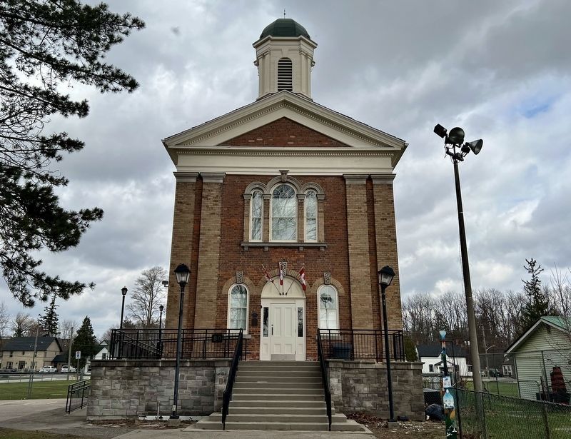
The placement of this marker is to commemorate the Black Settlers who fled from the United States to Canada through the Underground Railroad. Heritage Haldimand, the Canfield Community Centre and Haldimand County, in partnership, offer this . . . — — Map (db m252556) HM
1842
Swing Bridge and Navigation
The first bridge in Cayuga was built in 1842 and consisted of a wooden structure that stretched across the river near King Street, one block north of where the bridge now stands. The bridge was part of . . . — — Map (db m235472) HM
In 1811 Matthew W. Smith located the site for a flour
and saw mill here on the Dunnville Road, south of
the village of Canborough. The mill was constructed
later that year by Major Robinson and operated first
by horses and then by water . . . — — Map (db m235440) HM
Judicial Complex, Haldimand County
Court House, 1923, Jail 1850-51,
Registry Office 1871, Jailer's Residence 1877
Built as part of the original judicial complex, the
stone jail was designed by Cumberland and Ridout.
The registry office . . . — — Map (db m235119) HM
Haldimand County
Heritage Landmark
circa 1835
Nicholas
Log Cabin
A fine example of one of the
few remaining early pioneer
hand hewn timber constructed
log cabins in Haldimand County.
It was built by Thomas Nicholas
beside the Old . . . — — Map (db m235457) HM
This fine Greek Revival
country home
was built by master architect
John Latshaw
for David Thompson, M.P.P.
(1793 1851).
Five generations of the
Thompson family
have been prominent in
business, politics and military
affairs, both locally . . . — — Map (db m262079) HM
This country estate is a fine example of 19th-century Picturesque landscape design. Developed in the 1840s by David Thompson, promoter of the Grand River Navigation Company, its buildings and grounds are carefully integrated to create . . . — — Map (db m230560) HM
Following the American Revolution Sir Frederick Haldimand,
Governor-in-Chief of Canada, granted to the Six Nations of
the Iroquois a tract of land extending for six miles on both sides of the Grand River from its source to Lake Erie. This grant . . . — — Map (db m234947) HM
Wilson MacDonald, born here at Cheapside, established his
reputation as a poet with the publication, in 1926, of "Out
of the Wilderness", a collection of poems which received wide acclaim. This success followed many years of struggling
for . . . — — Map (db m254884) HM
The Founding of Dunnville
The construction of a dam and canal designed to feed water
from the Grand River to the new Welland Canal fostered the
development of a settlement here during the late 1820s. A
town plot, named Dunnville . . . — — Map (db m255042) HM
33 Main West - Muirheads - Built in the '60's as a farm implement dealership by George Pridmore.
37 Main West - West End Garage built in 1946. Built by Russel Dennis and Ross Hoover as a White Rose Gas Station, later a sign paint shop and . . . — — Map (db m262303) HM
"In the future when your children ask you
'What do these stones mean? Tell them....."
Joshua 4:6
In 1838 people of the Evangelical faith came
to this area and built churches at Rainham,
Stoney Creek and Selkirk. In 1965 these
churches . . . — — Map (db m254912) HM
In 1918 the Union School opened
on land originally granted to
Lt. John Dochstader. In 1922 the
Continuation School expanded to
three classrooms with grades
1 - 12 and two science labs.
closed in 1949, it reopened in 1967
as a library and . . . — — Map (db m254899) HM
The three-classroom Union School opened in September of 1918. The land on which the building sits was originally granted to Lt. John Dochstader. The upstairs had three classrooms, a teacher's room, a library, two cloakrooms and a large hall. The . . . — — Map (db m262294) HM
The UB Methodist Church was erected in 1851 and was a Methodist church until 1892. At that time an agreement of sale was made to the Evangelical. An addition was built to the church in
1908. In 1963 Rainham, Selkirk and Stoney Creek joined in . . . — — Map (db m262299) HM
Port Maitland was a major commercial
fishing port from the mid-1800s until
the late 1950s. Fishing took place in the
Grand River and Lake Erie, netting
abundant amounts of sturgeon, bass,
herring, whitefish, pickerel, perch and
clams. . . . — — Map (db m255171) HM
In 1845 the Feeder Canal was extended from Stromness (once called "Broad Creek") to the nearby Port Maitland Lock. This allowed ships to navigate from both the Welland Canal and from Lake Erie to the Upper Grand River. The Feeder Canal brought a . . . — — Map (db m255176) HM
In 1815 a small detachment of the Royal Navy established the first base on Lake Erie, at the mouth of the Grand River, which was to enforce the Rush-Bagot Treaty (1814) to protect Upper Canada from another invasion from the United States. The wharf . . . — — Map (db m255156) HM
From 1815 to 1834 members of the Royal Navy, along with some family members, were stationed at the Grand
River Naval Depot. Early history tells of a cemetery located at the Naval Depot where graves, coffins and
military buttons were found. Port . . . — — Map (db m255166) HM
On 13th November, 1813, Norfolk volunteer militia, led by
Lieutenant Colonel Henry Bostwick, routed a band of
American marauders who had terrorized the country. This
exploit inspirited the military forces, restored the confidence of . . . — — Map (db m254883) HM
In 1815 the Royal Navy began building a depot on the
present site of Port Maitland. Though intended in the event of war to accommodate three frigates and 1,000 men, the base actually supported only the four schooners which then made up the . . . — — Map (db m231010) HM
With the outbreak of hostilities in 1939, one of Canada's
major responsibilities was to provide air training facilities far removed from the theatre of war and so on December 17, 1939, the British Commonwealth Air Training Plan was inaugurated. The . . . — — Map (db m254917) HM
Also known as Mansion House
Georgian design with Regency
influence Purchased in 1923
from Lemuel Lowery by Masters
and Wardens of Enniskillen Lodge
AF & AM No. 185 — — Map (db m234919) HM
This was the site of a flour and grist mill that served the village of York and district for almost a century. The original mill built in the 1820's or 1830's had a
water-wheel operated by water from the Grand River Navigation Co. dam at York. . . . — — Map (db m234917) HM
After receiving lands on the Grand River in 1784, the Six
Nations Indians invited Captain Hendrick Nelles, a Loyalist from the Mohawk Valley, to settle there with five of his sons. He and Robert, the eldest, established farms in what is new . . . — — Map (db m234914) HM
The Youngs
United Empire Loyalists
This land beside the Grand River was part of the Young
Tract granted to Adam Young and his family for their
loyalty to the Crown during the American Revolution. This
was in recompense for the loss of . . . — — Map (db m234931) HM