In 1850, Lucian Lathrop (1800-1873) and his second wife Larissa Titus Lathrop (1803-1878) built this two-story Greek Revival home on South Main Street, where they lived with his children Helen and James Jerome and his mother Azubah Putnam Lathrop. . . . — — Map (db m180989) HM
On South River Road north of Anthony Wayne Trail (U.S. 24), on the right when traveling north.
Ohio Electric Railroad Bridge
The Lima and Toledo Traction Company Bridge was construted in 1907 by the National Bridge Company of Indianapolis, and it was considered to be a revolutionary type of bridge construction. The Old Electric . . . — — Map (db m30799) HM
On Adams Street at North Erie Street, on the right when traveling west on Adams Street. Reported missing.
Lucas County was named for Governor Robert Lucas who championed Ohio's cause in the "Toledo War," a boundary dispute arising when both Ohio and the Michigan Territory claimed this area. The Ohio legislature created Lucas County on June 20, 1835. . . . — — Map (db m245673) HM
On Ohio Route 66 0.2 miles south of County Road H, on the right when traveling south.
The Wabash Cannonball Trail is a 63-mile non-motorized, multi-use trail traversing four counties. Ownership is divided among six separate entities, which include Metroparks Toledo, Lucas County, Maumee, Whitehouse, Wauseon, and the Northwestern Ohio . . . — — Map (db m254415) HM
On MUOT Boulevard north of Glendale Avenue, on the right when traveling north.
State interest in medical education for northwest Ohio became a reality when the Medical College of Ohio at Toledo was established in December, 1964. Located initially at South Detroit and Arlington on Lucas County property, MCO moved to the present . . . — — Map (db m94749) HM
On River Road north of Carew Lane, on the right when traveling south.
For nearly a century, this 98-acre site was occupied by an orphanage that, over the years, cared for several thousand destitute children. Founded in nearby Toledo in 1867 as the Protestant Orphan's Home, the orphanage became the Lucas County . . . — — Map (db m94699) HM
On East Manhattan Boulevard at Summit Street, on the right when traveling west on East Manhattan Boulevard.
Canal Terminus. The original northernmost lock in a canal system which linked Lake Erie with the Ohio River was located near the foot of LaSalle Street. Indiana’s Wabash & Erie Canal (1843 – 1874) joined Ohio’s Miami & Erie Canal (1845 – 1913) . . . — — Map (db m256324) HM
On Airport Highway, on the right when traveling east.
Discover Swan Creek
For over 500 years, Swan Creek and its smaller tributary streams have shaped the Toledo-area landscape, meandering through dense woods, floodplains, swales and ravines. The creek is the second largest stream in the . . . — — Map (db m204830)
Near Hippo Way north of Anthony Wayne Trail ( Route 25), on the right when traveling west.
Spotted lanternfly (SLF) is an invasive insect that has been present in the United States since 2014. Ohio's first case of SLF was reported in 2020, and in 2023, Toledo Zoo's Horticulture and Wild Toledo staff positively identified several . . . — — Map (db m260955) HM
On Dartmouth Drive at Amherst Drive, on the right when traveling west on Dartmouth Drive.
Spotted lanternfly (SLF) is an invasive insect that has been present in the United States since 2014. Ohio's first case of SLF was reported in 2020, and in 2023, Toledo Zoo's Horticulture and Wild Toledo staff positively identified several . . . — — Map (db m260960) HM
Near Broadway Street west of Shadowlawn Drive, on the right when traveling north.
Spotted lanternfly (SLF) is an invasive insect that has been present in the United States since 2014. Ohio's first case of SLF was reported in 2020, and in 2023, Toledo Zoo's Horticulture and Wild Toledo staff positively identified several . . . — — Map (db m260962) HM
On Jackson Street west of North Huron Street, on the right when traveling west.
On November 9, 2001, the Ohio Building Authority manned this Plaza and Fountain area in honor of
James A. Rhodes, four-term Governor of Ohio, who through his leadership, provided great influence in obtaining numerous projects that continue to . . . — — Map (db m170998) HM
On Riverside Drive west of South Marina Drive, on the right when traveling west.
Safeguarding Our Water
The Great Lakes Water Quality Agreement (GLWQA) is an agreement between the United States and Canada to protect and restore the waters of the Great Lakes. Developed by the International Joint Commission and first . . . — — Map (db m204825) HM
On Wabash Cannonball Trail (North and South Fork) at County Road 23, on the left when traveling north on Wabash Cannonball Trail (North and South Fork).
The Wabash Cannonball Trail is a 63-mile non-motorized, multi-use trail traversing four counties. Ownership is divided among six separate entities:
- Toledo Metroparks
- Lucas County
- Maumee
- Whitehouse
- Wauseon
- . . . — — Map (db m235461) HM
Near Main Street north of Long Street, on the right when traveling south.
These trees furnished by the State Highway Department, planted November 11, 1940 to commemorate those from Lucas County, Ohio who gave their lives in the World War (1917-1918) were dedicated this date by Lucas County Council American Legion — — Map (db m197560) HM WM
On Jackson Street west of North Erie Street, on the left when traveling west.
This monument erected by Spanish War veterans, patriotic organizations and citizens of the city of Toledo to commemorate the valour and patriotism of the men who served in the War with Spain, Philippine Insurrection and China Relief Expedition . . . — — Map (db m121997) WM
On Wood Street just north of Mulberry Street, on the right when traveling north.
The Wabash Cannonball Trail is a 63-mile non-motorized,
multi-use trail traversing four counties. Ownership is divided
among six separate entities:
- Toledo Metroparks
- Lucas County
- Maumee
- Whitehouse
- Wauseon
- . . . — — Map (db m170875) HM
On Pine Street (Ohio Route 160) at Ohio River Scenic Byway ( Route 7), on the right when traveling north on Pine Street.
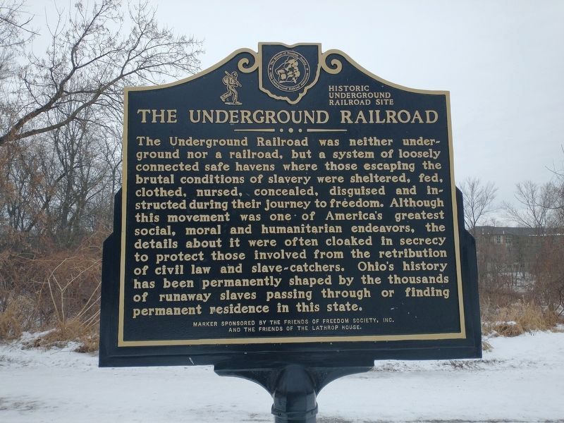
Founded circa 1818 by free African Americans as Bethel A.M.E. Church, this site served as the first stop on an Underground Railroad route from the Kanawha Valley of Virginia (now West Virginia), just across the Ohio River. Church leaders and members . . . — — Map (db m310586) HM
On Summit Street, on the right when traveling north.
Civil War
Brown, Wilson, W. Co. F, 21st Ohio Infantry, Private, Army. Born; December 25, 1837 in Logan County, Ohio. Entered service in Wood County, Ohio. Died; December 25th, 1916, in Toledo, Ohio. Buried at New Belleville Ridge Cemetery, . . . — — Map (db m160385) WM
Near Fallen Timbers Lane 0.5 miles north of U.S. 24, on the left when traveling west.
On this rock according to tradition, Chief Turkey Foot of the Ottawa Indians rallied his warriors during the Battle of Fallen Timbers. Here he was killed and for many years tribesmen made offerings of tobacco on the rock to appease the Great . . . — — Map (db m19572) HM WM
On Airport Highway (Ohio Route 2) at South Byrne Road on Airport Highway.
This memorial erected in memory of the soldiers of all wars from Adams Twp., Lucas County, Ohio, who arose to the defense of their country in times of danger, that America might continue to enjoy freedom, justice and democracy. — — Map (db m300527) WM
On North 4th Street at Farnsworth Road ( Route 64), on the right when traveling north on North 4th Street.
East Side of Marker:
"John Pray - Founder of Waterville, Ohio"
Born in Rhode Island, John Pray (1783-1872) moved to the Maumee River Valley from New York shortly after serving in the War of 1812 and completing a . . . — — Map (db m30795) HM
On W. Wayne Street west of Conant Street (U.S. 20), on the right when traveling west.
On March 5, 1817, Lieutenant Almon Gibbs, formerly of Army Lodge No. 24 at Fort Meigs, Perrysburg, formed Northern Light Lodge No. 40 "at Waynesfield" (now Maumee). Gibbs served as Worshipful Master, William Griffith as Senior Warden, and Charles . . . — — Map (db m67523) HM
On Champlain Street at Elm Street, on the right when traveling west on Champlain Street.
In 1934, workers at the Electric Auto-Lite Company and other automotive-related manufacturers secretly organized the Automobile Workers Federal Union Local 18384, American Federation of Labor (AFL), which became the United Auto Workers (UAW) . . . — — Map (db m177837) HM
On Adams Street east of North Michigan Street (State Route 25), on the left when traveling east.
(panel 1)
William McKinley
Born at Niles – Trumbull County, Ohio
January Twenty-Ninth – Eighteen Hundred and Forty-Three
Volunteer Soldier of the Rebellion
Representative in Congress
Twice Governor of Ohio
Twice . . . — — Map (db m121996) HM
Near Adams Street east of North Michigan Street (State Route 25), on the left when traveling east.
In recognition of
the Patriotism of
the People of
Lucas County
who so generously purchased
War Savings Stamps in 1918
this tablet is
gratefully erected by the
Ohio War Savings Committee — — Map (db m121995) WM
Near Anthony Wayne Trail (Ohio Route 25) north of Woodsdale Avenue.
The Toledo Zoo
Now ranked among the country's finest, the zoo began in 1900 with one large woodchuck in a box at Walbridge Park. After the organization of the Toledo Zoological Society, 1905-10, the zoo began its steady growth, particularly . . . — — Map (db m41959) HM
On Red Trail just south of Blue Trail, on the left when traveling east.
The first half of the twentieth century was an uncertain, but exciting time in American
history. In 1910, R.A. Stranahan moved the struggling Champion Spark Plug Company (owned by R.A. and brother F.D.) to Toledo. While Stranahan secured . . . — — Map (db m173507) HM
On South Marina Drive, on the left when traveling east.
The National Museum of the Great Lakes
Founded in 1945, the Great Lakes Historical Society has made known and preserved the history of the region for decades. In 2003, the Society embarked on a strategic plan to create the National Museum . . . — — Map (db m204611) HM
On South Main Street 0.1 miles south of East Wooster Street, on the right when traveling north.
Froney Building
It may be hard to believe, but the building at 139-143 S. Main St. is actually three separate buildings built by Albert Froney from 1892 to 1895. As shown by the pictures (left), you will see the structure has undergone many . . . — — Map (db m252937) HM
Thin black lines indicate changes in relevance. Between each pair of lines entries are ordered geographically but all have the same relevance.
* Inflectional forms of words are their plurals, singulars, and possessives as well as gramatical tenses and similar variations.