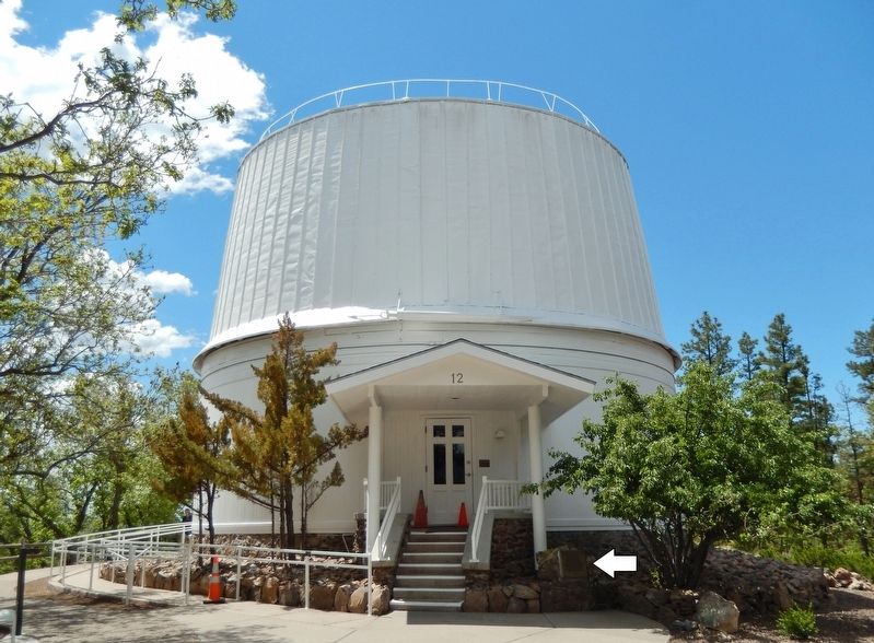
Intended for markers that are primarily about an astronomical observatory. Markers for astronomers, astronomical equipment, and astronomical events will each get their own series. Observatories that are not astronomical are excluded from this series.
Near West Mars Hill Road 0.6 miles west of West Santa Fe Avenue.
Lowell Observatory has been designated a Registered National Historic Landmark Under the provisions of the Historic Sites Act of August 21, 1935 this site possesses exceptional value in commemorating or illustrating the History of The . . . — — Map (db m149455) HM
On Arizona 386 12 miles south of Arizona 86, on the right when traveling south.
WIYN
Visible to the south is the octagonal dome enclosure of the 3.5 meter WIYN telescope. Dedicated in 1994, the WIYN Observatory was originally operated by a consortia consisting of the University of Wisconsin, Indiana University, Yale and . . . — — Map (db m305621) HM
On Arizona Route 386 12 miles south of of W. Tucson-Ajo Hwy. ( Route 86), on the left when traveling south.
Kitt Peak
National Observatory
Founded 1958
The observatory’s objectives are to
strengthen basic research and education
in astronomy throughout the United States, its
territories and possessions. The observatory is
available to . . . — — Map (db m102813) HM
Near Arizona Route 386 12 miles south of W. Tucson-Ajo Hwy. (Route 86), on the left when traveling south.
Steward Observatory
90 inch Reflector
University of Arizona
Erected 1967
Board of Regents
Jack Williams Governor · George W. Chambers President · Elwood W. Bradford · Sarah Folsom · Wesley P. Gross · Leon Levy · Norma Barr Rockfellow · . . . — — Map (db m102921) HM
Near Arizona Route 386 12 miles south of W. Tucson-Ajo Hwy. ( Route 86), on the left when traveling south.
The octagon-shaped building that you see in the distance is the enclosure for the telescope of the WIYN Observatory. Completed in 1994, WIYN is owned and operated by the University of Wisconsin, Indiana University, Yale University, and the . . . — — Map (db m102920) HM
Former site of the Students' Observatory, completed in 1886 and named in 1951 for Armin Otto Leuschner (1868-1953), Director of the Observatory (1898-1938) and Chair of the Astronomy Department (1900-1938). — — Map (db m114355) HM
On Jefferson Street at 11th Street, on the right when traveling south on Jefferson Street.
This marker, dedicated June 21, 2008, celebrates Chabot Space & Science Center's 125 years of inspiring Bay Area star gazers and curious minds of all ages.
From 1883-1915, an observatory on this site housed Chabot's first telescope, "Leah," an . . . — — Map (db m18875) HM
On Consolation Street at Main Street, on the right when traveling north on Consolation Street.
Here in Volcano in 1860, miner and amateur astronomer George Madeira built California's first astronomical observatory of record and operated it for two years. Using a three inch refractory telescope he studied sun and moon, stars and planets, and . . . — — Map (db m100583) HM
On Shake Ridge Road 1 mile west of Rams Horn Grade, on the left when traveling west.
On the knoll behind this marker, George Madiera built the first amateur astronomical observatory of record in California and there discovered the great comet of 1861 with a three-inch refractor telescope. — — Map (db m100584) HM
The Lowe Observatory housed an Alvan Clark 16-inch (lens) refracting telescope, one of the finest of its time. Dr Lewis Swift, the famous comet-seeker of
the Warner Observatory in New York, was the first director. He and the Observatory were . . . — — Map (db m248552) HM
On North Shore Lane near North Shore Drive, on the left when traveling west.
BBSO is home to the world's largest aperture,
and highest resolution solar telescope. The 1.6
meter primary mirror of the New Solar
Telescope (NST) is housed in the first facility-class solar telescope made in the USA in a
generation. The . . . — — Map (db m197808) HM
Near Mt. Evans Road south of Colorado Highway 103.
Mt. Evans, Colorado Elevation 14,125 ft.
“The World’s Highest Operational Observatory”
Building Dedication August 19, 1996
“...for educational purposes in astrophysics and astronomy...” — — Map (db m3364) HM
Near Mohegan Ave. Pkwy. north of Williams Street, on the right when traveling north.
The Observatory The sea and sky have long been connected. Mariners once had to rely completely on the stars to pilot their vessels. These techniques still serve as a backup to the advanced navigation technology aboard Coast Guard Cutters. Each year, . . . — — Map (db m205830) HM
In 1769, an international scientific effort was organized to observe a transit of Venus in order to determine the size of the solar system. This rare event, when Venus passes in front of the Sun's disk, makes such calculations possible when measured . . . — — Map (db m228456) HM
Near 23rd Street Northwest south of E Street Northwest, on the right when traveling south.
[Top plaque:]
U.S. Naval Observatory
Designed by LT James M. Gilliss in 1842, the U.S. Naval Observatory occupied this site from 1844 to 1893. In 1894 the domed structure became home to the Naval Museum of Hygiene. Eight years later the . . . — — Map (db m128012) HM
Near Independence Avenue Southwest west of 4th Street Southwest, on the right when traveling west.
This observatory is named to celebrate the spirit of Emma Phoebe Waterman Haas. In 1913 she became the first woman to earn a Ph.D. in astronomy from the University of California, Berkeley. She was the first woman to perform original research with . . . — — Map (db m114106) HM
On River Landing Road 0.3 miles south of U.S. 90, on the left when traveling west.
The 1795 Treaty of San Lorenzo defined the international border dividing Spanish Florida from the newly formed United States.
No one who signed the treaty had ever seen it, but the point of land formed by the confluence of the Chattahoochee and . . . — — Map (db m230733) HM
On River Landing Road 0.2 miles south of U.S. 90, on the left when traveling south.
At the end of the American Revolutionary War in 1783, Florida was returned to Spain after twenty years of British control. Controversy soon arose over the exact location of the boundary between Spanish Florida and the state of Georgia. In 1795, . . . — — Map (db m79444) HM
Near South Mathews Avenue south of West Oregon Street, on the right when traveling south.
This facility originally known as the
Astronomical Observatory
constructed in 1896
has been placed on the
National Register of Historic Places
by the United States
Department of the Interior — — Map (db m225534) HM
On Watch Street east of Raymond Street, on the right when traveling west.
Built in 1910, the observatory's purpose was to record and transmit precise time from the stars to the Elgin National Watch factory. This structure was deeded to School District U-46 in 1960. Designated a local landmark in 1992. — — Map (db m299967) HM
On Watch Street east of Raymond Street, on the right when traveling west.
The School District U-46 Planetarium, located at 312 Watch Street in Elgin, opened its doors in September 1963 for students to learn about astronomy under the dome. The planetarium is an addition on the back of the 1910 Elgin National Watch Company . . . — — Map (db m299945) HM
On Congress Street near North Street, on the right when traveling north.
Portland Observatory
has been designated a
National Historic Landmark
This site possesses national significance
in commemorating the history of the
United States of America.
The Observatory is the nation's only remaining . . . — — Map (db m50418) HM
On DeSellum Avenue 0.2 miles west of George Street, on the right when traveling west.
The Gaithersburg Latitude Observatory was constructed in 1899 as one of the original four stations selected by the International Geodetic Association to carry out systematic observations to measure the variations in latitude cause by the Earth's . . . — — Map (db m128813) HM
On DeSellum Avenue 0.2 miles south of George Street, on the right when traveling south.
The Gaithersburg International Latitude Observatory is listed on the National Register of Historic Places and has been declared a National Historic Landmark. The designation includes the Observatory, the Meridian Mark Pier, and the five monuments. . . . — — Map (db m56966) HM
On DeSellum Avenue 0.2 miles south of George Street, on the right when traveling south.
U.S. Coast and Geodetic Survey Assistant, Edwin Smith or Rockville, Maryland, was assigned to oversee construction and operations at the Gaithersburg Observatory. Original plans for the Ukiah and Gaithersburg Observatories, prepared by the Central . . . — — Map (db m128814) HM
On East Cass Street, on the left when traveling west.
The Albion College Astronomical Observatory was built in 1883-84 at the urging of Dr. Samuel Dickie, who later became president of the college. Dickie helped raise $10,000 to build and equip the facility. The observatory still harbors its original . . . — — Map (db m27743) HM
The Detroit Observatory, named in honor of major donors from Detroit,
was the centerpiece of President Henry Philip Tappan's efforts to
transform the University of Michigan into one of the first research
institutions in the United States. . . . — — Map (db m263782) HM
On Sorority Row at Student Union Drive on Sorority Row.
Built 1857-59 by Chancellor F.A.P. Barnard, the Observatory housed the Physics and Astronomy Department until 1939 and was the home of chancellors until 1971. The West Wing, called McCain Hall, was used by the NROTC, 1947-89. The Observatory was . . . — — Map (db m102769) HM
On Student Union Drive west of Sorority Row, on the right when traveling west.
Frederick A. P. Barnard (1809-1889) was the third president and first chancellor of the University of Mississippi, serving from 1856 to 1861. He joined the University of Alabama's faculty in 1838, and he started a Phi Beta Kappa Chapter there. In . . . — — Map (db m219853) HM
On North Stewart Street, on the left when traveling south.
This is the site of the house and observatory of Nevada’s first weatherman, astronomer, and seismologist, Charles William Friend. Born in Prussia in 1835, Friend immigrated by way of South America to California during the 1849 Gold Rush. In 1867, he . . . — — Map (db m162166) HM
Rutgers
The State University of New Jersey
Daniel S. Schanck Observatory
1866
The Daniel S. Schanck Observatory, a two-story edifice which includes a revolving roof and a rear wing connected by a passageway, was . . . — — Map (db m10068) HM
On Lester Road south of New York State Route 96, on the right when traveling north.
11 comets discovered here between 1881-1888 by international astronomer Dr. William R. Brooks (1844-1921)
Enterprise Grange, 1963 — Phelps Community Historical Society, 2014
In 1870, an aspiring young astronomer located to a . . . — — Map (db m245570) HM
On Broadway (U.S. 9) south of Washington Avenue, on the right when traveling south.
Henry Draper and His Observatories
From 1860, when he built his first observatory on his father's estate, until his death in 1882, Henry Draper photographed the heavens from this Hastings hilltop. In this 1880s image, the . . . — — Map (db m193479) HM
Side A:
Prompted by response to his popular lectures, astronomer Ormsby MacKnight Mitchel (1809-1862) founded the Cincinnati Astronomical Society (CAS) in 1842. With CAS funding, Mitchel traveled to Munich, Bavaria, to acquire the optical . . . — — Map (db m24623) HM
On College Street, on the right when traveling north.
Elias Loomis and Charles Augustus Young worked in this Observatory, built in 1838, the third to be erected in the United States, the second oldest standing (1926). — — Map (db m36202) HM
On Riverview Avenue 0.2 miles west of Perrysville Avenue (U.S. 19).
Part of the University of Pittsburgh. Chartered 1860; located here since 1912. At the original site nearby, Professor Samuel P. Langley conducted experiments that would lead to the first sustained, mechanically powered flight in 1896. — — Map (db m42219) HM
On McKnight Road (U.S. 19) at West View Avenue, on the right when traveling south on McKnight Road.
On the hill just west of here, the first known astronomical observatory with an aluminum dome was erected in 1930. Designed & built by Pittsburgh amateur astronomers led by Leo J. Scanlon, the Valley View Observatory stood beside his Van Buren St. . . . — — Map (db m35633) HM
On Stargazer Road at Embreeville Road (Pennsylvania Route 162), on the left when traveling south on Stargazer Road.
Site of
Mason & Dixon’s
“Stargazing” Observatory
1764
In the roadbed near this stone, a square iron spike marks the original location of the astronomical observatory used by surveyor-astronomers Charles Mason and Jeremiah Dixon in the . . . — — Map (db m193204) HM
700 feet N.E. of this memorial stood the log cabin from which David Rittenhouse observed the transit of Venus June 3, 1769. Permission to use this site was given by Herbert T. Ballard, owner of this property. — — Map (db m84849) HM
The Heavens declare the Glory of God;
and the firmament sheweth His handy.work.
This stone was taken from the Traill Green Observatory, the gift of Traill Green, A.M., LL.D., Trustee 1837-'41, Faculty 1837-'41, 1853-'97. Built at this site in . . . — — Map (db m136112) HM
Near Newberry St SW near New Lane SW. Reported permanently removed.
Iron heliometer tower, which served as an observatory, and housing for instruments, including powerful telescopes, used in viewing the December 6, 1882, Transit of Venus in Aiken, South Carolina. The observatory was built in two sections, each . . . — — Map (db m10193) HM
On Oman Drive 0.2 miles north of High Valley Drive.
This property has been placed on the National Register of Historic Places by the United States Department of the Interior
c. 1953 — — Map (db m221504) HM
Original unit in complex forming one of the great observatory centers of the world. Built in the 1930s under terms of legacy from William Johnson McDonald (1844-1926), a Paris (Texas) banker interested in the stars. A well-educated man, McDonald . . . — — Map (db m228569) HM
On September 30, 1869, George W. Dean of the U.S. Coast
and Geodetic Survey established this building as an
observatory for meridian line placement. Originally located
on the southeast corner of Temple Square, this building
also contained . . . — — Map (db m173496) HM
On Hinman Settler Road north of Old Stone House Road, on the left when traveling north.
The Orleans County Grammar School was built at the foot of Prospect Hill in 1823 by William Baxter, a prominent citizen of Brownington. He asked that worship services for the Congregational Church be held on the second floor until a permanent . . . — — Map (db m221755) HM
Near Breezy Hill Road 0.8 miles south of Monument Hill Road, on the left when traveling south.
Stellafane Observatory
Has been Designated a
National Historic landmark
This Site Possesses National Significance
In Commemorating the History of the
United States of America
1989
National Park Service
United States Department of . . . — — Map (db m75701) HM
On Solar Street south of Sycamore Street, on the right when traveling south.
Along with several locations in eastern America this hill was chosen as an observation point from which astronomers sent from Washington, D.C. could view the great solar eclipse of August 7, 1869. For this reason the area, which had been known as . . . — — Map (db m258102) HM
Near Birdwood Avenue 0.2 kilometers west of Dallas Brooks Drive, on the right when traveling north.
The Reliable Science of Astronomy
astronomy (def): the science of celestial bodies, their motions, positions, distances, magnitudes, etc.
"Every well-determined star, from the moment its place is registered becomes to the . . . — — Map (db m296520) HM
On Place Quetelet, on the left when traveling west.
Ancien observatoire
Dès 1823, l'astronome et statisticien Adolphe Quetelet
(1796-1874) - qui allait en être le premier directeur - avait
convaincu le gouvernement de la nécessité d'ériger à
Bruxelles un observatoire. Les . . . — — Map (db m224016) HM
Three panels are located at this site.
Chabert’s Mission / La mission du marquis de Chabert
English:
In 1750 the Marquis de Chabert, a French astronomer, was commissioned to go to North America to correct the maps of . . . — — Map (db m142944) HM
The first optical astronomical observatory in the province,
the Kingston Observatory was established in 1855 after
a solar eclipse aroused public interest in astronomical studies. Under the auspices of a committee of British . . . — — Map (db m217693) HM
On Avenue George VI at Rue Garneau, on the left when traveling east on Avenue George VI.
English:
The Quebec City Astronomical Observatory was officially established at the Citadel in 1850 by the Department of Marine and Fisheries in order to give the exact time to sailors on the many ships anchored at the port. In 1864, an . . . — — Map (db m80920) HM
On Avenue de l'Observatoire 0.08 kilometers south of Rue Cassini when traveling south.
L'astronome Danois
Olaus Römer
1644-1710
à découvert la vitesse de propagation
de la lumière
à l'Observatoire de Paris
en 1676
English translation:
The Danish astronomer Olaus Römer, 1644-1710, discovered . . . — — Map (db m178552) HM
On Montée des Accoules at Rue de Refuge on Montée des Accoules.
1702 – 1861
Où Jean-Louis Pons découvrit
au cours de l'été 1801
sa première planète et 17 autres
de cette date à 1819. English translation:
Former Marseille Observatory
1702 – 1861
Where Jean-Louis Pons . . . — — Map (db m315880) HM
Die historische Sternwarte auf Schloss Hohentübingen
- Ausgangspunkt der württembergischen Landesvermessung von 1818 -
Nachdem Württemberg 1806 zum Königreich aufgestiegen war,
ordnete König Wilhelm 1. die Vermessung und . . . — — Map (db m207387) HM
On Domerschulstraße at Neubaustrasse, on the right when traveling north on Domerschulstraße.
Im jahre 1757 stiftete Furstbischof Adam Friedrich von Seinsheim die erste Sternwarte der Universität Würzburg auf dem Turm der Neubaukirche. Mit der Ausstattung des Observatoriums wurde der Professor der Mathematik und Astronomie, Franz . . . — — Map (db m207326) HM
El ciudadano Jose Lopez Portillo Presidente de la Republica Conmemora el primer centenario del Observatorio Astronomico Nacional actual Instituto de Astronomia de la Universidad Nacional Autonoma de Mexico en donde se ha cultivado . . . — — Map (db m91253) HM
Near Carretera Costera de Golfo (at milepost 180), .
El Caracol Estructura conocida también como "El Observatorio" debido a su forma y a algunas posibles asociaciones astrales, ya que para las tres ventanas de la parte superior se han
propuesto una serie de alineaciones relacionadas con eventos . . . — — Map (db m101948) HM
(Korean text not transcribed)
This stone structure is presumed to have been built during the reign of Queen Seondeok (r. 632-647), the 27th ruler of the Silla kingdom (57 BCE-935 CE). Its name Cheomseongdae means "Platform of Gazing . . . — — Map (db m260549) HM
On Uraniastrasse, on the right when traveling east.
1905-1907 von Gustav Gull (1858-1942) errichtet. Bauherrschaft des wohnund geschäftshauses war die private genossenschaft << Urania >>, welche auch die volkssternwarte betrieb.
Seit 1936 wird die sternwarte von der volkshochschule des kantons . . . — — Map (db m67313) HM
Near Blackheath Avenue at Great Cross Avenue, on the left when traveling north.
Welcome to the Royal Observatory, the historic home of British astronomy, Greenwich Mean Time and the Prime Meridian of the world.
King Charles II signed a Royal Warrant in June 1675 to authorize building the Royal Observatory on the . . . — — Map (db m117707) HM