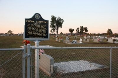
On McCullars Lane west of County Road 73, on the right when traveling east.
James Crook established this cemetery in
1837 on land he purchased from Creek
Indians. In 1834, he and his family moved
to this area from South Carolina.
In Nov. 1837, Samuel M. Crook, grandson
of James Crook, was the first person buried
here. . . . — — Map (db m36552) HM
On McCullars Lane west of County Road 73, on the left when traveling west.
At this site, on Nov. 3, 1813, after the Battle of
Tallasehatchee, known then as Talluschatches,
during the Creek Indian War,
Gen. Andrew Jackson found a dead
Creek Indian woman embracing her living
infant son. Gen. Jackson, upon hearing that . . . — — Map (db m36551) HM
On U.S. 431 2 miles north of State Route 144, on the right when traveling south.
Gen. John Coffee, commanding 900 Tennessee Volunteers, surrounded Indians nearby; killed some 200 warriors. This was first American victory. It avenged earlier massacre of 517 at Ft. Mims by Indians. — — Map (db m27610) HM
On McCullars Lane west of County Road 73, on the left when traveling west.
This stone marks the site of the Tallasahatchie Battle Field. On this spot Lieut. Gen. John Coffee with Gen. Andrew Jackson's men won a victory over the Creek Indians, Nov. 3, 1813. — — Map (db m36554) HM
On Atlanta Avenue at West 10th Street, on the right when traveling south on Atlanta Avenue.
13 W. 10th Street
1903
has been placed on the
National Register
of Historic Places
by the United States
Department of the Interior — — Map (db m217298) HM
Near Gurnee Avenue south of West 11th Street, on the left when traveling south.
On May 11, 2011, 40 students who were retracing the route of the original Freedom Ride, arrived in Anniston. The student Freedom Ride was part of a promotion organized by WGBH/Boston, a member of the Public Broadcasting system. The goal was to . . . — — Map (db m217423) HM
On East 10th Street, on the right when traveling east.
When seven injured "Freedom Riders" arrived at the Hospital on
this date, the mob that had attacked them earlier in the day
followed. The Riders were testing desegregation of public
transportation in the South by riding buses. The bus they . . . — — Map (db m106647) HM
On East 10th Street at Wilmer Avenue, on the right when traveling east on East 10th Street.
Desegregation of the Library began when two African American
pastors, Reverends William B. McClain and Nimrod Q. Reynolds,
peacefully attempted to enter the building on September 15, 1963.
Their actions were endorsed by the city of Anniston . . . — — Map (db m106644) HM
On Quintard Avenue at East 10th Street, in the median on Quintard Avenue.
This tablet is
erected in honor
of the
Soldiers and
Sailors from
Calhoun County
Alabama
who served in the
Great World War
1917 - 1919
Calhoun County's Honor . . . — — Map (db m106706) WM
On Gurnee Avenue south of 12th Street, on the right when traveling south.
In the early 1940s, all of the buildings
on Block 148 were demolished to make
way for two new buildings, the USO
Recreation Center and a public health
building. Paul W. Hofferbert designed the
USO building for the Army. Hofferbert
was a local . . . — — Map (db m217677) HM
On Albert P. Brewer Highway (State Highway 202) west of Old Birmingham Highway, on the right when traveling east.
On May 14, 1961, a Greyhound bus left Atlanta, GA carrying among its passengers seven members of the Congress of Racial Equality (CORE), a.k.a. the “Freedom Riders,” on a journey to test interstate bus segregation. The bus was met by an angry mob . . . — — Map (db m35737) HM
On East 17th Street at Quintard Avenue, on the right when traveling west on East 17th Street.
Seaman Second Class, United States Navy, George Washington Ingram was killed in action in the defense of Pearl Harbor on December 7, 1941.
For Seaman Ingram's bravery, an American destroyer was built and named in his honor. The U.S.S. George . . . — — Map (db m106617) HM
On East 10th Street west of Kirkwood Avenue, on the left when traveling east.
Outstanding local industrialist as President, Kilby Steel Company; Chairman, Board of Directors, Alabama Pipe Company; President, City National and Anniston National Banks. Served as Mayor of Anniston (1905-09); State Senator (1911-15); Lieutenant . . . — — Map (db m35758) HM
On East 10th Street west of Leighton Avenue, on the left when traveling east.
Called “A poem in cedar & stone,” its history is intimately related to that of Anniston: Town Founders, Daniel Tyler & Samuel Noble, inspired its conception, funded its construction & caused Woodstock Iron Co. to donate the land on which . . . — — Map (db m35759) HM
On Gurnee Avenue north of West 10th Street, on the right when traveling north.
Front
This was the site of the Greyhound bus terminal where on May 14, 1961, a bus carrying black and white Civil Rights Activists known as "Freedom Riders" was attacked by a mob of whites who were protesting desegregation of public . . . — — Map (db m106621) HM
On Woodstock Avenue at East 14th Street, on the right when traveling north on Woodstock Avenue.
This sign marks the start line of the
Woodstock 5K, one of the oldest continuous
footraces in the southeast. First held in
1980, the race takes place the first Saturday
in August each year and rollercoasters
through the historic neighborhoods . . . — — Map (db m217680) HM
Near Gurnee Avenue south of West 11th Street, on the left when traveling south.
The violence reached a crescendo when a flaming bundle of rags was thrown into one of the broken windows. Within seconds, the bundle exploded, sending dark gray smoke throughout the bus.
Three of the Riders found open windows, dropping to the . . . — — Map (db m217417) HM
On Gurnee Avenue south of 12th Street, on the right when traveling south.
Block 148, the block on which you are standing, was first developed in 1880 when three identical brick houses were constructed at the southeast corner of the block as rental properties for workers at the nearby factories. This 1888 Bird's Eye View . . . — — Map (db m217433) HM
Commanded Horse Artillery of
Army of Northern Virginia, C.S.A.
Killed at Kelly’s Ford, Va.
March 17, 1863
Styled “The Gallant Pelham”
By Robert E. Lee — — Map (db m36546) HM
On Quintard Avenue (U.S. 431), on the right when traveling north.
On July 3, 1887, a congregation of 45 people met at the Opera House on Noble Street to organize a new church. Originally called Second Baptist Church, the name soon was changed to Twelfth Street Baptist Church.
In 1889, it became Parker . . . — — Map (db m36545) HM
Near Gurnee Avenue south of West 11th Street, on the left when traveling south.
Prelude: 12 p.m.- 12:54 p.m.
Just before this picture of the Greyhound Bus Depot at 1031 Gurnee (below left) was taken, approximately 75 men had gathered in front of it. They quickly dispersed as free-lance photographer for The Anniston Star, . . . — — Map (db m217412) HM
Near Gurnee Avenue south of West 11th Street, on the left when traveling south.
Pursuit: 1:25 p.m. - 1:35 p.m.
Heading to Birmingham, the battered bus turned south on Gurnee from the station and west on 10th St. while men rushed to their cars to follow. Police escorted the bus to the city limits where they turned back, . . . — — Map (db m217416) HM
Near Gurnee Avenue south of West 11th Street, on the left when traveling south.
Rescue
Once there, all of the injured were treated at the urging of an FBI agent on the scene. In the meantime, the crowd outside the hospital grew larger and more menacing, with some Klansmen threatening to burn the building to the ground. At . . . — — Map (db m217420) HM
On East D Street at South Christine Avenue, on the left when traveling east on East D Street.
Saint John, founded at the turn of the 19th century, is the first
African-American Methodist Episcopal Church in South Anniston.
The original structure was built in 1922. The current building was
erected in 1951 on the corner of D Street and . . . — — Map (db m144905) HM
On Quintard Avenue (U.S. 431) at East 18th Street, on the right when traveling south on Quintard Avenue.
Built by John Ward Noble, one of Anniston’s founders. Consecrated on September 29, 1890. Widely acclaimed for unique and beautiful Norman Gothic architecture. The church dominated by imposing 95 foot bell tower.
Open Daily — — Map (db m36540) HM
On West 17th Street at Cooper Avenue, on the right when traveling west on West 17th Street.
Seventeenth Street Missionary Baptist Church served as the home of "mass meetings" for black Annistonians who planned and executed Anniston's part of the Civil Rights Movement. Reverends D.C. Washington (1937-1960) and Nimrod Q. Reynolds . . . — — Map (db m106651) HM
On West 4th Street east of Spruce Avenue, on the right when traveling east.
Local "Jim Crow" laws in the first half of the 20th century enforced racial segregation in public transportation facilities throughout the South. The U.S. Supreme Court decision in Boynton v. Virginia (1960) upheld that segregation in these . . . — — Map (db m106602) HM
On Gurnee Avenue south of 12th Street, on the right when traveling south.
In 1917, Block 148 appeared much as it did thirty years earlier. The only new addition was the Chero-Cola Bottling Company on West 12th Street. However, the surrounding blocks, which had been residential or had remained undeveloped, saw some major . . . — — Map (db m217673) HM
On Quintard Avenue (U.S. 431) at East 13th Street, on the right when traveling north on Quintard Avenue.
Temple Beth El is the oldest building continuously used for Jewish worship in Alabama. Anniston’s Reform Jewish congregation was established in 1888. Its women’s organization, the Ladies Hebrew Benevolent Society, directed the construction of the . . . — — Map (db m36543) HM
In April 1888, the founder of a newly established Reform Jewish congregation purchased twenty-three lots in Hillside Cemetery to bury their deceased members.
In 1987, the City of Anniston vacated right-of-way that allowed the Temple to expand the . . . — — Map (db m53163) HM
Near Gurnee Avenue south of West 11th Street, on the left when traveling south.
The Ambush: 12:54 p.m. - 1:10 p.m.
The silence didn't last long. Anniston Klansman William Chappell and a screaming mob of about 50 white men surrounded the bus. An 18-year-old Klansman, Roger Couch, lay on the pavement in front of the bus to . . . — — Map (db m217413) HM
On Choctaw Street north of Tomahawk Trail, on the right when traveling north.
Major John Pelham C.S.A.
Born September 14, 1838
at the home of his Grand Parents
William McGehee and Elizabeth Clay McGehee
Erected by Forney District U.D.C.
May 5, 1937 — — Map (db m36547) HM
Near Gurnee Avenue south of West 11th Street, on the left when traveling south.
While the Riders awaited rescue, the bus continued to burn. The Anniston Fire Department extinguished the flames and administered oxygen. A state trooper called an ambulance, but it took Cowling to force the driver to carry the injured black Riders . . . — — Map (db m217419) HM
Near Gurnee Avenue south of West 11th Street, on the left when traveling south.
The Rides began in May 1961 when the Congress of Racial Equality (CORE) decided to test a 1960 U. S. Supreme Court ruling that outlawed segregation in depot restaurants and restrooms serving interstate passengers.
Previously, CORE had organized a . . . — — Map (db m217406) HM
On Gurnee Avenue south of 12th Street, on the right when traveling south.
The Anniston City Commission, on May 16, 1963, established by resolution the Human Relations Council, consisting of five white men and four black men. The Council's purpose was to "make recommendations concerning human relations," and its members . . . — — Map (db m106627) HM
On Quintard Avenue at East 17th Street, on the right when traveling north on Quintard Avenue.
The Legacy of the Military
On the other side of Anniston, the Army constructed an Ordnance Depot on 15,000 acres west of the city during WWII. Over time, the depot evolved into the region's largest employer. The economic and community . . . — — Map (db m106619) HM
On West 11th Street at Gurnee Avenue, on the right when traveling west on West 11th Street.
Willie Brewster became the target of white extremists after words spoken at a National States Rights Party encouraged them to commit acts of violence against blacks. As Brewster drove home with co-workers from the night shift at Union Foundry, he . . . — — Map (db m106626) HM
Near Gurnee Avenue south of West 11th Street, on the left when traveling south.
The most famous photograph of the Freedom Rides and one of the most iconic of the Civil Rights movement was taken by a freelance photographer for The Anniston Star. Joe Postiglione, called “Little Joe” by his friends, was tipped off by the . . . — — Map (db m217422) HM
Near Gurnee Avenue south of West 11th Street, on the left when traveling south.
The Alabama Knights of the Ku Klux Klan had known about the Freedom Ride since mid-April and had detailed information on the city-by-city itinerary, thanks to FBI memos forwarded to the Birmingham Police Department. In a series of secret meetings in . . . — — Map (db m217411) HM
Near Gurnee Avenue south of West 11th Street, on the left when traveling south.
CORE leadership solicited applicants for the Ride from outside the organization as well as CORE veterans. They tried to achieve a reasonably balanced mixture of black and white, young and old, religious and secular. The only deliberate imbalance was . . . — — Map (db m217410) HM
On Noble Street at East 9th Street, on the right when traveling north on Noble Street.
1st Panel
Two busloads of Freedom Riders arrived in Alabama on Sunday, May 14, 1961, bound for New Orleans. It was an organized effort by the Congress of Racial Equality (CORE) to challenge the South's continued defiance of U. S. . . . — — Map (db m106721) HM
On Noble Street at 9th Street, on the right when traveling north on Noble Street.
Throughout the first half of the 20th century, race relations in the South were dominated by local "Jim Crow" laws. Although in 1960 the Supreme Court ruled that racial segregation violated the Interstate Commerce Act, local laws persisted. . . . — — Map (db m106605) HM
Near Gurnee Avenue south of West 11th Street, on the left when traveling south.
But the Ride didn't end. The national newspaper and television coverage of what had happened galvanized the Nashville Student Movement, which already had experience successfully challenging segregationist practices through lunch counter sit-ins, . . . — — Map (db m217421) HM
On East 10th Street at Quintard Avenue, on the right when traveling west on East 10th Street.
In 1904, 18 year old Tyrus Raymond Cobb lived in a boarding house on this site while playing minor league baseball for the Anniston Steelers. From nearby Scarbrough Drug Store on Noble Street he wrote letters, using fictitious names, to sports . . . — — Map (db m106606) HM
On Noble Street at East 12th Street, on the right when traveling north on Noble Street.
This property
has been placed on the
National Register
of Historic Places
by the United States
Department of the Interior
United States Federal Building - Courthouse
Built 1906 — — Map (db m217266) HM
On West 15th Street west of Walnut Avenue, on the right when traveling west.
This district was once the economic and social hub of Anniston's African American community. In its heyday (1940-1950), the District was a "city within a city," with businesses that catered to the black community. Grocery stores, restaurants, . . . — — Map (db m106650) HM
Near Gurnee Avenue south of West 11th Street, on the left when traveling south.
In Atlanta, the Riders separated into two integrated groups to board two different buses; the seven who were on the Greyhound bus destined for Anniston included:
• Albert Bigelow, 55 white male from Connecticut (a retired naval officer, . . . — — Map (db m217409) HM
On Martin Luther King Drive east of Douglas Street, on the right when traveling east.
Front
Hobson City is Alabama's first incorporated black city. The area was first known as Mooree Quarter, a black settlement that was part of Oxford, Alabama. After a black man was elected Justice of the Peace in Oxford, one mayor . . . — — Map (db m106598) HM
On Pelham Road (Alabama Route 21) at 5th Street NE, on the right when traveling north on Pelham Road.
Dean of American College Presidents
President of Jacksonville State Normal-State Teachers College 1899-1942
During an Educational Renascence in the South he was in the forefront of the Alabama Educational System
President 1st National Bank . . . — — Map (db m29922) HM
On Public Square West (State Highway 21) south of Clinton Street Southwest, on the left when traveling south.
This regiment took part for four years in major battles of Virginia theater. It served with distinction for dash and courage, suffering heavy casualties.
Officers at regiment’s organization June 4, 1861 at Montgomery, Alabama;
Colonel John . . . — — Map (db m36465) HM
On Pelham Road (State Highway 21) at James Street SE, on the left when traveling north on Pelham Road.
This house, "Ten Oaks", was headquarters for Gen. P.G.T. Beauregard, Oct. 15-23, 1864, when he coordinated the movement of Gen. J.B. Hood's army, then marching across northeast Alabama enroute to Nashville. He and his retinue, including Gov. I.G. . . . — — Map (db m29919) HM
Near Mountain Street Northwest west of Woodward Avenue Northwest.
The Chief Ladiga Trail was named for a Creek Indian leader who signed the Cusseta Treaty in 1832. Under the terms of that agreement, the Creeks gave up claim to their remaining lands in northeast Alabama. Because he had signed the treaty, Ladiga was . . . — — Map (db m36438) HM
On Clinton Street Southeast, on the right when traveling west.
This Church was used for a
Confederate Hospital
During the War
Between The States
Erected by
General John H. Forney
Chapter U.D.C. Sept 27, 1937 — — Map (db m36539) HM
On Gayle Avenue SW at Clinton Street SW, on the left when traveling north on Gayle Avenue SW.
This general practitioner's office is the only remaining structure of its type in northeast Alabama. It was built on the court-house square about 1850 by Dr. J. C. Francis, a beloved family doctor who served Jacksonville for more than 50 years. He . . . — — Map (db m23350) HM
On Public Square East (State Highway 21) north of Ladiga Street Southeast, on the left when traveling north.
Selected as a landmark contributing to a deeper
understanding of our American Heritage.
Entered on
The National Register of Historic Places
by the
United States Department of the Interior
May 13, 1986
Centered around Jacksonville’s . . . — — Map (db m36479) HM
On Public Square West (State Highway 21) south of Clinton Street Southwest, on the left when traveling south.
Jacob Forney III lived and operated a thriving mercantile establishment at Jacksonville from 1835-56 on the south-east corner of the square. He and his wife Sabina Swope Hoke were the parents of nine children.
1. Daniel Peter - b. Feb. 24, 1819, . . . — — Map (db m36450) HM
On Pelham Road North at College St SW on Pelham Road North.
The Civil Rights Act of 1964 opened the doors of educational opportunities for these students to pursue a different path to academic freedom. They walked miles to school, endured winter weather and other dangers that marked the unending ties of . . . — — Map (db m267047) HM
On Ladiga Street Southeast, on the right when traveling east.
From 1836 to 1881 the head of the City Government
carried the title of Intendant. After that
that the office has been filled by the Mayor.
The following have served in this capacity:
William Harrison Fleming,
1836-49, 1859-61
John D. Hoke, . . . — — Map (db m36533) HM
On Pelham Road North (State Highway 21) at Mountain Street Northeast, on the right when traveling north on Pelham Road North.
Postoffice established July 20, 1833 as Drayton, Benton County, Alabama. Name changed to Jacksonville Aug. 6, 1834 and county changed to Calhoun Jan. 29, 1858. Office maintained by Confederate Government 1861-1865.
Postmasters and dates of . . . — — Map (db m36449) HM
On Public Square East (State Highway 21) west of Ladiga Street Southeast, on the left when traveling north.
Town first called Drayton.
Renamed in 1834 to honor
President Andrew Jackson.
Seat moved to Anniston in 1899.
Calhoun Co. originally was Benton Co.,
for Col. T. H. Benton, Creek War officer,
later U. S. Senator from Missouri.
. . . — — Map (db m36471) HM
On University Circle west of North Pelham Road (State Highway 21), on the right.
This Educational Center of
Northeast Alabama Traces its Origin to
Jacksonville Male Academy 1836
Jacksonville Female Academy 1837
Calhoun College 1871
Calhoun Grange College 1878
State Normal School 1883
State Teachers College 1929
. . . — — Map (db m36426) HM
On Mountain Street Northwest west of Woodward Avenue Northwest, on the left.
Life here has long centered on education beginning in 1834 when a one-acre plot of land was reserved for a schoolhouse. Through the years, various institutions of higher learning developed that culminated into present-day Jacksonville State . . . — — Map (db m36429) HM
On Public Square West (State Highway 21) near Clinton Street Southwest, on the left when traveling south.
Graduate of West Point,
resigned from U.S. Army
to volunteer services
to State of Alabama.
Ably led Confederate forces
at Manassas, Pensacola,
Vicksburg, Mobile, Texas. — — Map (db m36482) HM
On Public Square West (State Highway 21) east of Ladiga Street Southwest, on the left when traveling south.
Lawyer, Soldier, Senator
← Lived here in 1838
1862-63 Colonel of
51st Alabama Cavalry
Raised by him in this county
1863-65 Brigadier General C.S.A.
with Wheeler’s Cavalry
1876-1907 United States Senator
Distinguished . . . — — Map (db m36468) HM
On University Circle west of North Pelham Road (State Highway 21), on the right.
Lawyer, Industrialist, Patriot
Brigadier General, U.S.A.
Gen. Burke helped rebuild
Alabama’s mining & manufacturing
interests after the Civil War.
He helped establish the Catholic
Church at Jacksonville.
His home, . . . — — Map (db m36424) HM
On Pelham Road (State Highway 21) at James Street SE, on the right when traveling north on Pelham Road.
"The Gallant Pelham" as called by Robert E. Lee Commanded Artillery, Army of Northern Virginia. Cited for conspicuous valor many times. Killed in action in Virginia. — — Map (db m29920) HM
On Church Ave SE at James St SE, on the right when traveling north on Church Ave SE.
Front:
Maj. John Pelham
born in
Alexandria, Alabama
killed at the battle of Kelly's Ford
March 17, 1863
Front base: Pelham
North side:
Erected by the General John H. Forney Chapter U.D.C. Jacksonville, . . . — — Map (db m23588) HM
On University Circle west of North Pelham Road (State Highway 21), on the right.
James G. Ryals, Jr. 1883-1885
J. Harris Chappell 1885-1886
Carleton B. Gibson 1886-1892
J. B. Jarrett 1892-1893
Jacob Forney, IV 1893-1899
Clarence William Daugette 1899-1942
Houston Cole 1942-1971
Ernest Stone 1971-1981
Theron E. . . . — — Map (db m36427) HM
On A Street Southwest near H Avenue Southwest, on the right when traveling west.
In 1905, local businessman Henry P. Ide joined with out-of-state investors and built the Ide-Profile Cotton Mill. Along with the mill, the company established the Profile Mill Village, which originally began as 40 homes for workers. The company . . . — — Map (db m195730) HM
479 entries matched your criteria. The first 100 are listed above. Next 100 ⊳