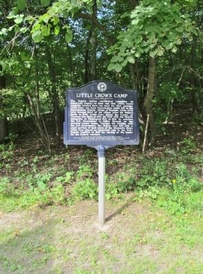
On 140th Avenue Northeast 0.5 miles west of State Highway 23, on the right when traveling west.
The Dakota nation established campsites in Kandiyohi County to hunt and fish. Little Crow's campsite located here was used for that purpose. Little Crow was born Taoyateduta about 1810 in the Mdewakanton Dakota village of Kaposia. Little Crow later . . . — — Map (db m78384) HM
On 30th Street Northwest (County Highway 5) 0.4 miles south of 37th Avenue Northwest (County Road 92), on the right when traveling south.
In May 1859, Olof Olson Haugen, his wife Bergeret, and son Frederick homesteaded here in section 32, Dovre Township. Over the next three years, the Haugen family diligently worked to establish their new life; building shelter, raising crops and . . . — — Map (db m77735) HM
On County Highway 9 0.6 miles south of 113th Avenue Northeast (County Highway 10), on the right when traveling south.
In May 1859, Olof Olson Haugen, his wife Bergeret, and son Frederick homesteaded here in section 32, Dovre Township. Over the next three years, the Haugen family diligently worked to establish their new life; building shelter, raising crops and . . . — — Map (db m77770) HM
Near 113th Avenue Northeast (County Highway 10) at County Highway 9, on the left when traveling west.
Ojibwe and Dakota nations had a long history of conflict in what would become Minnesota. Both Dakota and Ojibwe people contended for the control of the abundant natural resources in the future Kandiyohi County area that played an economic role in . . . — — Map (db m78028) HM
On 120th Street Southeast (County Road 134) 3.4 miles south of 15th Avenue Northeast (U.S. 12), on the right when traveling south.
Kandiyohi Town Site Corporation was organized in 1856, with John Swainson as president. By October of that year, the town site had been surveyed. David Charlton's plat indicates a large central area reserved for the State Capitol with a much . . . — — Map (db m78239) HM
On 160th Street Northeast at State Highway 23, on the right when traveling west on 160th Street Northeast. Reported missing.
What is believed to be one of the last pitched battles between the Ojibwe and Dakota ended near this marker about 1860. Some Dakota hunters found a party of Ojibwe encroaching on Dakota grounds. They attacked, killing several Ojibwe and driving the . . . — — Map (db m78413) HM
On 120th Street Southeast (County Road 134) 3.9 miles south of 15th Avenue Northeast (U.S. 12), on the right when traveling south.
Mrs. Carrie (Pehrson) Johnson, the first white person buried in what is now Kandiyohi County, came here with her husband, John, and six month old son in the fall of 1857, from Sweden. She died in April 1858, and was buried near her new house. After . . . — — Map (db m78311) HM
On County Highway 8 north of Big Kandi Drive (County Road 132), on the right when traveling north.
The United States Army responded to the U.S. - Dakota War of 1862 by carrying out federal government security policies of removing remaining noncombatant Dakota people and pursuing combatants while protecting settled areas. In August 1863, Jesse V. . . . — — Map (db m78292) HM
On 285th Avenue Northeast (County Highway 35) 1.8 miles west of County Road 9 Northeast (County Highway 9), on the right when traveling west.
Birthplace of Henrik Shipstead (1881-1966), the first native of Kandiyohi County to be elected to U.S. Senate. Henrik Shipstead was born on January 8, 1881 here in Burbank Township, Kandiyohi County, Minnesota, one of Norwegian immigrants Saave and . . . — — Map (db m231767) HM
On State Highway 4 0.1 miles north of 135th Street Northeast, on the right when traveling north.
The Red River Trail was the nineteenth-century answer to communication over the frontier between the early settlements on the Mississippi and Minnesota Rivers and Lord Selkirk's settlements (Winnipeg) in Canada. Trails, such as this, were not . . . — — Map (db m77016) HM
On North Shore Drive (County Highway 30) 1.5 miles west of County Road 4 Northeast, on the right when traveling west.
American Indians lived in Kandiyohi County for thousands of years before settlers first arrived in the 1850s. Among the earliest Euro-Americans to visit this area were traders and missionaries as far back as the mid-1700s. The Missionaries came to . . . — — Map (db m231752) HM
On County Highway 4 0.4 miles north of 60th Avenue Northeast (County Highway 26), on the right when traveling north.
At the start of the U.S.-Dakota War of 1862 settlers around Columbia (now Spencer) hastily formed an oxcart train and started for the stockade at Forest City. On the way to Diamond Lake, the refugees ran into other settlers fleeing from the Eagle . . . — — Map (db m77228) HM
On 180th Street Northeast 1.5 miles north of 30th Avenue Northeast, on the left when traveling north.
After fighting a running battle with the Dakota on August 20, 1862 at Diamond Lake, two groups of refugees from Spicer and Eagle Lake camped here at Wheeler's Lake. The Dakota camped across the lake from them. There were no disturbances during . . . — — Map (db m77273) HM
On County Highway 8 0.5 miles south of 52nd Avenue Southeast, on the right when traveling south.
John Other Day, a Dakota who disagreed with the decision to go to war with the Whites, led a party of sixty-two white men, women and children out of danger when the Dakota attacked the Upper Sioux Agency near Granite Falls. The party left the Agency . . . — — Map (db m76656) HM
On State Highway 4 south of 75th Avenue Northeast (County Highway 28), on the left when traveling south.
Joshua H. Gates arrived at Diamond Lake in 1857 where he claimed land in Sections 17 and 20 of Harrison Township. Gates may have been the first farmer in what is now Kandiyohi County. This is the site of the Joshua and Lucinda Gates family . . . — — Map (db m77102) HM
On 71st Avenue Southeast (County Highway 3) 1.1 miles west of County Highway 8, on the right when traveling west.
Wakanda is a spiritual place or "where the spirit dwells" in Dakota. The Dakota people named this area before the settlers came to Kandiyohi County. Prior to 1900 there was evidence of this being a place of burial grounds. Over time, erosion and . . . — — Map (db m231706) HM
On 165th Avenue Southwest (County Road 80) at 105th Street Southwest (County Highway 1), on the right when traveling east on 165th Avenue Southwest.
In 1877, William D. Washburn of Minneapolis purchased all of sections 3, 4, 5, 9, and part of section 6 in Holland Township to create one of Minnesota's first "bonanza" farms. Following the example of factories, bonanza farms were typically very . . . — — Map (db m231702) HM
On 99th Street Northwest at 195th Avenue Northwest, on the right when traveling north on 99th Street Northwest.
Following the Civil War, immigrants flowed into the Norway Lake area with the majority from Norway and Sweden. On October 10, 1868, Norwegian Evangelical Lutheran Church of Norway Lake incorporated and built a log cabin worship facility at this . . . — — Map (db m76700) HM
Near 67th Avenue Northwest 0.6 miles west of County Road 5 Northwest (County Highway 5), on the left when traveling west.
This log house is one of our state's Norwegian-American treasures. It was built about 1858 for the Endreson family, who had emigrated from Vikoy parish, Hardanger, Norway, in 1857.
Lars Endreson Rosseland, the builder of the house, had been a . . . — — Map (db m231777) HM
On County Highway 8 north of 154th Avenue Southeast, on the right when traveling north.
On August 16, 1885 thirty people met at the home of Erik and Anette Larsen located in Section 26 of Fahlun Township and under the direction of Rev. A.N. Kleven, a new Lutheran congregation was organized by the name of "Tromso Lutheran Church," . . . — — Map (db m78263) HM
On County Highway 4 0.3 miles south of North Shore Drive (County Highway 30), on the right when traveling south.
The first settlers in Kandiyohi County arrived in 1856 eager to stake a real estate claim on the shores of Green Lake. Early pioneers were hopeful that this place would soon become home to a thriving new city.
Two men from . . . — — Map (db m77865) HM
Near 45th Street Southeast (County Highway 44) 0.4 miles north of 150th Avenue Southeast, on the right when traveling north.
Immediately following the U.S.-Dakota Conflict of 1862, the United States Army established a chain of small military posts to stabilize the nearly abandoned frontier by keeping everyone—Dakota and settlers—out of the area. Temporarily mounted for . . . — — Map (db m231704) HM
On County Road 4 Southeast 0.5 miles north of 90th Avenue Southeast (County Highway 20), on the right when traveling north.
The Farm Holiday Association, which at one time was reported to be the largest organization of farmers in the United States, began in Kandiyohi County in 1932. One particular incident led to the formation of this organization. A Kandiyohi County . . . — — Map (db m231711) HM
On 190th Street Northeast (County Road 143) at 210th Avenue Northeast, on the right when traveling north on 190th Street Northeast.
The United States Army responded to the U.S.-Dakota War of 1862 by carrying out federal government security policies of removing remaining noncombatant Dakota people and pursuing combatants while protecting settled areas. In September 1862, . . . — — Map (db m231763) HM
On Roseville Road Northeast 0.3 miles south of Highway 23 Northeast (Minnesota Highway 23), on the right when traveling south.
The settlers of Roseville Township fled to Richmond when they heard of Dakota attacks in Kandiyohi County in 1862. When some time had passed without reports of Dakota in the Roseville area, a party consisting of John, Hugh and Robert Blakely, Hugh . . . — — Map (db m231764) HM
On 135th Street Southwest (County Highway 7) 0.2 miles north of 195th Avenue Southwest (State Highway 7), on the right when traveling north.
After the attack at the Lower Sioux Agency near Morton, twenty-five to thirty Dakota warriors camped here on August 18, 1862 en route to the lake settlements in Kandiyohi County. The Dakota in this party had frequently hunted in the lake region and . . . — — Map (db m231700) HM
On 60th Avenue Southeast 0.1 miles east of U.S. 71, on the right when traveling east.
In the fall of 1856, a party of land speculators, organized by Edwin Whitefield, projected a town site on the west shore of Lake Wakanda. As a real estate agent and artist, Whitefield did much to impress the merits of the Minnesota frontier upon . . . — — Map (db m79336) HM
On 132nd Avenue Northwest 0.4 miles west of County Highway 5.
On September 28, 1858, Johannes and Carin Iverson and family settled on section 32 of Lake Andrew Township near Crook Lake. Using supplies from the Eagle Lake Sawmill, Johannes Iverson built a log house here.
Almost four years later, on August . . . — — Map (db m79375) HM
On 195th Avenue Southeast (State Highway 7) east of 165th Street Southeast, on the right when traveling east.
A founding member of the Kandiyohi County PF (Pheasants Forever), Dalton worked tirelessly to keep the fledgling chapter going. He was committed to a cause he strongly believed in.....establishing quality habitat to help all . . . — — Map (db m77082) HM
On 165th Avenue Southwest (County Road 80) 0.2 miles west of U.S. 71, on the left when traveling west.
The morning of January 7, 1873, was mild and pleasant enough to encourage many farmers to make trips to town or to work in their woodlots. Shortly after 2 p.m. a howling blizzard of snow, driven by a 70-mph northwest wind broke the calm. The . . . — — Map (db m79353) HM
On Main Street South (State Highway 9) at 1st Avenue Southwest, on the right when traveling south on Main Street South.
1865 Louis Larson filed homestead rights and named the site New London.
1867 Merchants W.W. Pinney and Samuel Adams each built and opened stores. Postal service began.
1868 New London became county seat of Monongalia County.
. . . — — Map (db m79619) HM
On Olinda Trail (County Highway 3) at 209th St N, on the right when traveling south on Olinda Trail.
The first Swedes arrived in the territory of Minnesota in 1850, settling in Scandia. By 1920 nearly a quarter of Minnesota's foreign-born residents were from Sweden, making it the home of more Swedes than any other state. About half lived in . . . — — Map (db m207127) HM
Near 3rd Avenue Southwest east of Oak Street South, on the right when traveling east.
This historical inclosure and all of its adornments constitute a memorial to Victor E. Lawson (1871–1960) the pioneer historian of Kandiyohi County. It has been provided by the Tribune Printing Company, Inc. publishers of the West Central . . . — — Map (db m79397) HM
Near North Shore Drive (County Highway 30) 0.4 miles west of County Road 4 NE, on the right when traveling east.
Native Americans camped in Kandiyohi County for thousands of years before white settlers arrived in the 1850s. One of the large Indian camp sites was here on the north shore of Green Lake. The Santee, or eastern bands of the Dakota Indians, were the . . . — — Map (db m231748) HM
On Main Street South (State Highway 9) at 1st Avenue Southwest, on the right when traveling south on Main Street South.
1858 A natural waterfall was discovered by pioneer Larson while on a hunting and trapping expedition three miles upriver from Nest Lake.
1859 Larson established a camp near the falls but had to abandon it when his tent and most of his . . . — — Map (db m79590) HM
On 140th Street Northwest (County Highway 7) 1.6 miles south of 225th Avenue Northwest (County Road 112), on the right when traveling south.
On August 20, 1862, Andrew Jackson, a circuit-rider minister, was conducting services for members of the New Sweden Church (Lebanon Lutheran) at the Lundborg family cabin at this site. Young Peter Broberg interrupted to tell his parents that . . . — — Map (db m77823) HM
On 30th Street Northwest (County Highway 5) 0.1 miles south of 60th Avenue Northwest (County Highway 25), on the left when traveling south.
Turning Back Time
The wetland before you is only a small part of the Weber Waterfowl Production Area; this original 80 acre site was bought from Regina and Anthony Weber in 1965. Additional land was purchased between 1970-74. This 421 acre . . . — — Map (db m77714) HM
On County Road 5 0.2 miles north of 60th Avenue Northwest (County Highway 25), on the left when traveling north.
This monument has been placed to honor Guri Endresen-Rosseland and other early settlers of the Solomon Lake community. The settlers were predominately immigrants from Hardanger, Norway. Among the special characteristics of these pioneers were . . . — — Map (db m272229) HM
On 15th Street Northeast at 60th Avenue Northeast (County Highway 25), on the right when traveling north on 15th Street Northeast.
A Congregation & the Conflict
Kandiyohi County's first church once stood near here. Housed in an abandoned log cabin, the first congregation gathered in 1859 to hold its services. The congregation was called New Sweden and later became . . . — — Map (db m231773) HM
Near 3rd Avenue Southwest east of Oak Street South, on the right when traveling east.
Rev. Andrew Jackson had two services arranged in his Norway Lake Swedish Lutheran Parish for Wednesday, the 20th of August, 1862. In the forenoon a meeting was held at the Lundborg cabin at West Lake, now known as Monson Lake in Swift County. . . . — — Map (db m266388) HM
Near Town Highway 71 Service Drive east of Porto Rice Street Northeast, on the right when traveling east.
Seems every town in the Midwest has a local summer celebration of some kind, and Willmar, Minnesota is no different. 1946 was the Kaffe Fest's first year, the chosen name being Swedish for coffee festival. The self-dubbed "Coffee Drinking Capital . . . — — Map (db m231820) HM
Thin black lines indicate changes in relevance. Between each pair of lines entries are ordered geographically but all have the same relevance.
* Inflectional forms of words are their plurals, singulars, and possessives as well as gramatical tenses and similar variations.