348 entries match your criteria. The first 100 are listed. Next 100 ⊳
Lost at Sea Historical Markers
Markers honoring merchant mariners, fishermen/women, crew and passengers who have been lost at sea during warfare and peacetime. Excluded: military personnel (in war or peace); aircraft; vessels lost with no people lost.
Near Battleship Parkway at Old Spanish Trail (U.S. 98).
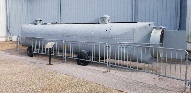
On February 17, 1864, the Confederate torpedo boat/submarine H. L. Hunley attacked and sank the Union warship U.S.S. Housatonic making it the first combat submarine to sink an enemy warship. Built in Mobile, Alabama in 1863, the . . . — — Map (db m191534) HM
On Battleship Parkway, on the right when traveling south.
The Fallen Guardians Monument
Dedicated to the personnel who lost their lives
while performing Coast Guard missions in Alabama
Eternal Father, Lord of Hosts, watch o’er the ones who guard our coasts, protect them from the raging seas and give . . . — — Map (db m136756) WM
On West Jeff Davis Avenue at Adeline Street, on the right when traveling west on West Jeff Davis Avenue.
Side 1:
Sherman, Sr. and Nettie White lived at this address on W. Jeff Davis Ave. Both teachers, they taught their children Sherman Jr., Willa, James, and Samson to love their country and value education. Willa, James, and Samson would graduate . . . — — Map (db m71084) HM
Dedicated to the men and women who have given
their lives to the Alaska commercial fishing industry.
The purpose of this Memorial is to demonstrate support for the
commercial fishing industry by individuals, families, and . . . — — Map (db m257928) HM
Facing the open Gulf of Alaska, Cape Saint Elias lighthouse stands on Kayak Island, where in 1741, Russian voyagers first set foot on North American soil. The Cape's bald pinnacle serves as a key landmark in daylight. The light provides guidance at . . . — — Map (db m181632) HM
Scotch Cap and Cape Sarichef lighthouses mark the north and south entrances to Unimak Pass in the Aleutian Islands. Both sites were declared to be too isolated for family life.
Scotch Cap was the first light on Alaska's outside coast and is the . . . — — Map (db m181636) HM
The drug store on the corner was once the jewelry store of Emery Valentine. In addition to serving several terms as mayor and founding the Juneau Volunteer Fire Department, he built
the elegant Queen Anne structure that housed his store and . . . — — Map (db m257941) HM
Eldred Rock is the oldest original lighthouse still standing in Alaska. It is a two-story building topped by a light tower. The ground floor was built of reinforced concrete, the first time that material was used for a lighthouse facing Alaska's . . . — — Map (db m181635) HM
Steamships brought passengers as well as goods. During the heyday of steam travel, there was a ship at the dock almost every day. In 1918, the Canadian Pacific Line's Princess Sophia was bound for this harbor when the ship foundered on a reef . . . — — Map (db m181792) HM
On Broadway at 1st Avenue, on the right when traveling north on Broadway.
Skagway was the starting point for the fateful voyage of the SS Princess Sophia on Oct. 23, 1918. After the arrival of the last train of Yukoners bound for southern ports, the Sophia left Skagway a few hours late. This delay was the . . . — — Map (db m248857) HM
On Broadway at 1st Avenue, on the right when traveling north on Broadway.
In memory of the more than 350 people lost on the SS Princess Sophia, on October 25, 1918.
On October 23, 1918, the Princess Sophia left Skagway, bound for Juneau. One of the final outbound ships of the year, the October sailing . . . — — Map (db m248856) HM
On Centerville Road 4.5 miles west of Ferndale, on the right when traveling east.
To the memory of the
38 pioneers who lost
their lives in the wreck
of the steamer "Northerner"
on January 6, 1860.
By Ferndale Parlor, NSGW, 1921.
Rebuilt because of
the earthquake of 1992.
Rededicated
February 11, 1995
by . . . — — Map (db m239831) HM
Near Ocean Avenue at Craig Street, on the right when traveling east.
This cross was erected on a bluff overlooking Centerville Beach on September 11, 1921, by the Native Sons
of the Golden West, Ferndale Parlor No. 93, to honor the 17 passengers and 21 crewmembers of the steamship
SS Northerner, who perished on . . . — — Map (db m247118) HM
The Trinidad Memorial Lighthouse is one of the most iconic landmarks on the North Coast and a beloved, historical symbol of the Trinidad community. The structure was built in 1949 as a replica of the original 1871 Trinidad Lighthouse, which . . . — — Map (db m139525) HM
On Chimney Rock Road near Sir Francis Drake Boulevard, on the left when traveling east.
No one knows how many cries for help went unanswered along this isolated coast. If shipwreck victims were not overcome by pounding surf, they would perish in a cold sea. But once the Life-Saving Station was established in 1889, victims of the coast . . . — — Map (db m102676) HM
On December 10, 1769, the Portola Crespi Expedition from Mexico erected a cross on this hill to signal its long-overdue supply ship San Jose. A message at the cross stated that they were suffering great privation and were returning to San Diego. The . . . — — Map (db m68862) HM
On October 12, 1865 the town of Rio Vista gained brief national attention
when Sacramento's newest and most luxurious river steamboat,
Yosemite, burst a boiler in her starboard side. Yosemite was bound
down river for San Francisco . . . — — Map (db m185611) HM
On the San Diego Embarcadero at W. G Street on the San Diego Embarcadero.
During World War II, 600 fishing vessels were taken by the Navy, Army, and Coast Guard, including 52 “Tuna Clippers”.
On Pearl Harbor Day, the U.S. canned tuna industry was located almost exclusively in Southern California, and canners received . . . — — Map (db m52350) HM
On 3rd Dr. S. at Cabrillo Memorial Drive, on the right when traveling east on 3rd Dr. S..
[Panel 1]:
Eternal God who alone spreads out the heavens and rules the raging seas, may this memorial bring continued remembrance to the one hundred and thirty seven men who died defending their country in time of danger, and whose . . . — — Map (db m8480) HM
On The Embarcadero North south of Broadway, on the right when traveling north.
Side 1:
I have heard that cry: that once heard can never be forgotten,
“Man overboard!”
I remember men lost from my ship, far out in the mid-ocean,
On dark midnights.
I remember how we used to stand,
Gathered under the mizzen . . . — — Map (db m200533) HM
On Embarcadero, on the right when traveling south.
R. Marks • J. Stanford • T. Pierce • B. Pierce • A. Lockard • D. Lockard • D. Fanning • R. Fanning • S. Fanning • A. Fanning • K. Dahl • J.J. Santos • J.A. Santos • A. Cowles • V. Woodward • J. Woods • D. Conger • G. Conger • J. Danner • R. . . . — — Map (db m299384)
Near Johnson Pier south of Pillar Point Harbor Boulevard, on the left when traveling south.
Down to the sea in ships they go, these chosen men of steel. Though mist and foam and northwest wind is pounding at the keel. So sail they must each crispy morn, away from trees and sod. The sea may own their windburned flesh but their souls . . . — — Map (db m183796) HM
Beginning in the 1840s, the dock at Alviso served as Santa Clara County’s access to the San Francisco Bay. From this port, passengers boarded steamboats loaded with goods and produce bound for San Francisco and points beyond. In the early days of . . . — — Map (db m64389) HM
In memory of those brave and forgotten airmen
of the 11th Air Force, whom God chose to place
beyond our reach, and who lost their lives in the
unforgiving waters of coastal Alaska, the Aleutian Islands,
the North Pacific, Bering Sea and . . . — — Map (db m163235) WM
On Washington Street at deKoven Avenue, on the right when traveling east on Washington Street.
Middletown became of the richest towns in all New England in the 1700s. during that time, thousands of ships loaded with local products like lumber, barrels, horses, pigs, corn, butter, and beef.
The ships sailed down the Connecticut River and . . . — — Map (db m98690) HM
Near Crystal Lake Road west of Connecticut Route 12 when traveling west.
In her nearly forty years of service, NR-1 was involved in a number of important missions, many of which may remain classified for years to come. Those that have beed revealed include:
1976 Recovery Effort Phoenix Missile
October 1976 . . . — — Map (db m206582) HM
Near Mohegan Ave. Pkwy. north of Williams Street, on the right when traveling north.
United States Coast Guard Cutter
Alexander Hamilton
On 29 January 1942, after successfully rescuing the USS Yukon from an angry winter storm and towing her through the high seas and U-boat infested waters of the North Atlantic, the Alexander . . . — — Map (db m205246) WM
Near Mohegan Ave. Pkwy. north of Williams Street, on the right when traveling north.
The United States Coast Guard Greenland Patrol
World War Two 1940 – 1945
The Greenland Patrol was the longest continuous operation of military forces of the United States during World War Two
Task force 24.8
Dedication from “Ice Brothers” – . . . — — Map (db m205545) HM WM
Near Greenmanville Avenue (Connecticut Route 27) south of Bruggeman Place, on the left when traveling north.
Hobart Ford, Jr.
Gunners Mate 2nd Class
Attached to U.S.S. LST-531
Born September 17th, 1924
Lost in Action at Sea
April 29th, 1945 — — Map (db m227133) WM
Near Greenmanville Avenue (Connecticut Route 27) south of Rossie Pentway, on the left when traveling north.
Length: 25'
Beam: 6'
This fiberglass Japanese fishing boat was swept out to sea during the deadly March 11, 2011 Japanese earthquake and tsunami, then drifted across the Pacific Ocean for a decade. It landed . . . — — Map (db m227088) HM
This poster depicts the heyday of the grand resort that existed at nearby Woodland Beach during the late 1800's to early 1900's. Note the passenger train, steamship, grand hotel, dance hall and other resort facilities. As many as a thousand visitors . . . — — Map (db m247066) HM
On Delaware Route 1 at milepost 12 at Savages Ditch Rd., on the right when traveling south on Delaware Route 1.
The Faithful Steward, bound from Londonderry, Ireland to Philadelphia, ran aground on a shoal September 1, 1785 with 249 passengers aboard. Stormy weather drove the vessel toward shore where it became stranded in 4 fathoms (24 feet) of water . . . — — Map (db m108226) HM
On Kings Highway (U.S. 9N) near 3rd Street, on the left when traveling north.
On May 25, 1798 at 4:00 pm, H.M. Brig DeBraak capsized and sank off the coast of Cape Henlopen, Delaware during a sudden squall. This memorial honors the thirty-three members of the eighty-five man crew who were lost at sea.
James . . . — — Map (db m38436) HM
On Shipcarpenter Street north of Pilottown Road, on the right when traveling north.
The Monomoy story and the story of the Lightship Overfalls are about saving the lives of seamen. The twenty-six foot Monomoy rowboat is constructed of oak and cedar and was designed in the perilous days of early WWII. Then, in the greatest . . . — — Map (db m232753) HM
On Shipcarpenter Street 0.1 miles north of Route 267, on the left when traveling north.
Known as the “Great White Hurricane,” the Blizzard of 1888 was one of the most devastating weather events in recorded history. Affecting coastal states from Virginia to Maine, this paralyzing storm resulted in widespread death and destruction. With . . . — — Map (db m19316) HM
Near Mount Vernon Trail 0.1 miles west of 14th Street Bridge (Interstate 395), on the right when traveling north.
In war and in peace, in commerce and in travel, in rescue and discovery, in fisheries and in research, this nation has forged a bond with and a dependence on the sea. This monument of waves and gulls memorializes our national life at sea. It is . . . — — Map (db m5108) HM
Near P Street Southwest 0.1 miles west of 4th Street Southwest, on the left when traveling west.
[front (north) face of statue base:]To the brave men
who perished
in the wreck
of the Titanic
April 15, 1912.
They gave their
lives that women
and children
might be saved.
[reverse (south) face of statue . . . — — Map (db m100951) HM
Near North Ocean Boulevard (Florida Route A1A) near Bay Drive, on the right when traveling north.
One of the most historic locations in Pompano Beach, the Hillsboro inlet was given its name by surveyor William de Brahm in the early 1870's. The name honored British aristocrat Lord Wills Hill, the Earl of Hillsborough. It is not clear how the . . . — — Map (db m213478) HM
Near East Fort King Street 0.1 miles south of East Silver Springs Boulevard.
United States Merchant Marine
WWII
833 Large ships sank
31 lost with no trace
8,651 Mariners killed at sea
11,000 wounded
1,100 died from wounds ashore
604 men and women taken prisoner
60 died in prison camps . . . — — Map (db m198371) WM
Near Southeast MacArthur Boulevard 1.4 miles south of Southeast Ocean Boulevard (State Road A1A), on the left when traveling south.
The iron-hulled Italian bark Georges Valentine was built in 1869 at Liverpool, England. She was wrecked here in a storm on October 16, 1904, while bound from Pensacola to Buenos Aires with a load of lumber. Five members of her twelve-man crew . . . — — Map (db m112173) HM
On South Bayshore Drive north of Darwin Street, on the right when traveling north.
(Side 1)
This seaplane hangar was a part of the first permanent United States Coast Guard Air Station in the country. Built in 1932, the hangar served as a crucial center for Coast Guard aviation in Florida. Planes from Dinner Key carried . . . — — Map (db m150778) HM
On Overseas Highway (U.S. 1 at milepost 78), 1.9 miles south of Old State Road 4a, on the left when traveling south.
This plaque is in memory of the many Cubans who were desperate to leave Castros' communist Cuba. They left their homes and families trying to cross the 90 miles of sea in rafts, innertubes or anything that would float.
Not knowing what rough . . . — — Map (db m83553) HM
On Overseas Highway (U.S. 1 at milepost 78), 1.9 miles Old State Road 4a, on the left when traveling south.
On Friday, July 13, 1733, the Spanish treasure fleet under the command of General Don Rodrigo de Torres Morales, sailed from Havana Harbor for Spain.
The fleet of 21 ships was loaded with gold and silver from the mine at Cartagena, Peruvian . . . — — Map (db m83550) HM
Near Overseas Highway (U.S. 1) north of North Ocean Lane, on the left when traveling north.
The "Overseas Railroad" was a masterpiece of engineering, proclaimed the "eighth wonder of the world." In 1904 Henry M. Flagler, oil magnate, hotelier, and owner of the Florida East Coast Railway, coined the battle cry for his engineers, "Go to . . . — — Map (db m224640) HM
On Wall Street at Tift’s Aly, on the left when traveling south on Wall Street.
This plaque is placed here to commemorate the lost souls aboard the galleons Nuestra Senora de Atocha, Santa Margarita and the other ships of the 1622 Fleet that found their final resting place on the ocean floor off Key West, Florida in the . . . — — Map (db m224566) HM
World War II
Following the outbreak of war in Europe in 1939, President Roosevelt visited Key West and ordered the naval base reopened to support naval operations in the Caribbean. Soon thereafter, destroyers and seaplanes operating . . . — — Map (db m224152) HM WM
On Sunshine Skyway (Interstate 275) 4 miles south of Pinellas Point Drive South, on the right when traveling south.
Semper Paratus
USCGC Blackthorn WLB-391
28 January 1980
SS1 Subrino I. Avila 1 May 1948 Paliwas, R.P. • SNGM Randolph B. Bar bay 27 Jan. 1958 Detroit, Mich. • MK2 Richard D. Boone 22 Sept. 1956 Patterson, Cal. • SA Warren R. Brewer 21 . . . — — Map (db m253718) HM
Near Red Cox Drive at Ocean Vista Avenue, on the right when traveling south.
On March 15, 2007, Steve Senecal, an avid fisherman left the lighthouse boat ramp for a day of offshore fishing. When he did not return that evening the Coast Guard was notified and they began a 39 hour search of more than 4,300 square miles of . . . — — Map (db m256106) HM
Near North Indian River Drive at Avenue E, on the right when traveling north.
This memorial is dedicated to all men
lost while serving in
The United States Submarine Service
Nearly 200 men were lost before World War II
52 submarines and over 3,600 men
were lost during World War II
From World War II to . . . — — Map (db m200767) WM
On East River Street, on the left when traveling east.
Before the Japanese attack on Pearl Harbor brought the United States into World War II, President Roosevelt and Congress authorized a ship building program to construct a fleet of transport vessels that could carry American supplies to England. . . . — — Map (db m19625) HM
Near Eckel Street east of Holtz Street, on the right when traveling east.
Named in honor of
Pvt. George Watson 29th. QM. Regt USA.
The first colored inductee of this
reception center to receive the D.S.C.
Awarded for heroism in action near Porloch
Harbor, New Guinea, by GO. 52, H Q.U.S.A.F.
in the Far . . . — — Map (db m297101) HM WM
On Bobby Brown Park Road at Ranger Drive, in the median on Bobby Brown Park Road.
Shipmates on Eternal Patrol in USS Scorpion (SS-278).
Lost February 1st, 1944
East China Sea
James S. Alexander, EM@/Charles W. Appleton, SC3/Lorren L. Bausman, SC1/ Hollis F. Bell, S1/Robert T. Brown, LTjg/Rufus H. Bynum, QM1/ Robert J. . . . — — Map (db m78674) HM
On Main Street at Athens Street, on the right when traveling east on Main Street.
(front)
Birth April 10, 1919
Died April 5, 1943
Grew up and educated in Lula, GA
He was a crewmember on Plane #5 as the Bombardier on the Tokyo Raiders Mission. He dropped the first bombs on Tokyo April 19, 1942.
Became known as . . . — — Map (db m180965) HM
On West Ogeechee Street (Georgia Route 73) at North Main Street, on the left when traveling west on West Ogeechee Street.
On September 25, 1918, the British troopship H.M.S. Otranto left New York carrying more than 1,025 U.S. soldiers and crewmen as part of a convoy headed to fight in Europe during World War I. Most of the soldiers onboard had trained at Fort . . . — — Map (db m159278) HM
On Highway 19 (Hawaii Route 19), on the right when traveling north.
The Laupahoehoe we see now is very different from the Laupahoehoe of old. Laupahoehoe Point was a peaceful, Hawaian fishing village, untouched by missionaries and plantation life; the valley and the sea provided bountiful life. In the late 1800's . . . — — Map (db m94338) HM
Launched 24 July 1943
USS Parche
P Π E
Par Excellence
Commissioned 20 November 1943
SS-384
These men served aboard during her six war patrols
[LEGEND: Name · Patrols · Role] •
Allard, C. J. · 3 · CMOMM • . . . — — Map (db m292238) WM
He goes a great voyage that goes to the bottom of the sea, George Herbert, Jacula Prudentum, 1651
Throughout the history of submarine development, men have fought enemies just as lethal as any human foe. Those who brave the deep in . . . — — Map (db m81389) HM WM
LCDR A.M. Bontier, USN, Commanding Officer; Launched 15 August 1939; Lost at Sea, 3 October 1944.
Beginning with her first patrol just hours after the Japanese attack on Pearl Harbor, a daring submarine embarked on a career that made the name . . . — — Map (db m81417) WM
CDR K.E. Montross, USN, Commanding Officer; Launched 1 April 1939; Lost at sea, January 1945.
Less than two weeks after the Japanese attack on Pearl Harbor, Swordfish sank her first ship. So began the career of a submarine that not only sank . . . — — Map (db m81419) HM WM
CDR R.H. Kane, USN, Commanding Officer; Launched 17 August 1943; Lost at sea, 24 October 1944.
The exploits of Tang are legendary in submarine history. Under the bold leadership of Commander Richard H. O’Kane, Tang executed five brilliant . . . — — Map (db m81473) HM WM
CDR D.W. Morton, USN Commanding Officer; Launched 14 February 1942; Lost at sea 11 October 1943.
If one submarine could be said to embody the spirit and pride of the U.S. Submarine Force, it would probably be Wahoo. Certainly the enemy . . . — — Map (db m81474) WM
In these gardens are recorded
the names of Americans
who gave their lives
in the Service of their Country
and whose earthly resting place
is known only to God
*Indicates Medal Of Honor Award — — Map (db m4504) WM
On Lee Street west of Fargo Avenue, on the right when traveling south.
When war broke out among European nations in 1914, the United States went to great lengths to remain neutral. After Germany sank the passenger liner RMS Lusitania in 1915, killing American citizens, public opinion began to swing toward US . . . — — Map (db m268647) HM WM
On West Walnut Street west of North Senate Avenue, on the right when traveling west.
Panel 1
Named in honor of our Capitol City, the heavy cruiser USS Indianapolis keel was laid on 31 March 1930 and launched on 7 November 1931. She was accepted by the Navy and Commissioned on 15 November 1932. She was 610 feet 4 inches . . . — — Map (db m55558) WM
On South Main Street (Kentucky Route 2083) at Route 4002, on the right when traveling south on South Main Street.
Side 1
Cmdr. D. W. "Mush" Morton, USN
This World War II hero spent his early youth & attended elementary school in Nortonville, high school in Madisonville. Graduated from U.S. Naval Academy in Annapolis, Md., in 1930. Became . . . — — Map (db m88927) HM
Near South Irma Boulevard 0.3 miles north of East Worthey Street, on the right when traveling north.
Post Pearl Harbor American and British military planners decided on a strategy of “Europe First", but that did not mean “Neglect Japan Entirely.” Indeed, fierce fighting took place in the Pacific in the immediate aftermath . . . — — Map (db m115786) HM WM
On West Main Street (U.S. 1), on the right when traveling north.
For 40 years Clara sailed, first with her father at age nine, then with her husband, Captain William Blanchard, aboard 13 vessels in all. She enjoyed one of the longest documented lives at sea and sailed to all parts of the world. . . . — — Map (db m59280) HM
On Harrington Road (U.S. 1) at Station Road, on the right when traveling north on Harrington Road.
Shipbuilding was an important enterprise in the early history of Jonesboro. The types of vessels built from 1816 through 1887 were varied and included schooners, sloops, brigs and barks. Accounts as to the number of ships built in the town of . . . — — Map (db m183782) HM
On 1st Street near Staples Street, on the right when traveling south.
In recognition of these early transatlantic flights from Old Orchard Beach, Maine
and
Harry M. Jones
Pioneer Aviator
whose airport on this beach made these flights possible
August 26, 1927
"Detroiter"
Edward Schlee & William Brock . . . — — Map (db m50263) HM
In command of the Central America, home-bound with California Gold seekers, Captain Herndon lost his life in a gallant effort to save ship and lives during a cyclone off Hatteras, September 12, 1857
"Forgetful of self, in his death . . . — — Map (db m7213) HM
On Governor Ritchie Highway (State Highway 450) at Chase Road, in the median on Governor Ritchie Highway.
Introduction
With their lives before them, they left everything – their families, their loved ones, the serenity and security of their homes – to fight for a just cause. They departed on a journey to places they had . . . — — Map (db m250676) HM WM
On Key Highway 0.2 miles east of Light Street, on the left when traveling east.
On May 14, 1986, the Pride of Baltimore, her captain, and three members of her crew were lost at sea.
The Pride now rests at the end of a goodwill journey that covered 150,000 miles and touched 125 cities around the world. . . . — — Map (db m20484) HM
On Eastern Neck Island Road, on the right when traveling south.
Major Joseph Wickes, who settled on Eastern Neck Island c. 1658, was Chief Justice of Kent County. Before 1674 the Court met at Wickliffe, his home here (no longer standing). By 1680 he had acquired 864 acres, the southern half of the island, which . . . — — Map (db m3076) HM
On Sligo Creek Trail west of New Hampshire Avenue (Maryland Route 650), on the right when traveling west.
On the evening of August 9, 1969 during a severe thunderstorm and flash flood these men gave their lives while attempting to rescue flood victims.
This plaque is dedicated to the memory of these men by their brother firemen and friends this . . . — — Map (db m153497) HM
Near North Talbot Street at Dodson Avenue, on the right when traveling north.
Originally, a small boat hung here. This boat was the only way the lighthouse keepers had to get back to the mainland and civilization, a good five miles away. By sail, the trip took an hour or two; with a motorboat, 45 minutes to an hour. Most . . . — — Map (db m285700) HM
On Academy Drive, on the right when traveling west.
This plaque is dedicated to the officers and crew members of the S/S Marine Electric who lost their lives in the line of duty on 12 February 1983.
By Marine Transport Lines, Inc. M.E.B.A District 81 National Maritime Union Masters, Mates and . . . — — Map (db m85581) HM
On Academy Drive, on the right when traveling west.
This bell is dedicated to the memory of those who were lost at sea when the SS Pan Oceanic Faith went down in the North Pacific on 9 October 1967.
John P. Dunphy ’65 • John M. Ward ’65 • John R. McPhee ’67 • Joseph P. Nowd ’67 • James . . . — — Map (db m85577) HM
On Academy Drive, on the right when traveling west.
The Unknown Seaman Dedicated 7, October 1989 This monument is dedicated to the officers and men who sailed the ships of the U.S. Merchant Marine during World War II. Especially to the 6700 unsung heroes who lost their lives in that conflict. And . . . — — Map (db m85575) WM
Near Highland Light Rd 0.2 miles east of S Highland Rd.
On November 27, 1898
The Steamer
Portland
With 176 persons aboard
Sank with No Survivors
About Seven Miles Out To
Sea From This Station
At Cape Cod Light
_____ ___ _______
This Memorial Dedicated November 27, 1948
By . . . — — Map (db m141449) HM
On Beach Road at Surf Path, on the right on Beach Road.
For nearly two centuries after the Sparrow-hawk rescue, there were no organized efforts to aid those who were involved in shipwrecks off Cape Cod shores. Those who found themselves cast up on the shores or sandbars of Cape Cod were at the mercy . . . — — Map (db m158807) HM
Near Rogers Street (Massachusetts Route 127) at Porter Street, on the right when traveling east.
From a large bark or packet ship 200 to 300 feet long, lost at sea. Salvaged by Captain Salvatore Zappa and crew of the fishing vessel Carol Ann in 1988. — — Map (db m193088) HM
On Western Avenue (Massachusetts Route 127) at Babson Court, on the right when traveling north on Western Avenue.
For nearly four centuries the history of Gloucester has been the story of America's greatest fishing port. With this memorial we commemorate the lives and the legacy of those who died at sea while fishing.
The first settlers came from England . . . — — Map (db m156491) HM
The Brig Falconer was wrecked on Ipswich Beach December 17, 1847. Seventeen of the passengers and crew were lost. Twelve lie buried here in one common grave.
Thomas Shaw, and his wife • Julia Laskin • Margaret Hennesy • Howard Fling • Peter . . . — — Map (db m107994) HM
In honor of
the proud, brave fishermen
who lost their lives at sea.
May they rest in peace.
In memory of
The Crew of F/V Lady Luck
Who were lost at sea
The night of January 31, 2007
Captain Sean P. Cone - Age 24
Crewman . . . — — Map (db m85230) HM
On Humphrey Street (Massachusetts Route 129) at Greenwood Avenue, on the left when traveling north on Humphrey Street.
In Memory Of The Men
Of Swampscott Who Lost Their
Lives At Sea
This Anchor Believed To Be From
The Bark "Tedesco" Wrecked January 18, 1857
And Found Off Swampscott August, 1968 By
Mark Cheevers • William Clarke • Mark O'Grady • Kevin . . . — — Map (db m36697) HM
On Front Street at Bonneville Avenue, on the right when traveling east on Front Street.
North side CHICOPEE Erects this monument in grateful memory of all her sons who served on land and sea in the World War 1914-1918 West side DIED OF DISEASE Ralph Anderson Charles Bancroft . . . — — Map (db m54869) HM
In memory of
Three Brothers
who lived and died
in the service
of their Country.
Sons of Thomas Boylston
and Ann Harrod Adams
————————————
Thomas Boylston . . . — — Map (db m119177) WM
On Spring Street west of Spinnaker Island Causeway, on the right when traveling west.
Interred herein are approximately
100 men, women and children
known only to God.
Victims of shipwrecks
on our shores, nearby islands
or shoals, from
1860 to 1898.
Erected in their memory — — Map (db m118049) HM
On Point Road east of Spruce Trailways Road, on the left when traveling east.
On August 29, 1880, the sidewheel passenger vessel Marine City steamed across Lake Huron. While just off Sturgeon Point, passengers and crew noticed smoke
coming from the engine room. In very little time, the fire engulfed the ship. As thick . . . — — Map (db m277836) HM
On Point Road east of Spruce Trailways Road, on the left when traveling east.
After stopping for a load of shingles at Alcona the ship caught fire three miles off shore from Sturgeon Point. The fateful day was Aug. 29, 1880.
The tugs Vulcan and Grayling came to the rescue. Approx. 100 passengers, 41 crewmen leaped into . . . — — Map (db m277845) HM
On Grand Marais Avenue (County Road H-58) at Randolph Street and Crawford Street, on the right when traveling north on Grand Marais Avenue.
This type of anchor was in use before the discovery of America, and
was common on the Great Lakes up to the end of the sailing era. Old
sailing schooners carried them, and these boats saw many more years’
usefulness on the Great Lakes after their . . . — — Map (db m253828) HM
On East Superior Street at Elm Avenue, on the right when traveling east on East Superior Street.
The maritime artifacts displayed in this community fountain were salvaged from the S.S. Kiowa - a steel freighter built in 1920 by the Detroit Shipbuilding Company. S.S. Kiowa measured 251 feet in length, 43 feet in beam, 24 feet in depth, . . . — — Map (db m278450) HM
Near West Fletcher Street west of Commercial Street, on the left when traveling north.
Life on the frontier Great Lakes was dangerous when the sidewheeler Vermilion went into service in 1838. In 1842, the 151-foot steamer burned to the waterline, killing several people. A year later, with immigration booming and the economy . . . — — Map (db m122429) HM
Near West Fletcher Street at Cedar Street, on the left when traveling north.
The Civil War created an insatiable demand for copper. At a time when Michigan's Upper Peninsula produced the majority of America's supply, vessels like the Pewabic played a critical role in the war effort. On a typical trip between lakes . . . — — Map (db m121896) HM
Near North Huron Street. Reported permanently removed.
The Griffin, the first ship on the Upper Great Lakes, disappeared on its maiden voyage in 1679.
Since then the Lakes have swallowed over 10,000 vessels.
Early wooden ships were often lost to on-board fires.
Many others were destroyed by . . . — — Map (db m107191) HM
Near North Huron Avenue at Henry Street, on the right when traveling west.
The Straits of Mackinac have claimed many a ship
blown off course onto dangerous shoals submerged
outside narrow shipping lanes. Fog, swift currents,
and crushing winter ice also have taken their toll.
In 1983 the Straits were designated a . . . — — Map (db m255144) HM
348 entries matched your criteria. The first 100 are listed above. Next 100 ⊳