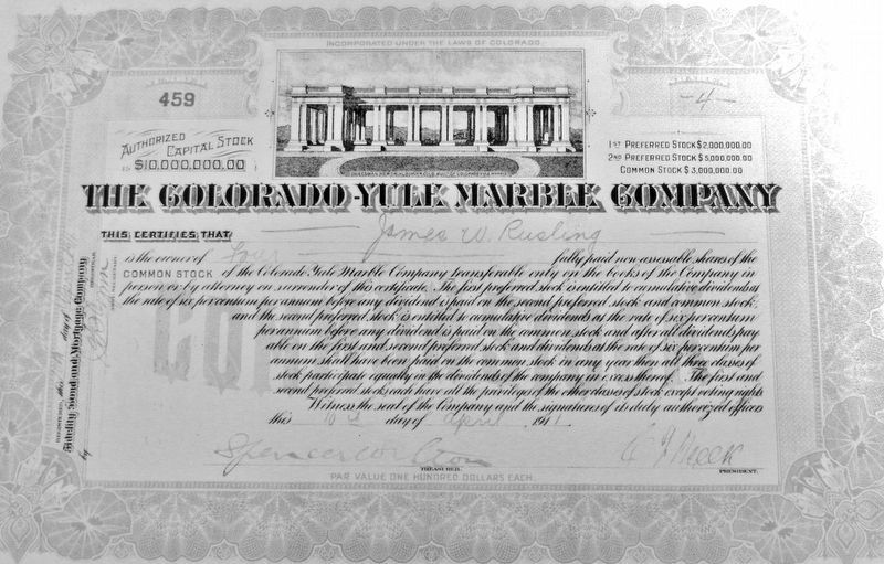
Near Silver Street at 2nd Street (County Road 20), on the right when traveling north.
Colorado Stone Quarries, a subsidiary of the international Italian stone quarry corporation R.E.D. Graniti, extracted and donated this 2,300-lb. marble slab from the company's Colorado Yule Marble Quarry in Gunnison County. The slab is displayed at . . . — — Map (db m292298) HM
On Gunnison Avenue (State Highway 149) just north of 3rd Street, on the right when traveling north.
Excitement was rampant in September of 1877 as Lake City awaited the arrival of a graying spinster nationally known for her strong opinions on liquor abstinence, the role of African Americans in post-Civil War America, and most notably — the . . . — — Map (db m291796) HM
On Henson Street north of 3rd Street, on the left when traveling north.
The Hinsdale County Courthouse is a two-story, front-gabled frame building that was built in Italianate style and completed in June of 1877. It is Colorado's oldest courthouse which continues to function as a courthouse and is a rare surviving . . . — — Map (db m292100) HM
On Gunnison Avenue (State Highway 149) at 6th Street, on the right when traveling south on Gunnison Avenue.
This location has played an important role in the education of Lake City area children for over a century. Lake City's first private school was organized in 1875 by Prof. T.H. Cannon who taught a class of 40 students “all branches of English” for . . . — — Map (db m292506) HM
Near Silver Street at 2nd Street (County Road 20), on the right when traveling north.
The Yule brothers, William and George, are credited with first discovering promising deposits of dense, white marble in apparently limitless quantities while prospecting on Ute Indian lands in the Elk Mountains in 1874. The marble, it was said, was . . . — — Map (db m292486) HM
On Silver Street at 2nd Street (County Road 20), on the right when traveling north on Silver Street.
Two of Lake City's earliest cabins were built near this location in August, 1874, by Enos Hotchkiss and John Bartholf. The men were part of a road building party which passed through the area while constructing the Saguache & San Juan Toll Road . . . — — Map (db m292188) HM
On Silver Street at 2nd Street (County Road 20), on the right when traveling north on Silver Street.
Town founder Enos T. Hotchkiss (1832-1900) built a dirt-roofed log cabin near this site in August 1874. More permanent structures, like the Finley Block built in 1877, now the Hinsdale County Museum, turned Lake City into the “Metropolis of San . . . — — Map (db m292187) HM
On Silver Street at 3rd Street, on the left when traveling north on Silver Street.
Western Colorado's first banking house, the Hinsdale County Bank, opened in Lake City in June of 1876. The bank was a branch of the First National Bank of Colorado Springs and boasted prominent banker H.A. McIntire as president and H.J. Alexander . . . — — Map (db m292157) HM
On April 6, 1883, the trial for Alferd Packer began at the Hinsdale County Courthouse. This trial was for the murder of Israel Swan. On April 13, 1883, Packer was found guilty by a jury and received a death sentence. Packer's First . . . — — Map (db m291799) HM
On Gunnison Avenue (State Highway 149) at 7th Street, on the left when traveling south on Gunnison Avenue.
The tree before you is the largest narrow leaf cottonwood tree in the State of Colorado and second in the nation to a tree located in Murray City, Utah. Indications are that the tree is approximately 140 years old. It was planted in the 19th . . . — — Map (db m292295) HM
On State Highway 149 at milepost 93, just west of County Road 25, on the right when traveling south.
“In the Colorado Rockies where the snow is deep and cold… a man afoot can starve to death unless he’s brave and bold.” ~Ballad of Alferd Packer What is now recognized as one of the most notorious events in Colorado's . . . — — Map (db m291792) HM
Near Silver Street at 2nd Street (County Road 20), on the right when traveling north.
This narrow-gauge caboose car is a perfect example of those which operated on the Denver & Rio Grande Western (D&RGW) railroad in the late 1800's and early 1900's. Since shorter trains did not require cabooses, Caboose 588 did not operate on the . . . — — Map (db m292583) HM
On 4th Street just west of Gunnison Avenue (State Highway 149), on the right when traveling west.
During his six-plus decades as a Lake City resident from the mid-1890s through the late 1940s, Missouri native William Francis “Billy” Green (1866-1950) was a versatile businessman and public official who also happened to be an inveterate tinkerer. . . . — — Map (db m292197) HM
Near Silver Street at 2nd Street (County Road 20), on the right when traveling north.
John J. Crooke (1824-1911) and his brothers, Lewis Crooke and Robert Crooke, were noted 19th Century metallurgists and New York City industrialists who were responsible for patenting the manufacture of tin-foil in the 1880s. The brothers' . . . — — Map (db m292598) HM
On County Highway 20 0.1 miles west of County Highway 24, on the right when traveling west.
George S. Lee arrived in Hinsdale County from Massachusetts in May, 1877 with ambitious plans for the newly formed Galena Mining District. Lee saw opportunities to invest in the future of Colorado. At the time, the two-hundred-acre town site known . . . — — Map (db m177868) HM
On Gunnison Avenue (State Highway 149) at Henson Street, on the right when traveling north on Gunnison Avenue.
Gold strike in the San Juans! Word spread like wildfire that summer of 1874, and the following spring prospectors crowded into this hidden mountain valley. They pitched tents and crafted log cabins with dirt floors and sod roofs. In August 1875 the . . . — — Map (db m298157) HM
Near Henson Street north of 3rd Street, on the left when traveling north.
Henry C. & Eugenie W. Olney, J.W. Mills and others formed local Women’s Suffrage Assn. here after Susan B. Anthony’s visit, Sept. 1877. — — Map (db m279600) HM
On Silver Street just north of 2nd Street (County Road 20), on the left when traveling north.
In September, 1875, members of the Masonic fraternity proposed the establishment of a lodge in Lake City. Twenty Masons, who felt themselves to be sufficiently permanent residents to affiliate with a local lodge, met on December 4, 1875. To provide . . . — — Map (db m292097) HM
On Gunnison Avenue (State Highway 149) at 5th Street, on the left when traveling south on Gunnison Avenue.
Writing in 1937, Lake City newspaper editor William C. Blair observed that the San Juan region had “contributed its share of tragedy, romance and pathos to the history which records the incidents of all mining discovery and development, but in . . . — — Map (db m292290) HM
On County Highway 20, on the left when traveling west.
As the primary impetus of Lake City's initial boom and the mainstay of its survival through the mid-1900s, the Ute-Ulay Mine and Mill Complex is linked to Hinsdale's county seat and only incorporated town emotionally and irrevocably. Architecture . . . — — Map (db m177908) HM
On Silver Street at 3rd Street, on the left when traveling south on Silver Street.
Both adversity and opportunity were the result of the Great Fire of 1879 which destroyed the major business district of Lake City. The fire started during the early morning hours of November 8 in a one-room saloon known as "Billy's Place" on Third . . . — — Map (db m292185) HM
On 5th Street just west of Gunnison Avenue (State Highway 149), on the left when traveling west.
Lake City was just beginning to boom when the Rev. Alexander Darley arrived from Del Norte, Colorado Territory, in June of 1876. Within a few weeks, Darley gathered the signatures necessary to charter a congregation, making Lake City's Presbyterian . . . — — Map (db m292199) HM
On Highway 20 4 miles west of South Gunnison Avenue (Highway 149), on the left when traveling west.
Living conditions were often deplorable in the Galena Mining District. Miners often lived in company supplied boarding houses set up in close proximity to the mines. The houses were poorly built, drafty, and had leaky roofs. Although conditions at . . . — — Map (db m177890) HM
On Gunnison Avenue (State Highway 149) at 5th Street, on the right when traveling south on Gunnison Avenue.
St. James Episcopal Chapel occupies one of Lake City's oldest surviving frame structures, a carpenter shop with vertical board and bat siding which was built in 1875 by a building and contracting firm owned by H.E. Turner and J.B. Lyons. Turner & . . . — — Map (db m292196) HM
On Silver Street just south of 3rd Street, on the left when traveling south.
History swirled in and around the grand false-fronted wooden buildings which formerly tightly filled the area now known as the Lake City Park. Beginning in the mid-1870's this portion of Block 58 developed as Lake City's principal commercial . . . — — Map (db m292054) HM
On Gunnison Avenue (State Highway 149) at 2nd Street (County Road 20), on the right when traveling south on Gunnison Avenue.
The northwest corner of Gunnison Avenue and Second Street in the Lake City Historic District exemplifies the financial ebb and flow which was typical of boom towns in the western United States in the late 19th Century. Situated at a relatively . . . — — Map (db m291797) HM
On Gunnison Avenue (State Highway 149) just north of 3rd Street, on the right when traveling north.
This sign commemorates the location of Lake City's first Post Office in July of 1875. The Barlow & Sanderson Stage & Express Office (1877-1886) was sold to the Colorado & Wyoming Stage, Mail & Express Company in 1884. The present-day route of the . . . — — Map (db m291798) HM
On County Highway 20 4.5 miles west of Highway 24, on the right when traveling west.
At 2:14 AM on March 24, 1929, the Big Slide on the north side of Gravel Mountain tore loose and buried the Bonanza Empire Chief main office building, a dining hall/bunk house, and a five-room bunkhouse. Two cooks - Mrs. Mayme Watson and Mrs. E.L. . . . — — Map (db m177866) HM
On County Highway 30 1.5 miles east of County Highway 12, on the right when traveling west.
Burrows Park, Argentum, or Whitecross the name may have changed, yet the community and its place in history have remained the same. Situated within a five-mile long grassy meadow known as Burrows Park, clusters of hotels, blacksmith shops, . . . — — Map (db m177915) HM
Thin black lines indicate changes in relevance. Between each pair of lines entries are ordered geographically but all have the same relevance.
* Inflectional forms of words are their plurals, singulars, and possessives as well as gramatical tenses and similar variations.