By Gary Sonnenberg, April 22, 2024
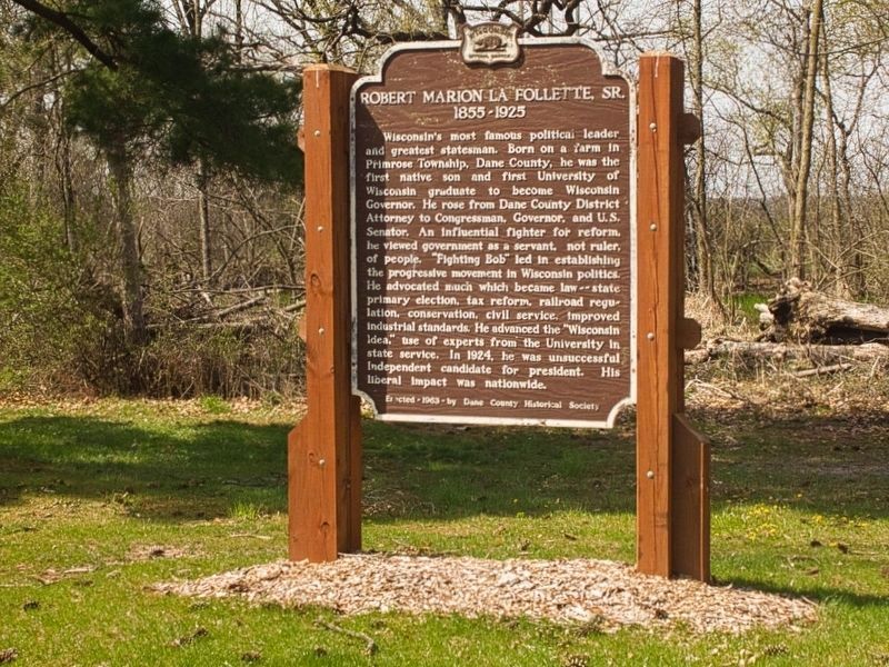
Robert Marion La Follette, Sr. Marker
RANKED BY RELEVANCE
| On Williams Drive 0.3 miles north of River Drive, on the left when traveling north. |
| Near Observatory Drive, on the right when traveling west. |
| On Moorland Road, on the right when traveling east. |
| Near Moorland Road, on the right when traveling east. |
| On Martin Luther King, Jr. Boulevard at East Wilson Street, on the right when traveling south on Martin Luther King, Jr. Boulevard. Reported missing. |
| On East Main Street (State Highway 113) 0.1 miles west of 2nd Street, on the right when traveling west. |
| On King Street 0.1 miles east of South Webster Street, on the left when traveling east. |
| Near State Highway 19 at Matz Road, on the left when traveling west. |
| On South Dakota Route 10 near Route 47. |
| On West Washington Avenue at South Carroll Street, on the right when traveling east on West Washington Avenue. |
| Near Fish Camp Road 0.3 miles east of County Highway AB, on the right when traveling east. |
| On County Route Y 3 miles County Route M, on the left when traveling north. Reported missing. |
| Near Lorillard Court at Findorff Court, on the right when traveling east. |
| On County Highway G at Oak Grove Road, on the left when traveling south on County Highway G. |
| On Campus Lane north of Edgerton Road, on the left when traveling north. |
| Near County Route F 0.8 miles north of Cave of the Mounds Road, on the right when traveling north. |
| On Dunroven Road at County Road DM, on the right when traveling south on Dunroven Road. |
| On the Capitol City Trail 0.5 miles west of Lake Farm Road, on the left when traveling west. |
| On the Capitol City Trail 0.5 miles west of Lake Farm Road, on the left when traveling west. |
| Near Parkside Drive north of East Washington Avenue (U.S. 151), on the left when traveling north. |
| Near Fish Camp Road 0.4 miles east of County Highway AB, on the right when traveling east. |
| Near North Mechanic Street just north of West Day Spring Lane, on the left when traveling north. |
| Near Scherbel Road, on the right when traveling north. |
| On West Wilson Street at South Hamilton Street, on the right when traveling west on West Wilson Street. |
| On Mineral Point Road at Junction Road, on the right when traveling west on Mineral Point Road. |
| Near Mounds Road/ Park Entrance Road 1.5 miles north of County Road Id (County Route Id). |
| On Moorland Road 0.3 miles east of Raywood Road, on the right when traveling east. |
| On Observatory Drive 0.2 miles west of Charter Street, on the left when traveling west. |
| Near Burrows Road 0.1 miles west of Sherman Avenue, on the left when traveling west. |
| Near Femrite Drive at Edna Taylor Parkway, on the left when traveling east. |
| On Observatory Drive 0.2 miles west of Charter Street, on the left when traveling west. |
| Near Observatory Drive 0.2 miles west of Elm Drive, on the right when traveling west. |
| On Edgewood Drive 0.1 miles west of Edgewood Avenue, on the right when traveling west. |
| On South Dickinson Street at Rutledge Street, on the left when traveling south on South Dickinson Street. |
| Near Lakeland Avenue at Maple Avenue, on the right when traveling east. |
| Near Lakeland Avenue at Hudson Avenue, on the right when traveling east. |
| Near North Henry Street at West Gilman Street, on the left when traveling north. |
| Near Vilas Avenue near Campbell Street, on the left when traveling west. |
| On Erin Street at Wingra Street, on the left when traveling west on Erin Street. |
| On East Main Street (U.S. 51) east of Forrest Street, on the right when traveling west. |
Thin black lines indicate changes in relevance. Between each pair of lines entries are ordered geographically but all have the same relevance.* Inflectional forms of words are their plurals, singulars, and possessives as well as gramatical tenses and similar variations.
Nov. 13, 2026
