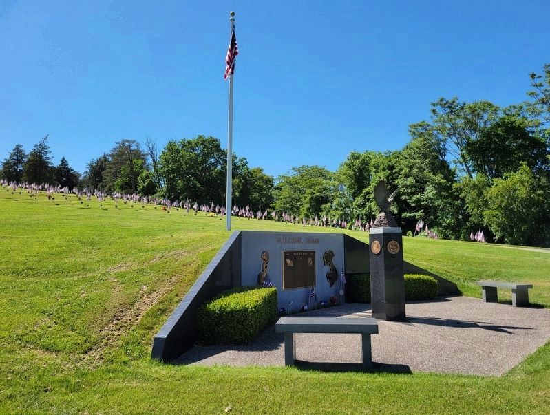
By Bradley Owen, June 4, 2022
Washington County Pennsylvania Vietnam Veteran's Memorial
RANKED BY RELEVANCE
| Near Park Avenue (Pennsylvania Route 18) 0.2 miles north of Williams Street, on the right when traveling east. |
| On South Main Street (Pennsylvania Route 18) at Cherry Way, on the right when traveling south on South Main Street. |
| Near South Main Street south of West Beau Street, on the right when traveling south. |
| On Murtland Avenue (U.S. 19) at North Avenue, on the right when traveling south on Murtland Avenue. |
| On 2nd Street Extension at Grant Avenue, on the right when traveling west on 2nd Street Extension. |
| On Franklin Farms Road 0.4 miles south of Franklin Farms Road and US 40, on the right when traveling south. |
| On 10 Mile Street at County Park Road, on the right when traveling east on 10 Mile Street. |
| On West Lincoln Avenue (Pennsylvania Route 980) 0.1 miles west of 6th Avenue, on the right when traveling east. |
| On Mapleville Rd at Fahrney Church Rd., on the right when traveling north on Mapleville Rd. |
| On Greencastle Pike (Route 63), on the right when traveling north. Reported missing. |
| On Fox Chapel Road, on the right when traveling north. |
| Near Buchanan Drive (State Highway 29) at Fort Croghan Drive. |
| Near Navasota Street at Inks Avenue, on the right when traveling north. |
| On Crockett Street 0.1 miles east of Gay Hill Street, on the right when traveling west. |
| On Noblestown Road (Pennsylvania Route 980), on the right when traveling east. |
| Near Main Street north of Rices Landing Road (County Route 1010), on the left when traveling north. |
| On Main Street (U.S. 40) at the Nemacolin Country Club driveway, on the right when traveling west on Main Street. |
| On South Main Street (U.S. 77) at East Richmond Street, on the right when traveling north on South Main Street. |
| On State Road 21 3.1 miles west of Old San Antonio Road, on the right when traveling east. |
| Near West Memorial Boulevard at South Potomac Street. |
| On West Pike Street east of Iron Street, on the left when traveling west. |
| On Virginia Creeper National Recreation Trail west of Mountain View Drive, on the left when traveling west. |
| On Tanger Boulevard 0.4 miles south of Racetrack Road, on the right when traveling south. |
| On Rush Creek Road (Local Road 26) at Local Road 32, on the left when traveling east on Rush Creek Road. |
| On West Memorial Boulevard 0.1 miles west of South Potomac Street (Maryland Route 65), on the right when traveling east. |
| On South Mulberry Street south of East Antietam Street, on the right when traveling south. |
| On East End Avenue, on the right when traveling north. |
| On Mingo Church Road west of Route 88, on the left when traveling west. |
| Near Panhandle Trail east of South McDonald Street. |
| Near Beechland Road (Kentucky Route 438) at Lincoln Park Road ( Route 528), on the left when traveling east. |
| On Cunningham Falls Park Road. |
| On West Memorial Boulevard 0.1 miles west of South Potomac Street (Maryland Route 56), on the right when traveling west. |
| Near Home Road east of Parkview Circle, on the right when traveling east. |
| On Log Cabin Drive, on the right when traveling north. |
| Near Highway 18 near Highway 120. |
| On Lakeview Parkway near Shoosmith Road, on the left when traveling north. |
| On W. State Street, on the right when traveling west. |
| On Main Street (Pennsylvania Route 837) at 7th Street, on the left when traveling west on Main Street. |
| On Pine Street West at Third Street South (County Highway 23), on the left when traveling west on Pine Street West. |
Thin black lines indicate changes in relevance. Between each pair of lines entries are ordered geographically but all have the same relevance.* Inflectional forms of words are their plurals, singulars, and possessives as well as gramatical tenses and similar variations.
Nov. 12, 2026
