348 entries match your criteria. The first 100 are listed. ⊳
Lost at Sea Historical Markers
Markers honoring merchant mariners, fishermen/women, crew and passengers who have been lost at sea during warfare and peacetime. Excluded: military personnel (in war or peace); aircraft; vessels lost with no people lost.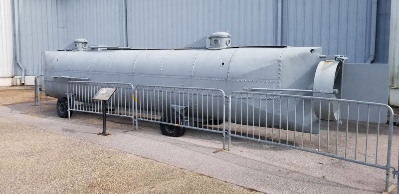
By James Hulse, January 24, 2022
The H.L. Hunley replica and Marker
1 ► Alabama, Mobile County, Mobile — H.L. Hunley — Confederate States Torpedo Boat Submarine —  |
| Near Battleship Parkway at Old Spanish Trail (U.S. 98). | |||
| 2 ► Alabama, Mobile County, Mobile — The Fallen Guardians Monument — |
| On Battleship Parkway, on the right when traveling south. | |||
| 3 ► Alabama, Montgomery County, Montgomery — Sherman W. White, Jr. — (1919 - 1943) — First Lieutenant, 99th Fighter Squadron — |
| On West Jeff Davis Avenue at Adeline Street, on the right when traveling west on West Jeff Davis Avenue. | |||
| 4 ► Alaska, Juneau Borough, Juneau, Downtown Juneau — Alaska Commercial Fishermen's Memorial in Juneau — |
| Near North Franklin Street. | |||
| 5 ► Alaska, Juneau Borough, Juneau, Downtown Juneau — Cape Saint Elias — |
| Near Marine Way. | |||
| 6 ► Alaska, Juneau Borough, Juneau, Downtown Juneau — Cape Sarichef & Scotch Cap — |
| Near Marine Way. | |||
| 7 ► Alaska, Juneau Borough, Juneau, Downtown Juneau — Corner of Front & Seward — Downtown Historic District — |
| Near Peoples Wharf. | |||
| 8 ► Alaska, Juneau Borough, Juneau, Downtown Juneau — Eldred Rock — |
| Near Marine Way. | |||
| 9 ► Alaska, Juneau Borough, Juneau, Downtown Juneau — Passenger Traffic — Sea & Sky: Juneau's Links to the World — |
| Near Marine Way. | |||
| 10 ► Alaska, Skagway Borough, Skagway, Dyea — Events Leading to the Shipwreck — Princess Sophia 1912-1918 — |
| On Broadway at 1st Avenue, on the right when traveling north on Broadway. | |||
| 11 ► Alaska, Skagway Borough, Skagway, Dyea — SS Princess Sophia Memorial — 1912-1918 — |
| On Broadway at 1st Avenue, on the right when traveling north on Broadway. | |||
| 12 ► California, Humboldt County, Ferndale — 173 — Centerville Beach Cross — |
| On Centerville Road 4.5 miles west of Ferndale, on the right when traveling east. | |||
| 13 ► California, Humboldt County, Ferndale — 173 — Centerville Beach Cross — |
| Near Ocean Avenue at Craig Street, on the right when traveling east. | |||
| 14 ► California, Humboldt County, Trinidad — 146 — Trinidad Memorial Lighthouse — A New Home! — |
| On Lighthouse Road near Bay Street. | |||
| 15 ► California, Marin County, Inverness — Victims of the Coast — |
| On Chimney Rock Road near Sir Francis Drake Boulevard, on the left when traveling east. | |||
| 16 ► California, Monterey County, Carmel-by-the-Sea — Portola Crespi Cross — |
| Near Calle La Cruz at Ribera Road. | |||
| 17 ► California, Sacramento County, Isleton — The Explosion of the Yosemite — |
| Near State Highway 160. | |||
| 18 ► California, San Diego County, San Diego, Marina — Tuna Fleet Service, World War II (1941-1945) — Tuna Harbor, San Diego — |
| On the San Diego Embarcadero at W. G Street on the San Diego Embarcadero. | |||
| 19 ► California, San Diego County, San Diego, Point Loma — USS Gambier Bay CVE 73 and Composite Squadron VC-10 — United States Navy — In Memory of the Men Lost in Action — |
| On 3rd Dr. S. at Cabrillo Memorial Drive, on the right when traveling east on 3rd Dr. S.. | |||
| 20 ► California, San Francisco City and County, San Francisco, Northern Waterfront — A Sailor’s Life is a Dangerous One — |
| On The Embarcadero North south of Broadway, on the right when traveling north. | |||
| 21 ► California, San Luis Obispo County, Morro Bay — Fishermen Lost at Sea Memorial — |
| On Embarcadero, on the right when traveling south. | |||
| 22 ► California, San Mateo County, Half Moon Bay, Pillar Point Harbor — In Memorial to the Commercial Fisherman Lost at Sea — |
| Near Johnson Pier south of Pillar Point Harbor Boulevard, on the left when traveling south. | |||
| 23 ► California, Santa Clara County, Alviso — The Steamboat Jenny Lind Disaster — |
| On Hope Street, on the left when traveling north. | |||
| 24 ► Colorado, El Paso County, United States Air Force Academy — 10th Emergency Rescue Boat Squadron — 1942 - 1945 — |
| Near Parade Loop. | |||
| 25 ► Connecticut, Lower Connecticut River Valley Region, Middletown — The deKoven House — |
| On Washington Street at deKoven Avenue, on the right when traveling east on Washington Street. | |||
| 26 ► Connecticut, Southeastern Region, Groton, Conning Towers-Nautilus Park — Missions NR-1 — |
| Near Crystal Lake Road west of Connecticut Route 12 when traveling west. | |||
| 27 ► Connecticut, Southeastern Region, New London — Coast Guard Cutter Alexander Hamilton — |
| Near Mohegan Ave. Pkwy. north of Williams Street, on the right when traveling north. | |||
| 28 ► Connecticut, Southeastern Region, New London — The United States Coast Guard Greenland Patrol — |
| Near Mohegan Ave. Pkwy. north of Williams Street, on the right when traveling north. | |||
| 29 ► Connecticut, Southeastern Region, Stonington, Mystic — "Hobey's Dock" — ★ In Memoriam ★ — |
| Near Greenmanville Avenue (Connecticut Route 27) south of Bruggeman Place, on the left when traveling north. | |||
| 30 ► Connecticut, Southeastern Region, Stonington, Mystic — 2023.22 — Tsunami Boat from Japan — |
| Near Greenmanville Avenue (Connecticut Route 27) south of Rossie Pentway, on the left when traveling north. | |||
| 31 ► Delaware, Kent County, Smyrna, Duck Creek Hundred — Just Down the Road… — Late 1800's to Early 1900's — |
| Near Lighthouse Road. | |||
| 32 ► Delaware, Sussex County, Bethany Beach, Lewes-Rehoboth Hundred — SC-73 — Shipwreck of the Faithful Steward — |
| On Delaware Route 1 at milepost 12 at Savages Ditch Rd., on the right when traveling south on Delaware Route 1. | |||
| 33 ► Delaware, Sussex County, Lewes, Lewes-Rehoboth Hundred — H.M. Brig DeBraak — |
| On Kings Highway (U.S. 9N) near 3rd Street, on the left when traveling north. | |||
| 34 ► Delaware, Sussex County, Lewes, Lewes-Rehoboth Hundred — 11 — Monomoy History & Restoration — Lewes Maritime History Trail — |
| On Shipcarpenter Street north of Pilottown Road, on the right when traveling north. | |||
| 35 ► Delaware, Sussex County, Lewes, Lewes-Rehoboth Hundred — SC-221 — The Blizzard of 1888 — |
| On Shipcarpenter Street 0.1 miles north of Route 267, on the left when traveling north. | |||
| 36 ► District of Columbia, Washington, Southwest Washington, Columbia Island — Navy and Marine Memorial — Dedicated to Americans Lost at Sea — |
| Near Mount Vernon Trail 0.1 miles west of 14th Street Bridge (Interstate 395), on the right when traveling north. | |||
| 37 ► District of Columbia, Washington, Southwest Washington, Southwest Waterfront — Titanic Memorial — |
| Near P Street Southwest 0.1 miles west of 4th Street Southwest, on the left when traveling west. | |||
| 38 ► Florida, Broward County, Pompano Beach — A History of Hillsboro Inlet Park — |
| Near North Ocean Boulevard (Florida Route A1A) near Bay Drive, on the right when traveling north. | |||
| 39 ► Florida, Marion County, Ocala — United States Merchant Marine — WWII — Ocala - Marion County Veterans Memorial Park — |
| Near East Fort King Street 0.1 miles south of East Silver Springs Boulevard. | |||
| 40 ► Florida, Martin County, Stuart — Georges Valentine — |
| Near Southeast MacArthur Boulevard 1.4 miles south of Southeast Ocean Boulevard (State Road A1A), on the left when traveling south. | |||
| 41 ► Florida, Miami-Dade County, Coconut Grove — F-892 — U.S. Coast Guard Station Hanger — |
| On South Bayshore Drive north of Darwin Street, on the right when traveling north. | |||
| 42 ► Florida, Monroe County, Islamorada — Rafters — |
| On Overseas Highway (U.S. 1 at milepost 78), 1.9 miles south of Old State Road 4a, on the left when traveling south. | |||
| 43 ► Florida, Monroe County, Islamorada — Spanish Treasure Fleet of 1733 — |
| On Overseas Highway (U.S. 1 at milepost 78), 1.9 miles Old State Road 4a, on the left when traveling south. | |||
| 44 ► Florida, Monroe County, Islamorada — The Railway That Went To Sea — Heritage Monument Trail, Matacumbe Historical Trust — |
| Near Overseas Highway (U.S. 1) north of North Ocean Lane, on the left when traveling north. | |||
| 45 ► Florida, Monroe County, Key West — Mel Fisher and 1622 Fleet Shipwreck Memorial — |
| On Wall Street at Tift’s Aly, on the left when traveling south on Wall Street. | |||
| 46 ► Florida, Monroe County, Key West — World War II — Key West — Florida Keys Historical Military Memorial — |
| Near Wall Street at Tifts Street. | |||
| 47 ► Florida, Pinellas County, St. Petersburg — USCGC Blackthorn WLB-391 Memorial — |
| On Sunshine Skyway (Interstate 275) 4 miles south of Pinellas Point Drive South, on the right when traveling south. | |||
| 48 ► Florida, St. Johns County, St. Augustine, Anastasia — In Loving Memory of Steve Senecal — January 17, 1973 - March 15, 2007 — |
| Near Red Cox Drive at Ocean Vista Avenue, on the right when traveling south. | |||
| 49 ► Florida, St. Lucie County, Fort Pierce — The United States Submarine Service Memorial — Indian River Veterans Memorial Park — |
| Near North Indian River Drive at Avenue E, on the right when traveling north. | |||
| 50 ► Georgia, Chatham County, Savannah, Hitch Village/Fred Wessels Homes — 14 — Savannah's Liberty Ships and the Atlantic Bridge — |
| On East River Street, on the left when traveling east. | |||
| 51 ► Georgia, Chattahoochee County, Fort Benning — 42 — George Watson Field — |
| Near Eckel Street east of Holtz Street, on the right when traveling east. | |||
| 52 ► Georgia, Elbert County, Elberton — USS Scorpion (SS-278) — |
| On Bobby Brown Park Road at Ranger Drive, in the median on Bobby Brown Park Road. | |||
| 53 ► Georgia, Hall County, Lula — Capt Denver V. Truelove — |
| On Main Street at Athens Street, on the right when traveling east on Main Street. | |||
| 54 ► Georgia, Screven County, Sylvania — 124-1 — The Sinking of the H.M.S. Otranto — |
| On West Ogeechee Street (Georgia Route 73) at North Main Street, on the left when traveling west on West Ogeechee Street. | |||
| 55 ► Hawaii, Hawaii County, Laupahoehoe — Laupahoehoe Point — |
| On Highway 19 (Hawaii Route 19), on the right when traveling north. | |||
| 56 ► Hawaii, Honolulu County, Aiea — USS Parche — |
| Near Arizona Memorial Rd. | |||
| 57 ► Hawaii, Honolulu County, Honolulu — Lost Submarine Memorial — United States Submarine Losses-Prior To and After World War II- — USS Bowfin Museum and Park — |
| On Arizona Memorial Drive. | |||
| 58 ► Hawaii, Honolulu County, Honolulu — USS Seawolf (SS-197) — Bowfin Park — Pearl Harbor — |
| On Arizona Memorial Drive. | |||
| 59 ► Hawaii, Honolulu County, Honolulu — USS Swordfish (SS-193) — Bowfin Park — Pearl Harbor — |
| On Arizona Memorial Drive. | |||
| 60 ► Hawaii, Honolulu County, Honolulu — USS Tang (SS-306) — Bowfin Park — Pearl Harbor — |
| On Arizona Memorial Drive. | |||
| 61 ► Hawaii, Honolulu County, Honolulu — USS Wahoo (SS-238) — Bowfin Park — Pearl Harbor — |
| On Arizona Memorial Drive. | |||
| 62 ► Hawaii, Honolulu County, Honolulu, Nuuanu - Punchbowl — The Honolulu Memorial at the National Memorial Cemetery of the Pacific — |
| Near Puowaina Drive. | |||
| 63 ► Illinois, Cook County, Des Plaines — World War I, 1917-1918 — |
| On Lee Street west of Fargo Avenue, on the right when traveling south. | |||
| 64 ► Indiana, Henry County, New Castle — USS Hyman DD732 — 1944 - - 1969 — |
| On North Memorial Drive south of County Road 100 N, on the right when traveling south. | |||
| 65 ► Indiana, Marion County, Indianapolis, Upper Canal — USS Indianapolis CA-35 — |
| On West Walnut Street west of North Senate Avenue, on the right when traveling west. | |||
| 66 ► Kentucky, Hopkins County, Nortonville — 1612 — Cmdr. D. W. "Mush" Morton, USN / Wahoo — |
| On South Main Street (Kentucky Route 2083) at Route 4002, on the right when traveling south on South Main Street. | |||
| 67 ► Louisiana, Ascension Parish, Gonzales — WWII - War In The Pacific — |
| Near South Irma Boulevard 0.3 miles north of East Worthey Street, on the right when traveling north. | |||
| 68 ► Maine, Penobscot County, Bangor — Nathaniel Lord — Died July 12, 1852, — |
| On Western Avenue north of Lake Avenue, on the right when traveling west. | |||
| 69 ► Maine, Waldo County, Searsport — 15 — Home of Clara Pendleton Blanchard 1843-1931 / La maison de Clara Pendleton Blanchard 1843-1931 — Searsport, Maine — The Museum in the Streets — |
| On West Main Street (U.S. 1), on the right when traveling north. | |||
| 70 ► Maine, Washington County, Jonesboro — Shipbuilding — |
| On Harrington Road (U.S. 1) at Station Road, on the right when traveling north on Harrington Road. | |||
| 71 ► Maine, York County, Old Orchard Beach — "Runway to Glory" — |
| On 1st Street near Staples Street, on the right when traveling south. | |||
| 72 ► Maryland, Anne Arundel County, Annapolis — Commander William Lewis Herndon — 1813 - 1857 — Naval Officer - Explorer - Merchant Captain — |
| On Blake Road, on the right when traveling east. | |||
| 73 ► Maryland, Anne Arundel County, Annapolis — Maryland World War II Memorial — |
| On Governor Ritchie Highway (State Highway 450) at Chase Road, in the median on Governor Ritchie Highway. | |||
| 74 ► Maryland, Baltimore, Inner Harbor — Pride of Baltimore — |
| On Key Highway 0.2 miles east of Light Street, on the left when traveling east. | |||
| 75 ► Maryland, Cecil County, Elkton — Michael Rudulph — |
| On East Main Street. | |||
| 76 ► Maryland, Kent County, Rock Hall, Eastern Neck National Wildlife Refuge — Wickliffe — |
| On Eastern Neck Island Road, on the right when traveling south. | |||
| 77 ► Maryland, Montgomery County, Takoma Park — Memorial for Pvt. Robert J. Harmon Jr. (1946 - 1969) and Pvt. Robert C. Hobstetter (1938 - 1969) — |
| On Sligo Creek Trail west of New Hampshire Avenue (Maryland Route 650), on the right when traveling west. | |||
| 78 ► Maryland, Talbot County, St. Michaels — Hooper Strait Lighthouse Boat — |
| Near North Talbot Street at Dodson Avenue, on the right when traveling north. | |||
| 79 ► Massachusetts, Barnstable County, Bourne — Crossing the Bar Memorial — Part of the Merchant Marine Memorial at Massachusetts Maritime Academy — |
| On Academy Drive, on the right when traveling west. | |||
| 80 ► Massachusetts, Barnstable County, Bourne — Merchant Marine Memorial — |
| On Academy Drive, on the right when traveling west. | |||
| 81 ► Massachusetts, Barnstable County, Bourne — SS Pan Oceanic Faith Memorial — Part of the Merchant Marine Memorial at Massachusetts Maritime Academy — |
| On Academy Drive, on the right when traveling west. | |||
| 82 ► Massachusetts, Barnstable County, Bourne — The Unknown Seaman Memorial — Part of the Merchant Marine Memorial at Massachusetts Maritime Academy — |
| On Academy Drive, on the right when traveling west. | |||
| 83 ► Massachusetts, Barnstable County, North Truro — The Steamship Portland — |
| Near Highland Light Rd 0.2 miles east of S Highland Rd. | |||
| 84 ► Massachusetts, Barnstable County, Orleans — The Legacy Continues — Lifesaving Heritage of Orleans — |
| On Beach Road at Surf Path, on the right on Beach Road. | |||
| 85 ► Massachusetts, Essex County, Gloucester — Admiralty Anchor — In use between 1800 and 1850 — |
| Near Rogers Street (Massachusetts Route 127) at Porter Street, on the right when traveling east. | |||
| 86 ► Massachusetts, Essex County, Gloucester — Gloucester Fishermen's Memorial — |
| On Western Avenue (Massachusetts Route 127) at Babson Court, on the right when traveling north on Western Avenue. | |||
| 87 ► Massachusetts, Essex County, Ipswich — Brig Falconer Memorial — |
| On High Street at Short Street on High Street. | |||
| 88 ► Massachusetts, Essex County, Newburyport — Newburyport Sailor's Memorial — |
| Near Water Street. | |||
| 89 ► Massachusetts, Essex County, Swampscott — Swampscott Mariners Memorial — |
| On Humphrey Street (Massachusetts Route 129) at Greenwood Avenue, on the left when traveling north on Humphrey Street. | |||
| 90 ► Massachusetts, Hampden County, Chicopee — World War Memorial — |
| On Front Street at Bonneville Avenue, on the right when traveling east on Front Street. | |||
| 91 ► Massachusetts, Norfolk County, Quincy — Three Adams Brothers — |
| Near Southern Artery. | |||
| 92 ► Massachusetts, Plymouth County, Hull — Strangers Corner — |
| On Spring Street west of Spinnaker Island Causeway, on the right when traveling west. | |||
| 93 ► Michigan, Alcona County, Harrisville, Haynes Township — Marine City — "Buried on Lake Huron", Sarnia Observer 1880 — Great Lakes Maritime Heritage Trail — |
| On Point Road east of Spruce Trailways Road, on the left when traveling east. | |||
| 94 ► Michigan, Alcona County, Harrisville, Haynes Township — Rudder "Marine City" — |
| On Point Road east of Spruce Trailways Road, on the left when traveling east. | |||
| 95 ► Michigan, Alger County, Grand Marais, Burt Township — Bay Shore Park Anchor — |
| On Grand Marais Avenue (County Road H-58) at Randolph Street and Crawford Street, on the right when traveling north on Grand Marais Avenue. | |||
| 96 ► Michigan, Alger County, Munising — S.S. Kiowa Wreck — |
| On East Superior Street at Elm Avenue, on the right when traveling east on East Superior Street. | |||
| 97 ► Michigan, Alpena County, Alpena — Rising from the Ashes: The New Orleans — |
| Near West Fletcher Street west of Commercial Street, on the left when traveling north. | |||
| 98 ► Michigan, Alpena County, Alpena — The Loss of the Pewabic — Great Lakes Maritime Heritage Trail — |
| Near West Fletcher Street at Cedar Street, on the left when traveling north. | |||
| 99 ► Michigan, Cheboygan County, Mackinaw City — Graveyard of the Deep — Mackinaw City Historical Pathway |
| Near North Huron Street. Reported permanently removed. | |||
| 100 ► Michigan, Cheboygan County, Mackinaw City, Mackinaw Township — Graveyard of the Deep — Straits of Mackinac Shipwreck Preserve — Mackinaw City Historical Pathway — |
| Near North Huron Avenue at Henry Street, on the right when traveling west. | |||
348 entries matched your criteria. The first 100 are listed above. Next 100 ⊳