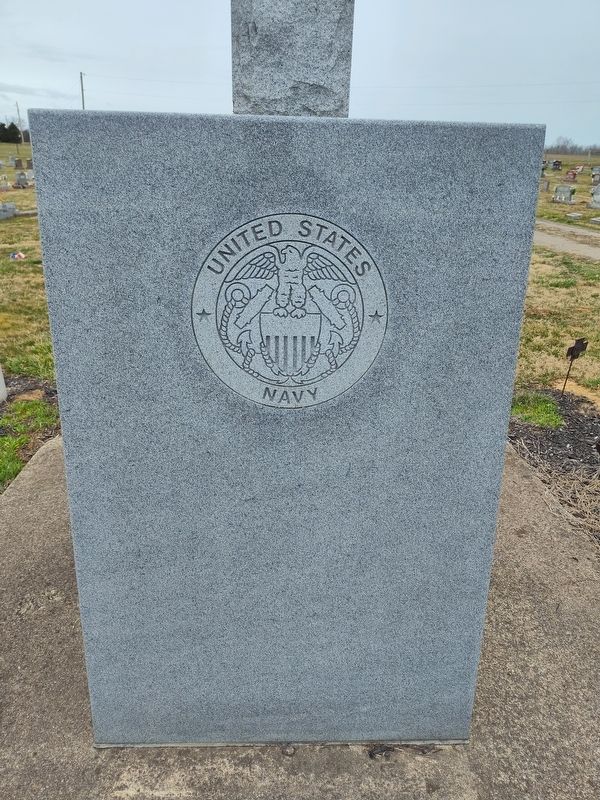
By Craig Doda, March 15, 2025
Cherry Fork Cemetery Veterans Memorial
GEOGRAPHIC SORT Title Sort Marker Number Sort Marker Number Sort for Trails Publication Order Sort Publication Order Sort A Erected Year Sort Most Viewed Sort Most Recent-Interest Sort Most Recently Changed Sort SEE FAQ #33 FOR DESCRIPTIONS
On Ohio Route 136 at Coon Hill Road (County Route 11) on Ohio Route 136.
On Ohio Route 138 south of 2nd Street (U.S. 137), on the right when traveling south.
On Ohio Route 73 1 mile west of Horner Chapel Road (County Route 116), on the right when traveling north.
On Ohio Route 73 1 mile west of Horner CHeapel Road (County Route 163).
On Ohio Route 73 1 mile west of Horner Cheapel Road (County Route 116), on the right when traveling north.
On Ohio Route 73 1 mile west of Horner Cheapel Road (County Route 116), on the right when traveling north.
On Ohio Route 73 1 mile west of Horner Cheapel Road (County Route 116), on the right when traveling north.
On Ohio Route 73 at Horner Cheapel Road (County Route 116), on the right when traveling north on Ohio Route 73.
On Ohio 73 (Ohio Route 73) 1 mile west of Horner Cheapel Road (Route 116), on the right when traveling north.
On Ohio Route 73 1 mile west of Horner Chapel Road (County Route 116), on the right when traveling north.
On Ohio Route 73 1 mile west of Horner Cheapel Road (County Route 116), on the right when traveling north.
On Pike Street at West 4th Street, on the right when traveling south on Pike Street.
Near East 8th Street 0.2 miles east of Cemetery Street, on the right when traveling east.
Near East 8th Street 0.2 miles east of Cemetery Street, on the right when traveling east.
Paid Advertisement
Near East 8th Street 0.2 miles east of Cemetery Street, on the right when traveling east.
On East 5th Street at Jack Roush Way ( Route 136), on the right when traveling east on East 5th Street.
On 2nd Street (U.S. 52) west of Jack Roush Way, on the right when traveling west.
Near East 8th Street 0.2 miles east of Cemetery Street, on the right when traveling east.
Near East 8th Street 0.2 miles east of Cemetery Street, on the right when traveling east.
On East 2nd Street (U.S. 52) 0.5 miles east of Cemetery Street, on the right when traveling west.
On Jack Roush Way (Ohio Route 136) at Brown Hill Road (County Route 3) on Jack Roush Way.
On Ohio River Scenic Byway (U.S. 52) at Yates Road, on the right when traveling east on Ohio River Scenic Byway.
On East Front Street at Pike Avenue, on the right when traveling east on East Front Street.
On East 5th Street at Jack Roush Way ( Route 136), on the right when traveling west on East 5th Street.
On West Front Street at Pearl Street, on the right when traveling west on West Front Street.
On 2nd Street (U.S. 52) east of Cemetery Street, on the right when traveling east.
Near East 8th Street 0.2 miles east of Cemetery Street, on the right when traveling east.
On Pike Avenue at East 2nd Street ( Route 52), on the right when traveling south on Pike Avenue.
On East 5th Street at Jack Roush Way ( Route 136), on the right when traveling west on East 5th Street.
On East 5th Street at Jack Roush Way ( Route 136), on the right when traveling west on East 5th Street.
Paid Advertisement
On Mineral Springs Road (County Route 18) north of Garnet Shiveley Road, on the right when traveling south.
Near Horner Chapel Road (Ohio Route 73) 0.9 miles west of Horner Chapel Road (County Road T-116), on the right when traveling west.
Near Ohio Route 73 0.9 miles west of Horner Chapel Road (County Road T-116), on the right when traveling west.
Near Main Street (Ohio Route 41) at Elm Street, on the left when traveling south.
On Ohio Route 73 near Route 41, on the left when traveling east.
On North Main Street (Ohio Route 41) near Elliott Avenue, on the right when traveling north.
Near Horner Chapel Road (Ohio Route 73) 0.9 miles west of Horner Chapel Road (County Road T-116), on the right when traveling west. Reported permanently removed.
Near Horner Chapel Road (Ohio Route 73) 0.9 miles west of Horner Chapel Road (Route T-116), on the right when traveling west. Reported permanently removed.
Near Horner Chapel Road (Ohio Route 73) 0.9 miles west of Horner Chapel Road (County Road T-116), on the right when traveling west. Reported permanently removed.
On North Main Street at Vine Street, on the left when traveling north on North Main Street.
On Horner Chapel Road (Ohio Route 73) 0.9 miles west of Horner Chapel Road (County Road T-116), on the right when traveling west. Reported permanently removed.
On Ohio Route 73 0.9 miles west of Horner Chapel Road (County Road T-116), on the right when traveling west. Reported permanently removed.
On Horner Chapel Road 1 mile west of Horner Cheapel Road (County Route 116), on the right when traveling north.
On Ohio Route 73 1 mile west of Horner Chapel Road (County Road T-116), on the right when traveling west. Reported permanently removed.
On Ohio Route 73 0.9 miles west of Horner Chapel Road (County Road T-116), on the right when traveling west. Reported permanently removed.
Near Ohio Route 73 west of Horner Chapel Road (Local Route 116), on the right when traveling west.
Paid Advertisement
On Ohio Route 41 at Adkins Rd, on the right when traveling north on Ohio Route 41.
On Ohio River Scenic Byway (U.S. 52) 0.3 miles west of Blue Creek Road (County Highway 18), on the right when traveling west.
On Main Street (Ohio Route 247) 0.2 miles south of Tri-County Road, on the right when traveling south.
On Main Street (Ohio Route 247) 0.2 miles south of Tri-County Road, on the right when traveling north.
On Main Street (Route 247) 0.2 miles south of Tri-County Road, on the right when traveling south.
On Main Street (Ohio Route 247) south of Tri County Road, on the right when traveling south.
On Main Street (Ohio Route 247) 0.3 miles north of East 2nd Street, on the right when traveling north.
Near Ohio Route 73 0.9 miles west of Horner Chapel Road (County Road T-116), on the right when traveling west. Reported permanently removed.
On Ohio Route 73 0.9 miles west of Horner Chapel Road (County Road T-116), on the right when traveling west. Reported permanently removed.
On Ohio Route 73 0.9 miles west of Homer Chapel Road (County Road T-116), on the right when traveling west. Reported permanently removed.
Near Ohio Route 73 0.9 miles west of Homer Chapel Road (County Road T-116), on the right when traveling west.
On North Chery Street west of North Cross Street ( Route 247), on the right when traveling west.
On West Main Street at North Market Street, on the right when traveling west on West Main Street.
On West Main Street at North Market Street, on the right when traveling west on West Main Street.
On West Main Street (Ohio Route 41) at North Cherry Street, on the right when traveling west on West Main Street.
On West Main Street (Ohio Route 125) at North Cross Street ( Route 247), on the right when traveling west on West Main Street.
Paid Advertisement
On North Cross Street at West Main Street, on the right when traveling north on North Cross Street.
On Second Street (Ohio Route 247) at East Walnut, on the left when traveling south on Second Street.
On North Cross Street (Ohio Route 247) north of North Cherry Street, on the right when traveling south.
On North Wilson Drive at Mulberry Street, on the right when traveling north on North Wilson Drive.
Near South Cherry Street south of West South Street, on the right when traveling south.
On North Cherry Street at West Main Street ( Route 125), on the right when traveling north on North Cherry Street.
On West South Street at South West Street, on the left when traveling west on West South Street.
On Manchester Street (Ohio Route 41) 0.1 miles east of McHenry Street (County Route 70) when traveling east.
On North Cherry Street west of North Cross Street ( Route 247), on the right when traveling west.
On Zane Trace (Ohio Route 41), on the right when traveling south.
On Ohio Route 41 at Texas Street, on the right when traveling north on Ohio Route 41.
On Washington Street north of Main Street ( Route 136), on the right when traveling south.
On Washington Street 0.1 miles north of Main Street ( Route 136), on the right when traveling east.
On Main Street at Route 32, on the right when traveling north on Main Street.
On Main Street (Ohio Route 136) at Washington Street on Main Street.
On East Washington Street at Main Street ( Route 136), on the right when traveling west on East Washington Street.
Paid Advertisement
On Main Street (Ohio Route 136) at Dorsey Road (Local Route 48) on Main Street.
On Ohio River Scenic Byway (U.S. 52) 1.5 miles west of State Highway 247, on the right when traveling west.
On West Street/Napoleon Road at Lincoln Highway ( Route 696), on the left when traveling north on West Street/Napoleon Road.
On West Main Street (Ohio Route 696) just west of Mill Street, on the left when traveling west.
On Lima Street at Water Street, on the right when traveling east on Lima Street.
On East Main Street (Ohio Route 696) at Church Street, on the right when traveling east on East Main Street.
On East Main Street (Ohio Route 696) at Church Street, on the right when traveling east on East Main Street.
On North Pevee Road, on the right when traveling north.
On Bentley Road south of Augsburger Road, on the right when traveling south.
On Bentley Road near Riley Street, on the right when traveling south.
Near College Road south of Sunset Drive, on the right when traveling south.
On North Main Street north of Vine Street, on the left when traveling north.
On East Elm Street east of North Main Street, on the left when traveling east.
Near Bentley Road south of Augsburger Road, on the right when traveling south.
Near Bentley Road south of Augsburger Road, on the right when traveling south.
Near Bentley Road south of Augsburger Road, on the right when traveling south.
Paid Advertisement
On West College Avenue south of Rosenberger Road, on the left when traveling north.
On East College Avenue at Railroad Street, on the right when traveling south on East College Avenue.
On East College Avenue at Railroad Street, on the right when traveling east on East College Avenue.
Near Bentley Road south of Augsburger Road, on the right when traveling south.
Near Bentley Road south of Augsburger Road, on the right when traveling south.
︽
13359 entries matched your criteria. The first 100 are listed above.
Next 100 ⊳