46 entries match your criteria.
Entries Containing All of the Phrases «cecil county» AND «maryland»
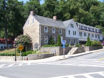
By William Pfingsten, July 17, 2007
Creswell's Home
RANKED BY RELEVANCE
1 ► Maryland, Cecil County, Port Deposit — John A. J. Creswell —  |
| On Main Street (Maryland Route 222) at Center Street ( Route 276), on the right when traveling north on Main Street. | |||
| 2 ► Maryland, Cecil County, North East — Gilpin’s Falls Covered Bridge — |
| On North East Road (Route 272) 0.3 miles north of Old Bayview Road, on the right when traveling north. | |||
| 3 ► Maryland, Cecil County, Elkton — Holly Hall — |
| On Bridge Street (Maryland Route 213) 0.1 miles north of Pulaski Highway (U.S. 40), on the right when traveling north. | |||
| 4 ► Maryland, Cecil County, Elkton — Mitchell House — |
| On East Main Street at Grooms Lane, on the left when traveling east on East Main Street. | |||
| 5 ► Maryland, Cecil County, Calvert — Brick Meeting House — |
| On Brick Meeting House Road 0.2 miles west of Route 272, on the right when traveling west. | |||
| 6 ► Maryland, Cecil County, Elkton — Old Post Road — Established 1666 — |
| On Maryland Route 281 0.3 miles east of Delancy Road, on the right when traveling east. | |||
| 7 ► Maryland, Cecil County, Perryville — Old Post Road — |
| On Broad Street 0.1 miles west of River Road, on the right when traveling west. | |||
| 8 ► Maryland, Washington County, Sharpsburg — 5th Md. Vet. Vol. Infy. — |
| Near Richardson Avenue, on the left when traveling east. | |||
| 9 ► Maryland, Prince George's County, Laurel — Dinosaur Alley |
| Near Mid Atlantic Blvd.. Reported permanently removed. | |||
| 10 ► Delaware, New Castle County, Middletown, Pencader Hundred — NC-47 — Welsh Tract — |
| On DE 896, DE 71 (Summit Bridge Road) 0.1 miles south of Victoria Drive, on the right when traveling south. | |||
| 11 ► Maryland, Cecil County, Chesapeake City — St. Augustine School — |
| On Cayots Corner Road at St. Augustine Road, South, on the right when traveling east on Cayots Corner Road. | |||
| 12 ► Maryland, Cecil County, Elkton — Rock Presbyterian Church — |
| On Telegraph Road (Route 273) at Rock Church Road, on the left when traveling east on Telegraph Road. | |||
| 13 ► Maryland, Garrett County, Swanton — Fighting Forest Fires Is a Hard Job — |
| Near State Park Road at Brant Road. | |||
| 14 ► Maryland, Talbot County, St. Michaels — Log House — Welcome — Chesapeake Bay Maritime Museum — |
| Near North Talbot Street at Dodson Avenue, on the right when traveling north. | |||
| 15 ► Maryland, Cecil County, North East — Welcome to Turkey Point! — |
| Near Turkey Point Lighthouse Trail. | |||
| 16 ► Delaware, New Castle County, Glasgow, Pencader Hundred — The Hundreds of Delaware — |
| On Pulaski Highway (U.S. 40). | |||
| 17 ► Maryland, Cecil County, Earleville — Mount Harmon Plantation at World’s End — Historic Tidewater Plantation & Nature Preserve — |
| On Mount Harmon Road. | |||
| 18 ► Utah, Utah County, Lehi — Bishop David Evans — A Lehi Founding Father — Sculpted by Jonathan Bronson — |
| On North Center Street, on the right when traveling south. | |||
| 19 ► Delaware, New Castle County, Wilmington, Old Swedes — The Congregation of Crane Hook Church Built Holy Trinity Church 1698-1699 — |
| Near North Church Street (U.S. 13) at East 7th Street, on the right when traveling north. | |||
| 20 ► Maryland, Cecil County, Earleville — Hilltop View — Star Spangled Banner National Historic Trail — National Park Service, U.S. Department of the Interior — |
| On Mount Harmon Road. | |||
| 21 ► Maryland, Cecil County, Perryville — Perryville — One Week After the War Began |
| On Broad Street (Maryland Route 7) at Roundhouse Drive, on the right when traveling west on Broad Street. Reported permanently removed. | |||
| 22 ► North Carolina, Iredell County, Mooresville — Early History — |
| On River Highway (North Carolina Route 150) at Mariner Pointe Lane, on the right when traveling west on River Highway. | |||
| 23 ► Delaware, New Castle County, New Castle, New Castle Hundred — NC-193 — Crane Hook Church — |
| On New Castle Avenue (Delaware Route 9), on the right when traveling north. | |||
| 24 ► Maryland, Cecil County, Chesapeake City — World War I Monument — |
| On Bohemia Avenue, on the left when traveling north. | |||
| 25 ► Maryland, Cecil County, Perryville — Striking a Blow — Star-Spangled Banner National Historic Trail — |
| On Philadelphia Road (Maryland Route 7) 0.2 miles east of Jackson Station Road, on the right when traveling east. | |||
| 26 ► Maryland, Frederick County, Woodsboro — Col. Joseph Wood — Founder of Woodsboro — |
| On North Main Street (Woodsboro Pike) just north of Old Creagerstown Road, on the left when traveling north. | |||
| 27 ► North Carolina, Mecklenburg County, Huntersville — The Tanner — |
| On Tidal Court at Coastal Way, on the left when traveling west on Tidal Court. | |||
| 28 ► Tennessee, Trousdale County, Hartsville — 3B 86 — Captain William Alexander — 1746 ~ 1830 — |
| On East Main Street 0.1 miles east of Western Avenue, on the right when traveling east. | |||
| 29 ► Delaware, New Castle County, Newark, Pencader Hundred — The Hundreds of Delaware — |
| On Dayett Mills Road south of Old Baltimore Pike, on the right when traveling south. | |||
| 30 ► Maryland, Cecil County, Elkton — Valentine Hollingsworth (1632-1710) — (Patriarch of the Hollingsworth family in America) — |
| On Landing Lane. | |||
| 31 ► Maryland, Harford County, Havre de Grace — Surprise Attack — Star-Spangled Banner National Historic Trail — National Park Service, U.S. Department of the Interior |
| On Pennington Avenue west of North Lodge, on the right when traveling east. Reported permanently removed. | |||
| 32 ► Virginia, Stafford County, Stafford — E-49 — Accokeek Iron Furnace — |
| On Courthouse Road (County Route 630), on the left. | |||
| 33 ► Maryland, Cecil County, Cecilton — Founded on Friendship — Chesapeake Country National Scenic Byway |
| On W. Main Street (Maryland Route 282) west of Bohemia Avenue ( Route 213), on the right when traveling west. Reported permanently removed. | |||
| 34 ► Maryland, Cecil County, Earleville — Tobacco and Mount Harmon — |
| On Mount Harmon Road. | |||
| 35 ► Delaware, New Castle County, Glasgow, Pencader Hundred — Historic Iron Ore Mining — |
| On Route Newark. | |||
| 36 ► Delaware, New Castle County, Newark, Pencader Hundred — Historic Roads of Newark, Delaware / Petrified Log from Central Delaware — |
| Near South Old Baltimore Pike. | |||
| 37 ► Maryland, Anne Arundel County, Crownsville — Crownsville Hospital and Civil Rights — A New Era of Healing (1960s-1970s) — |
| On Crownsville Road, on the right when traveling north. | |||
| 38 ► Maryland, Baltimore, Locust Point Industrial Area — 3 — Steam Tug Baltimore — 1906 — National Historic Landmark — |
| Near Key Highway east of Boyle Street, on the right when traveling west. | |||
| 39 ► Maryland, Cecil County, Fredericktown — Fort Duffy — |
| On School House Lane, on the right when traveling west. | |||
| 40 ► Maryland, Cecil County, Perryville — Perryville — War Brings Drastic Changes — |
| On Broad Street at Roundhouse Drive, on the right when traveling west on Broad Street. | |||
| 41 ► Delaware, New Castle County, Glasgow, Pencader Hundred — Exploring the Past of Pencader Hundred — |
| On Pulaski Highway (U.S. 40) east of South College Avenue (Delaware Route 896) when traveling west. | |||
| 42 ► Delaware, New Castle County, Glasgow, Pencader Hundred — Exploring the Past of Pencader Hundred — |
| On Pulaski Highway (U.S. 40). | |||
| 43 ► Delaware, New Castle County, Newark, Pencader Hundred — Exploring the Past of Pencader Hundred — |
| Near South Old Baltimore Pike west of Iron Hill Road, on the right when traveling west. | |||
| 44 ► Delaware, New Castle County, Newark, Pencader Hundred — Historic Iron Ore Mining |
| On Dayett Mills Road south of Old Baltimore Pike, on the right when traveling south. Reported permanently removed. | |||
| 45 ► Delaware, New Castle County, Newark, Pencader Hundred — Historic Iron Ore Mining — |
| On Robert L. Melson Lane near Whitaker Road, on the left when traveling north. | |||
| 46 ► Delaware, New Castle County, Newark, Pencader Hundred — Your Gateway to Pencader Heritage — Exploring the Past — |
| On Dayett Mills Road near Old Baltimore Pike, on the right when traveling south. | |||
Thin black lines indicate changes in relevance. Between each pair of lines entries are ordered geographically but all have the same relevance.
* Inflectional forms of words are their plurals, singulars, and possessives as well as gramatical tenses and similar variations.
Nov. 13, 2026